I left home in Galisteo on Sunday, June 15th around mid-day. Its Father’s Day but Paul isn’t much on celebrating that anyways. I figured we would drive as far as possible but not too late. Cedar Bluff State Park in Kansas was our destination. We arrived after check in so self pay and find a spot. There were plenty of places to camp next to the lake. I didn’t end up swimming (buggy) but Billy Goat and I took a nice hike on some trails starting from the visitor center in the morning. Off early then stopped for a coffee and break at the World’s Largest Ball of Twine in Cawker City Kansas. Pretty cool and some other tourists took our photo.
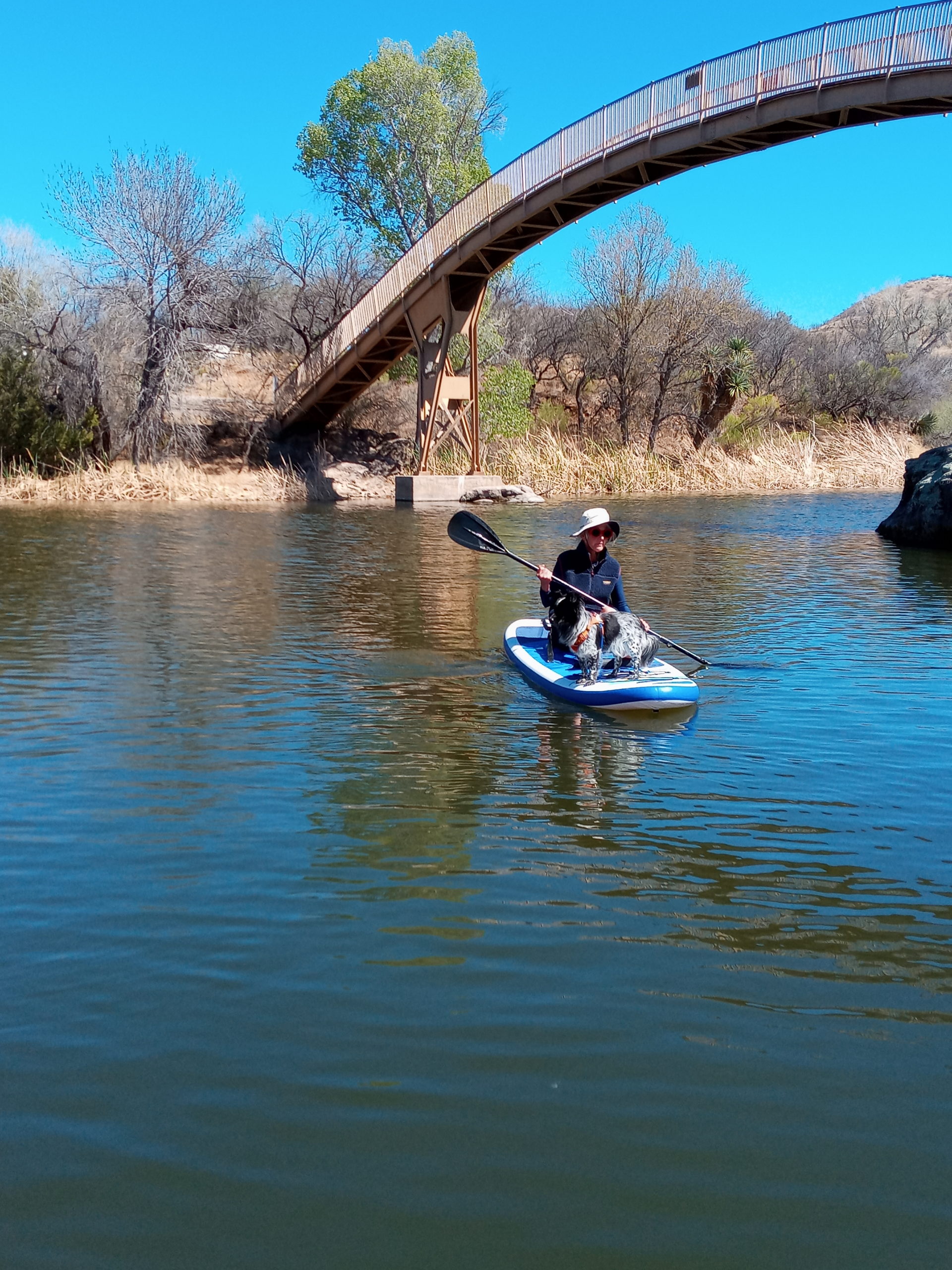
A nice rest area worth noting -The Big Blue River Historical Marker on Hwy. 80 in Kanasas. There is a cool concrete bridge and a nice walk in the woods with a sculpture by Paul Von Ringelheim.
Traveling some back roads and scenic routes like 34 it took awhile to move forward but it was pretty. We made it to a community park, Nicholson-Ford Marsh in Marshalton, Iowa where we took a stroll and settled in. The parking lot had some late guests playing music so not the best sleep. Woke up groggy and decided to get going to Madison. Anne and Pat are selling their home so a lot of hustle and bustle cleaning and getting ready for realtor photos. (realtor brother Matt). I headed to moms in the country to chill out for the rest of the week
Mom is doing good. Gardening, library, store, puzzles, movies, and dinner out a couple of nights. I took mom to a cool sculpture garden near her home.(Bobrowitz Sculpture Garden)almost too much to see. We did an easy walk at the Loew Lake Unit of the Kettle Moraine Forest. Some of the family came for Friday night fish fry and slept over. Sunday I spent the day/evening in Madison. It was very hot so I slept indoors. Dinner with Carrie and Anne at Mickey’s. Billy Goat was loving the cousin dog company of Maeve and Nicco.
Morning coffee with Luna, Jacob and George at Rotunda Cafe. Sweet place for breakfast and they allow dogs. I set off soon after to Northern Wisconsin to visit my friends Max and Rochelle near Shell Lake. They have a large farm and it was super quiet at night. I had a peaceful sleep in the van. We hung out the next day and I got to see more of the property. We enjoyed outdoor dinner and again Billy was loving Mixer and Mizu’s dog company. Sadly the concert for Wednesday in Excelsoir was cancelled so I didn’t get to see The Suburbs play. Next time.
Early up and out and mostly an uneventful driving day. Stopped at Kanoplolis Lake SP and camped right next to the lake. I jumped in for a swim and Billy stayed at the shoreline. Relaxed, read a book, and tried to get some sleep. We woke early to a storm coming in and so we packed up. A beautiful, striking sunrise with the dark clouds looming to the West. We got swallowed up in it for a bit but no one was on the roads. Hard driving but we made it back home for dinner in Galisteo, Whew!
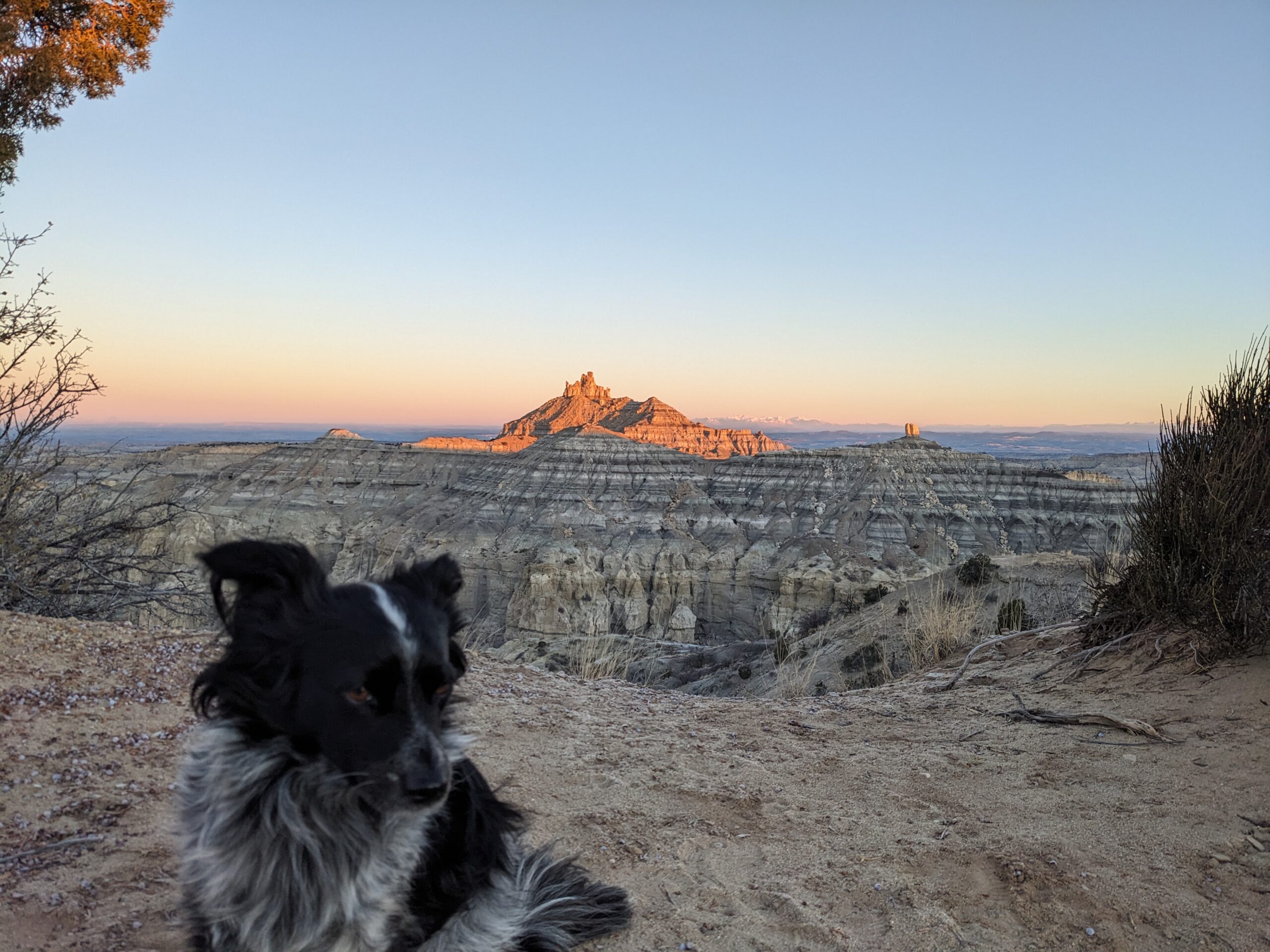
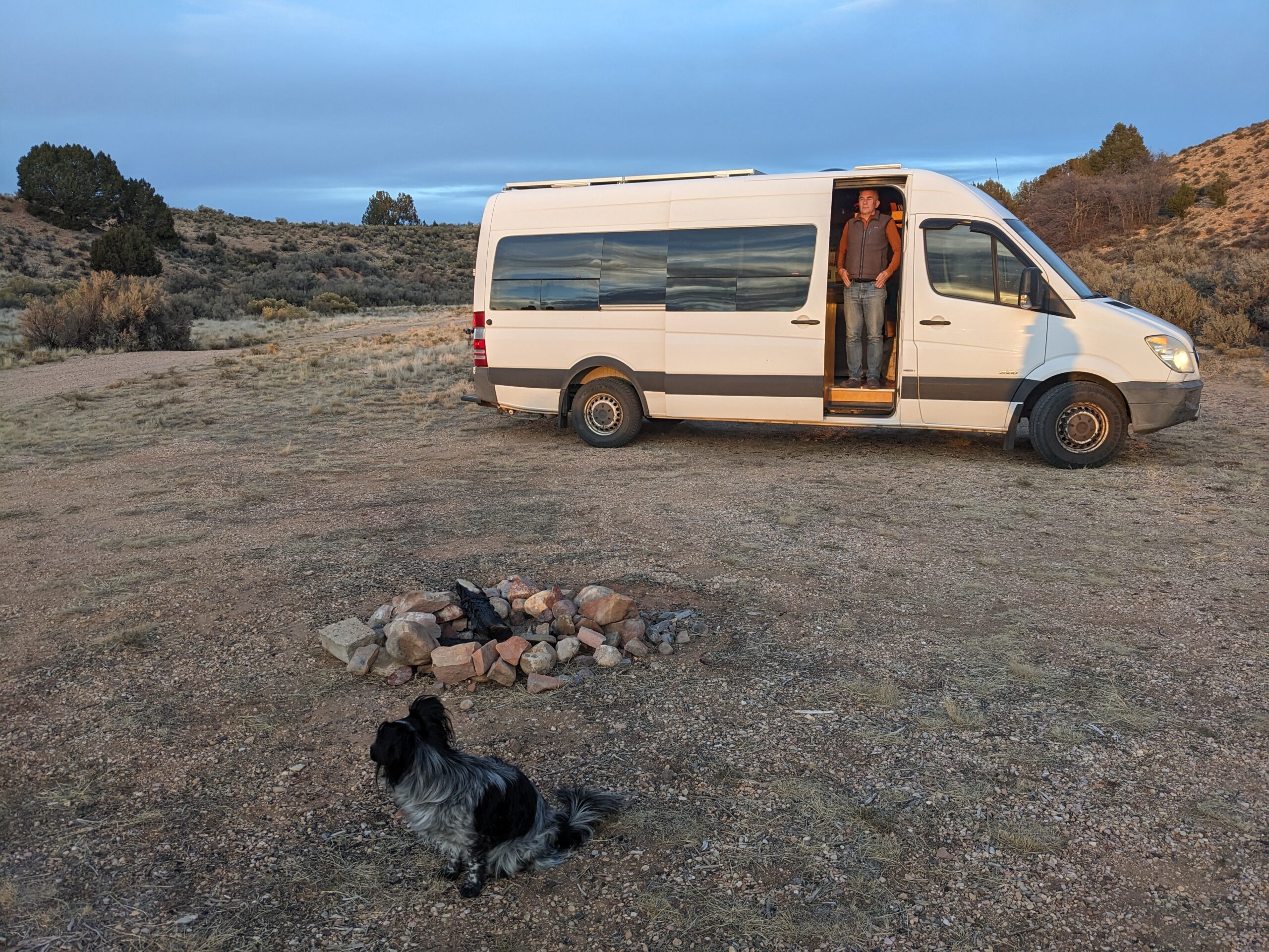
Thanksgiving 2025: We pack up the van and get started a bit later than expected. We meet up with Evan, Mia, Elliott and their dog Hermes at Angel’s Peak. After a short but beautiful hike, Paul, Billy Goat and I settle in the van for a Thanksgiving dinner of sorts(lots of stuffing). Scrabble game, some vino, and though its cold outside we are cozy in the van.
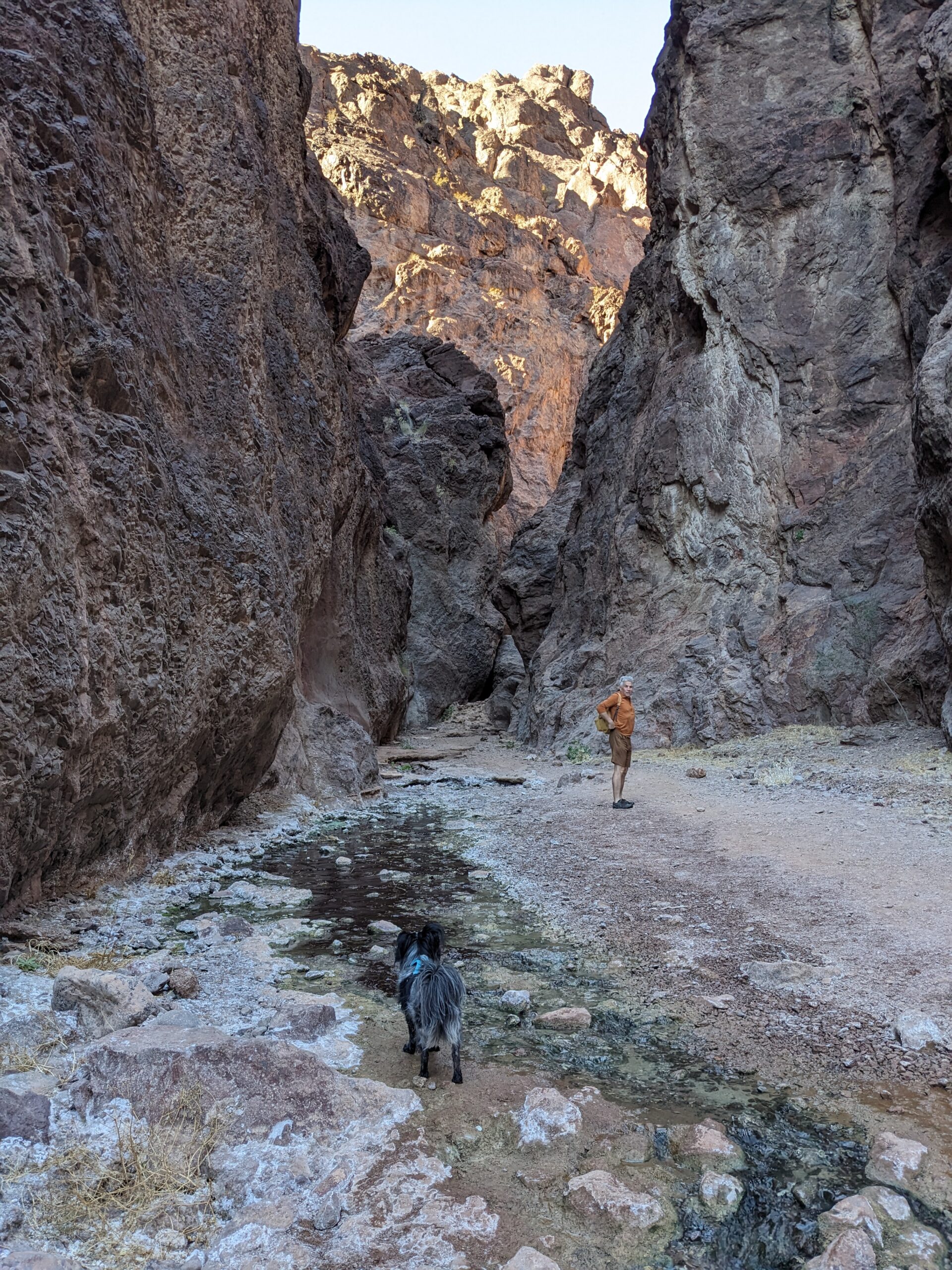
In the morning I do a short walk with Billy Goat, brrrr. After breakfast and packing up I run to the exit of the BLM park(6 miles). We back track on 550 to Chaco Canyon. After checking out the visitor center and having lunch in the van, we do a longish hike. (7m) Penasco Blanco which is mostly flat till the end. We were the only ones out there or crazy enough. We make it back to our campsite#31 to a dark sky, stars galore, warm bathroom is a plus. Eat leftover stuffing, read, game and sleep.
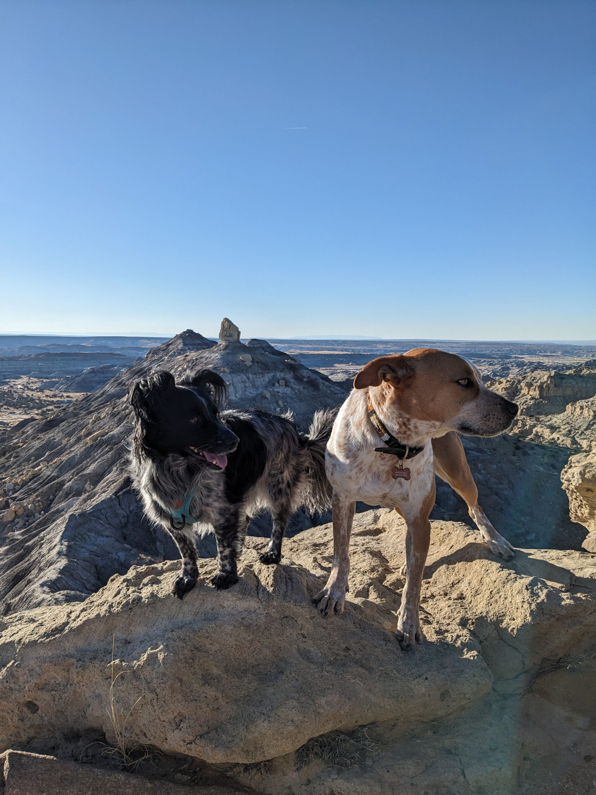
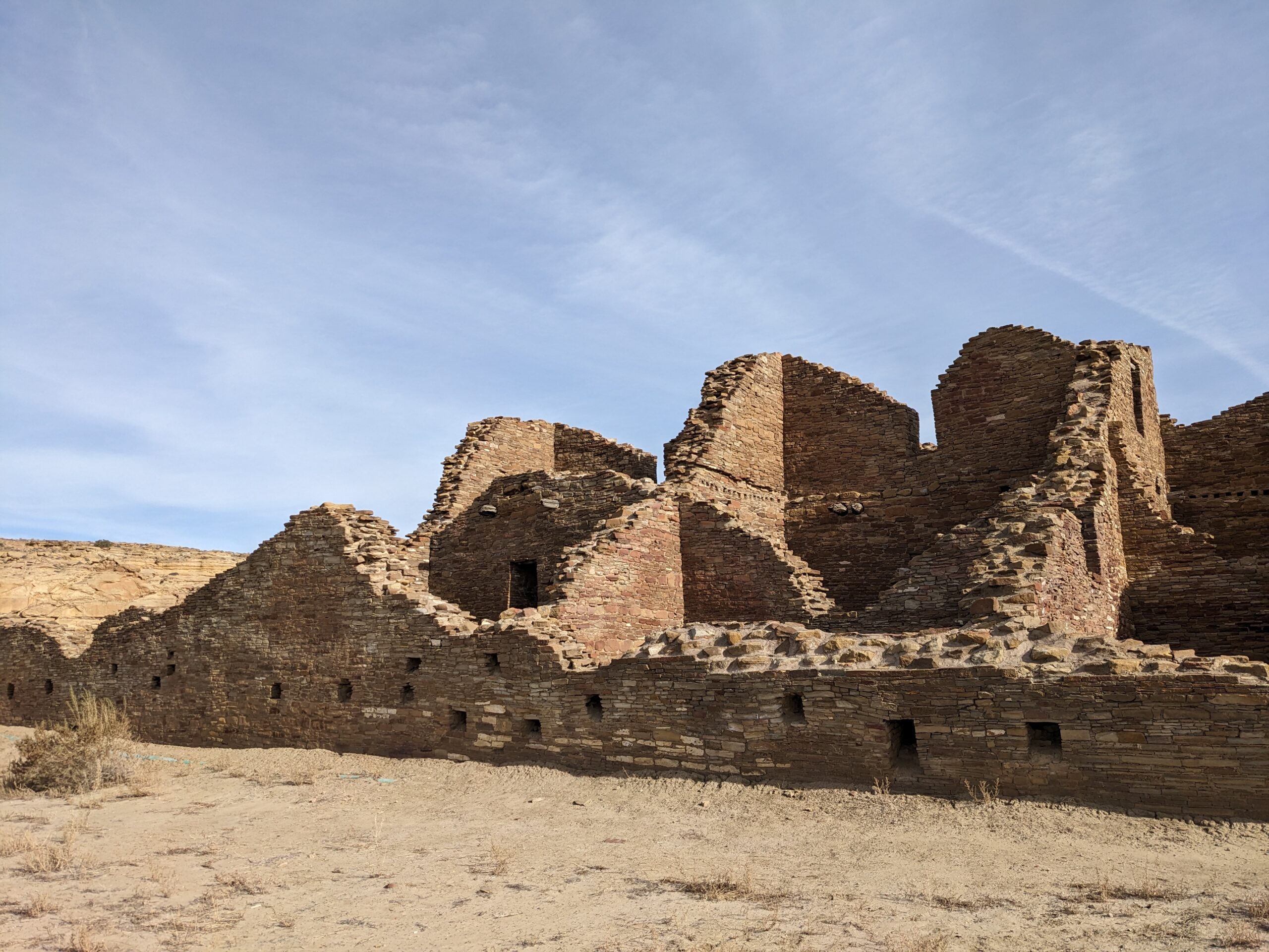
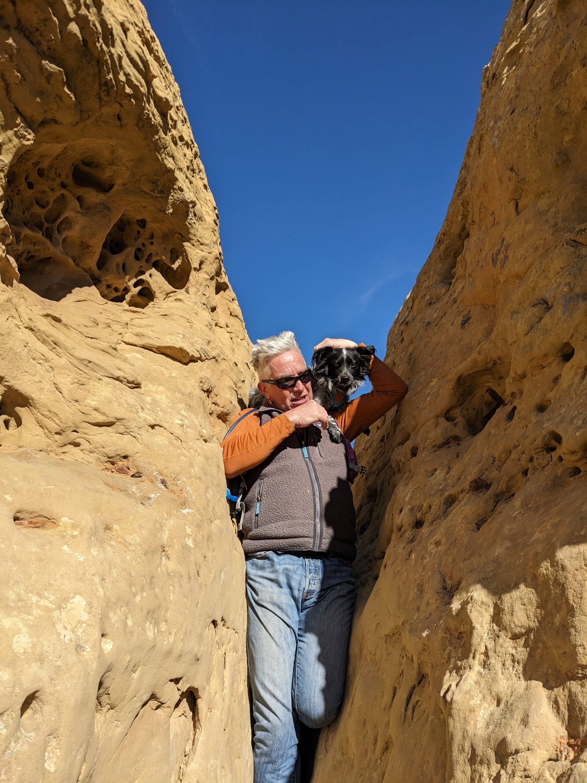
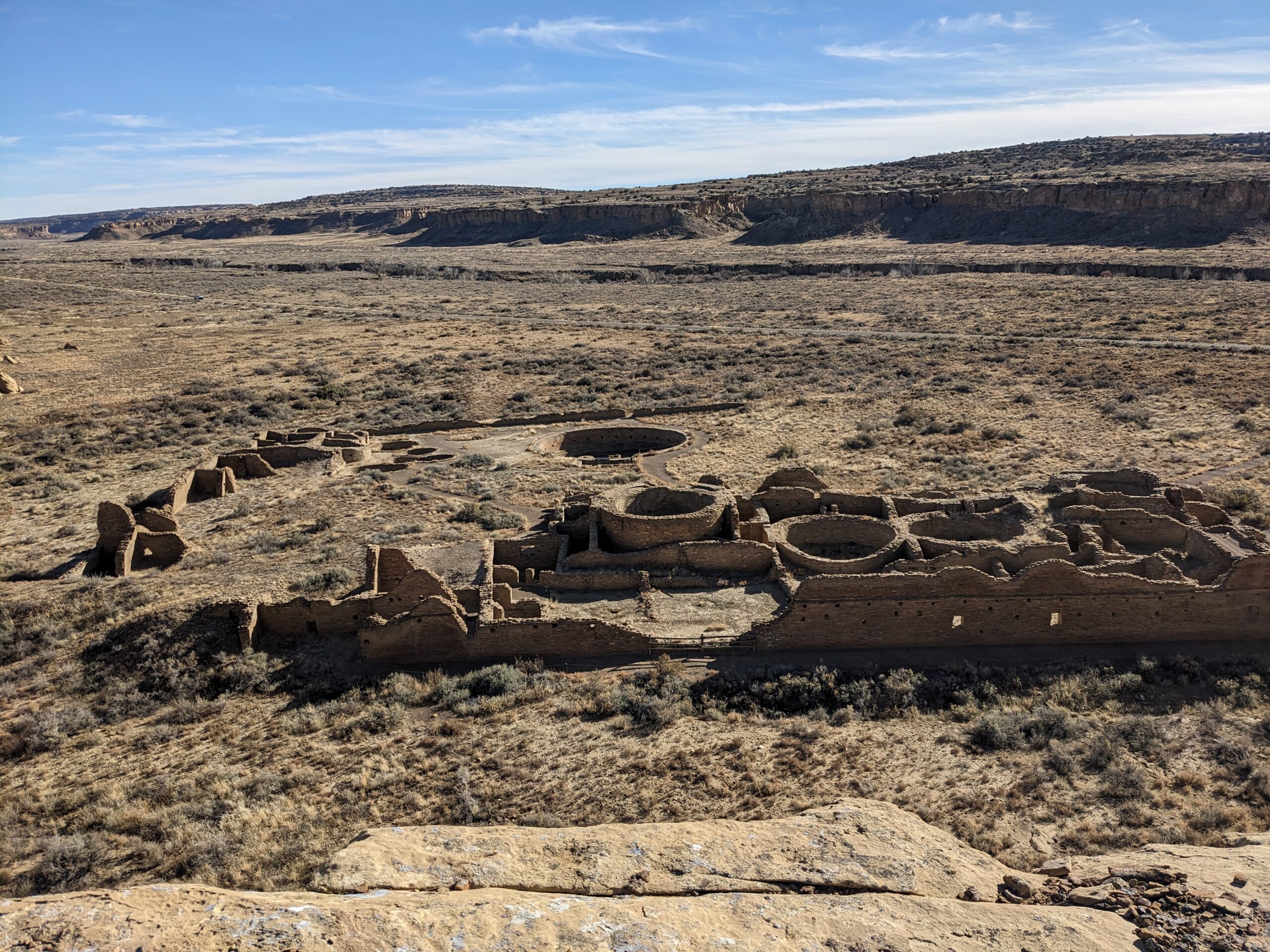
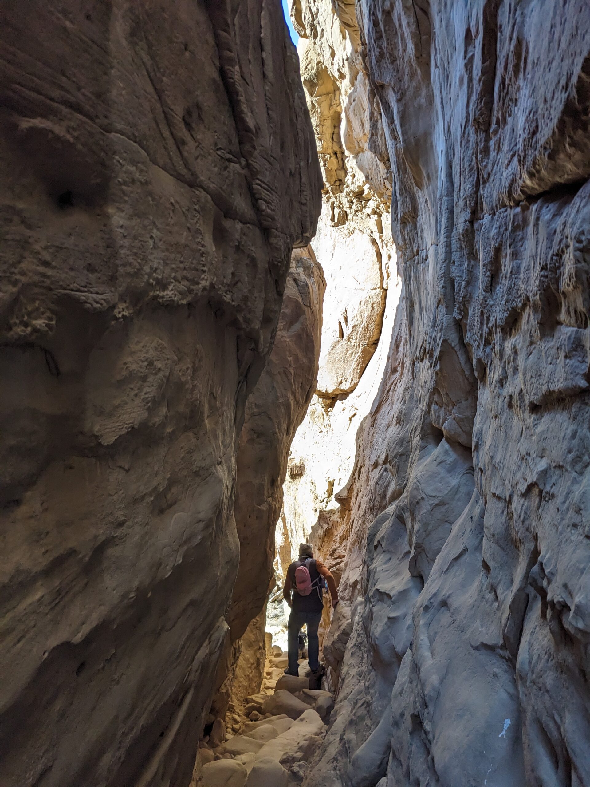
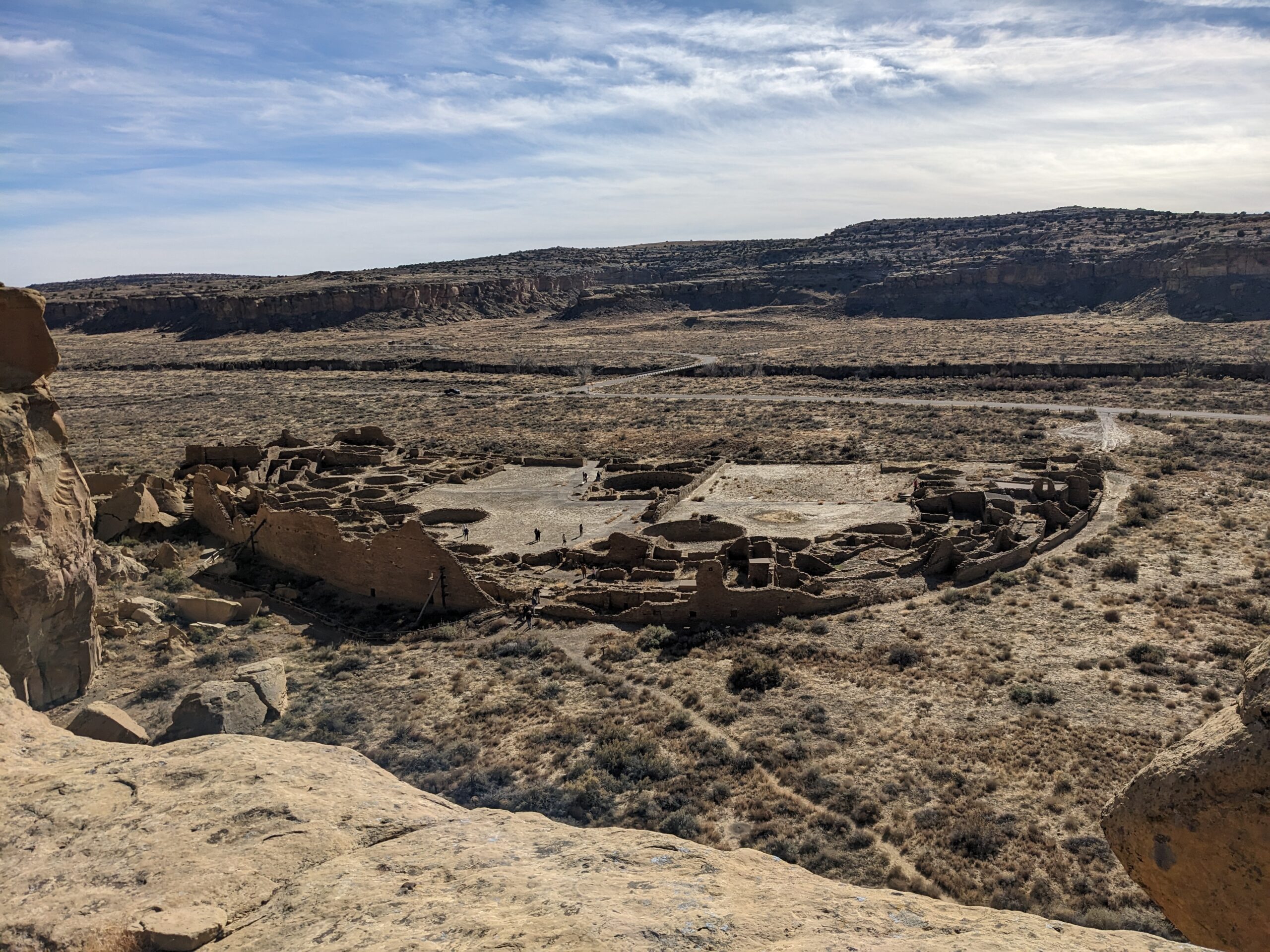
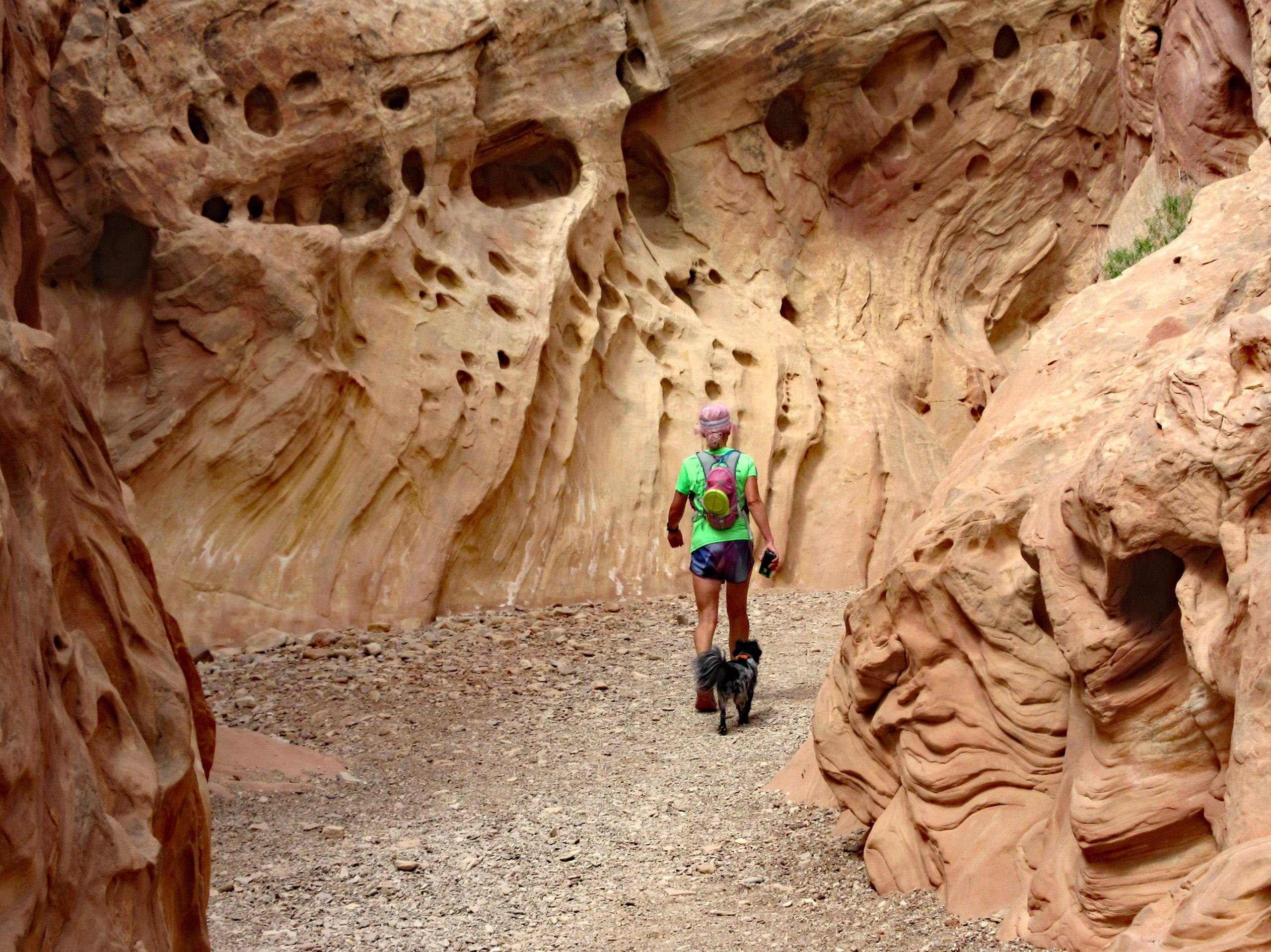
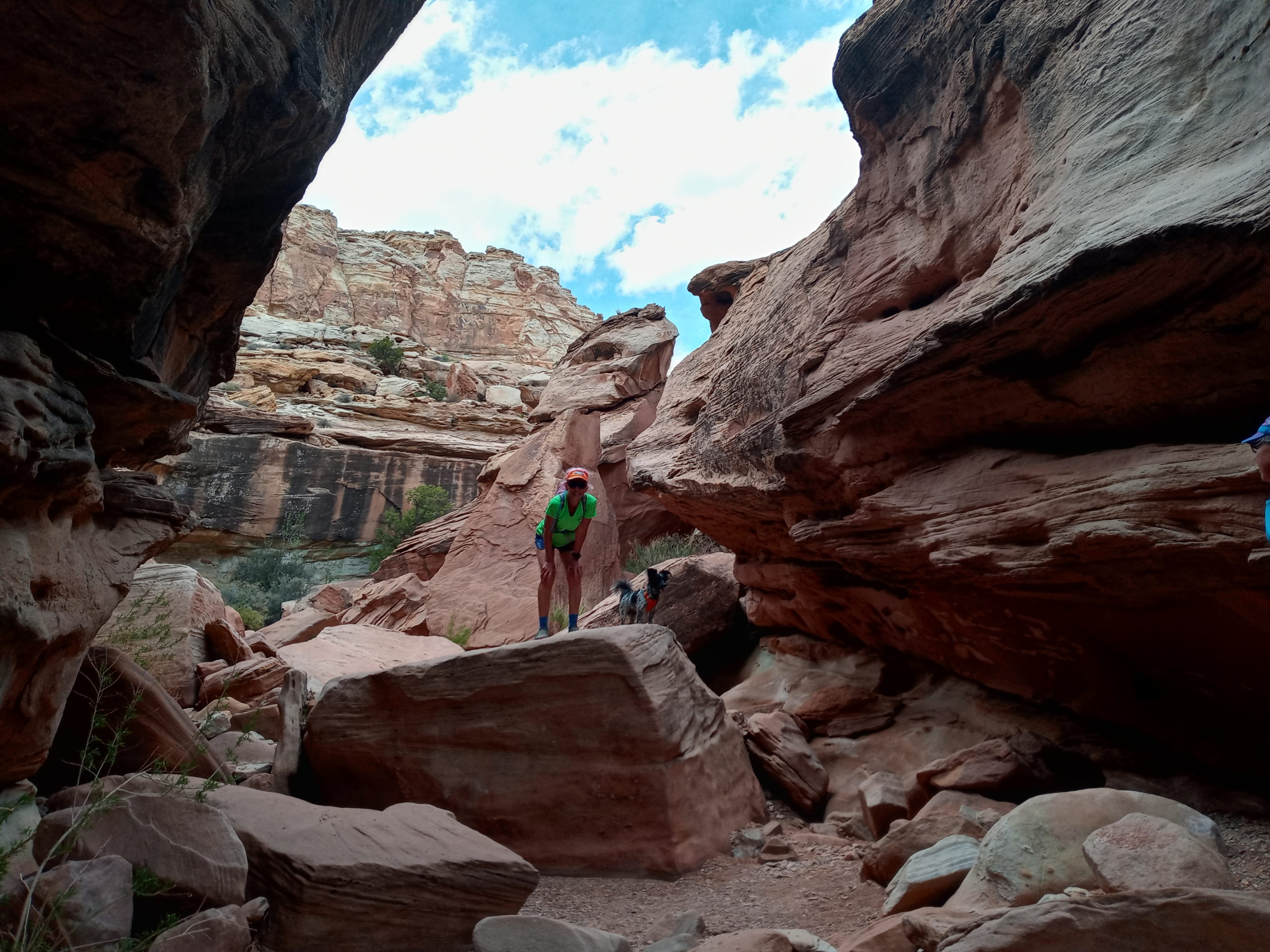
Day three we hike in the morning to Wijiji around 8am. Sparkly frost on everything. Again, only ones out there. Breakfast and another Visitor Center stop. Buy some books, gifts, and check out the Una Vida complex. The next hike I think was our favorite, Pueblo Alto Complex Loop hike. Stunning views that overlook Pueblo Bonito and Chetro Keti. You are also able to get up close to the Pueblos on top. A bit challenging navigating Billy Goat through a small slot canyon, but he did great. After a quick lunch in the van we do the last hike from Casa Rinconada Community to Tsin Kietsin and back. Too many goat heads or prickly weeds so Paul ended up carrying Billy Goat through a large field section. Back at camp, dinner, read and sleep
We do a short hike in the morning on Canyon Trail. Great views for a short hike and right by the camp ground. Clean up, pack up, finish reading Winter Garden by Kristin Hannah. Head north, Farmington, Page, camp on BLM land Forest Road 508 before Kanab.
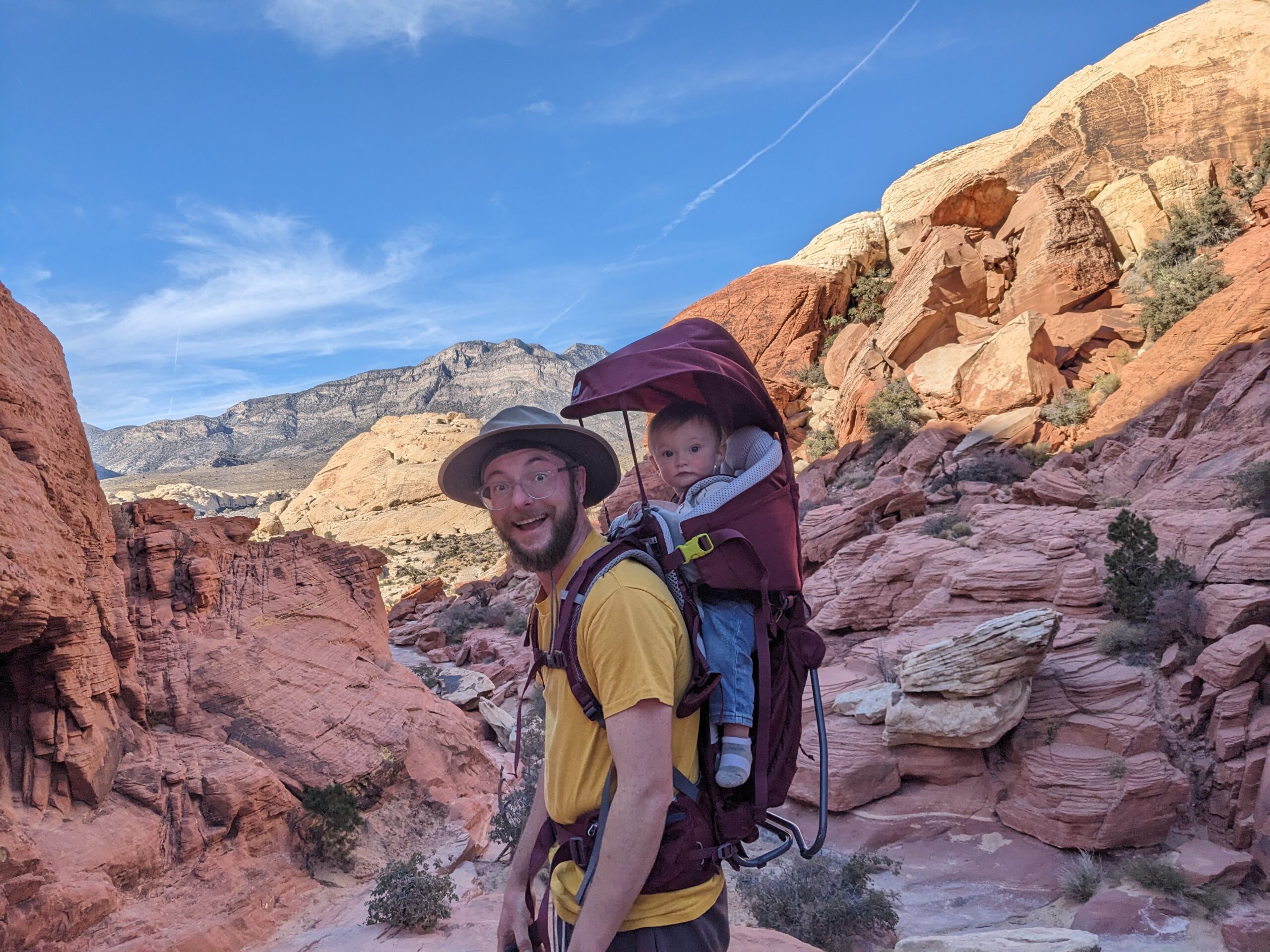
Day 5: arrive in Las Vegas. Meet Evan, Mia, Elliott and Hermes at Red Rock Canyon and do some hiking with them. Babysit Elliott in the evening and park outside their hotel behing the super 8.
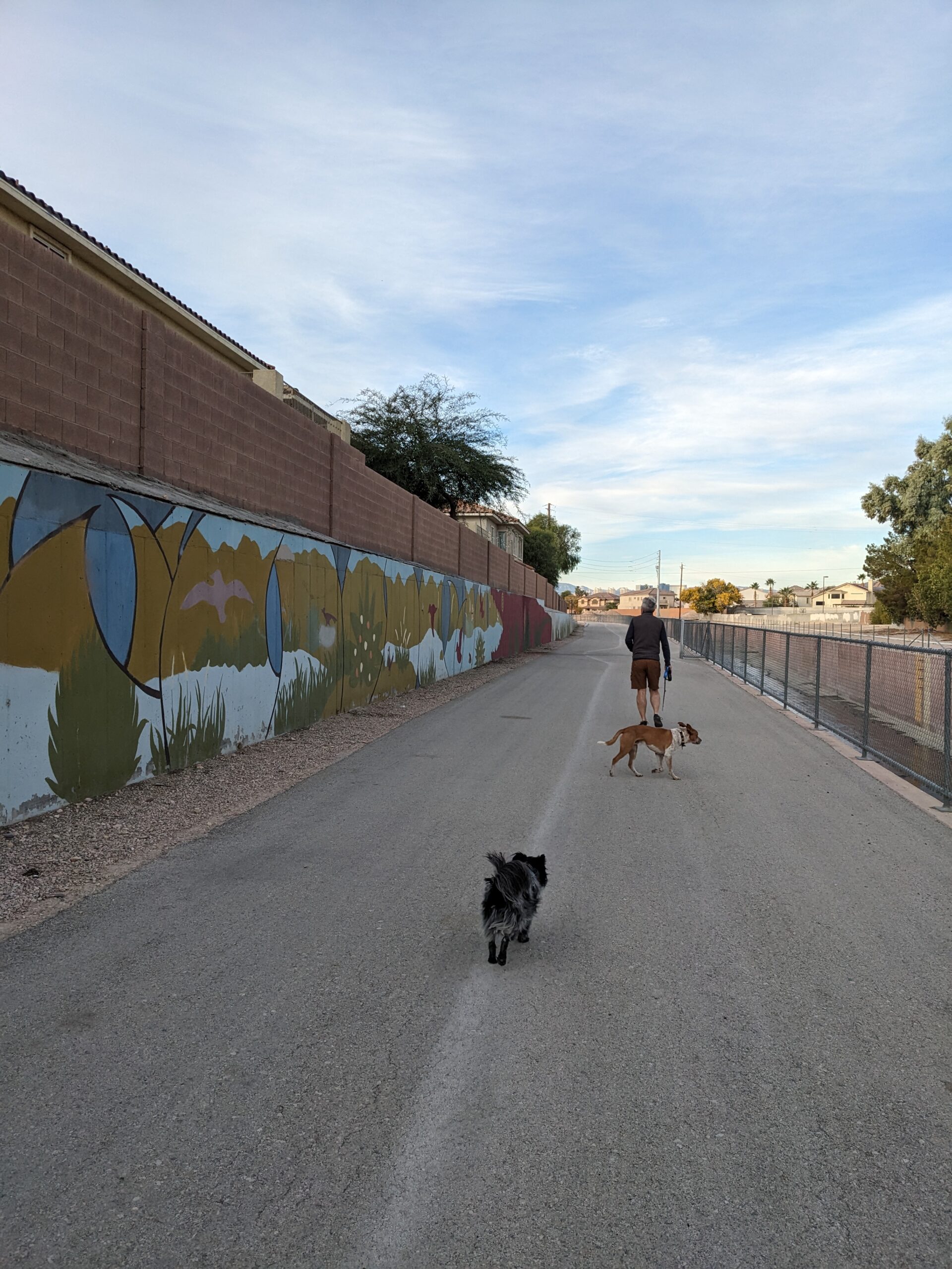
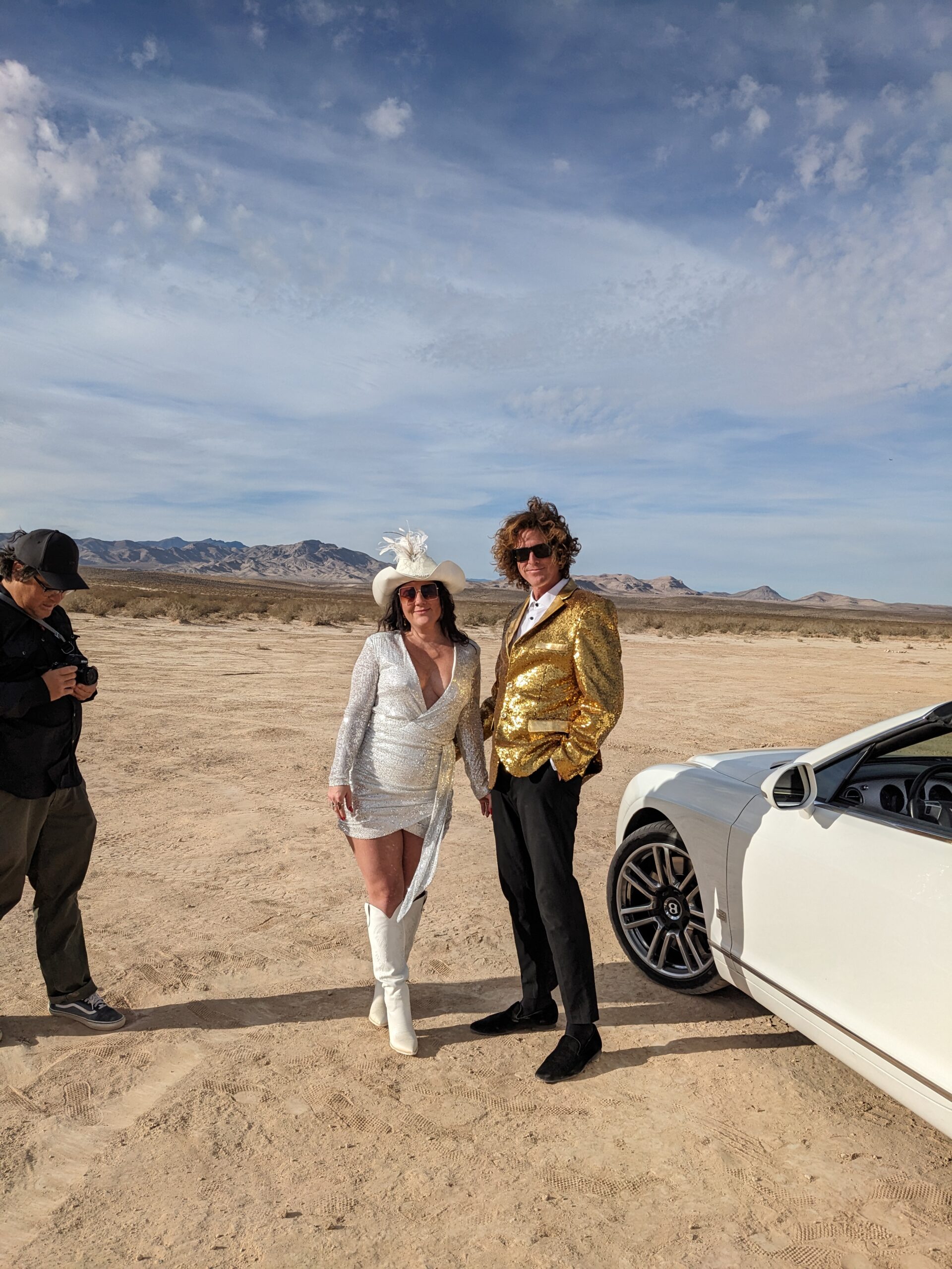
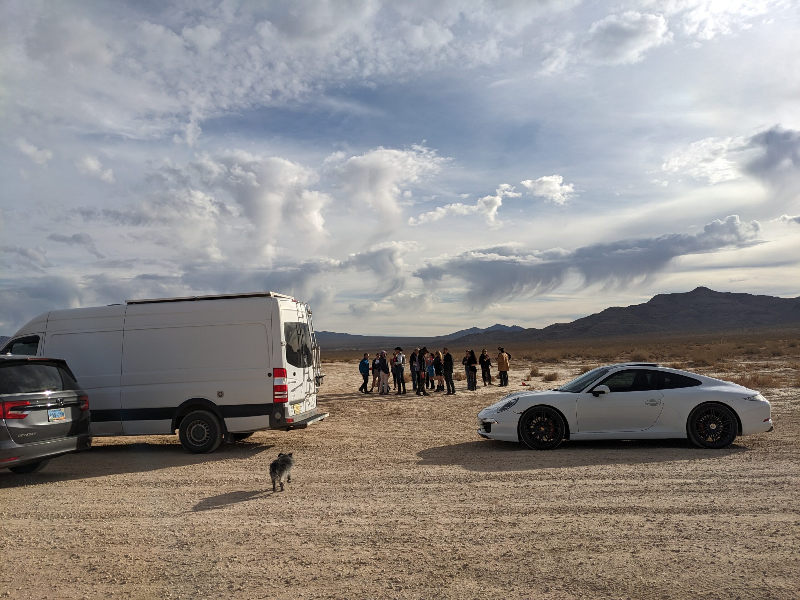
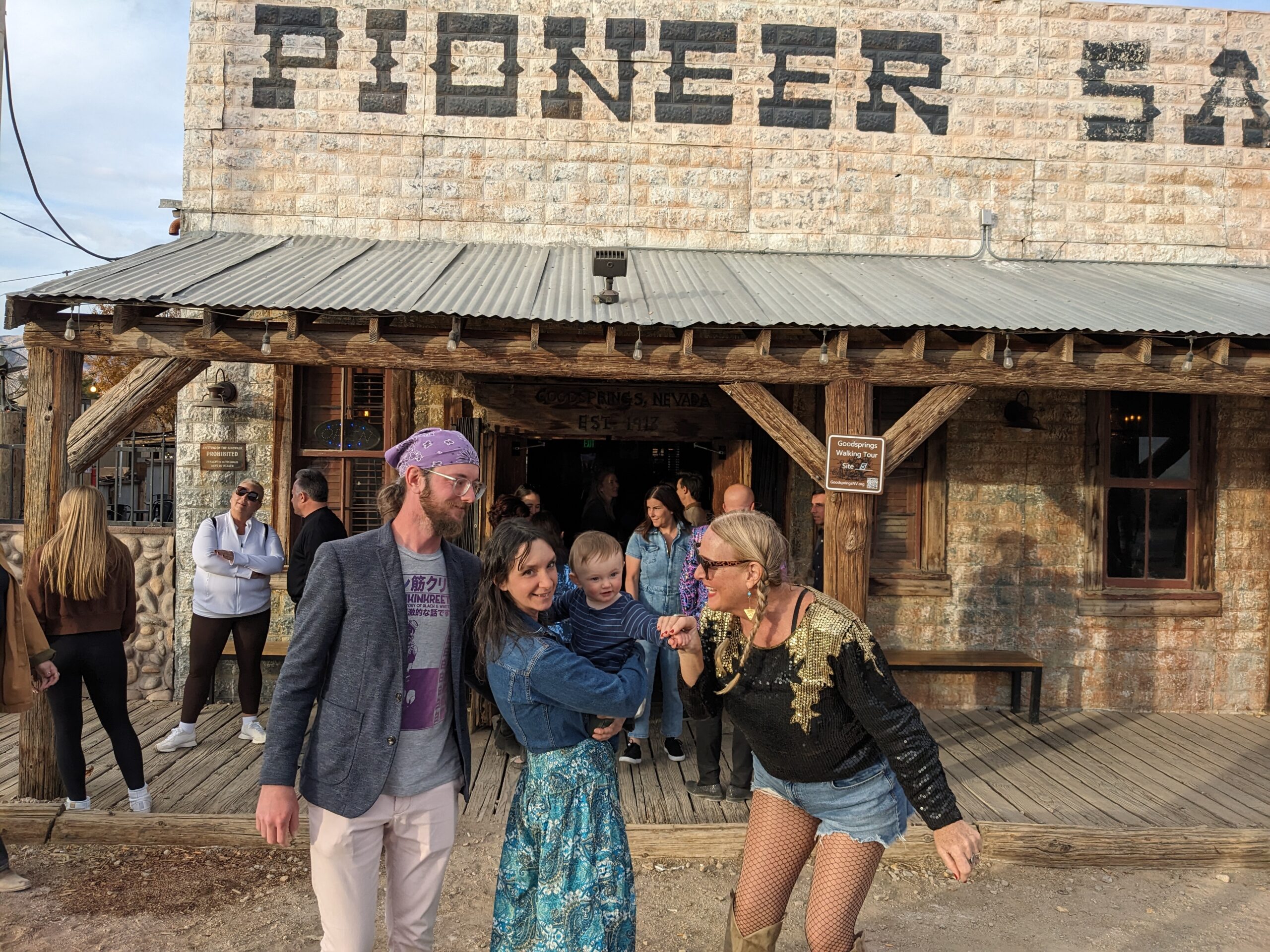
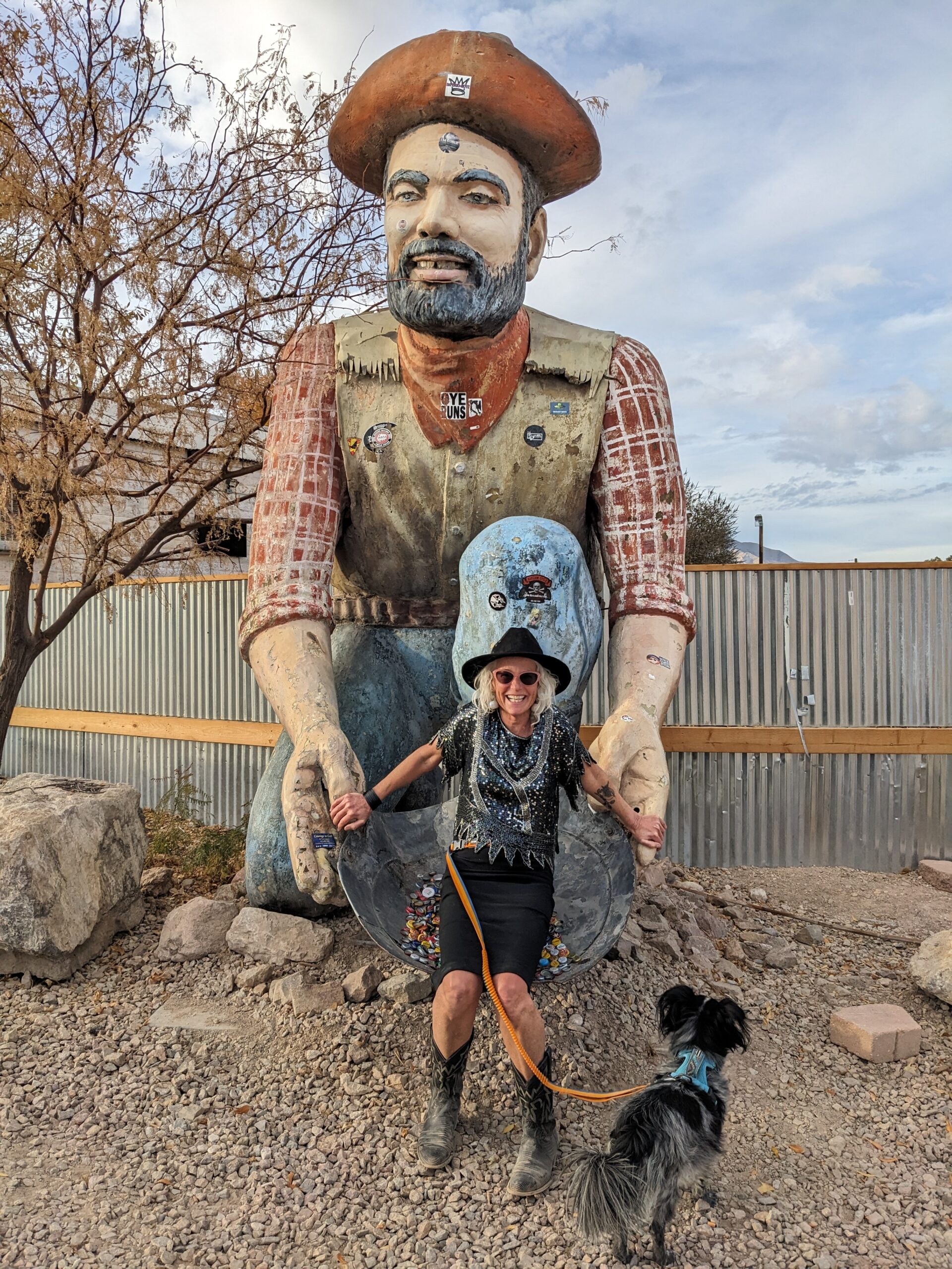
Day 6: Walk Hermes in the morning. Breakfast at sunrise cafe. Hike at Anthem Hills Park while Mia does some work. Meet up in the desert for a photo shoot. Pioneer Saloon for a reception, the oldest bar in southern Nevada. Paul and I take the doggies back to the desert to sleep.
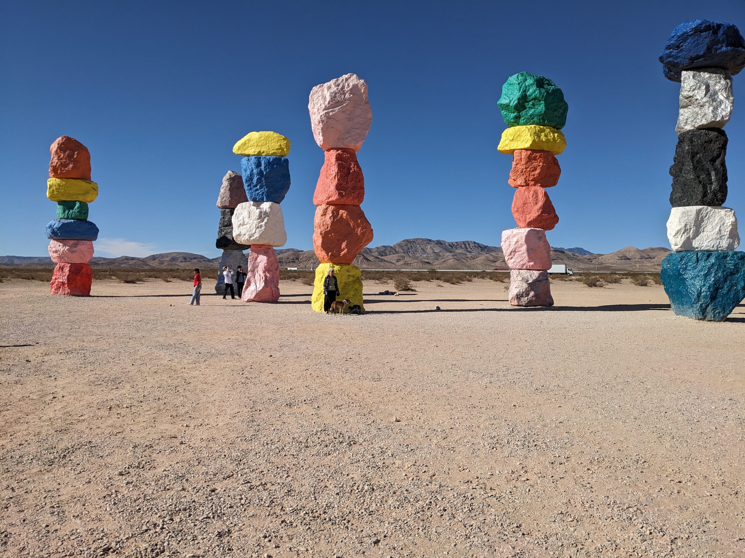
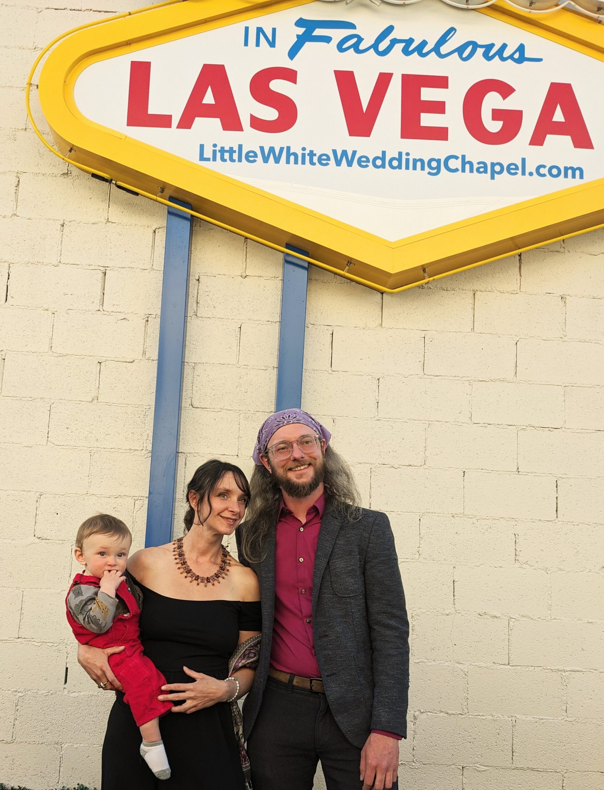
Wedding Day! Not feeling super great so I run 6 miles with Hermes across the desert. I believe I sweated it all out. Visit 7 Magic Mountains the bop around for awhile, dog park, shopping center. Dress in van and meet up at the Litte White Chapel. Elvis is officiating and he does a great job singing too. A small reception at the Oasis with champagne. Take Evan and Mia out to dinner at La Mona Rosa. Surprisingly delicious food which was much needed. We end up on Freemont Street and meet up with the Martier gang. Back in the van by 12:30, walk doggies and sleep.
Day 8: Walk Hermes and then drop him off. Head out of Vegas and go on a hike to hot springs. Gold Strike Hot Springs Trail is harder than you expect. It is challenging but if you have over 3 hours to hike(7 plus miles) and soak a bit, I recommend. Billy Goat was a champ! We headed to Flagstaff afterwards and slept in our usual National Forest spot.
Uneventful rest of the ride home, slight traffic but glad to be back.
I decided to do a trip out east to help my daughter and Ozzy with their new baby Stella. It was early July and Elliott’s surgery went well so I decided to leave on July 10th. I made my way down hwy 40 and was hoping to stop at the Blue Hole in Santa Rosa, NM. Sadly it was closed down but I had lunch and walked around the place for a bit. Moving on I stopped for the night at Foss State Park. A really pretty place and quiet next to Foss lake. Fabulous sunset too. The next day we had a brief stop in Clinton, OK where they had set up in town for a fair. Billy Goat and I walked around and had some coffee. Next stop, Lake Alma in Arkansas where Billy and I ran in humid weather around the lake. Whew! After lunch and rehydrating we drove till dark and camped outside the city of Memphis, TN. T.O. Fuller State Park. Basically drove in, parked, slept, and left in the morning early. Never got the bathroom key so I didn’t pay. Big drive day, stopped at Parkway Pourhouse in Chattanooga, NC for lunch outside on the deck. Dog friendly. (BIG NEWS< Stella is born, Friday, July 12) made it to Asheville, NC and camped at the KOA outside of town. Good sleep. Up and out in the morning and headed to OBX. Easy driving, one big accident really close, and a bunch of traffic closer to the beach. Once there I spent a nice week with the Martier family. On Sat. July 20, I left the beach to go north. I parked at the Chesapeake Bay Bridge rest stop and slept over night. Leaving early I got to Rachel and Ozzy’s by mid morning on Sunday. There I spent a wonderful 2 and 1/2 weeks helping with Stella, visiting with friends, and even doing an open mic on Ozzy’s birthday.
After a teary goodbye, Billy and I headed west to Wisconsin. We had an uneventful but quiet stay at an Ohio rest area. In Wisconsin I had some family time at Matt’s lake house. Mom, Carolyn and I also went to a St. Olaf’s Bluegrass festival. Sadly I had no lake swim time but I did do some country runs. I left Tues August 13, stopped in Madison for a haircut, and made it to Smith Creek Rec. Area in Nebraska. A nasty storm hit with a bunch of lightning, thunder, rain and wind. Billy and I felt pretty secure but not the best night sleep. Up early, short walk, and put some miles in until NM. Hiked at Climax Canyon Nature trail and then made it the rest of the way home.
Visiting my mom is a journey in itself. I set out in the late afternoon from our home in Galisteo with Billy Goat. I wasn’t feeling well (pretty f*cking bad actually) but I needed to see my mom and how she was doing after a nasty fall. I drove until it was dark past Las Vegas , NM and Springer and slept at a rest area on 56. Poor Billy Goat had to deal with my cough and restlessness. As soon as the sun rose we headed through Kansas and parked for the evening at Brown State fishing lake. It was a lovely sunset but I had a hard time enjoying it. The lake was empty except for one other person. Quiet and free. The next evening I was at my mom’s and spent and enjoyable week with her. Thankfully I felt much better. My sister Carrie decided to drive back with me. It was so nice to have her along and made the journey way more interesting with her playlists and podcasts. We left from Madison and stayed our first night in Lake Annita SP. in Iowa. It was a stormy evening but we were cozy in the van. Not many people in the park either. We took a little morning stroll along a path that goes around the whole lake. Back on Hwy 80 for awhile an then we headed to Little Jerusalem Bad Lands SP. There we went on a nice long hike to shake out our legs.Surorisingly beautiful hidden gem. We camped nearby at Historic Lake Scott SP with a view of the lake. Quiet and peaceful. In the mornng we did a trail run around the park which ended up being longer(and harder) than we expected. Whew! We got back to Glaisteo and home in time for dinner.
I went the easy way to Seattle, by van. Paul on the otherhand rode his bike. He headed out three weeks prior and although I did help him out Day # 1: Camping at Abiqui Lake, the rest of the time he was solo.
On my drive I stayed overnight at Angel Peak Campground in N.M. Very pretty canyon and free! Just a bit off the road. The next day was a crazy long drive for me and Billy Goat. We landed at Balanced Rock County Park in Idaho. The water, singing birds and a nice trail were amazing and helped us relax and sleep well. Another free place.
Driving West early the next morning, I enjoyed the Idaho countryside. Stunning. I took a short hike in the Yakama Valley with Billy midday. Very hot. We met Paul on Vantage Hwy. where we picked him up for the night and camped at Sand Hollow Rec. Site. Nice cool Columbia River to swim in.
Next morning we meet up with the Matza Family, (Max, Kim, Zoe, Mike and Linda). We have a nice brunch and catch up a bit. Then I drive to Seattle and Paul finishes his last day on the bike. We stay at Bridget and Andrew’s home. Lovely walks in the Ravenna each day. Hike in Discovery Park, ride 1/2 around the lake with Bridget, Hannah and Sophie make us a tasty dinner. Paul and I spend a few days/nights on Orcas Island. We stop at Cap Sante viewpoint before the ferry. Camping at Moran S.P. in the northend campground. Billy and I walk around the lake in the morning. Doe Bay for a private soak, wow! Love this place.
Hike to the beach at Obstruction Pass. There are places to camp but all walk in. On our last day we hike up Mt. Constitution to the tower and back down. Drinks at Julia’s home on the water. Dinner at King Fish. A very late ferry back and drive to Seattle.
Carrie and George arrived. We walk and have lunch nearby. Paul makes dinner and early to bed. In the morning Carrie and George start on their bike ride across the country. Andrew and Bridget send them off at Anacortes. Paul and Hannah ride bikes, Billy and I run around Green Lake. I help Bridget with plants. Dinner at Magneson Brewery with Hannah and Sophie. Chilly out by the water.
Next day we have breakfast with Sophie and Hannah and eat on the lawn by their home. Then we head out to meet up with George and Carrie on the drive over to Winthrop. They needed some help and we were glad to be there. We drove to Brenda and Dennis’s house to stay for the night. Take out pizza and early bed.
I ride my bike the next day with George and Carrie. Warm weather but manageable. We end up in Omak at City RV Park. No one warned us about sprinklers!!! Carrie and George got woken up before sunrise. Carrie takes a ride day off and I go with George. We stop for some treats at the Tomasket Food Co-op. We meet up for camping at a private RV(rugged) spot in Wauconda. Turned out to be pretty nice. Next morning George and Carrie head out. We meet in Republic which is a cute town and it has a Food Co-op too!(more eggsalad for George) I ride the rest of the day over Sherman Pass. Camping at Canyon Creek FS campground. We soak our legs in the cool water.
Next morning we sadly leave Carrie and George and start our way back home. We have dinner in Butte Montana at Casagranda’s Steak House which was good but a bit pricey. Free camping at Homestake NF dispersed camping.
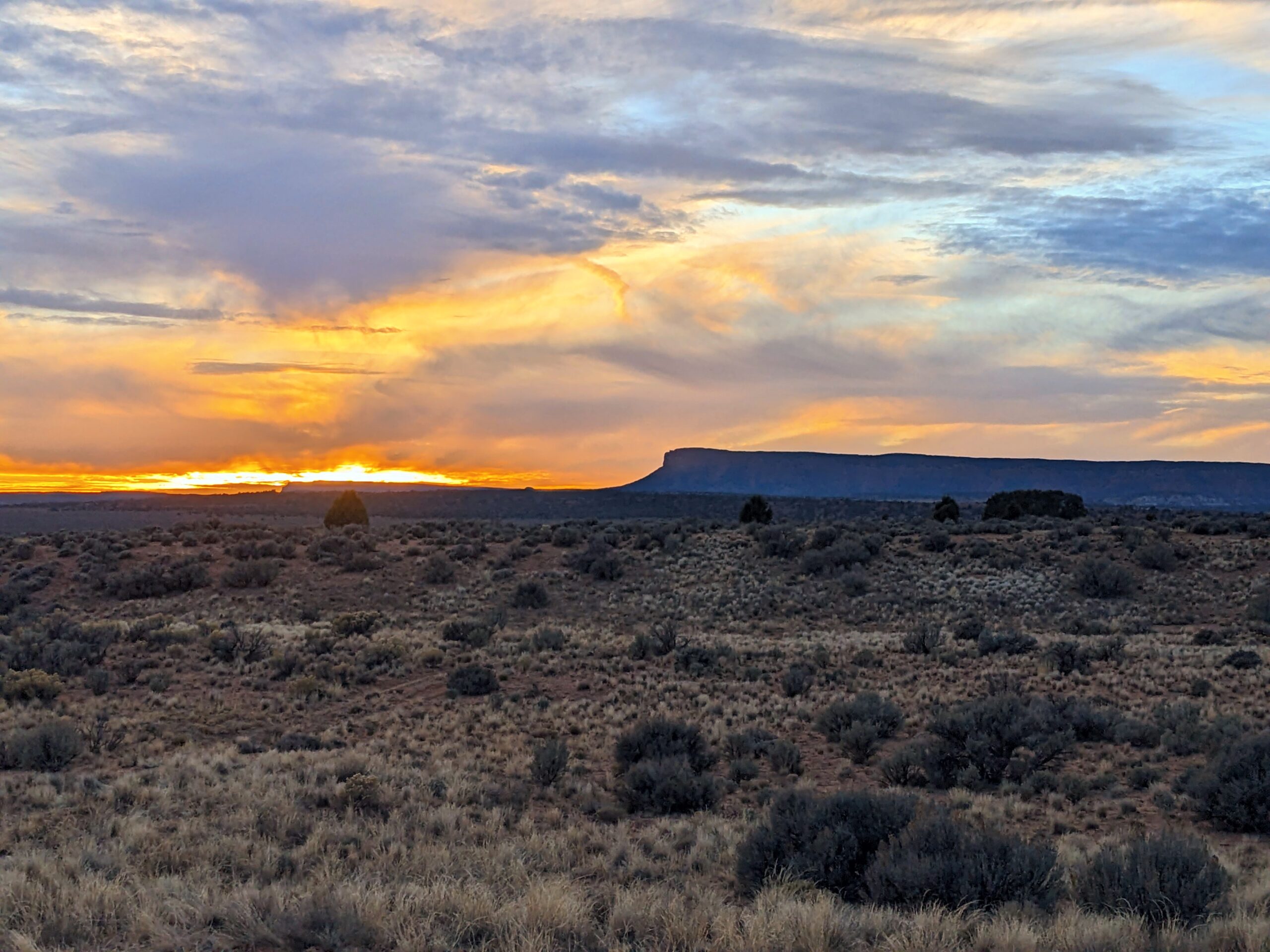
Today we drive to Yellow Stone and do the slow crawl through the park. Nice moments and views. Grand Teton is next and I loved this park. Stopped for lunch and a walk on the beach. Getting tired I found a camp ground off our road (US 191). Big Sandy West campground(Free) with mountain views but a lot of bugs. Quiet and a really pretty sunset.
We made a stop in Colorado at Freemont Pass and hiked around a lake. We actually had some snow to get through and it started snowing on us. Fun! For our last night out we camp in the San Luis Valley, Villa Grove (by the water tank) Stary skies, nice hike, quiet and views! All free! In the morning we make our way home. What a journey!
Paul and I left on a Thursday , March 9th, to travel toTexas where I would meet up with my friend Gene Dykes. To make the journey a bit more comfotable we chose to do it in two days. We headed south on 285 to 40 E through Clovis then took 84 south to Lake Colorado City SP. Paul picked a spot by the water but it was a bit strange to see the lights of the power plant across the lake. Warm showers were a plus but otherwise we probably won’t be returning. Next morning we headed south through Eldorado Texas where Paul got his first speeding ticket. (school zone) He was distracted by a good podcast. J and J Reunion race was just outside of Rocksprings TX. Long bumpy dirt road to get to Camp Eagle. Bad news is that the camp does not allow dogs! What?? No one bothered to tell us so this put a damper on the weekend. Gene arrived on Friday and we discussed plans and went to bed early. Nice day for a race and although I could have probably done the 50 miles(Gene finished) I decided to DNF and go 30 miles. I wasn’t particulary fond of the course , rocks, roots and then it was way to hot for me mid day. Gene fell more than once and I kinda wanted to get into the river and hang with my dog. (Paul too) After good byes we left on Sunday to head home this time taking the lower route. (90) So beautiful and makes me want to go back to Big Bend again. We headed to Balmorhea for a swim with the fishes . Lucky us going this way so soon after our last trip. Back on 285 heading north to home, we spent the night in the undeveloped area of Brantley Lake SP closer to the dam. It was pleasant and cheaper with nice views, and clean pit toilets. Headed out in the morning for home.
We decided to leave our home in New Mexico on December 14th, 2022. Our daughter Rachel and husband Ozzy invited us for Christmas and we decided to make the journey in our van. This way we could bring our dog, Billy Goat and make some stops along the way there and back. Our normal routine is to clean up and pack up and head out in the late evening. We stay overnight in the van at the rest area outside of Las Vegas, NM. We can get an early morning start from there.
Making our way North we drove through familiar territory stopping for breakfast at a roadside rest stop on 412 after Springer. Lunch? Can’t remember but it was a local park. We camped for the night at Mushroom Rock S.P. in Kansas. There was room for our van to park level but not much more. Super quiet and the mushroom rocks were brilliant. Nice find!
The next day we realized we had an issue with the van (terrible front wheel alignment) so we headed to Omaha, Nebraska where we thought a Mercedes dealer could help. While Paul went in search of options, Billy Goat and I ran around Wehrspann Lake in the Chalco Hills Recreation Area. Thankfully the van was fixed and we could continue on. We stayed overnight ar the Cedar Rapids rest area. Clean Bathrooms but a bit noisy.
The next day, Paul’s birthday, we drove towards Madison, WI. We had a nice breakfast at a rest area and then arrived mid day to Anne and Pat’s. Paul wanted to deliver some gin to friends he met in Prague…then we went to dinner with Anne, Pat, Carrie and George. We cuddled up and watched Love Actually and drank more wine and ate chocolate. Billy and Maeve are the best dog cousins now. So cute.
I always wish we could hang in Madison longer but we really needed to head out to mom’s. We bought some food to make a nice dinner or two. Mom looked good and we enjoyed spending three relaxing nights at her place. We decided to depart Wednesday morning early beacause of bad weather arriving.
The drive started out well and we made in to Ohio without any issues. For dinner we stopped at the Biker Brew House microbrewery inside a Harley-Davidson dealership. It was a bit strange yet we enjoyed the Quizo that everyone was doing and the baked goods from the table next to us. Oh, and the beer was very tasty. We camped for the night a little ways further at a Park and Ride in West Middlesex, P.A.
The worst travel day was on I-80 in PA heading to Lansdale. We hit a snow storm and of course traffic accidents and visability made it slow going. It added at least 3 hours…
Lansdale and Philadelphia, celebrating with friends and family for a few weeks. Hikes in parks, soaking at the Russian-Turkish Bath house in Southhampton, running in the Wissahickon, food, cheer, music and making memories.
After a really nice farewell dinner at Nancy Bea Miller and Paul Down’s home, we slept outside in our van for an early departure. Heading south now, we stopped at the Barton’s (Hannah’s maternal grandparents) home to chat and share a late lunch. We found a place to rest overnight in Elizabeth Furnace N.F. (Virginia). We could hear the rushing water through the night as the river was nearby. In the morning Billy Goat and I ran up a trail and back. There was so much moisture in the air I had to take some layers off.
Our plan was to drive a long distance on the Blue Ridge Parkway, but we ended up with road closures due to fallen trees, etc.. It turned out okay and we made it to Stone Mountain S.P. in North Carolina for the night. The campground was very quiet with only one other camper. The Big Sandy Creek was right outside the windows for a pleasant sound. Paul had some stomach issues and spent a good part of the night in the warm, clean bathhouse. Paul and I decided to do a hike in the morning and we are so glad that we did. The over 4 mile trail was spectacular with a large waterfall, a huge stone mountain, and then a climb for an expansive view of this part of the Appalachian chain.
We arrived in Asheville a bit late in the afternoon bit still got to see some of the beautifully preserved historic downtown buildings. The Grove Arcade with its shops and glass ceilings, the Woolworth Walk that still has the old soda fountain and now houses many artists. Then we headed to the River Arts district to grab a beer from The Wedge and enjoy a delicious dinner at All Souls Pizza.
Driving a bit out of Asheville we boondocked by the Pigeon River in the Pisgah N.F. Big parking space that we found on ioverlander. Up and out early, we waited to have breakfast at the Dandridge Dock in TN. There was a pull off that was better than the dock area. We did a long driving day and then grabbed take out from Betty B’s in Forest City, AR. Really good, authentic barbeque place. Boondocking again we parked in the Shefield-Nelson Dagmar WMA in Arkansas even though it felt a bit dark and creepy. The full moon rising didn’t help much.
The morning brought the sounds of gunshots. I put on my florescent vest and headed out for a quick explore run with Billy Goat. Cool marshy woods with a river, lake and miles of trees. Less scary in the day light and kinda cool looking. Would be a good movie setting.
We had another long drive day and ended up in Brownwood, Texas. We parked the van and splurged on a nice dinner at The Turtle restaurant. We made reservations earlier for Brownwood Lake SP so we could pull right in and go to sleep. In the morning I had a long run (18 miles) planned so I got up early and started out on park trails. There were some great rocky ridge trails but I preferred the 3 mile loop that I repeated a few times. Surprisingly it turned out okay and I felt pretty good. Paul made me a big breakfast after a shower and we made our way out towards west Texas.
Since we had no real options for where to sleep I went on ioverlander and found a rest area in Pecos county highly reviewed. Normally we try and avoid them but it turned out to be really nice. We could park the van towards a field and the noise from trucks overnight was minimal. Plus it was super clean, beautifully maintained, had a nature walk and a small museum.
For a real treat we stopped at Balmorhea, SP to swim with the fishes in the spring fed 1.75 acre pool. The water is always at 72-76 degrees so even though the air temperature was cold, we could swim for quite awhile.
Arriving in New Mexico we made a reservation for 1:30 pm at Carlsbad Caverns N.P. Not very many people there on a Monday and the caverns were super quiet. You feel as though you stepped into another world or alien planet.
We spent a little money to camp at Brantley Lake, S.P. for our last evening on the trip. The New Mexico wind picked up but it felt soothing. The morning brought a gorgeous sunrise that we watched through the van windows.
A very sunny, windy ride home the next day and a quick stop in Roswell for an alien encounter ends it all. After about 5,000 miles we arrived back home in Galisteo.
Friends of ours from Philadelphia, Linda and Mike, invited us to their daughter Zoe’s wedding. Why not? We can drive the van out to California for the weekend. We left on a Wednesday from home and landed in Flagstaff for the night. We decided to sleep near Lower Lake Mary in the National Forest. It was starting to get dark and the forest had a bunch of campers in it already. We went a bit further and found the perfect spot. Quiet, woods on one side and marshy water on the other. In the morning it was cool and misty but we set out for a 6 mile run to explore. Great trails to run on, although one trail that we went on was a dead end. If you can get a map, do it.
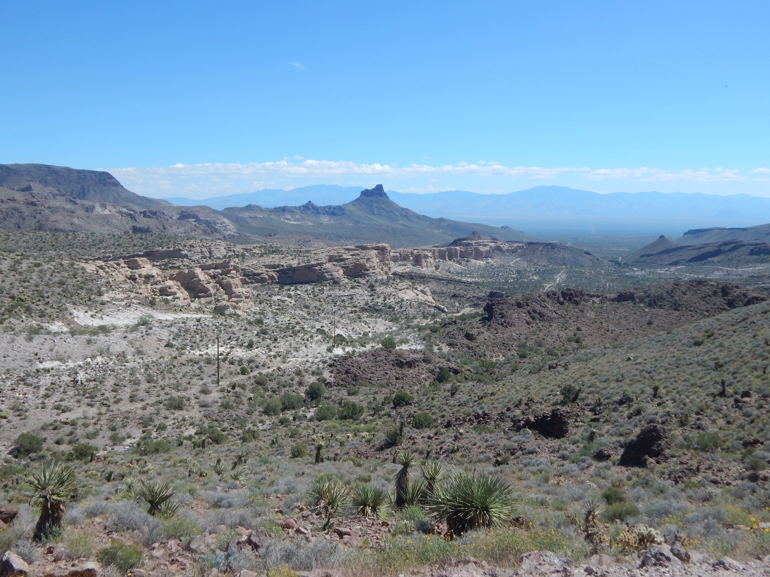
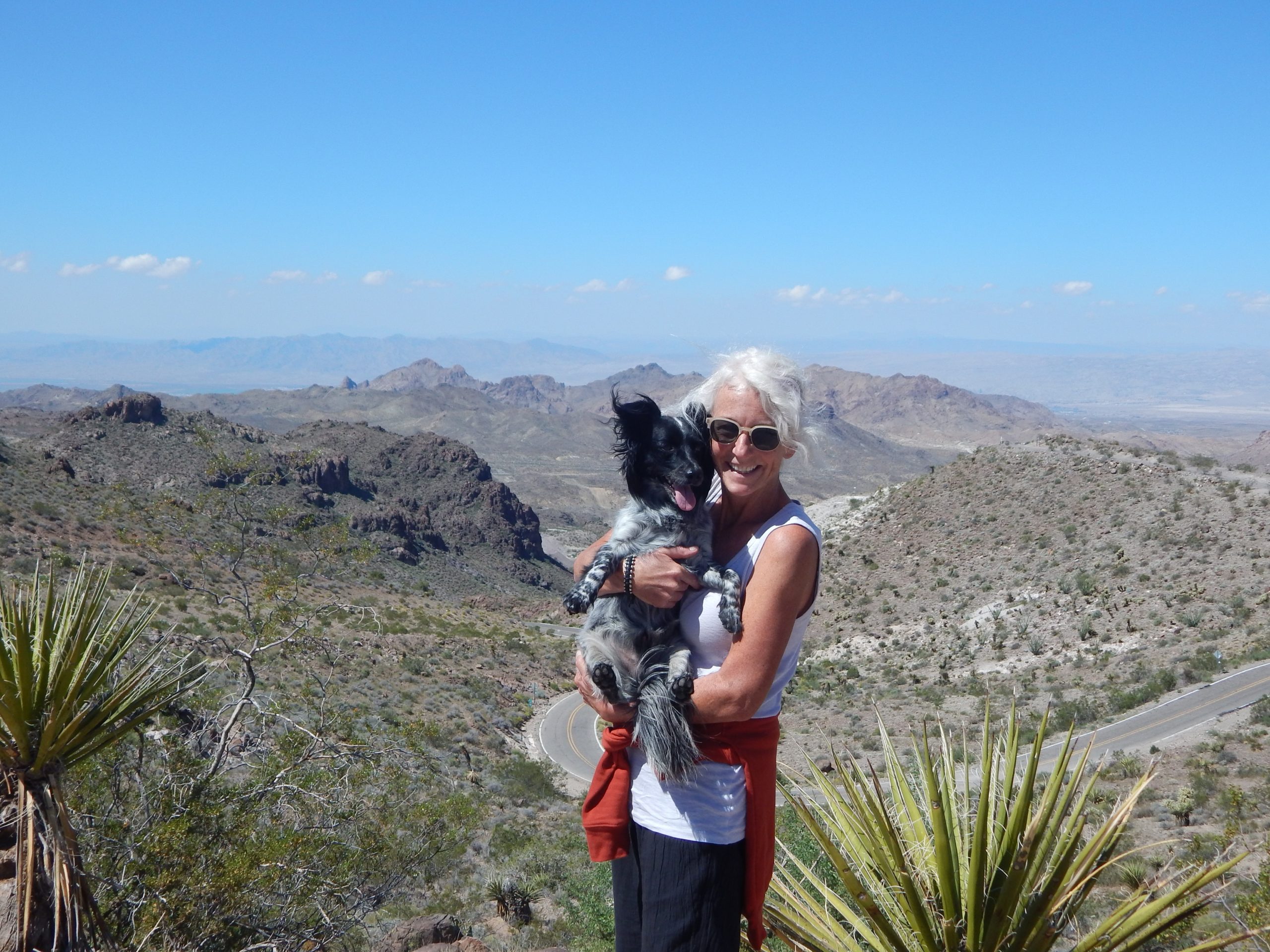
Instead of staying on Interstate Hwy 40, we took a long detour on historic Route 66 through Oatman. You can imagine the cars and travelers going around these windy bends and feeling nostalgic.
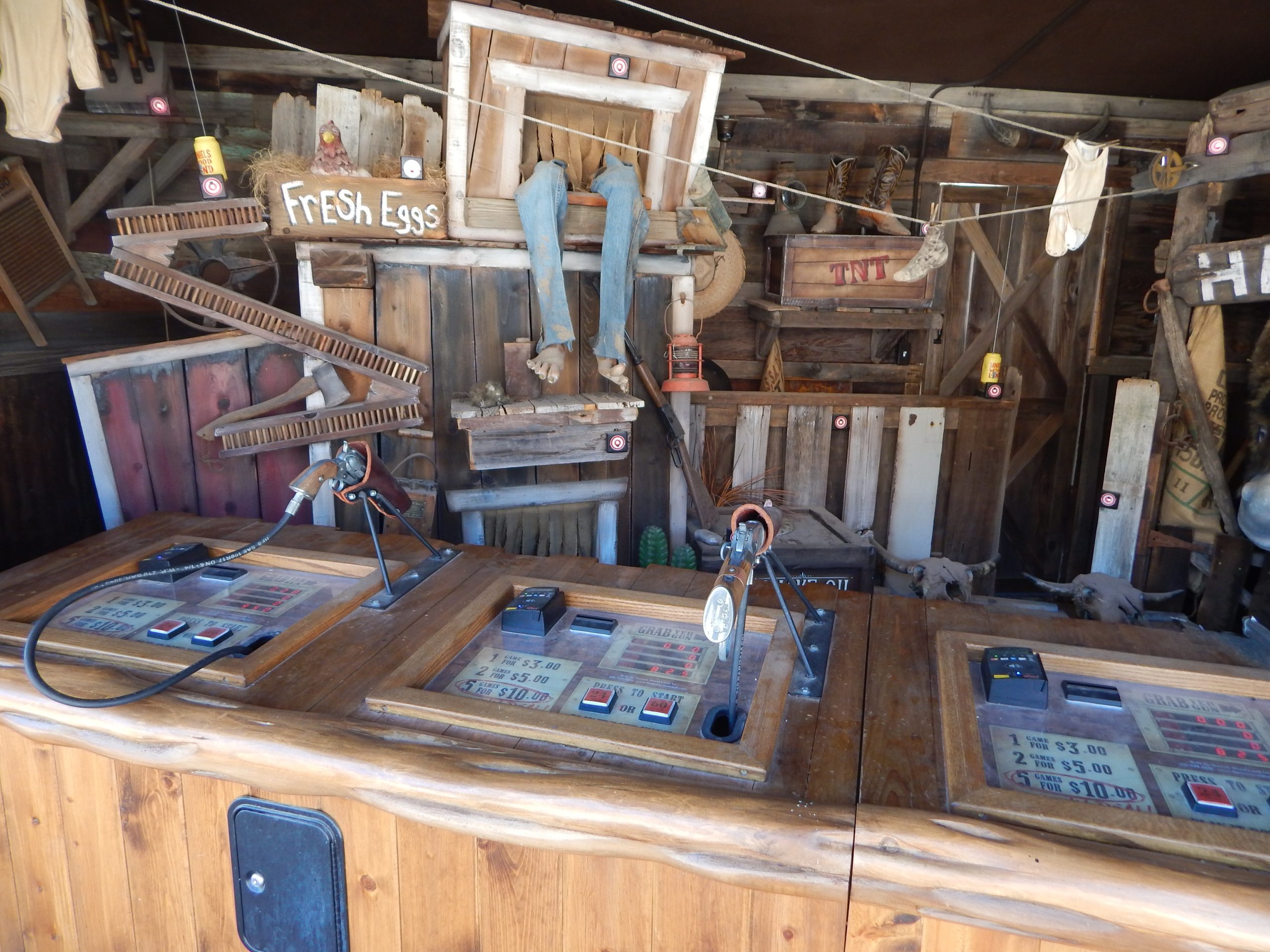
View to the north from Sitgreaves Passview to the south from Sitgreaves Passold timey shooting, with credit card option
We believe the old route went this way because there were already established mining roads. Pretty crazy drive though with the added free roaming burros to boot. The town felt a bit rough around the edges but you get a feel of what it might have been.
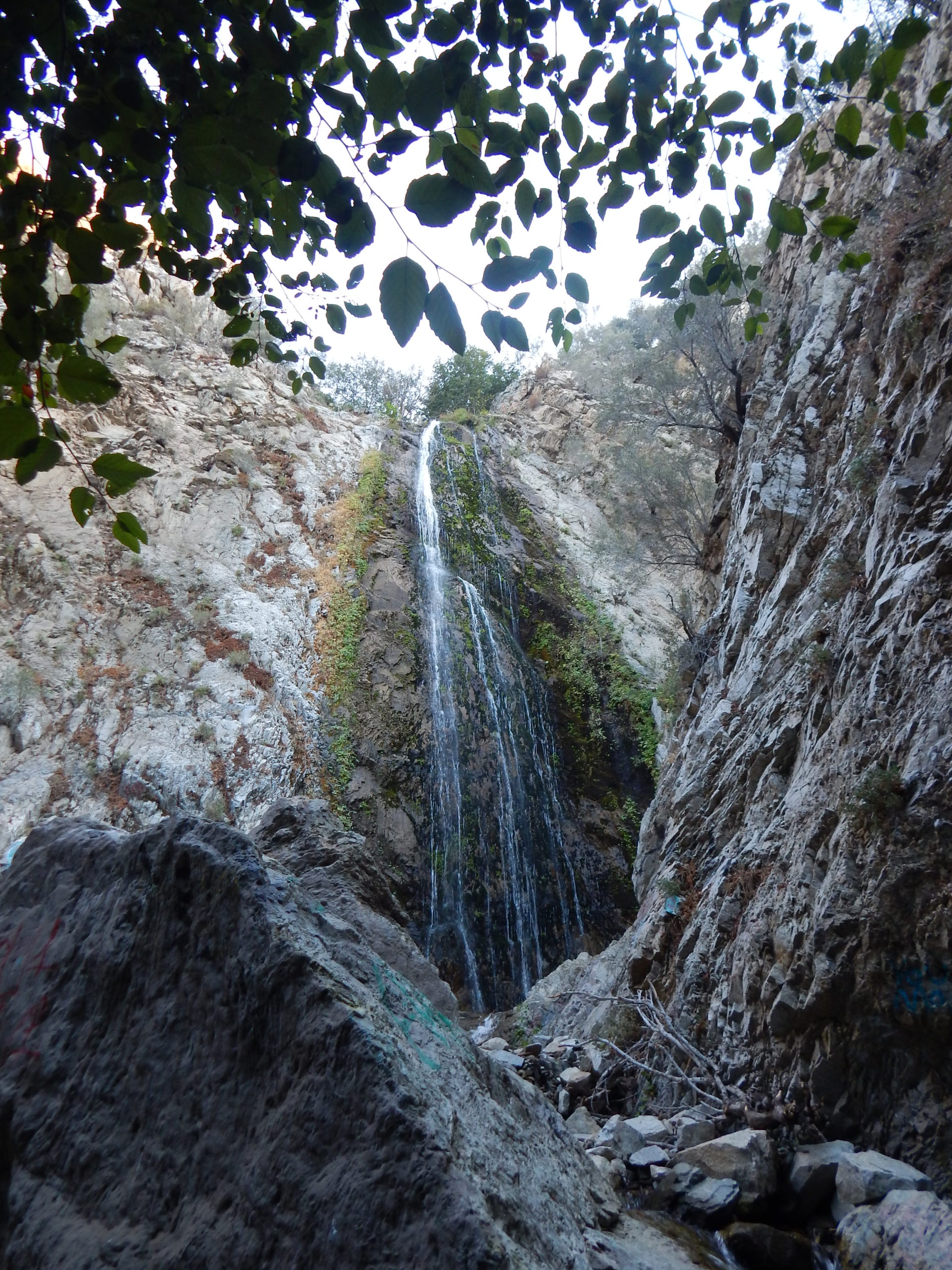
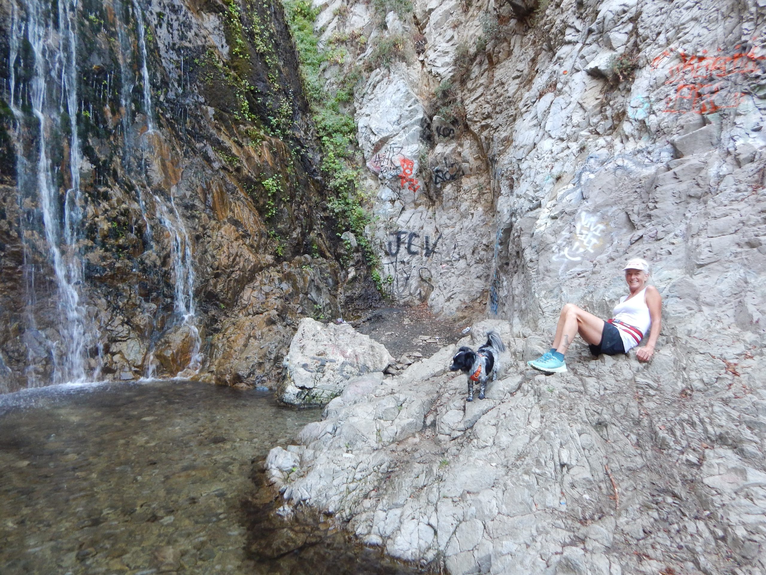
Paul found a pay campsite, Bonita Falls, near San Bernardino and we pulled in there for the night. It was an okay campsite with showers, plug-in etc. We did enjoy hiking up to the waterfall after arriving. Not very far and it was pretty impressive even with all the graffiti rocks. There were too many dogs barking at night to sleep well.
bonita fallsfalls pool with julie & mr goat
In the morning we did a 9 mile hike/run up Middle Fork Road to the Stone House Crossing Campground area. It was lovely and difficult at the same time. We got back and showered and headed to the Leta Hotel in Goleta. We parked in the back lot and after walking Billy Goat, dressd for the evening. Merriment with old neighbors and friends.
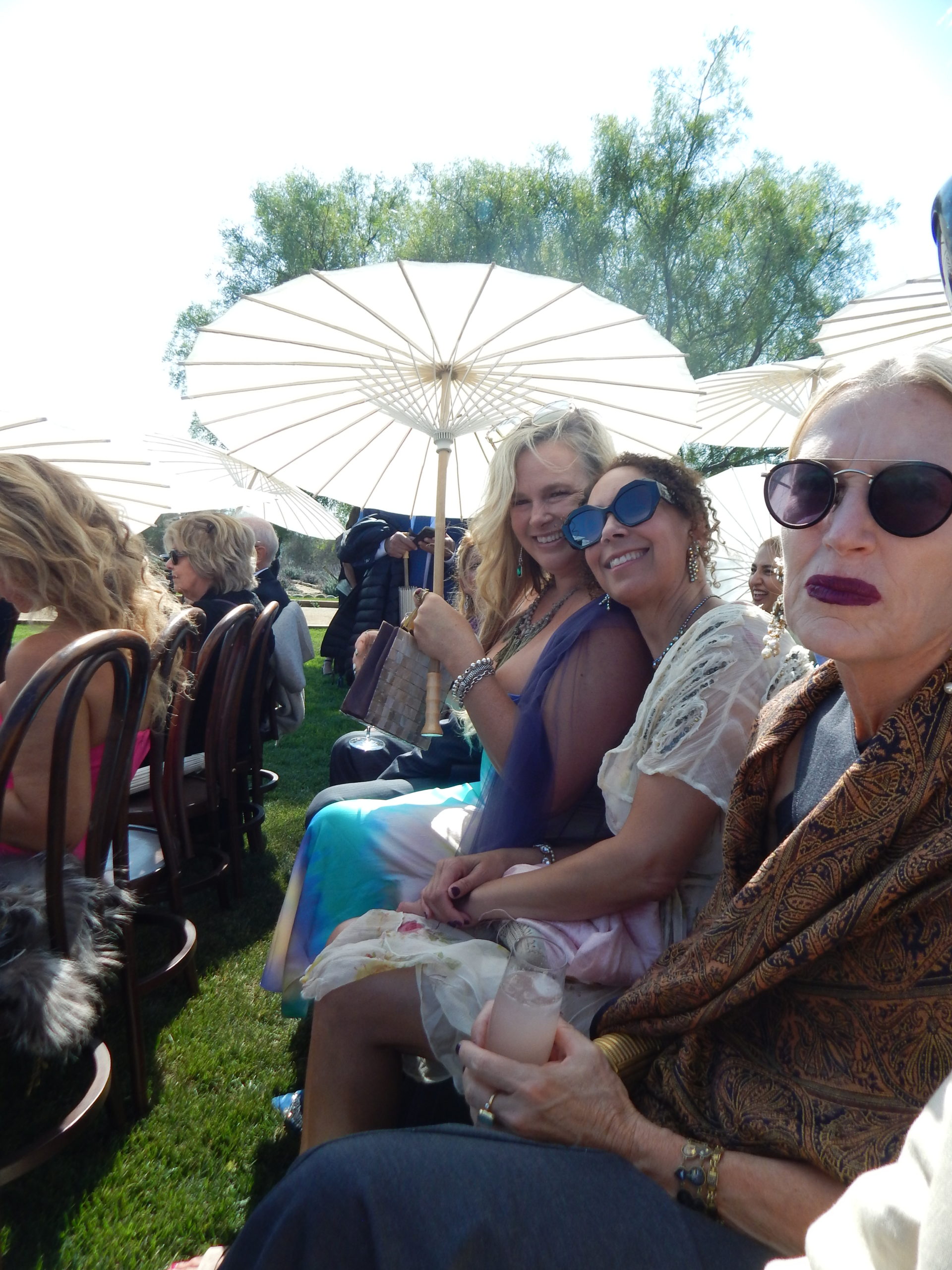
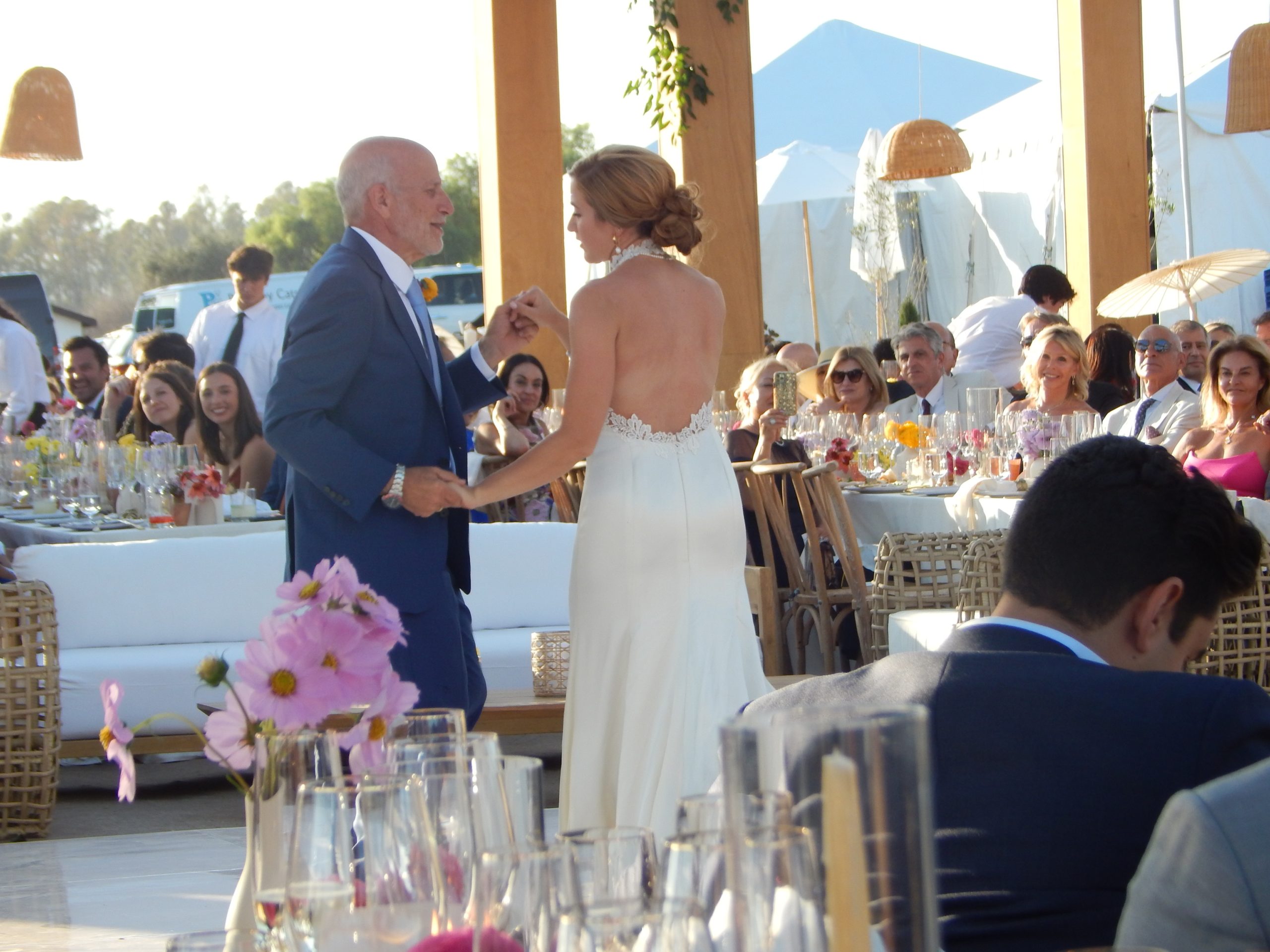
Wedding Day: We went for a run from the hotel down to Goleta Beach Park on a nice trail. Sadly I fell and hurt my shoulder pretty good. (not paying attention) Back at hotel we showered and dressed for an amazing wedding day for Dan and Zoe. We dropped Billy Goat off at a dog sitter and got on a shuttle to an event space. Lovely all around!
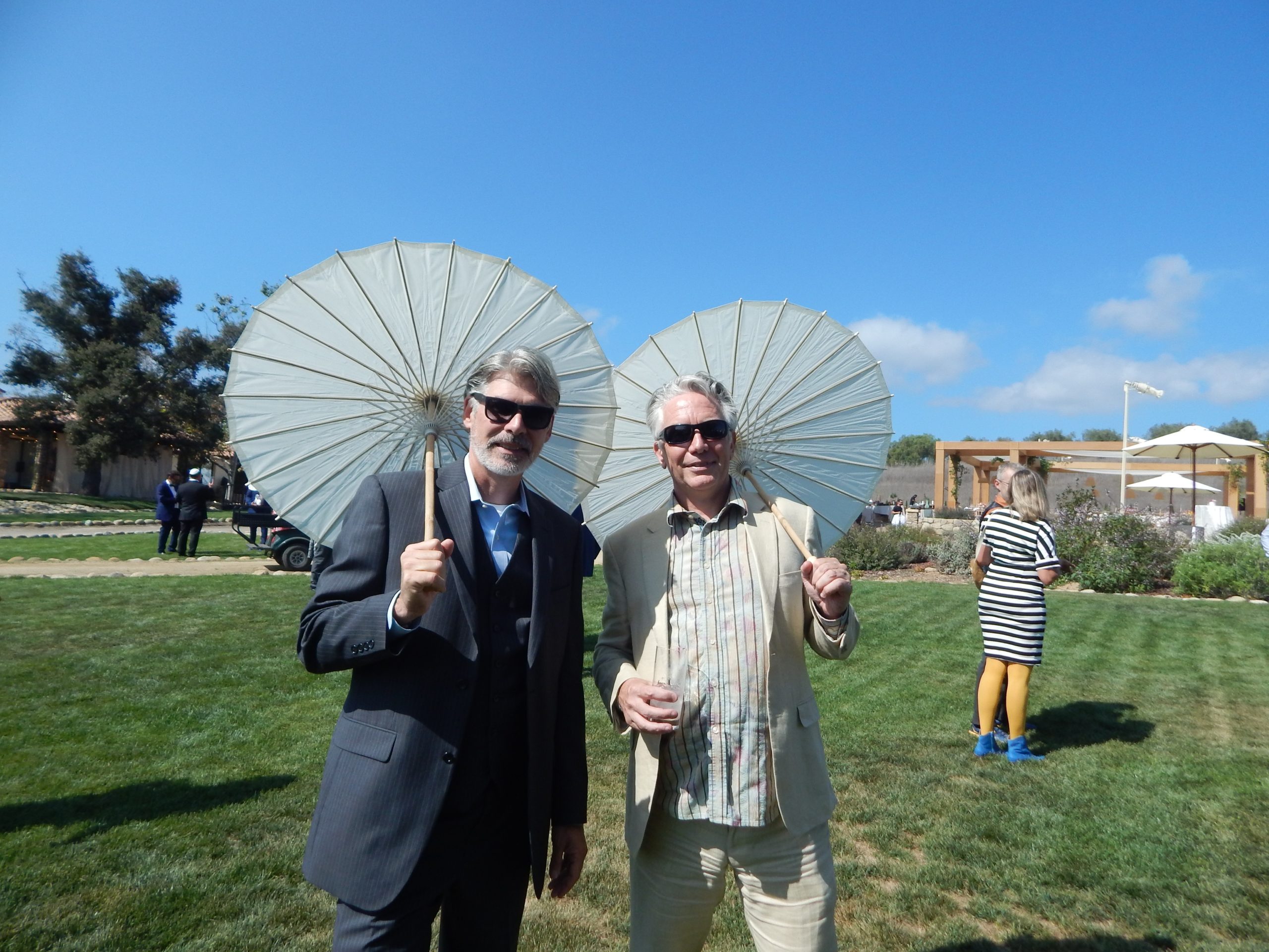
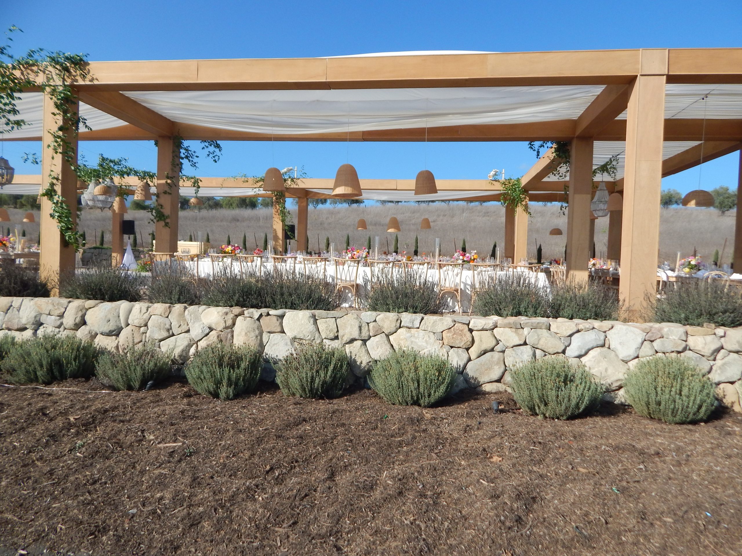
Paul, Dan & Amy … Swingin’Dan & Paul with parasolsold neighbors Amy & ChristyZoe and Mike, FoBWedding dinner siteZoe and Mike, FoB
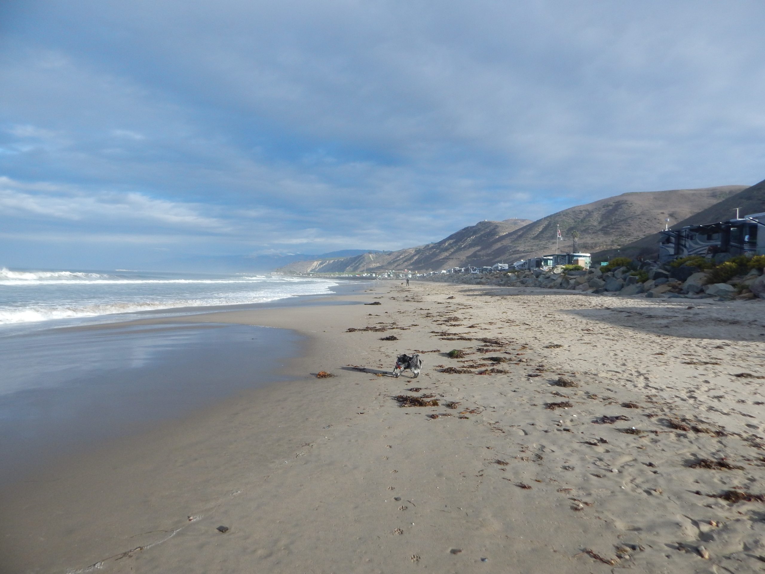
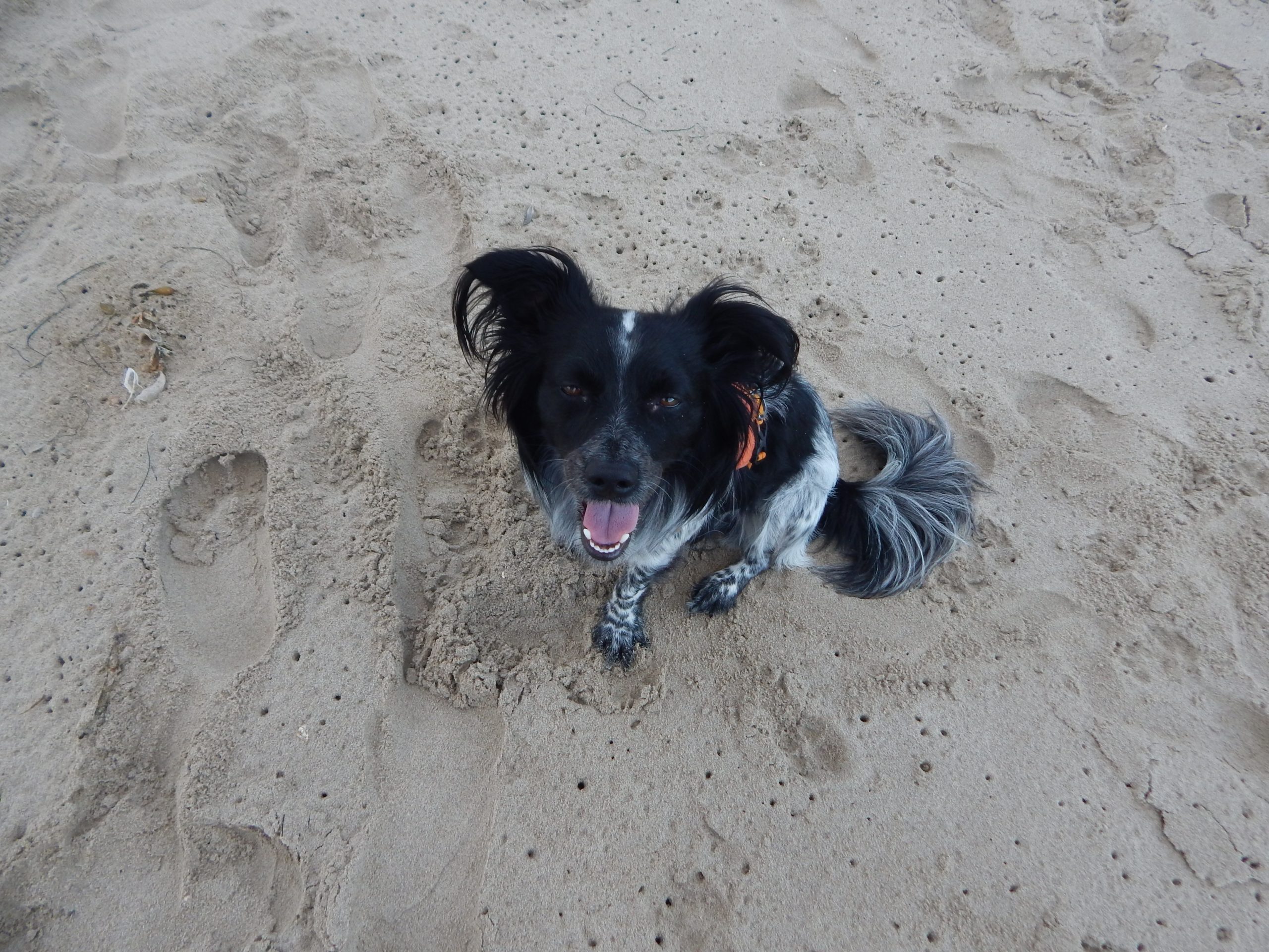
Beach day for people and dogs! We went to Campus Point beach to relax and enjoy the water with Mike, Linda, Zoe, Dan and family. Billy Goat loved this! Running around after Mello and other dogs. We were planning to drive inland for the night but got a late start and decided to sleep right directly on the Pacific Coast Hwy 1 just past Rincon Point. It was a bit strange to be parked next to big RVs but the sound of the ocean was worth it for a night. Mornings are particularly noisy with car traffic and for the high cost we probably wil not do that again.
William T. Goat at the Pacific Ocean
Heading back to New Mexico we made one stop at the Lavic Volcanic Field to take a break, eat lunch and roast in the black earth. We actually picked up our dog a few times as we were worried about his feet. There are suppossed to be pretty cool cave here but we just hiked up the mound and down. Might be nicer on a cooler day.
BLM land for the night near the Wabayuma Peak Wilderness. Just off hwy 40 and pretty easy to get to, although you have to drive in about a mile or two to get the best spot. Fantastic!
My friend Gene Dykes asked if I would like to join him and some other folks on a run crossing of Zion National Park. We made plans to cross in 2020 but it was cancelled because of covid. Thankfully this year we were able to have the go ahead.
Paul and I left our home on Tuesday, May 3rd 2022. We offered our home for the week to fire evacuees that lost their home in the Mora area of NM. We stopped in ABQ to fill the van with food supplies and headed to Flagstaff. There we parked and walked around then met up with friends Shari and Paul for dinner at Swaddee Thai. Our friends offered their driveway for the night and we slept well. Billy Goat and I took a morning walk on the forest road before saying our goodbyes.
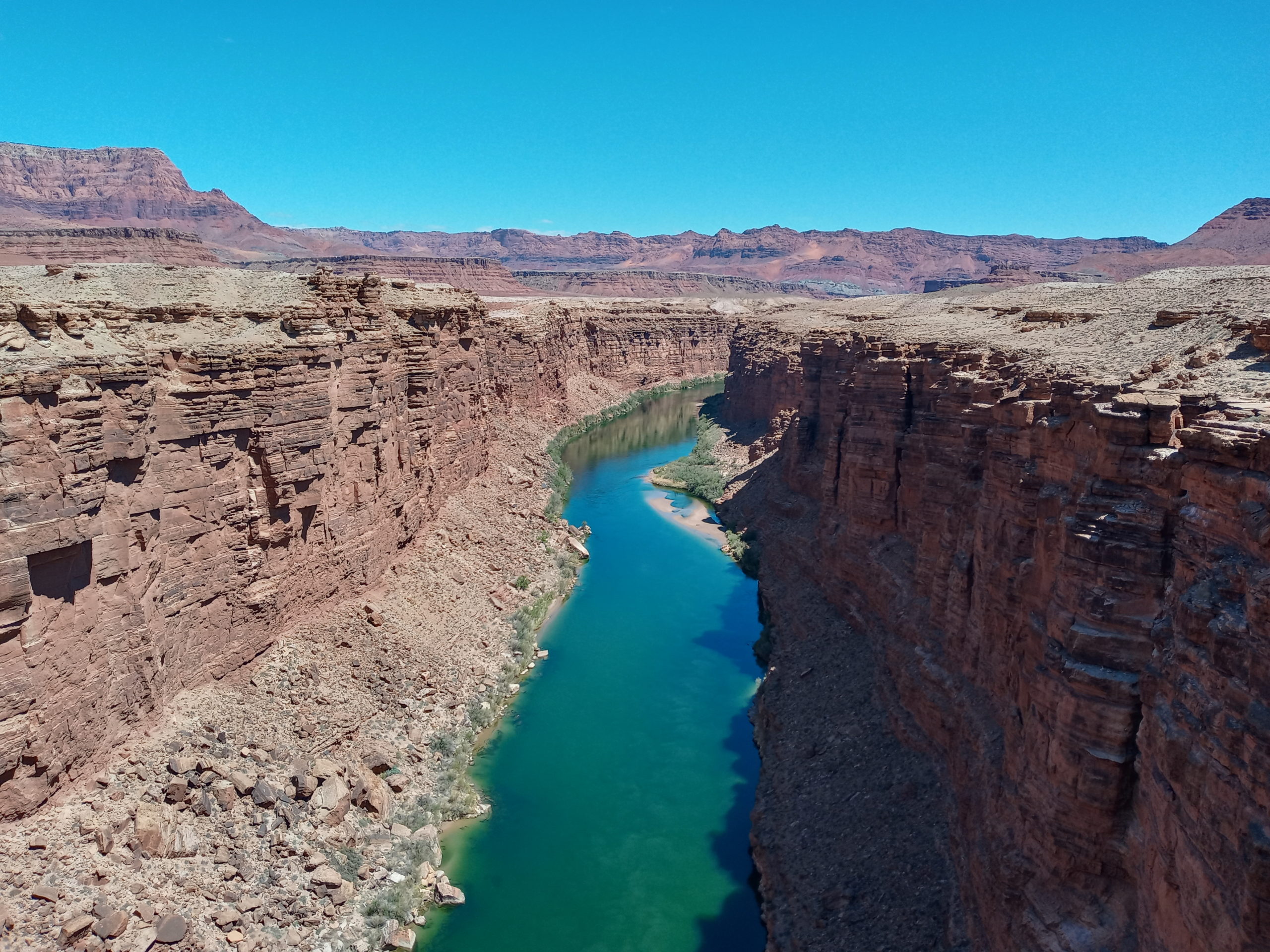
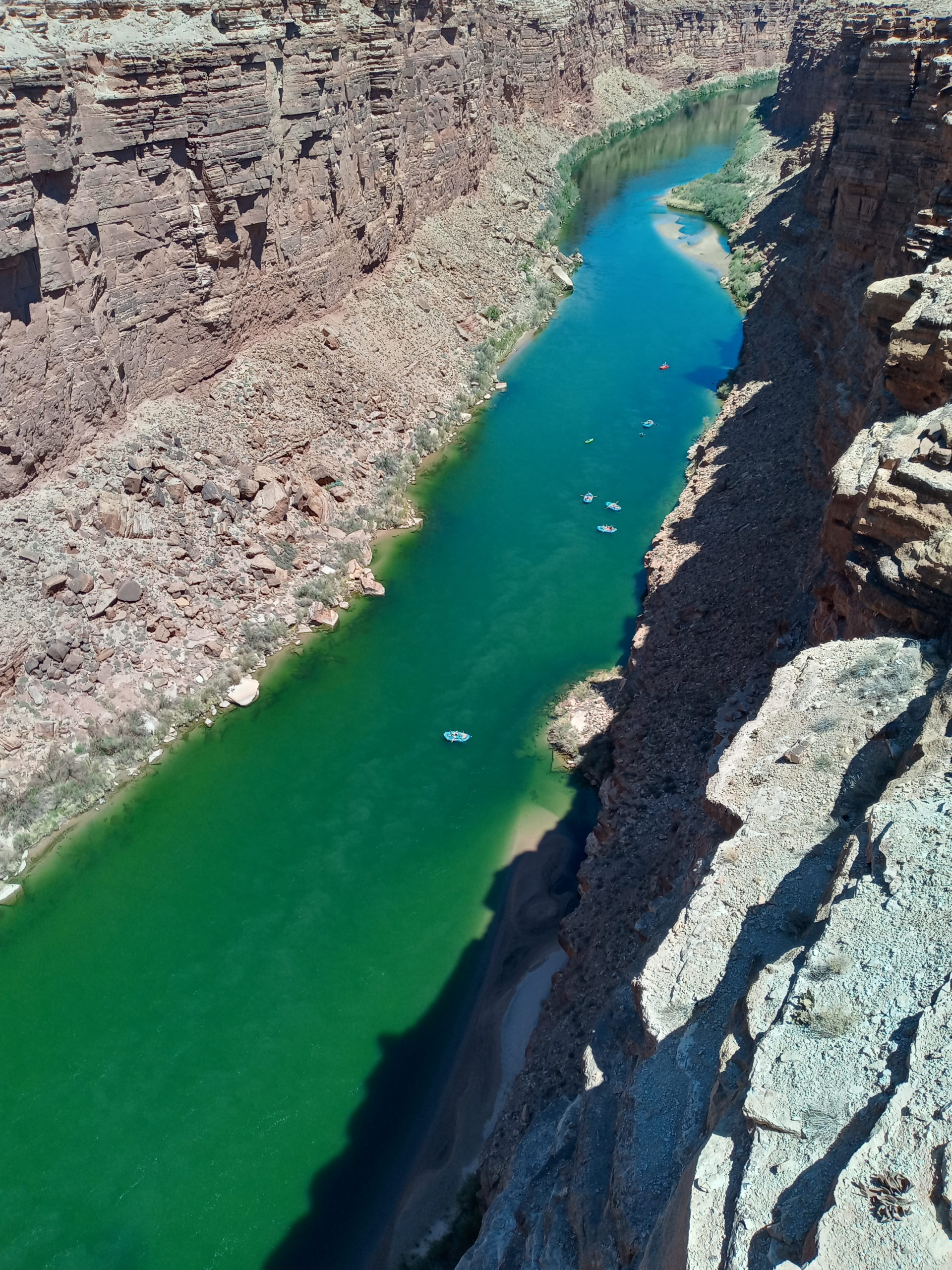
I love breakfast trucks so when Paul stopped for gas I jumped out to order a breakfast burrito at one in between the Circle K and Cinders Liquors on 89 N leaving Flagstaff.(Definitely recommend) We then drove on a bit and stopped at a favorite spot on Loop Road 545 to make coffee and eat. Continuing on 89 N is a lovely drive. We stopped on the Historic Navajo Bridge for a leg stretch and watched rafters below in the Colorado River.
We drove along the Vermillion Cliffs and stopped for lunch in the National Forest just past the North Rim Road to the Grand Canyon. It is hard to tire of this drive even though we have done it before. Our meet up place was La Verkin, UT at an airbnb. We parked in the driveway and Christine and Brent were already there. After the rest of the gang arrived, (Gene, Candy and Nicole) we had a meeting about the next day plans and headed to bed early.
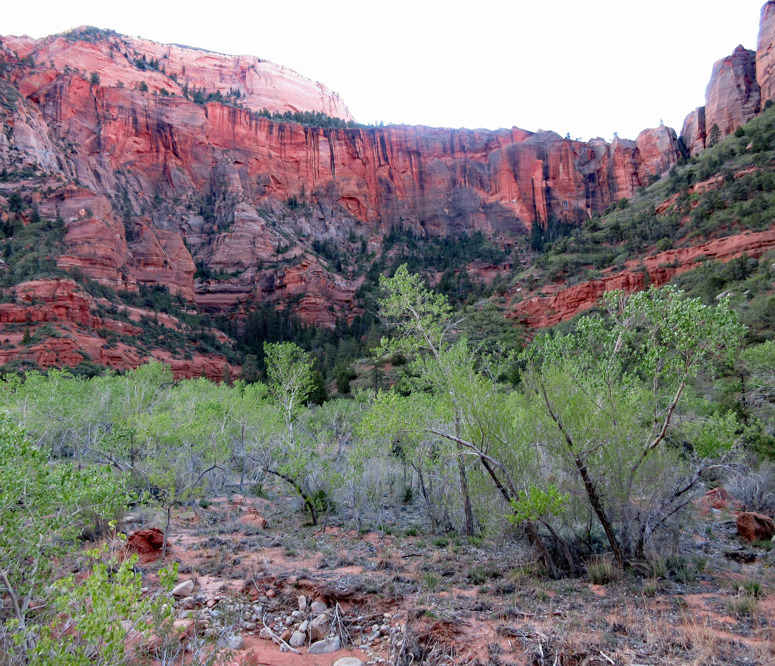
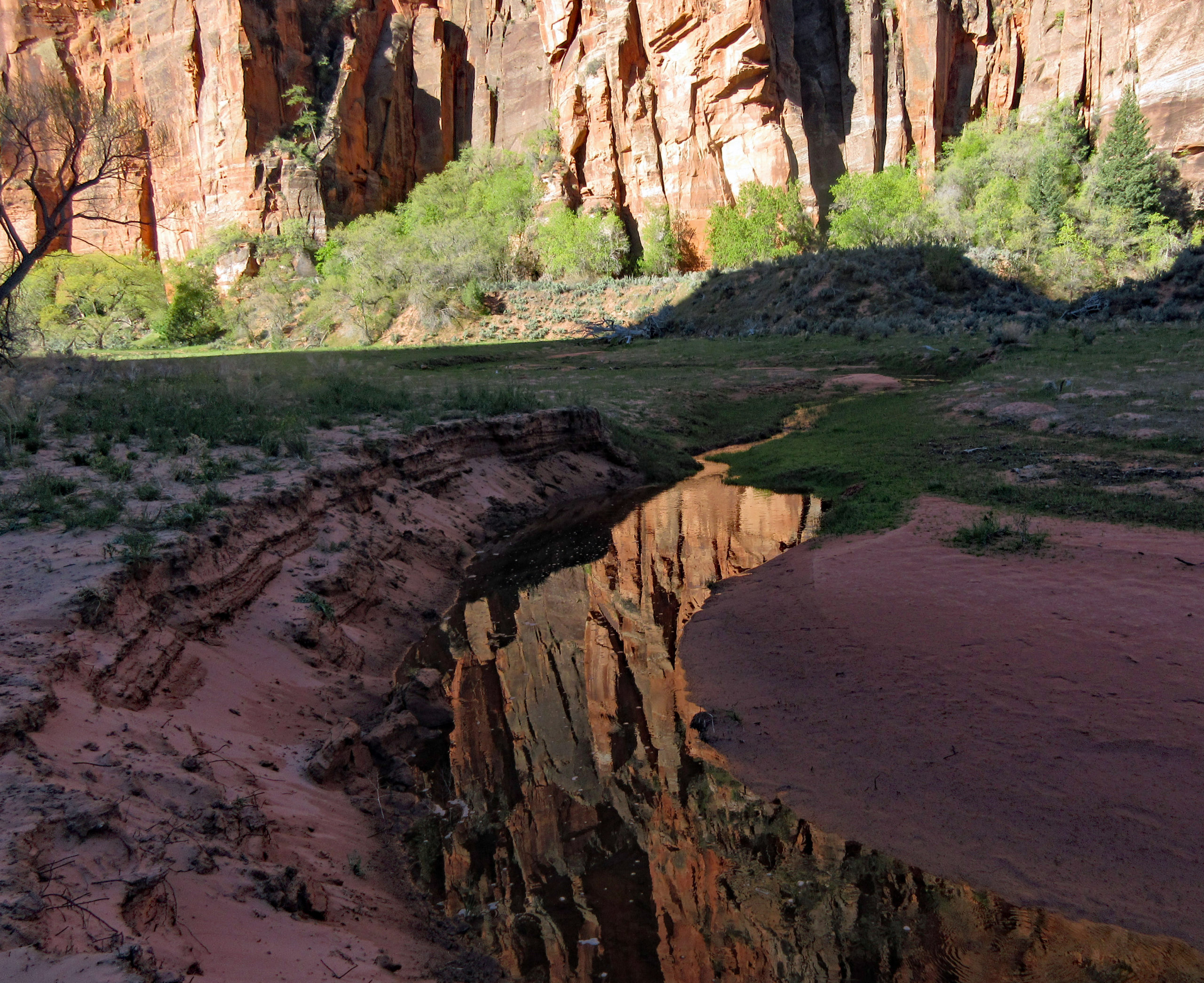
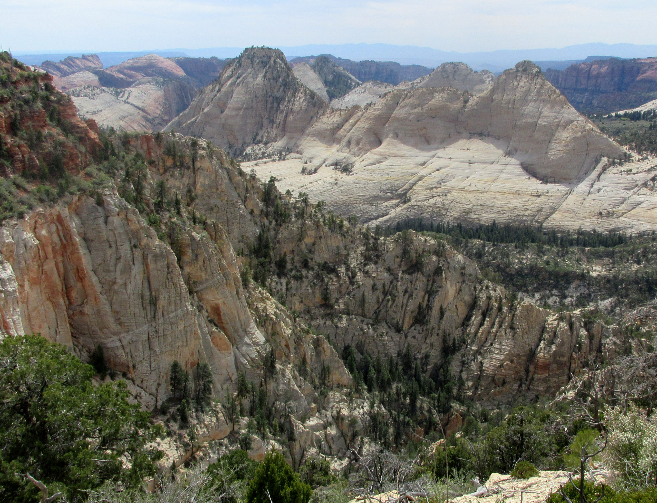
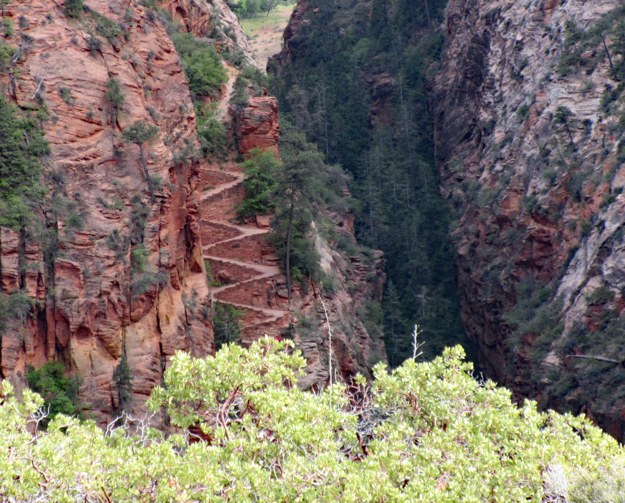
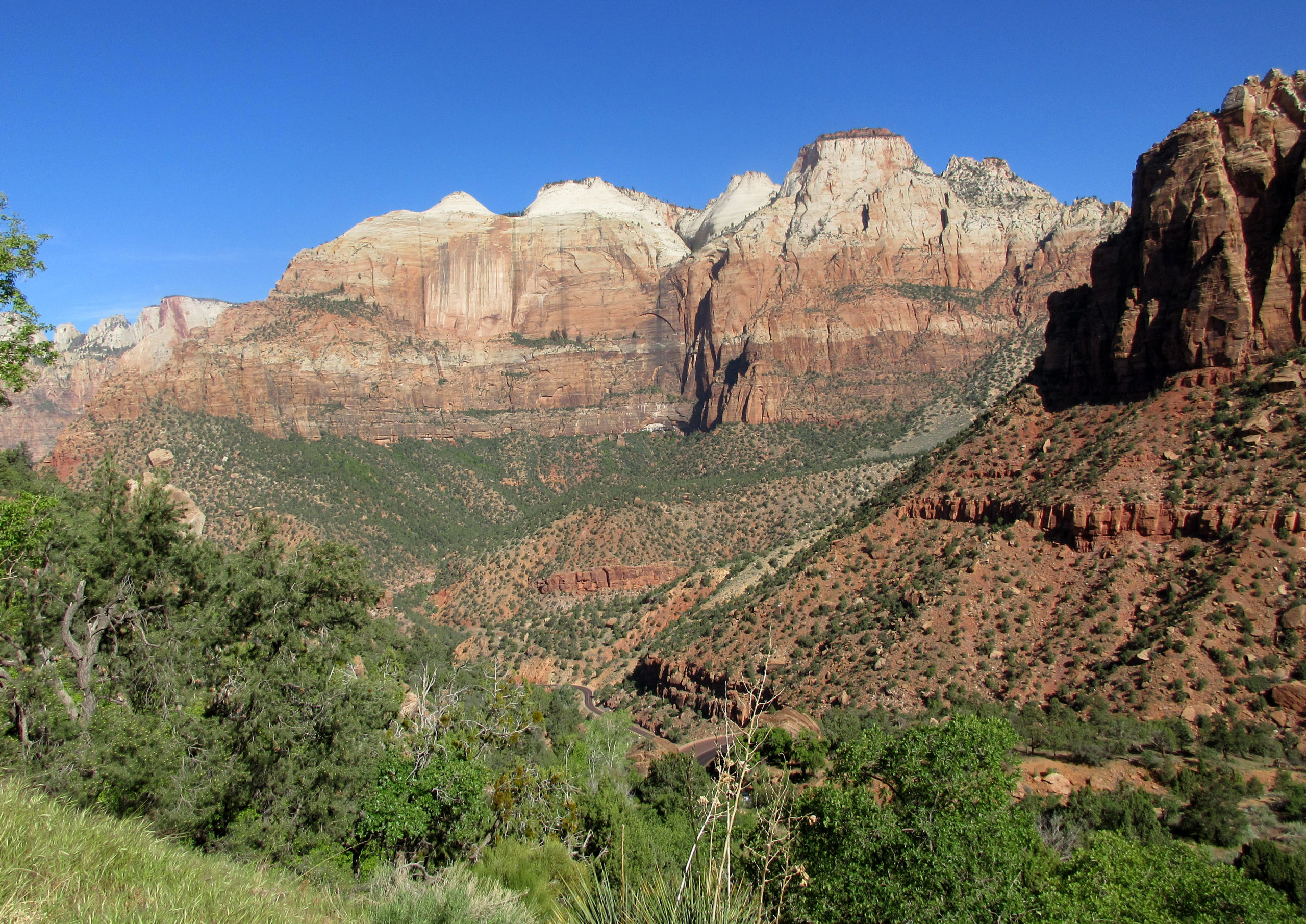
Zion Crossing: Up before dawn and walk Billy Goat, breakfast, then head to Lee Pass where we start our journey. The sun is already rising so we don’t need a torch for long. Its cool, almost chilly but if we keep running at a slow pace I find it mostly comfortable. La Verkin creek trail winds along Timber creek then hits La Verkin Creek. This was my favorite part of the day, criss crossing the creek with the huge canyon walls on both sides. The sand slows us down and some have wet feet. We meet back up with Paul around mile 14 , Hop Valley, for our only aide station. The rest of the run was stops and starts, ooohs and aaaaahs. Very hard descent back into Zion to get to the Visitors area where Paul was waiting with pizza. 37+ miles and I am totally spent.
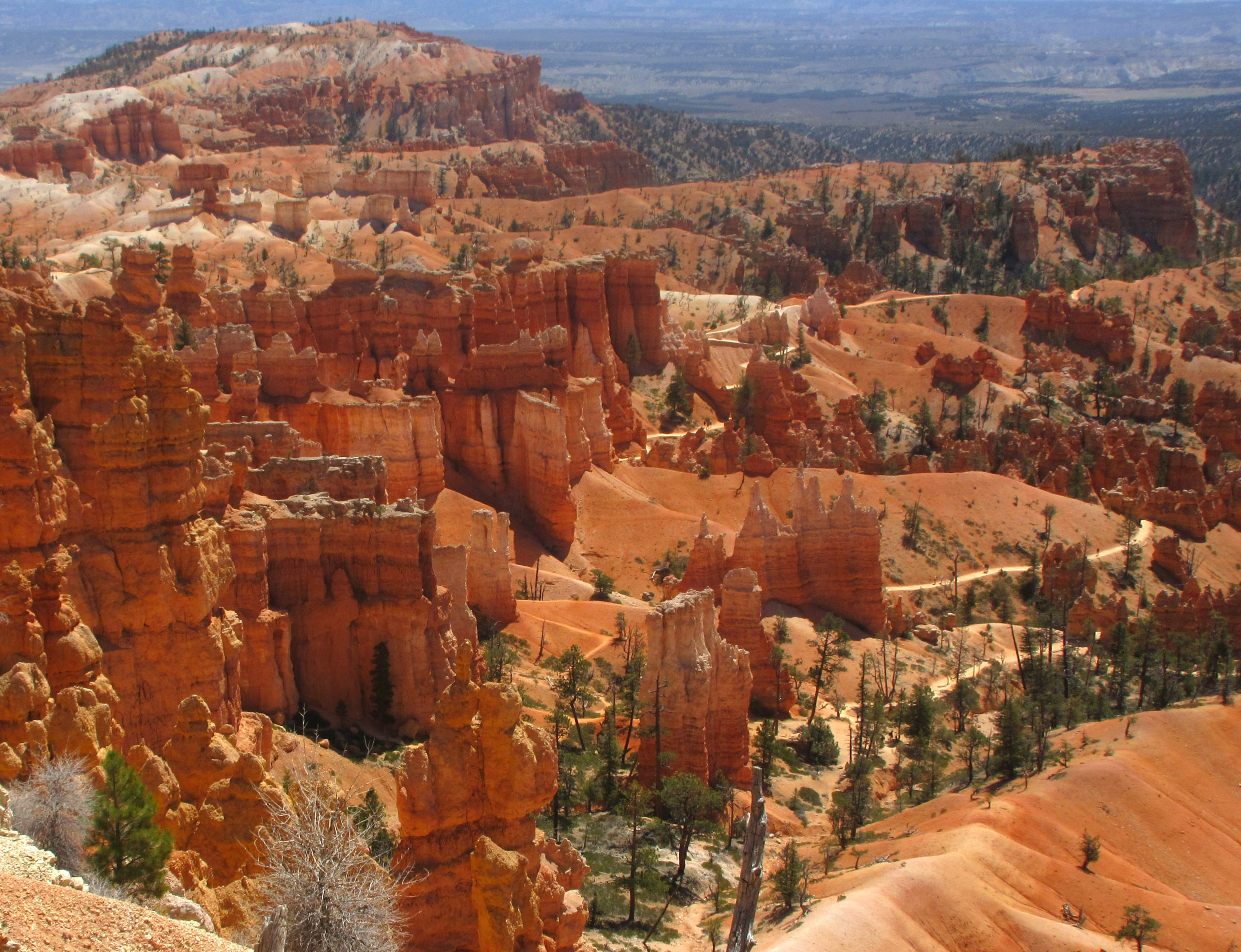
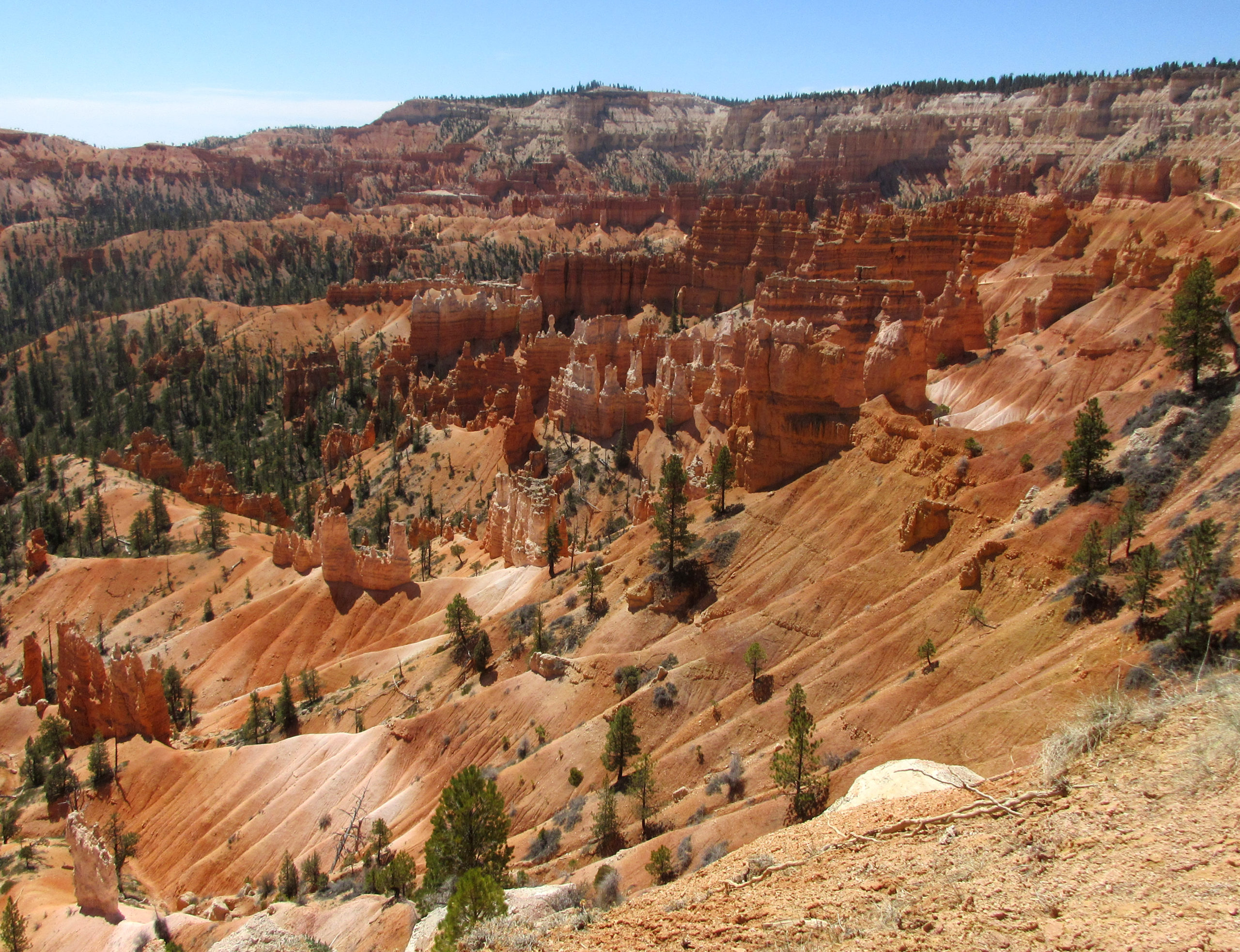
Bryce Canyon and Capital Reef: I have never been to Bryce Canyon before and was wowed immediately. After walking Billy on the ridge we hiked/ran a bit of the canyon. Gene had some other plans for the day so we made it quick.
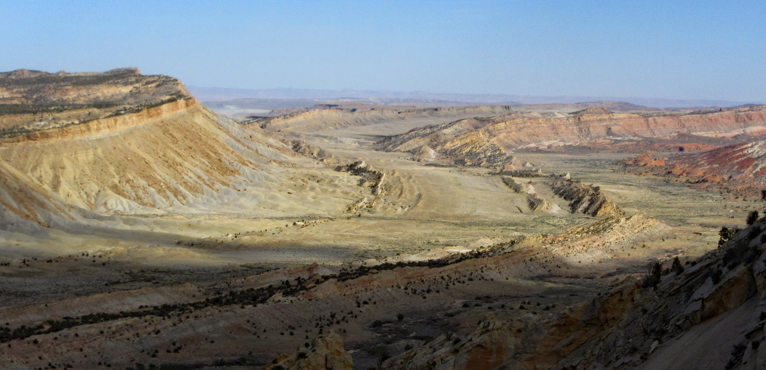
Back on the road we turned right a little after Boulder, UT onto back roads of Capitol Reef. When I say back roads, I mean 4wd roads. Gene showed us some amazing spots though so it was worth the crazy, bumpy ride. After driving through Singing Canyon(Long Canyon) and eating some lunch, we headed to Strike Valley Overlook. We let Billy Goat do the short out and back with us, even though the sign said no dogs. He was so happy to be with the group for a bit. Afterwards we drove a long way back through the park to an airbnb in Teasdale where we parked in the driveway and slept to mooing cows.
Strike Valley (from “Strike Valley Overlook”)
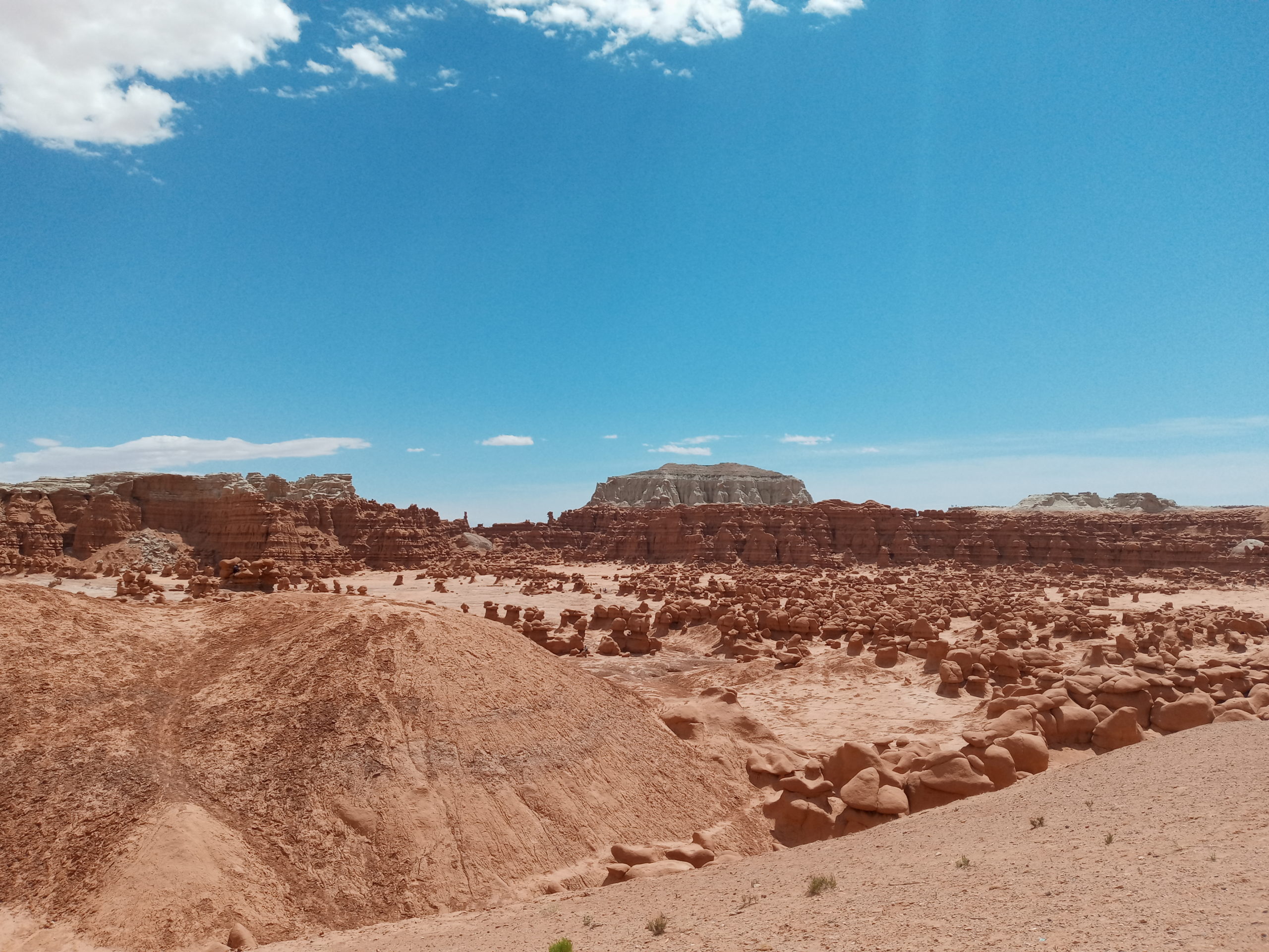
Goblin Valley SP and Wild Horse Canyon: Breakfast, pack up and drive back through the heart of Capitol Reef and on to Goblin Valley State Park. Here we just let loose and explored the place. You can have dogs hike with you which made Billy Goat happy. He was jumping up on rocks and cliff formations.
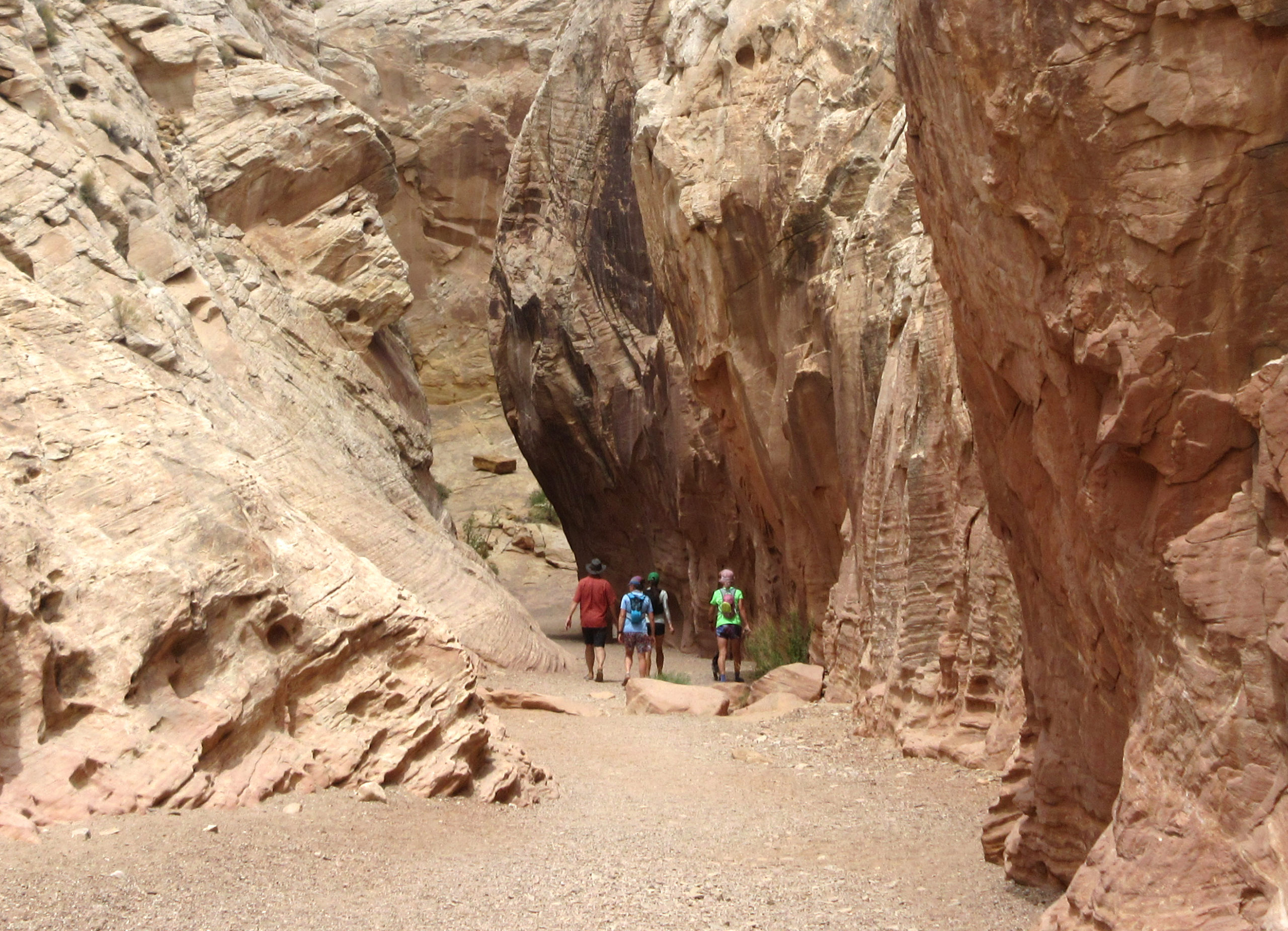
Next we went to run in some slot canyons. We chose the Wild Horse loop which was about 9 miles. It was getting a bit hot but the shade and wind helped keep us mostly cool. There was some technical scrambling and we had to lift Billy a few times. Toward the end we took off running and searching for shade.
The wind picked up and dust covered everything. Glad to be back in the van and heading to Moab. Here the airbnb had a sweet pool so Paul and I cleaned up and went for a swim. Afterwards the whole gang met for dinner at Arches Thai. John and Jen came too and spent the night in the airbnb. Paul and I went to BLM land just North of Moab to snooze.
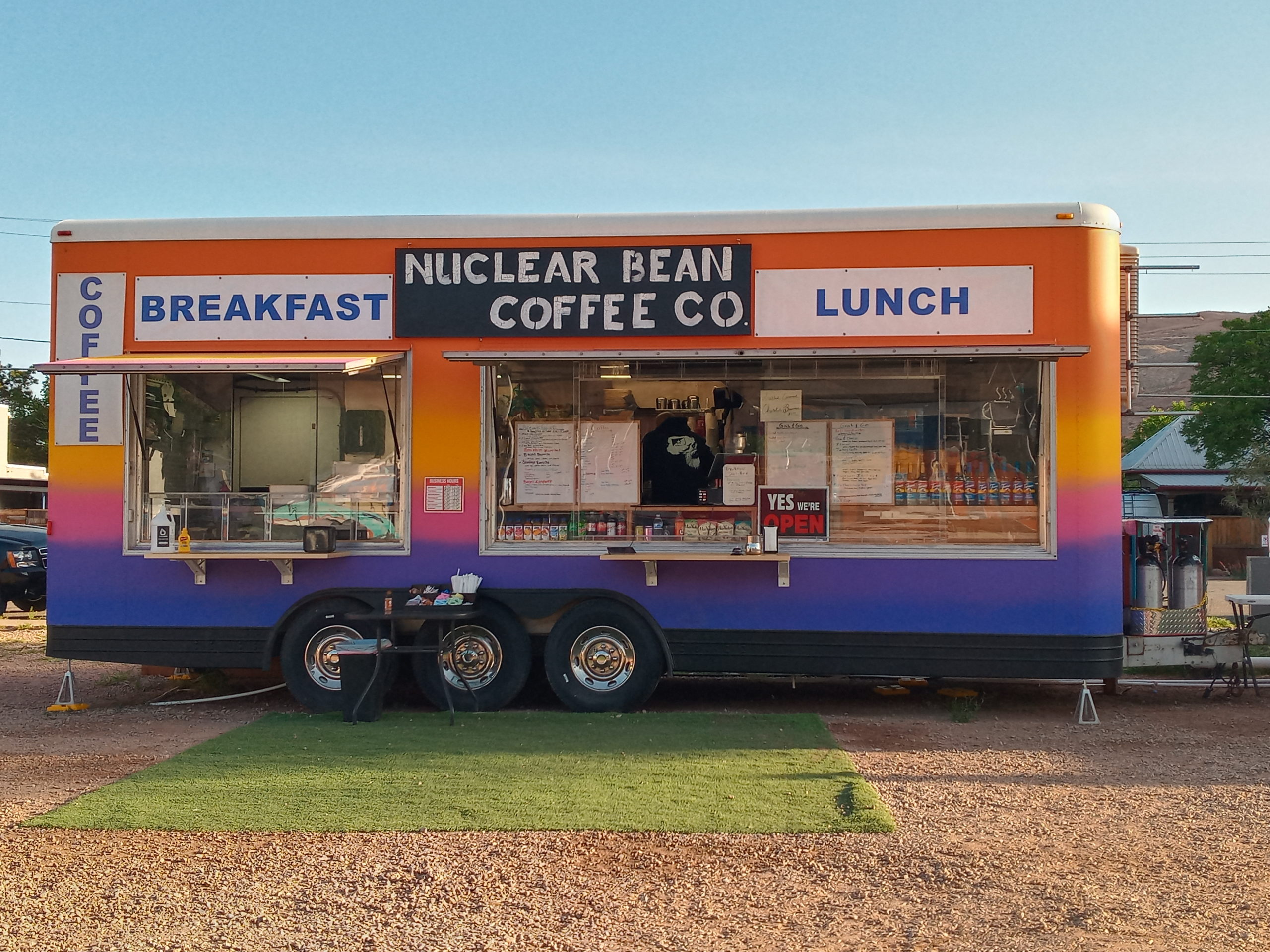
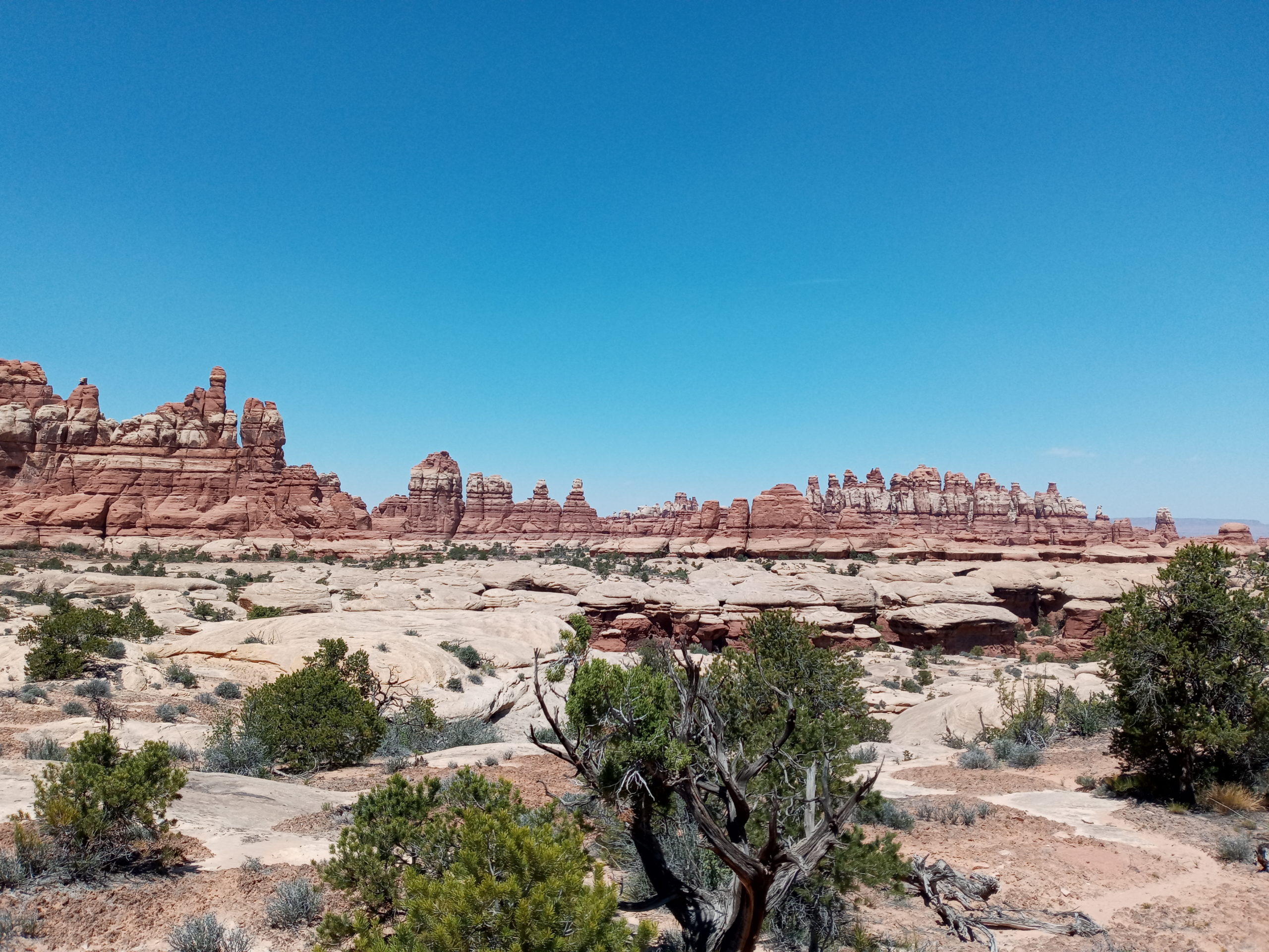
Canyonlands Needles Area: In the morning we could see clearly that we parked close to the Bar M trails where Gene and I did the Arches Ultra race in 2019. After a Billy’s walk we headed into Moab and had coffee and breakfast at Nuclear Bean Coffee in the Moab food truck park.
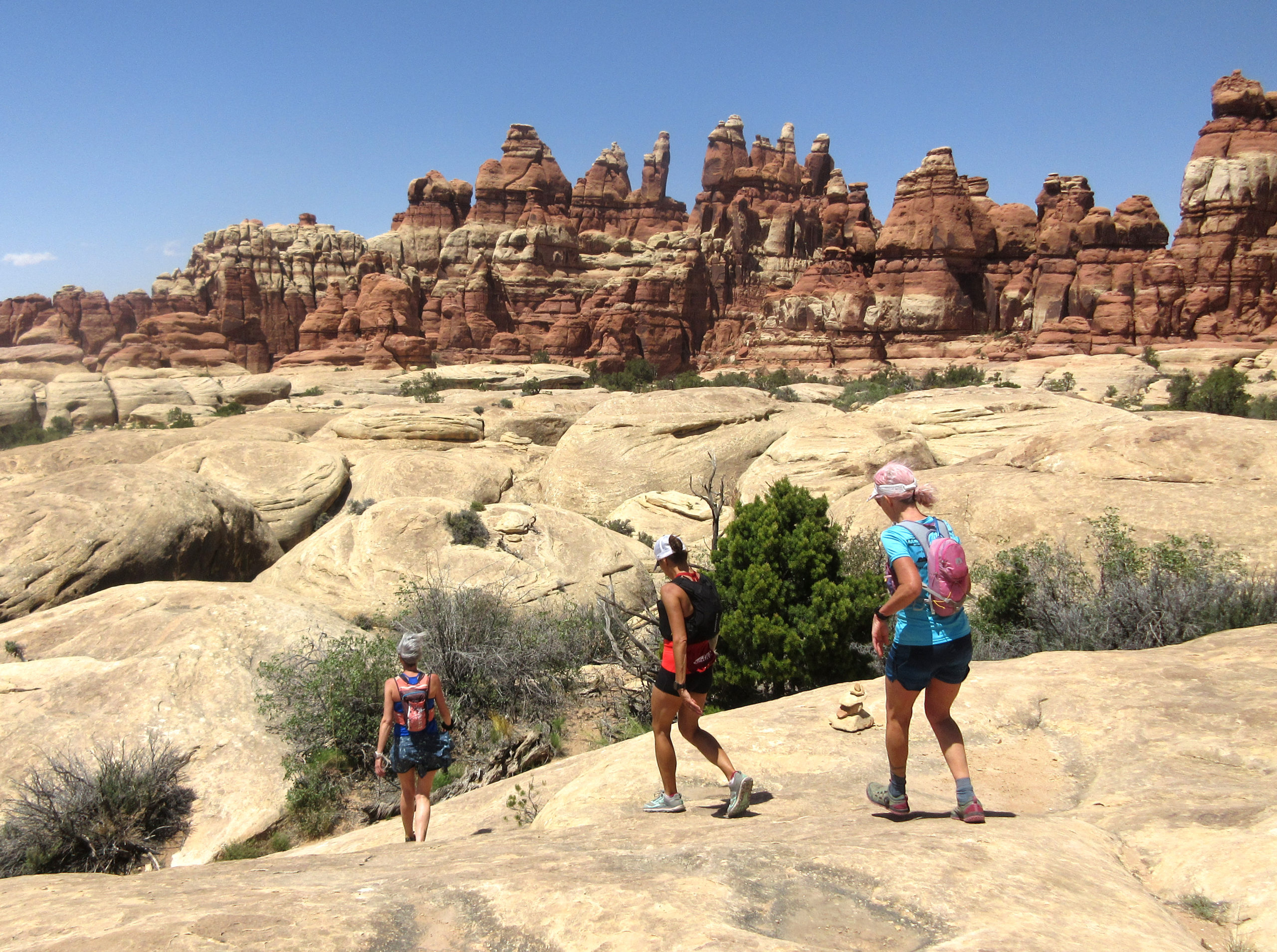
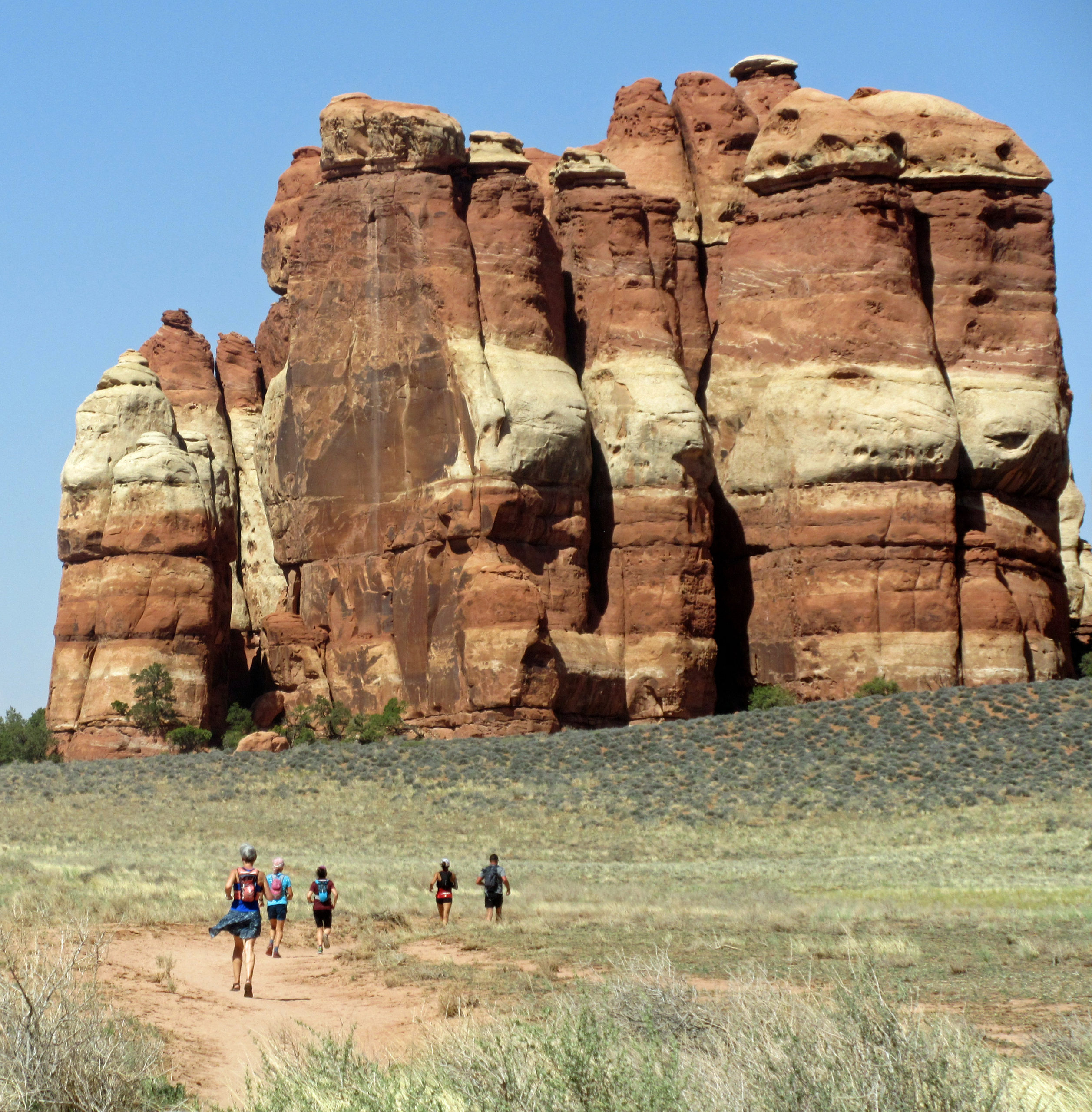
Yummy and a very tasty sauce for the breakfast burrito. We drive back to the gang and then meet up at Elephant Hill trail head for our day run/hike. It was already windy but we ran into the park and it was one of the best days on the trip. The running was easy and the caves, slot canyons and views were spectacular. It took us about 5 hours to do our lollipop loop and after saying goodbyes we started for home.
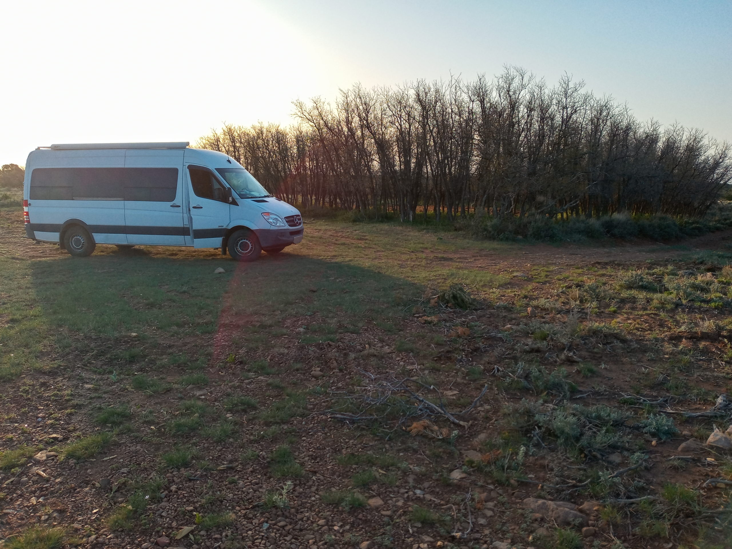
We only made it to Monticello before the winds and dust-filled sky made us find refuge in the National Forest. We went towards Lloyd’s Lake and continued on the forest road (5255)to park behind some trees for the night.
the trees that protected us through the nightmorning view, no dust
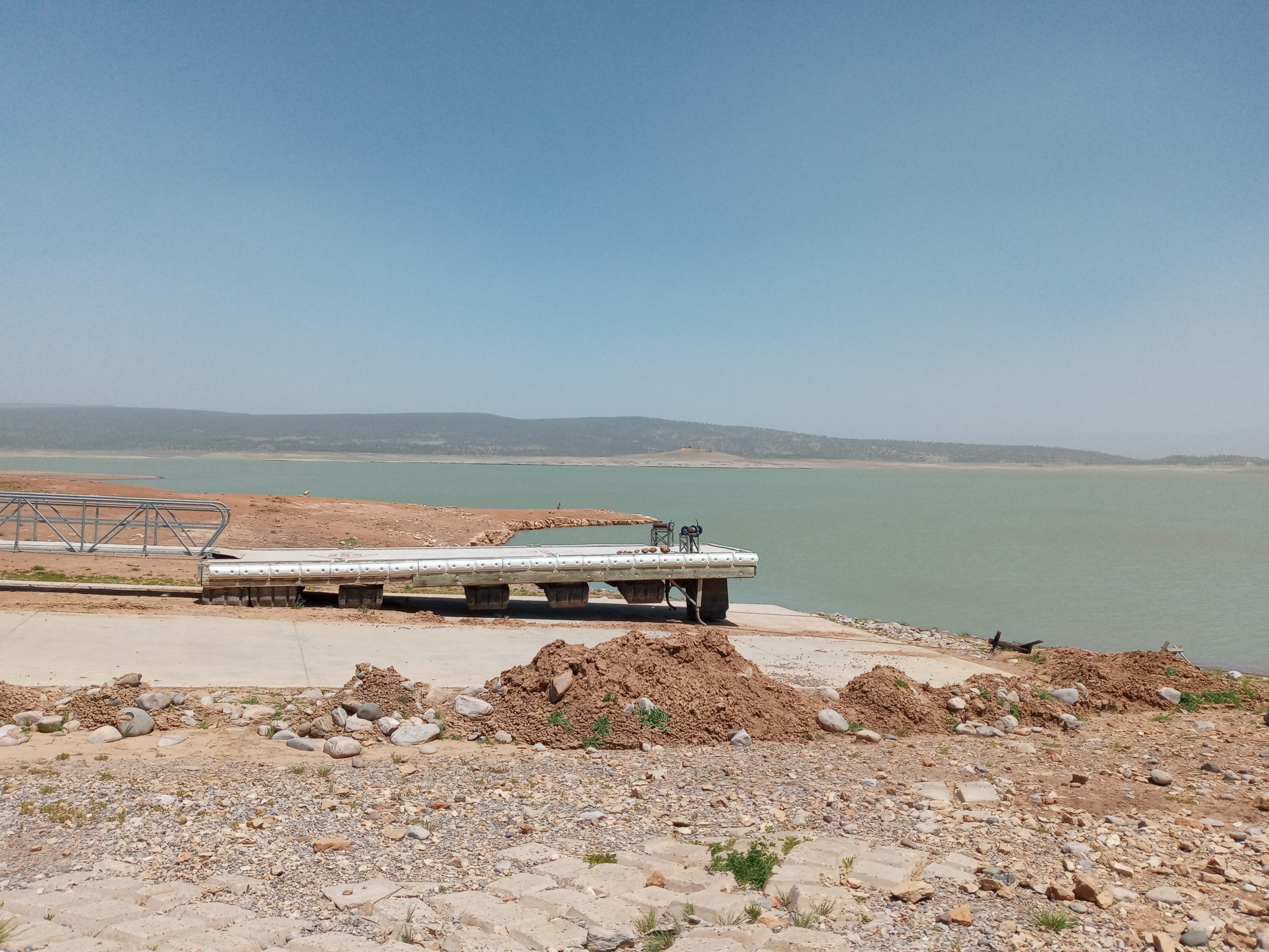
Making our way back home: In the morning it was much calmer. It was a pretty drive with a breakfast stop in Cortez at a little park on Denny Lake. We made our way through Durango, Pagosa Springs and stopped again for lunch at Heron Lake SP. The lake was pretty sad and the water level very low. No boats could use the ramp. We enjoyed lunch, paid the $5 and left.
We make a few more stops before arriving home safely. Whew!
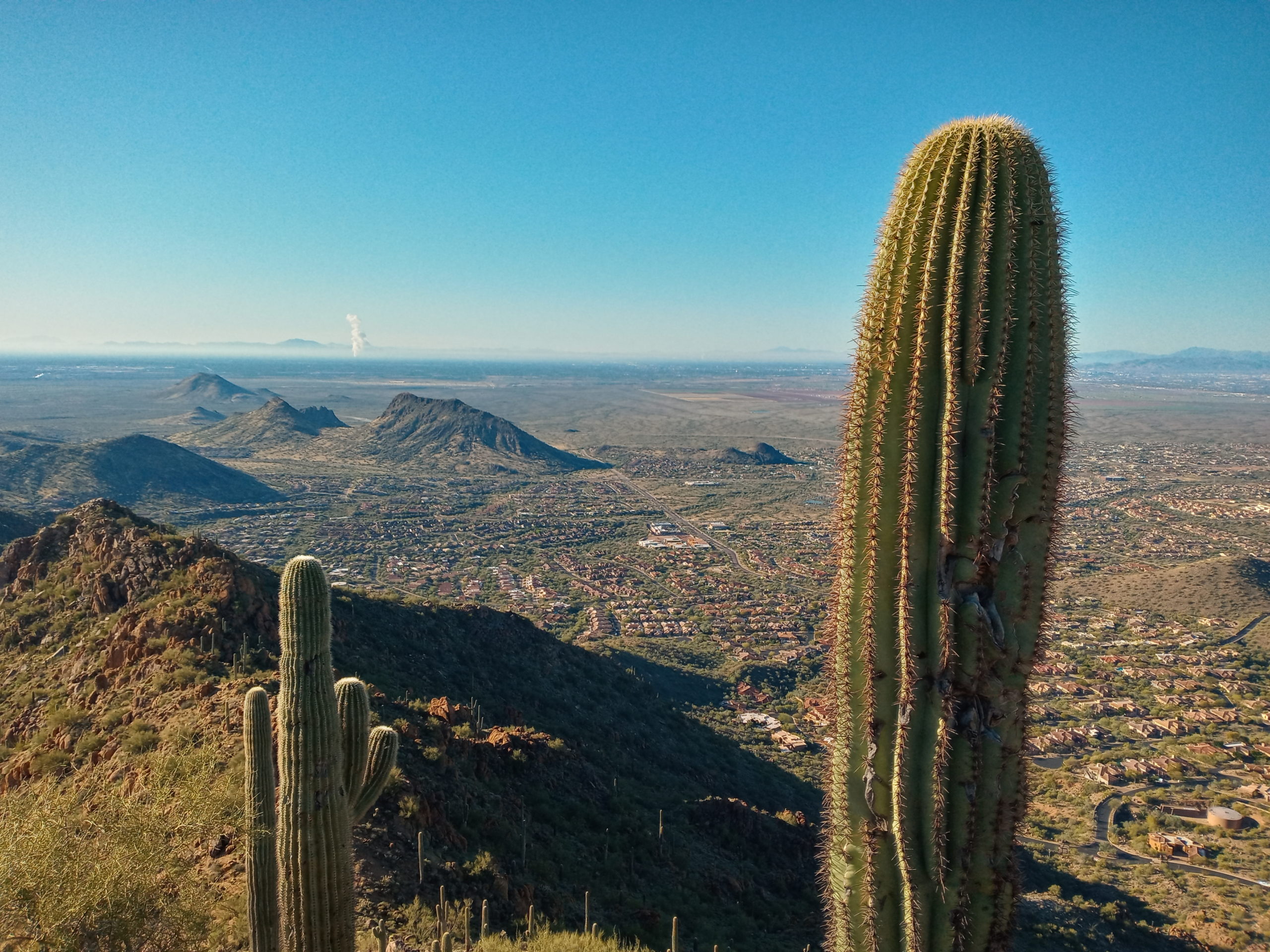
When the start of a journey is as crazy as ours, I was wondering if we should postpone. We woke up at our home in Galisteo and it was 6F (-14.4C). The van did not want to start! I had an early morning appointment so by the time I got back, Paul had most things ready to go. We headed to Hwy 40 through ABQ and then hit a traffic jam and accident. No worries, we have time. But then…..our route gets diverted because of snow and we go all the way to Flagstaff before heading south. The snow is bad and goes down to a single lane for awhile. We make it to Fountain Hills and my cousin Kelly and Mark’s home. They waited to have a late dinner with us (so sweet) and we sleep parked in their driveway.
The next morning Billy and I hike/run up Sunrise Peak. Wow! So glad to finally do a trail here.
When we get back, Paul says there are more van issues and we head out after breakfast to an RV parts place and get a new water pump. Yes! It works. We head back on the road and try to find BLM land. We get stuck in some sand in California and Paul digs us out. We decide to find a better camp spot. Butterfly Dunes BLM Land has a flat camping area with pit toilets. Lots of ATV peeps there but its safe and quiets down.
Billy and I wake early while the stars are out. The dunes look shimmery and cool in the dawn light. When Paul gets up we head to the border crossing where there are no issues getting into Mexico. Head down Hwy 5 to San Felipe and stop at public beach. Billy gets his first taste of ocean water.
first beach in Baja at San Felipe
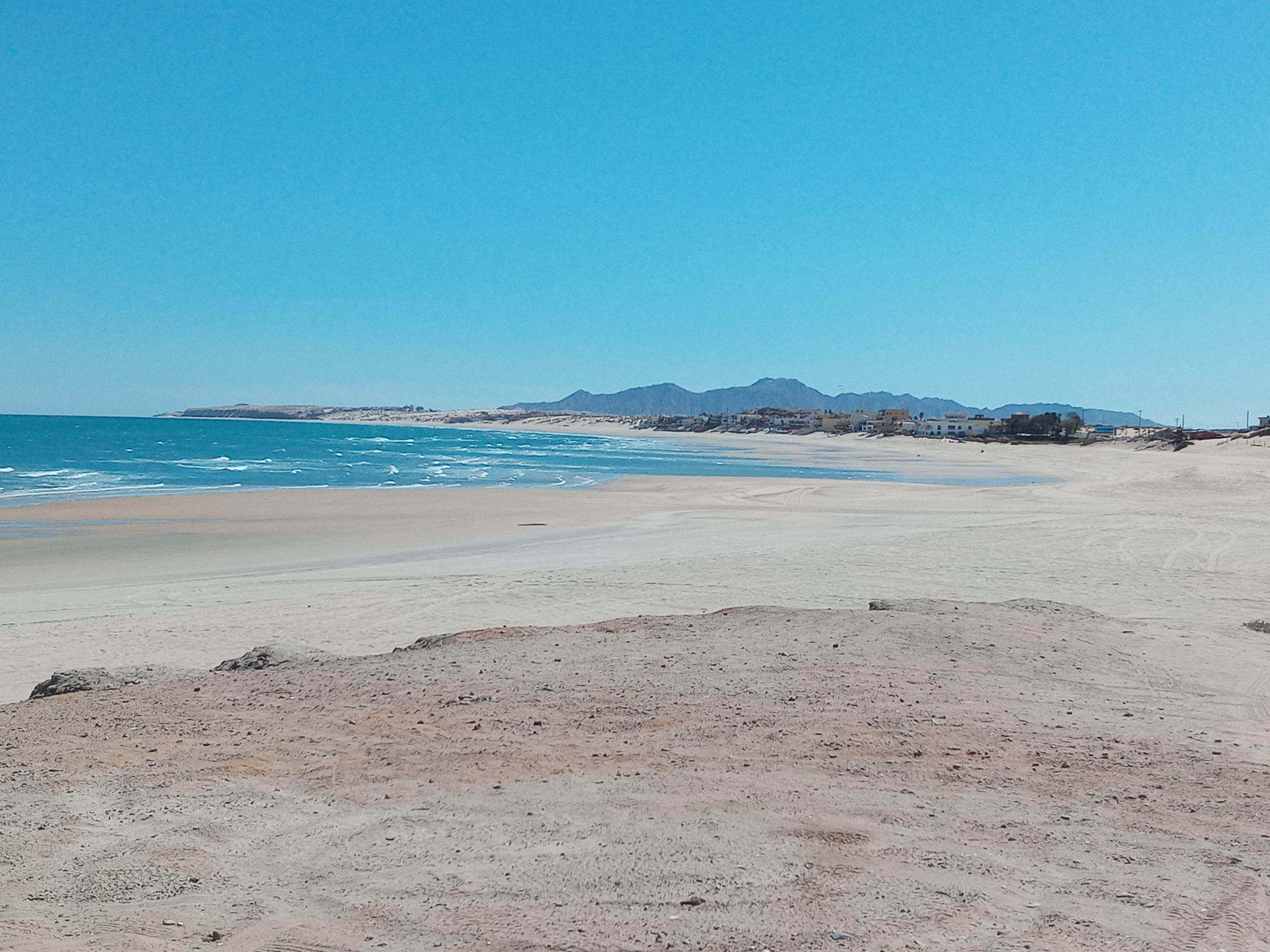
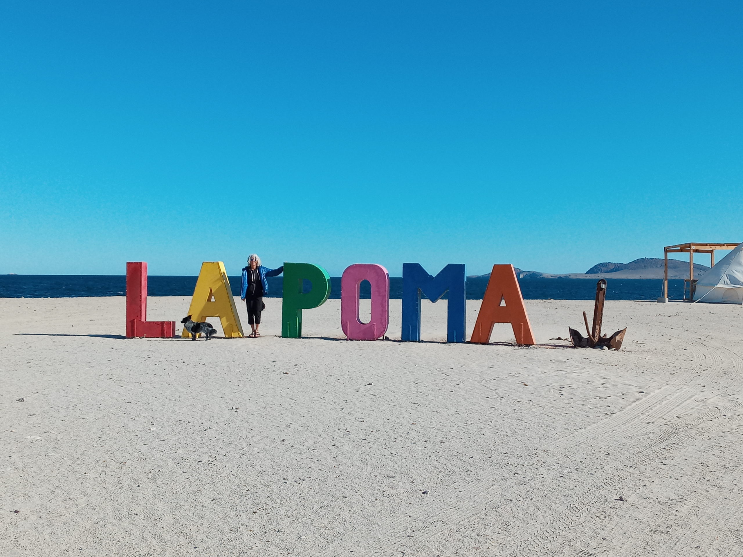
Going further we stop at La Poma, but directions took us the wrong way and again we are stuck in the sand. Luckily there are many nice folks who help us out. We park on the beach next to a palapas. We decide to have dinner there also and it was really good, fresh fish tacos and platters. The beach is excellent for shell seekers although too cold to swim.
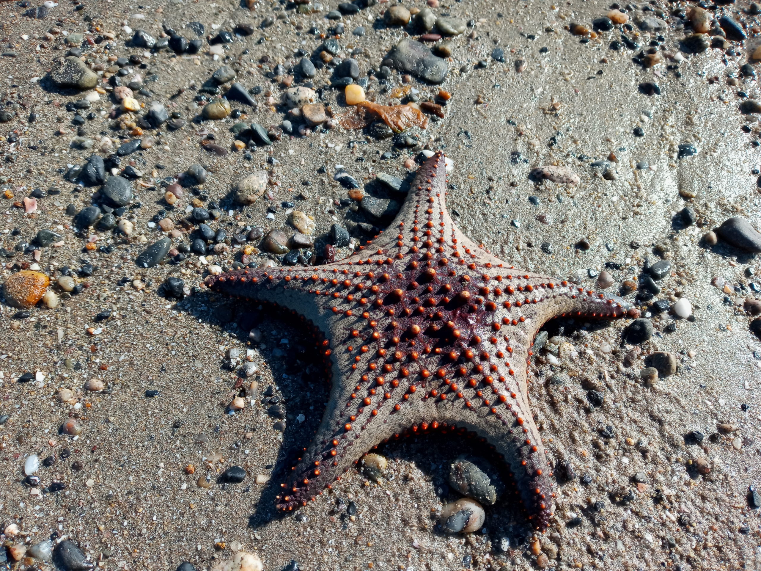
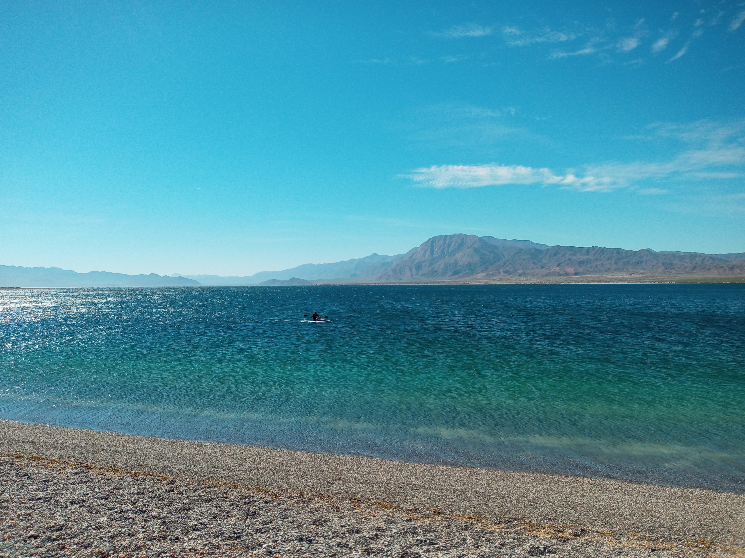
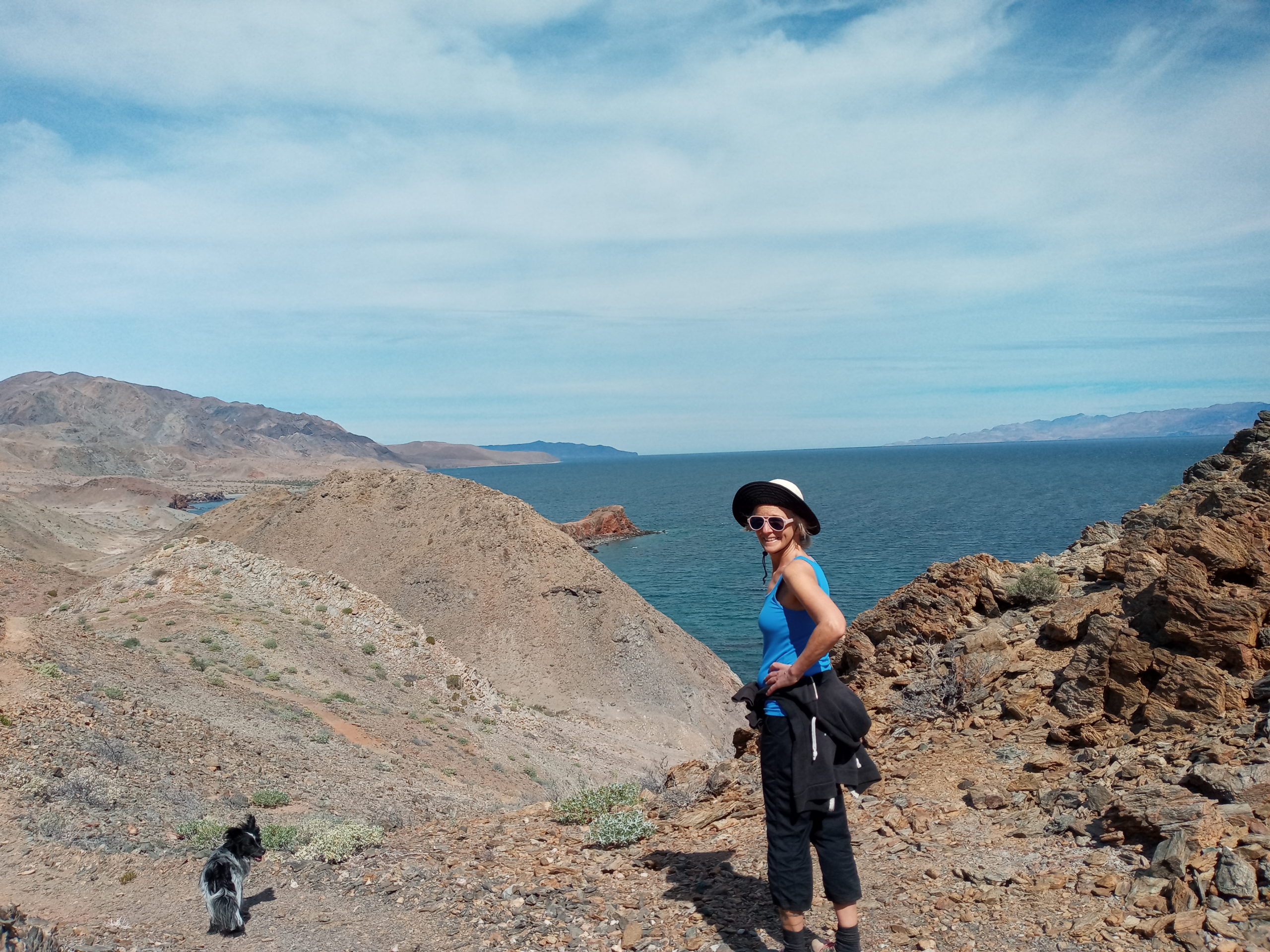
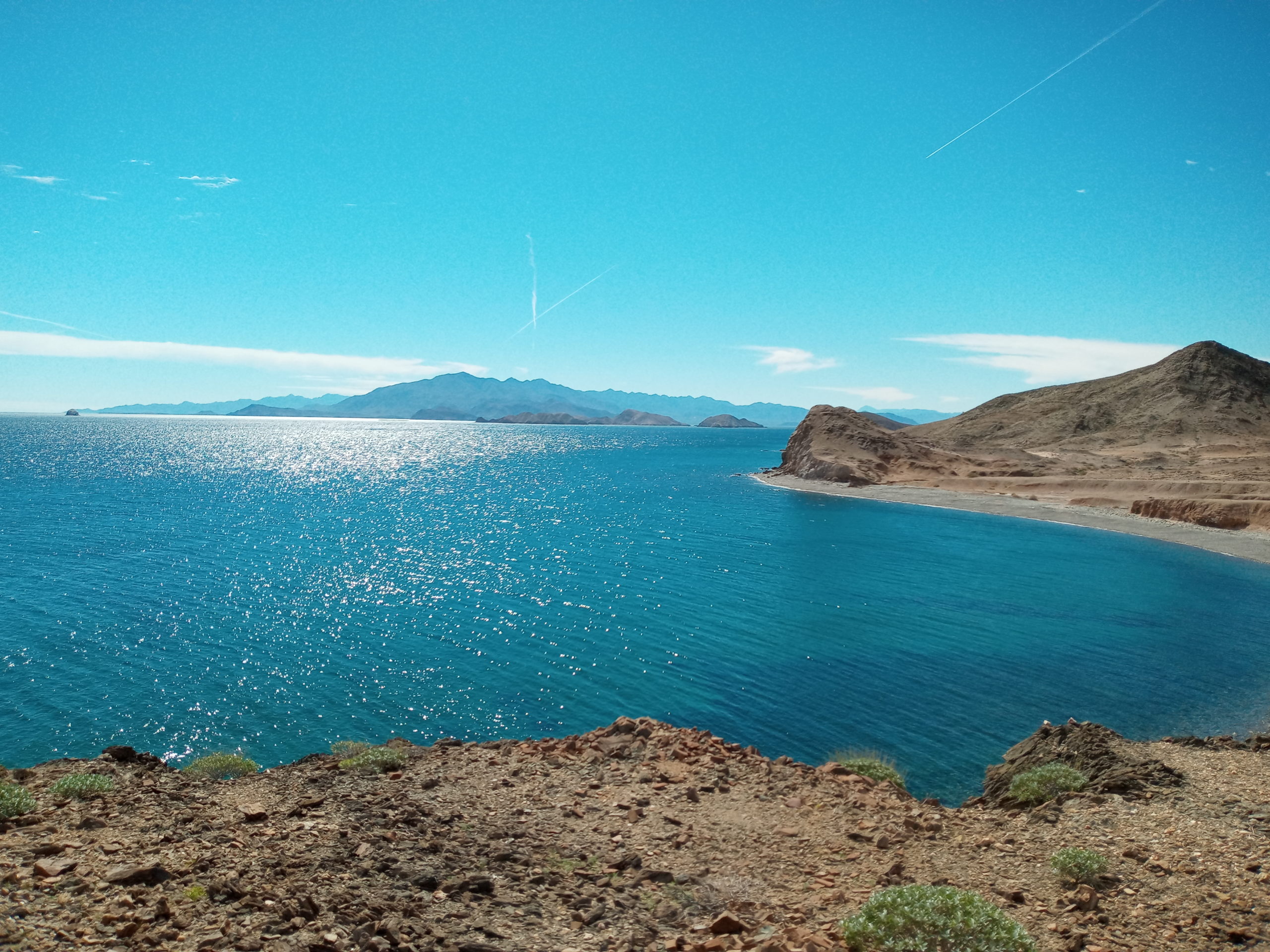
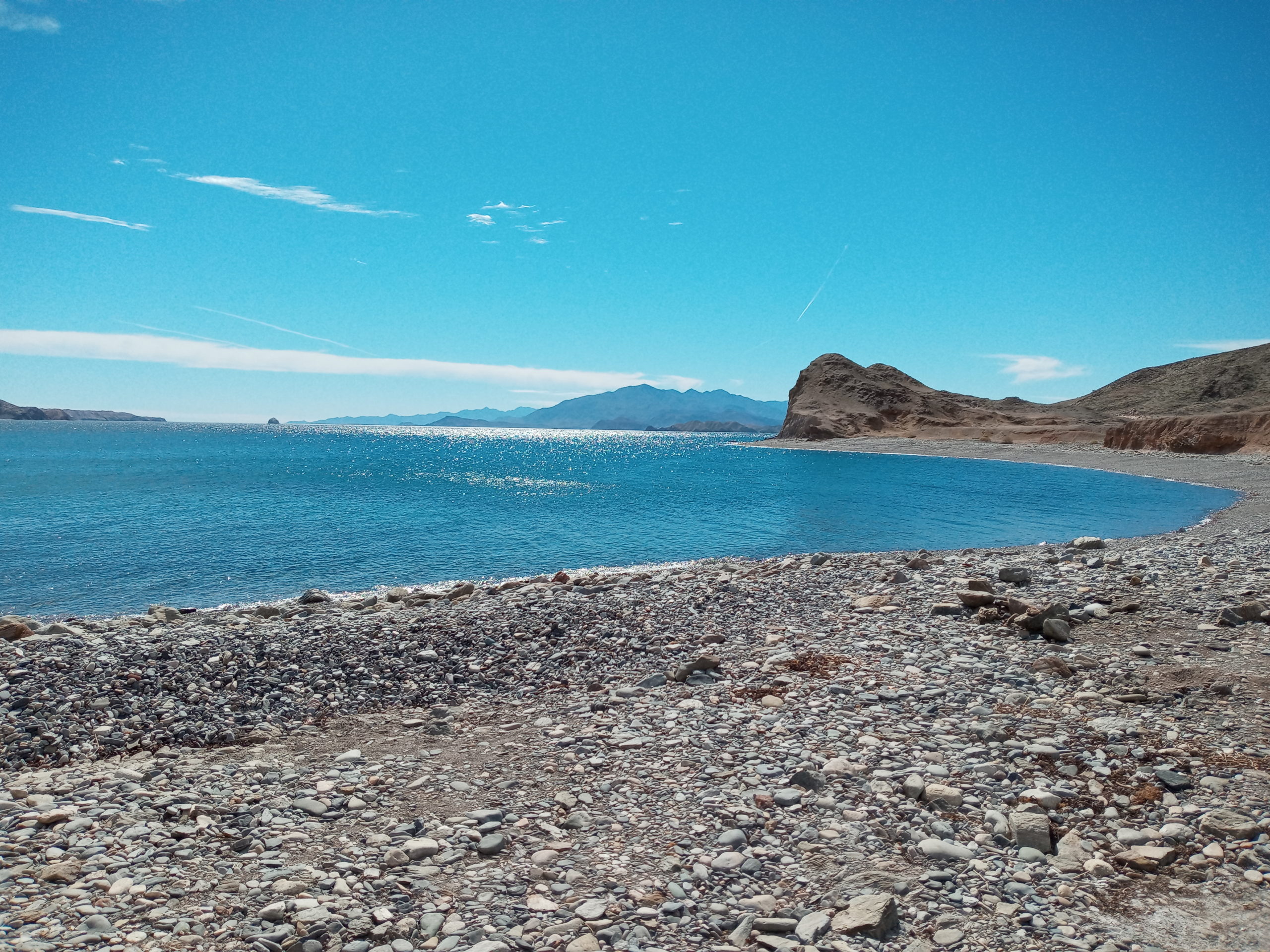
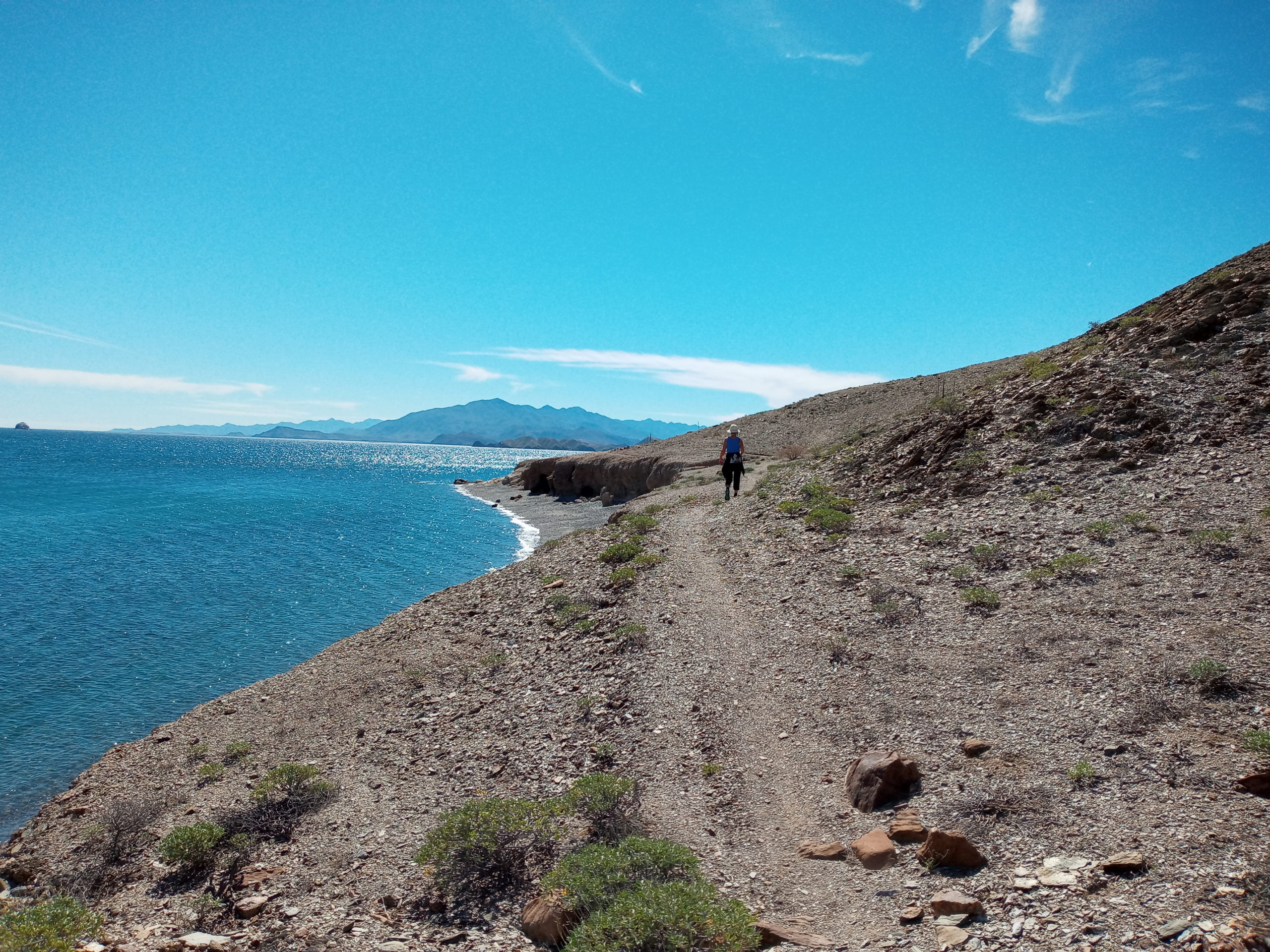
Our next destination is Bahia de Los Angeles and Playa La Gringa. The views and access to water are perfect for free camping. (except no banos). Very windy but I do a short run with Billy on coastal trails. They remind me of the coast in Spain. We spend a good couple days exploring the beach, hiking and looking at star fish.
Paul bought a SUP board which was great to use in the bay. Billy got his first scary ride on the board but he was super brave. Paul makes pizza on the beach and we have a least one roaming coyote who likes the smell
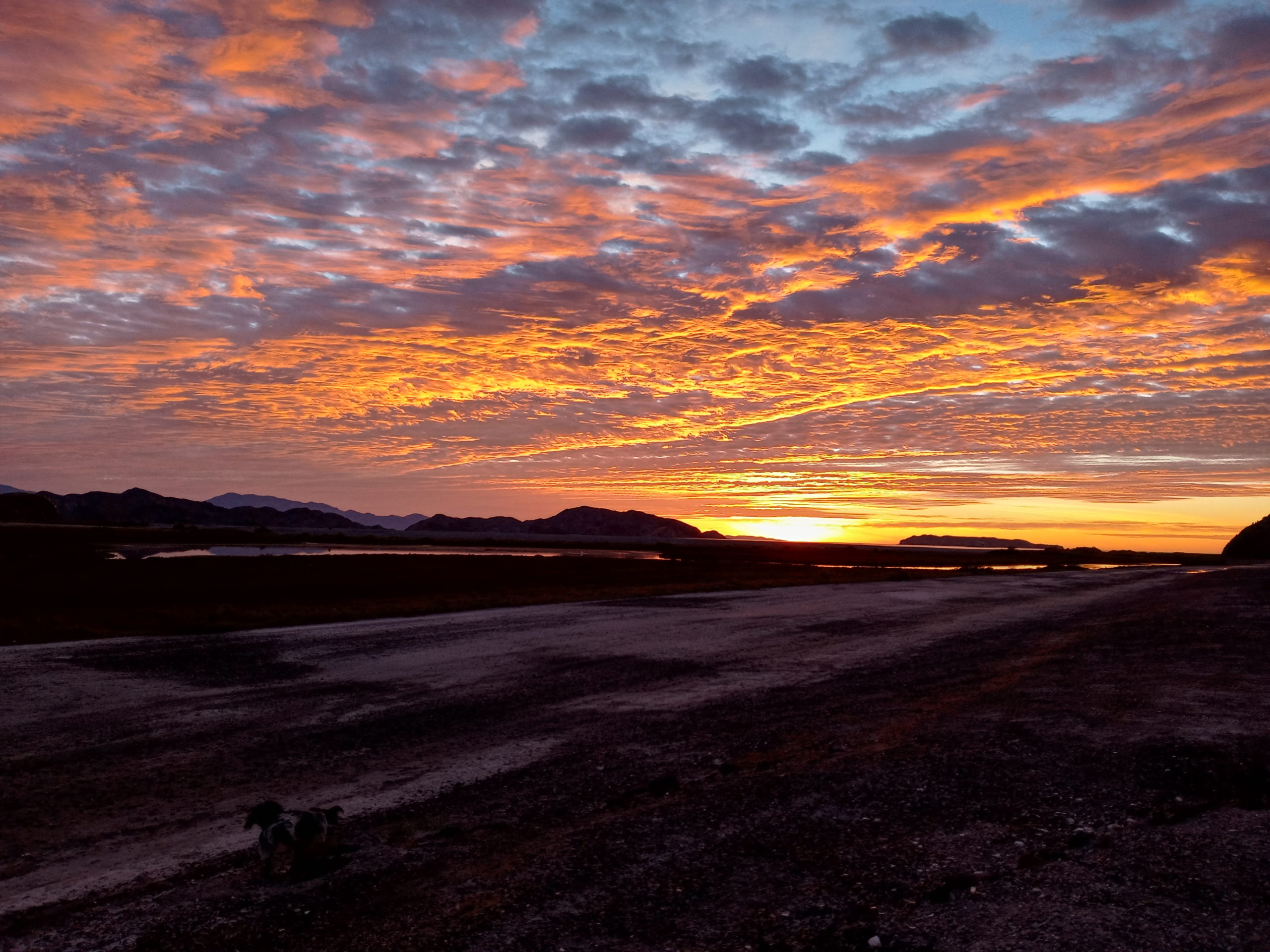
Sunset at Playa la Gringa
Paul needs some brief internet connectivity so we head to Camp Archelon closer to the town of Bahia de Los Angeles. We camp really close to the other guests. I am not in love with this location but they do have some nice amenities like a photo show, small restaurant, wi-fi, showers (mostly cold) and banos. If you rent a hut it could be different.
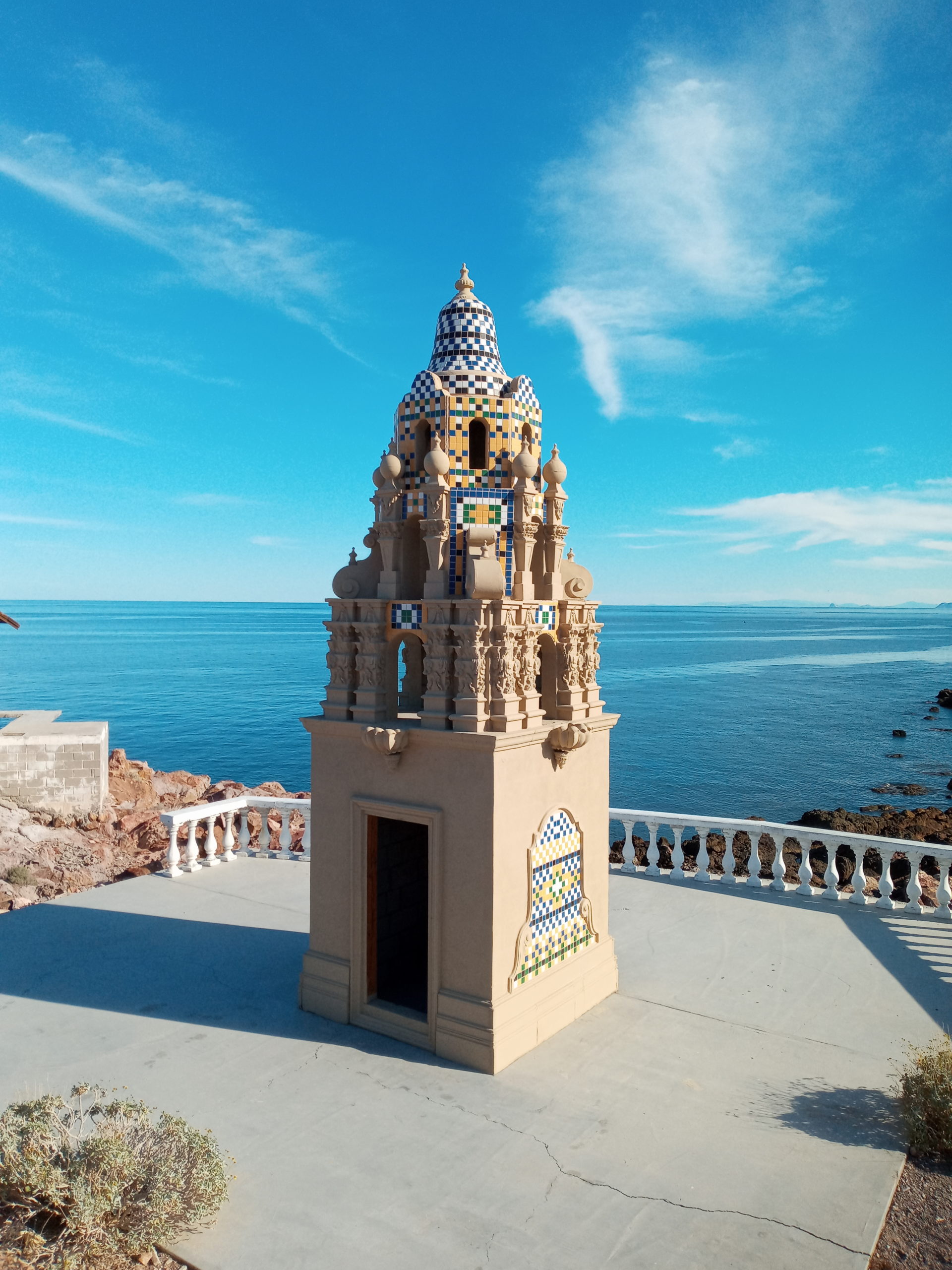
Heading back north we arrive at Campo Tourista Puertocitas and I jump in the warmer water of the bay. There are natural hot springs in the rocks here. We enjoy a good soak before dinner. The town has a strange feeling. We saw an artist working on a mural and many sculptures scattered about. We heard that the economy and a hurricane caused the decline and many properties were destroyed.
a monument to the town’s founderby the hot springs
We do a morning soak also and there are quite a few people there. I still would recommend if soaking is your thing. $34 dollars or 600 pesos a night. Pricey for Baja but gated, safe, nice people, and quiet in the night.
Paul and Billy in/by the beach hot springs
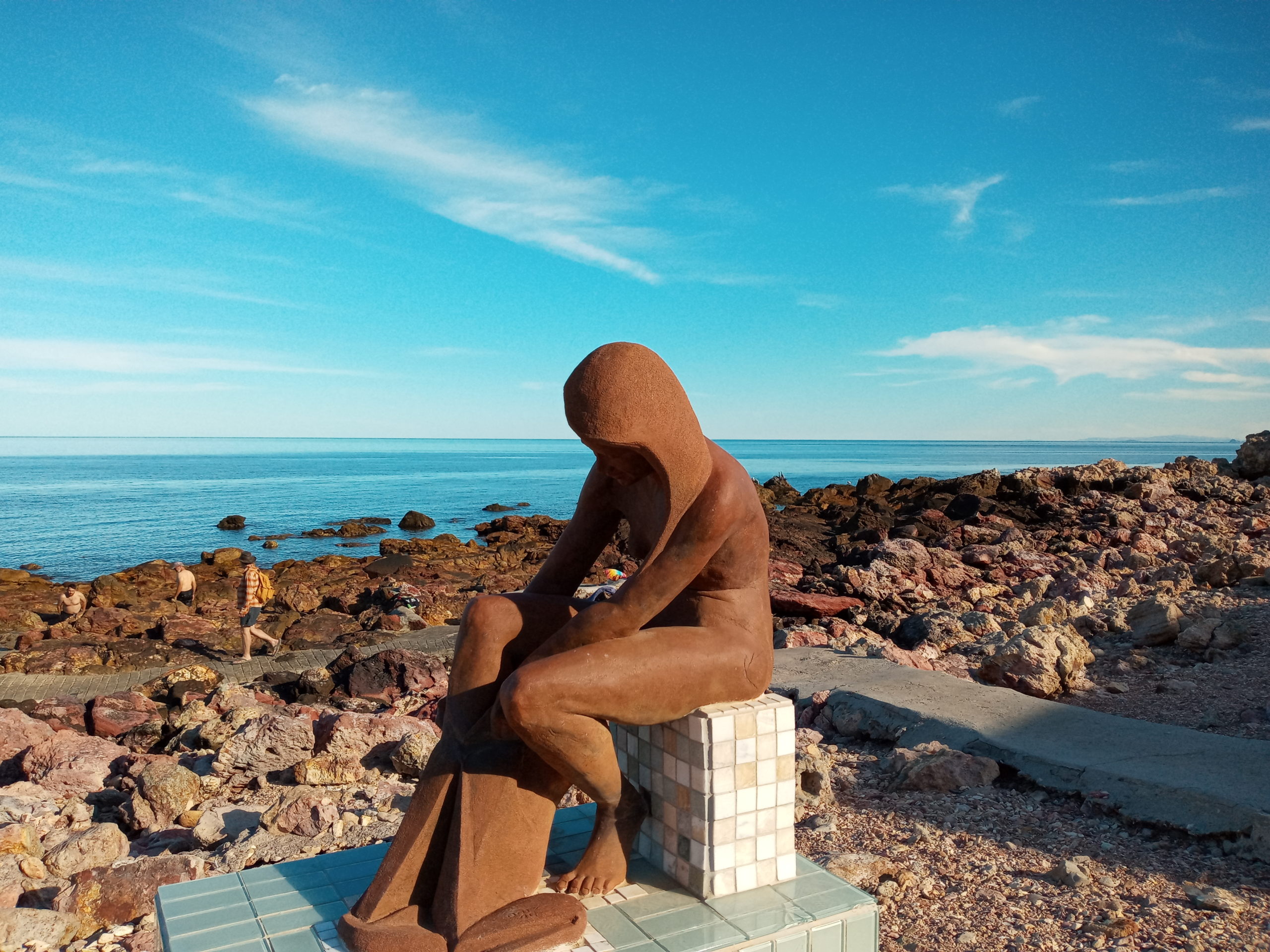
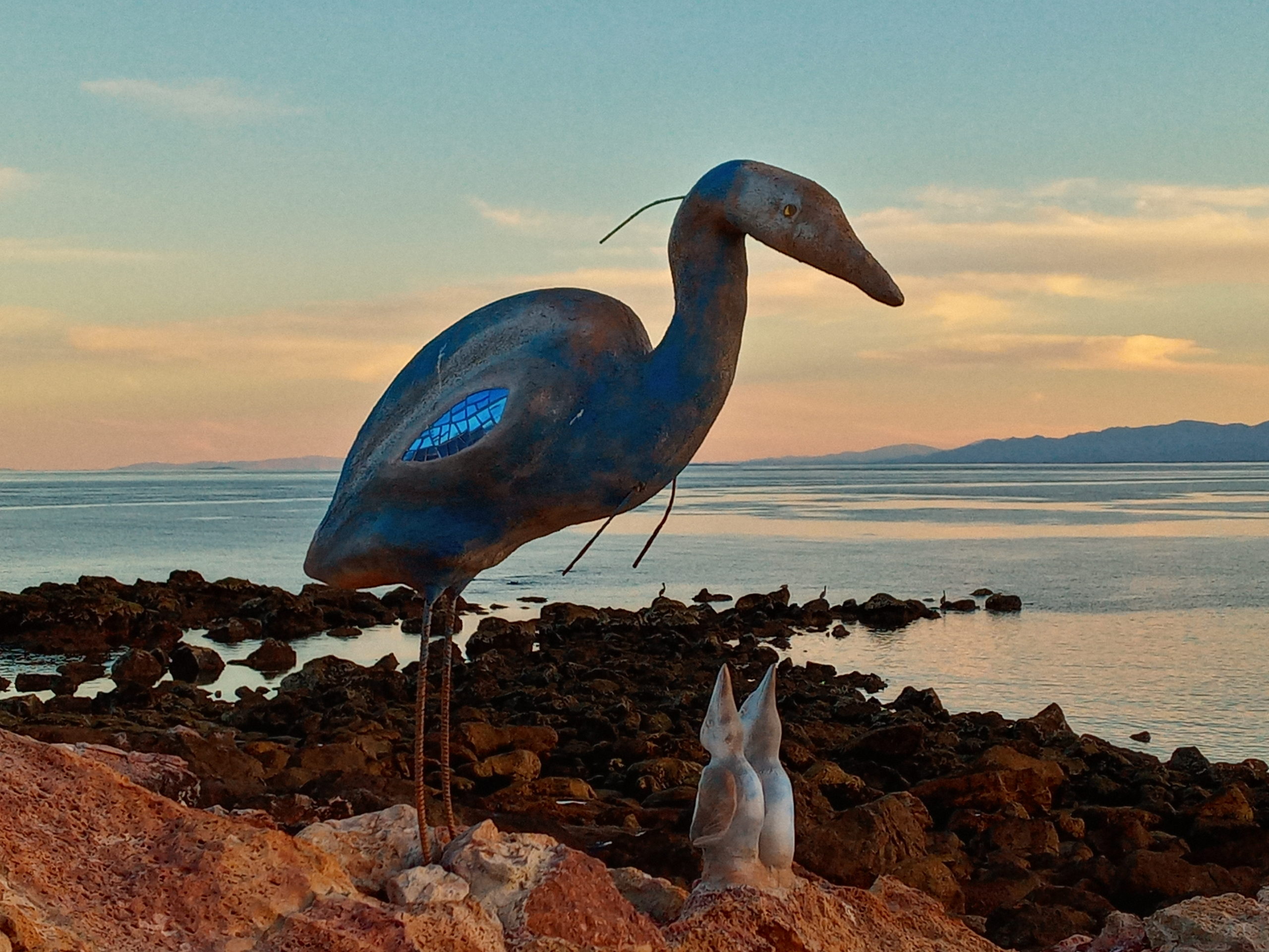
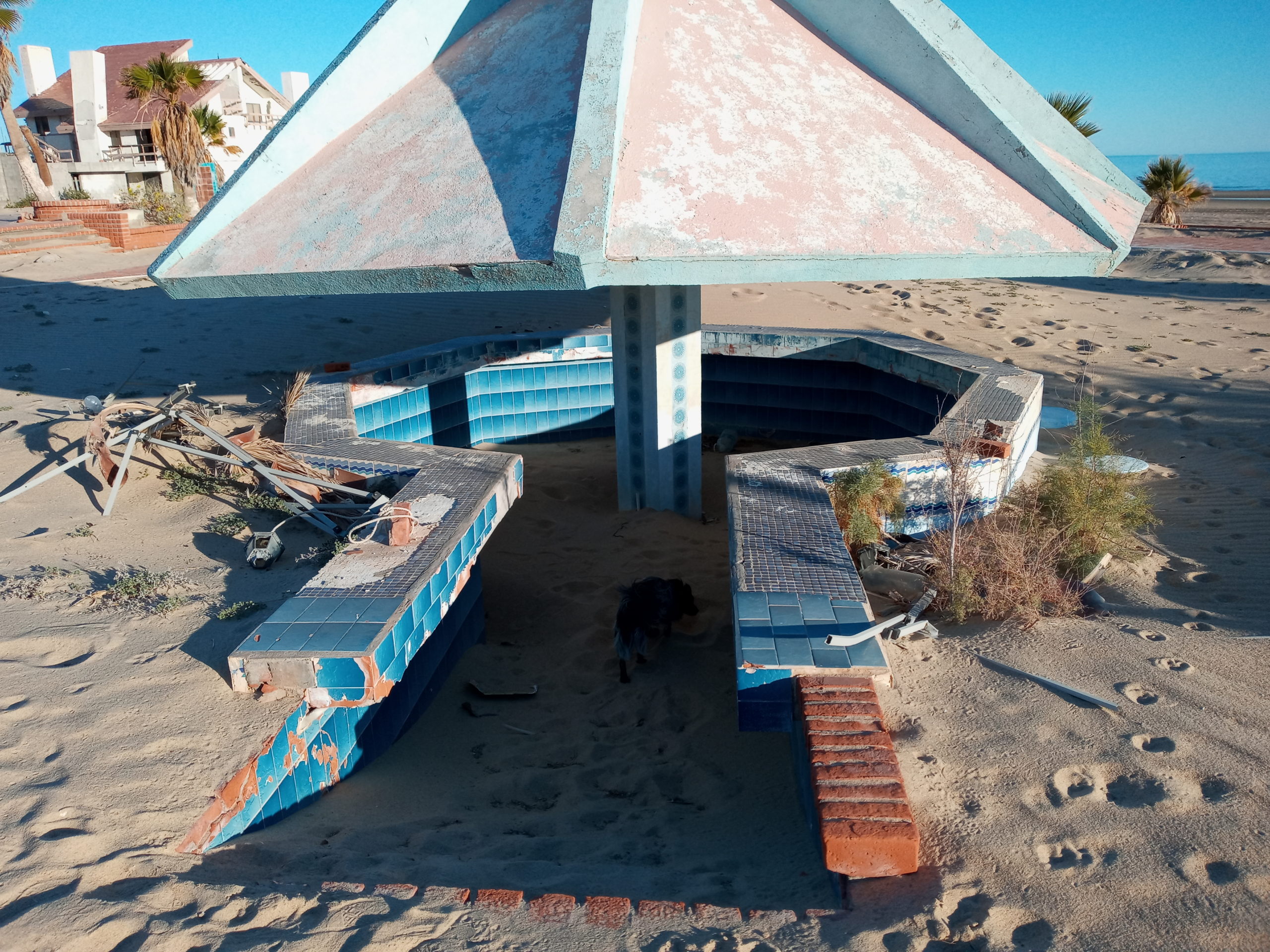
Again on our way North we stay one night at Betel Residence 2 which is a defunct and destroyed RV park that Rueben manages. At one point there was a shwanky club house and a swim up pool bar. Now the sand has reigned king and everything is falling apart. We were surprised that the toilets flushed in the camping area. We went on a beach adventure here to find hot springs we read about. It was a lot of fun but the springs were only tepid. Super quiet as hardly anyone was there.
swim-up tiki bar, just add sanddystopian vibesHeron at mid-tidePaul armed to dig for hot springsBeach scenes near the dystopian RV park
The border crossing on the way back was a bit longer but not too bad. Extended drive day so we got to Picacho Peak SP late where we stayed in the over flow area. A sunset to die for! We showered in the am and shopped in Tucson before heading out to Kentucky Ranch where the race starts the next day. Super windy and colder than I would like.
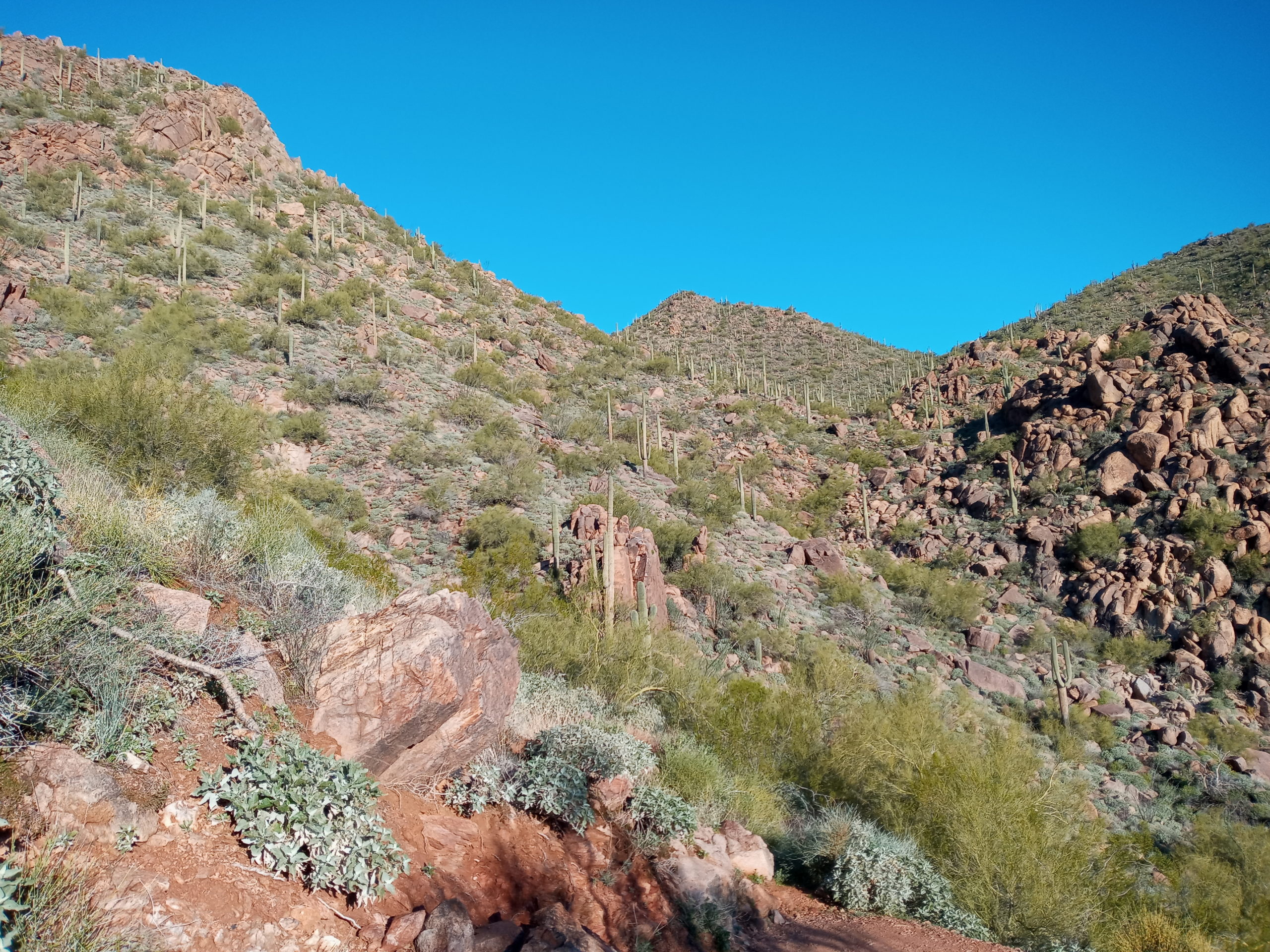
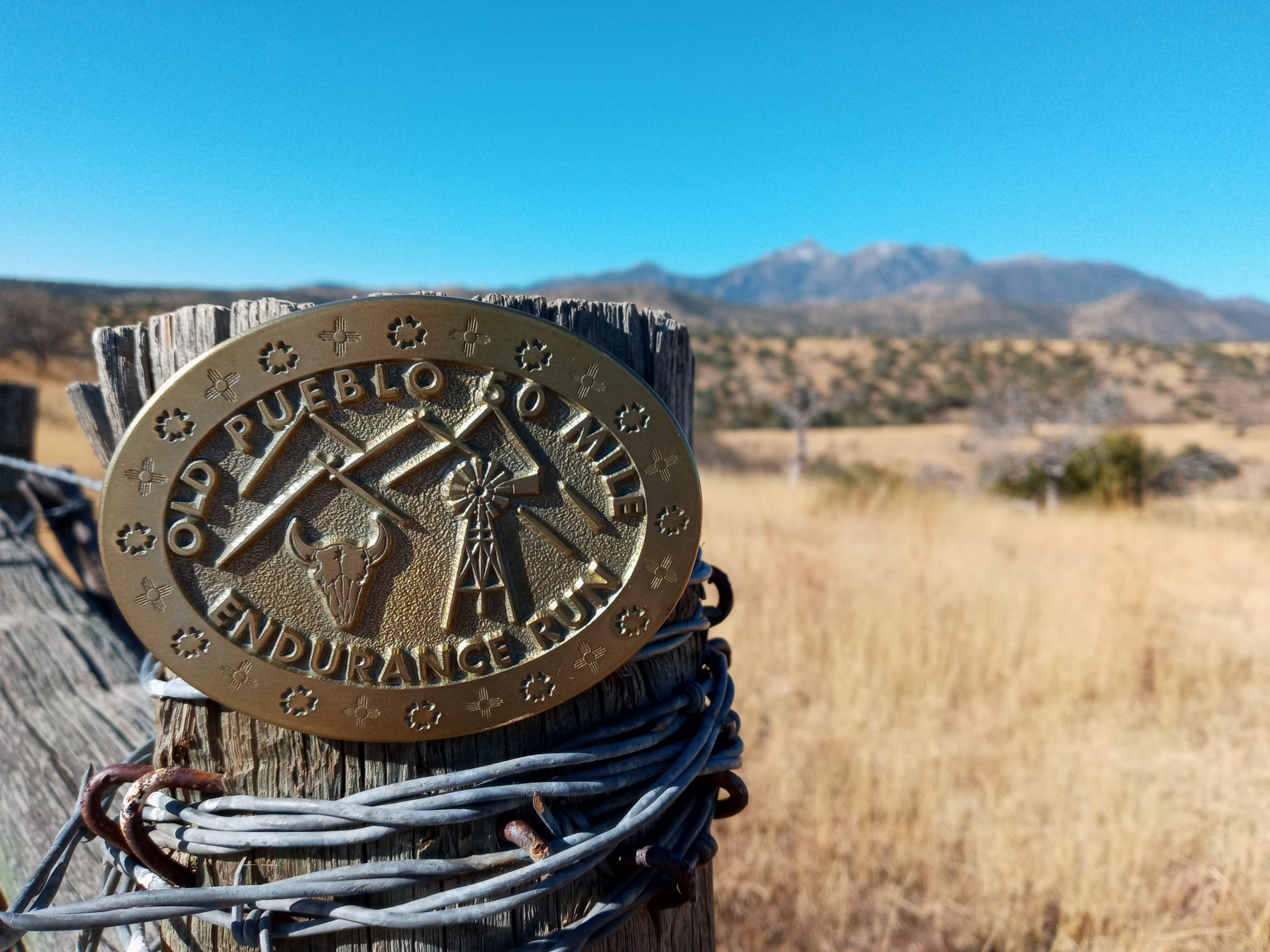
Gene Dykes meets me in the morning and we head out on a 50 mile adventure. The Old Pueblo Trail Race is the oldest in Arizona and it is way harder than we both expected.
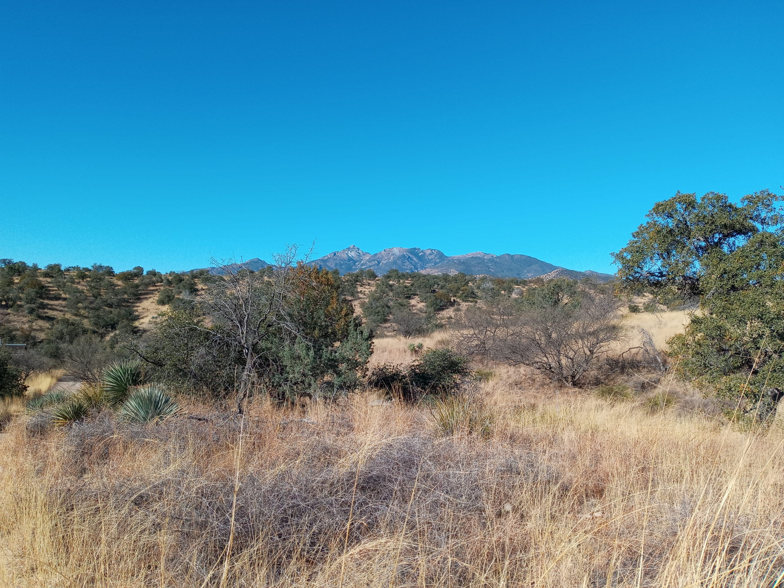
Landscape near the race, looking towards Mt. Wrightson (9456′)
We try and run together but in the end we are separated. I wait at the mid point and when Gene shows up he is bloodied but ready to head back out even after I try and talk him out of it. I again go faster and try to beat sunset which I don’t. I did manage to be the last female and Gene the overall last finisher so hooray! Paul and I sleep at race site again.
Next day we pack and head not too far over to BLM land – Las Cienegas. There are many camp sites but most are filled. We pull into one and go for a walk. You can actually go through the cow gate at the end and reach more dispersed camping. That also looked nice and a bit more private. We visit Empire Ranch and view some of their artifacts, history and trails. Paul fills the van up with water there too.
History at La Cienegas
I am in the mood for a dip in water. We hoped to camp at Patagonia Lake SP. but dogs are only allowed in day area. We have lunch and use the SUP board there. Billy goes for a ride and scares some of the birds hiding in the marshy inlets on the side of the lake. So many birds!!
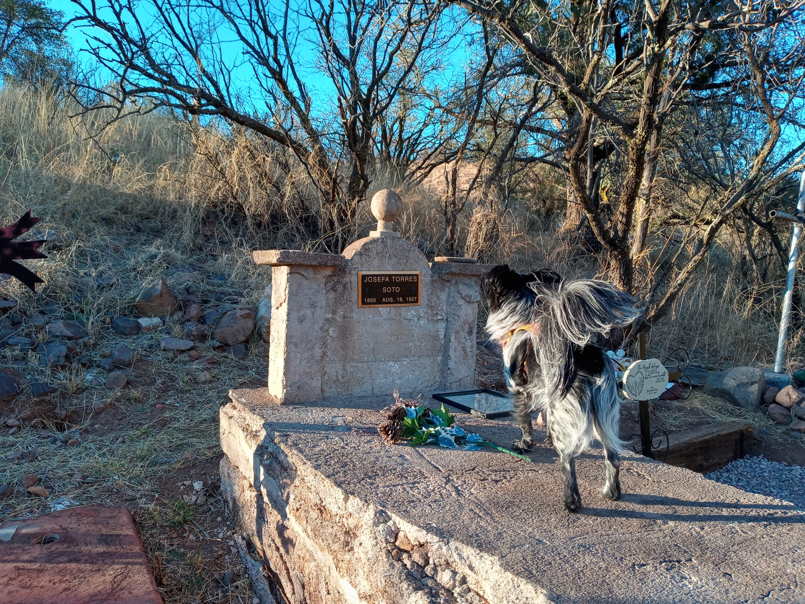
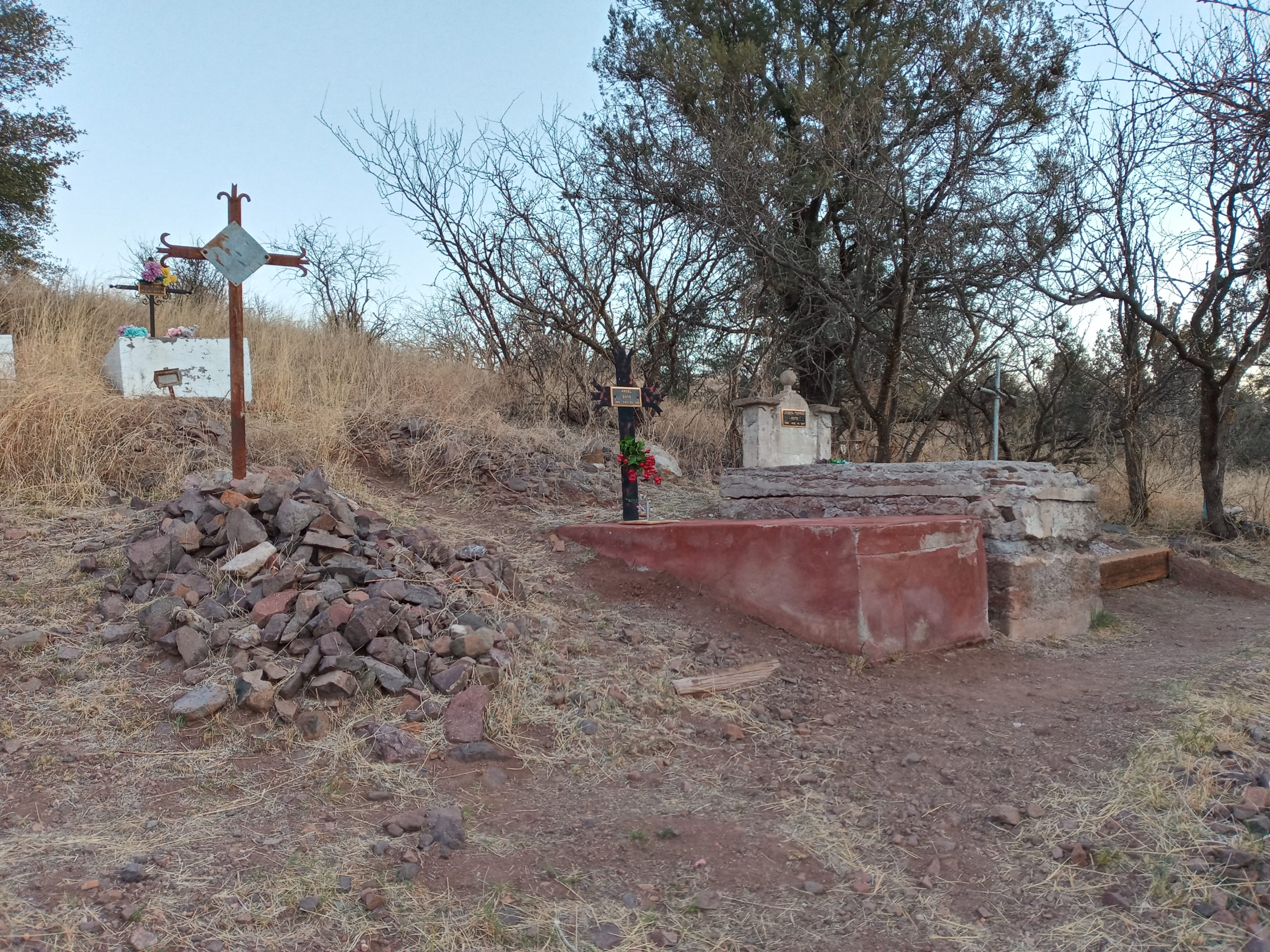
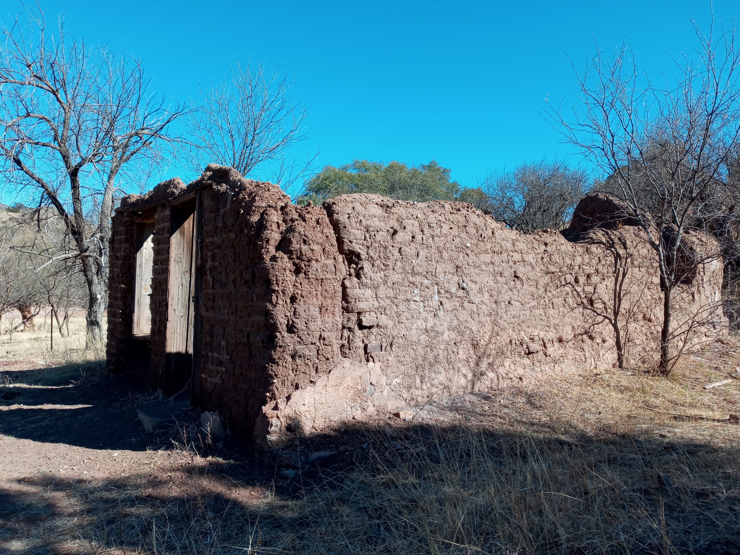
In Patagonia Paul talks with RAAM legends Susan and Lon Notorangelo, still leading PAC Tours (this one seemed to mostly off-road in the surrounding part of southern AZ). Cute town and the only one “on” the Arizona Trail (the actual trail crosses a road a couple of miles out of town). A local tell us about Harshaw an old ghost town. We end up camping there for the night next to a cemetery and one old adobe home.
Billy greets the deadA bit worse condition than our old adobe from 1875
It was fine in the evening but a mining company, South 32, is working on the Hermosa Project right now and they started driving by early. Controversial in the area because of water rights, traffic, pollution etc.
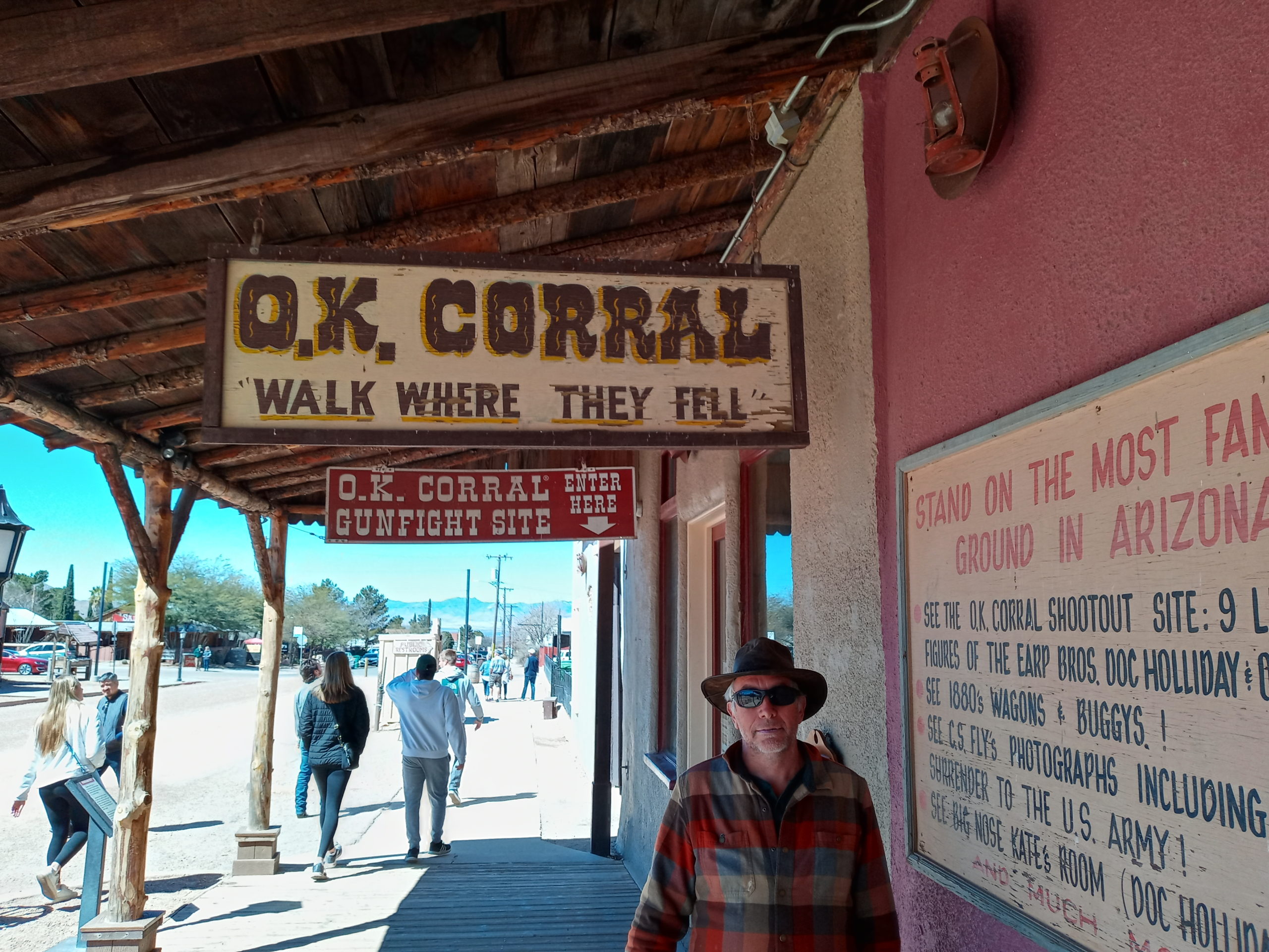
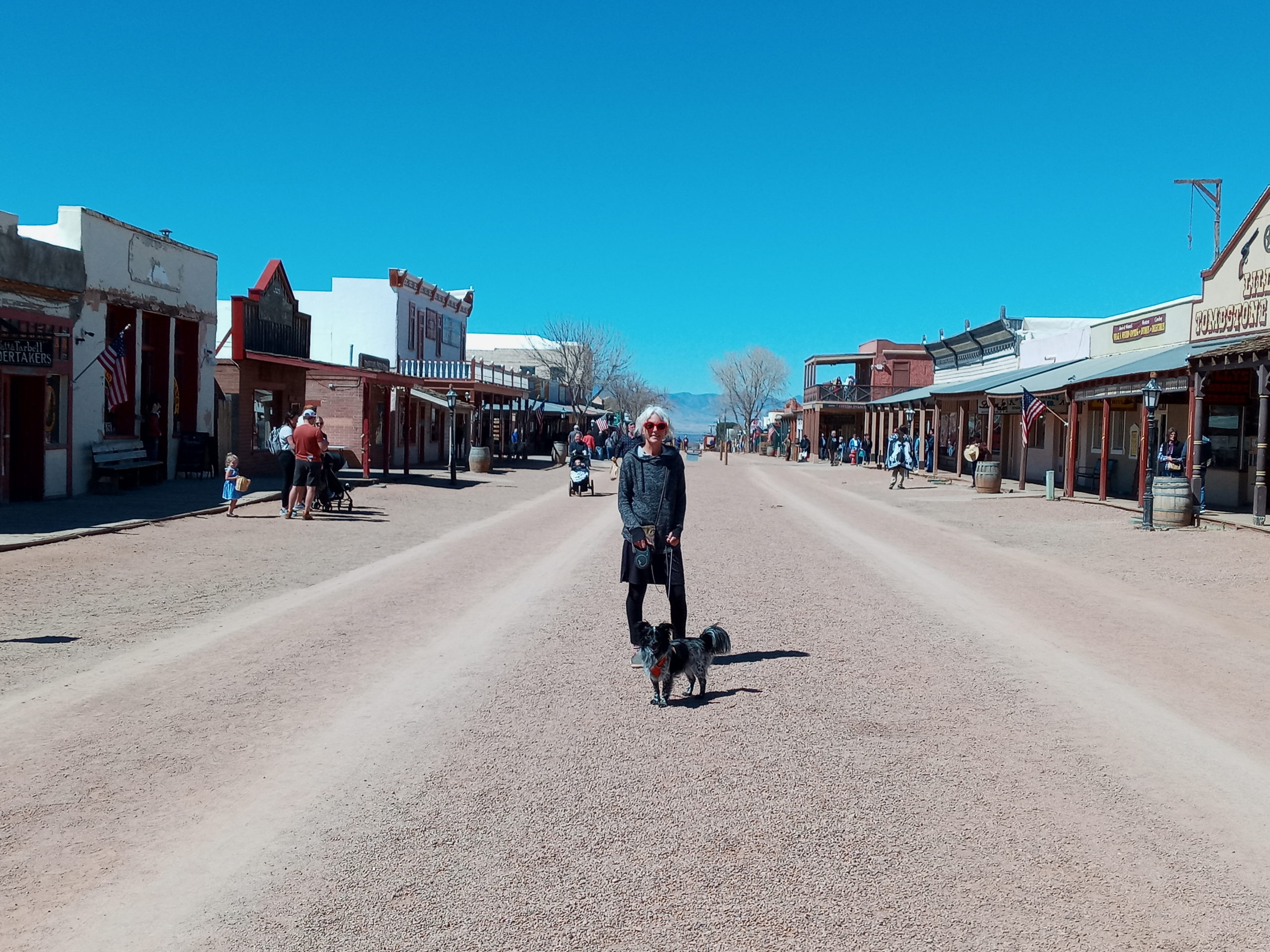
Next we stopped in Tombstone, really a tourist place but tacky and could be fun with a bunch of friends. We didn’t stay for a gun fight show.
They call him paul the triggerShowdown in some version of the old west
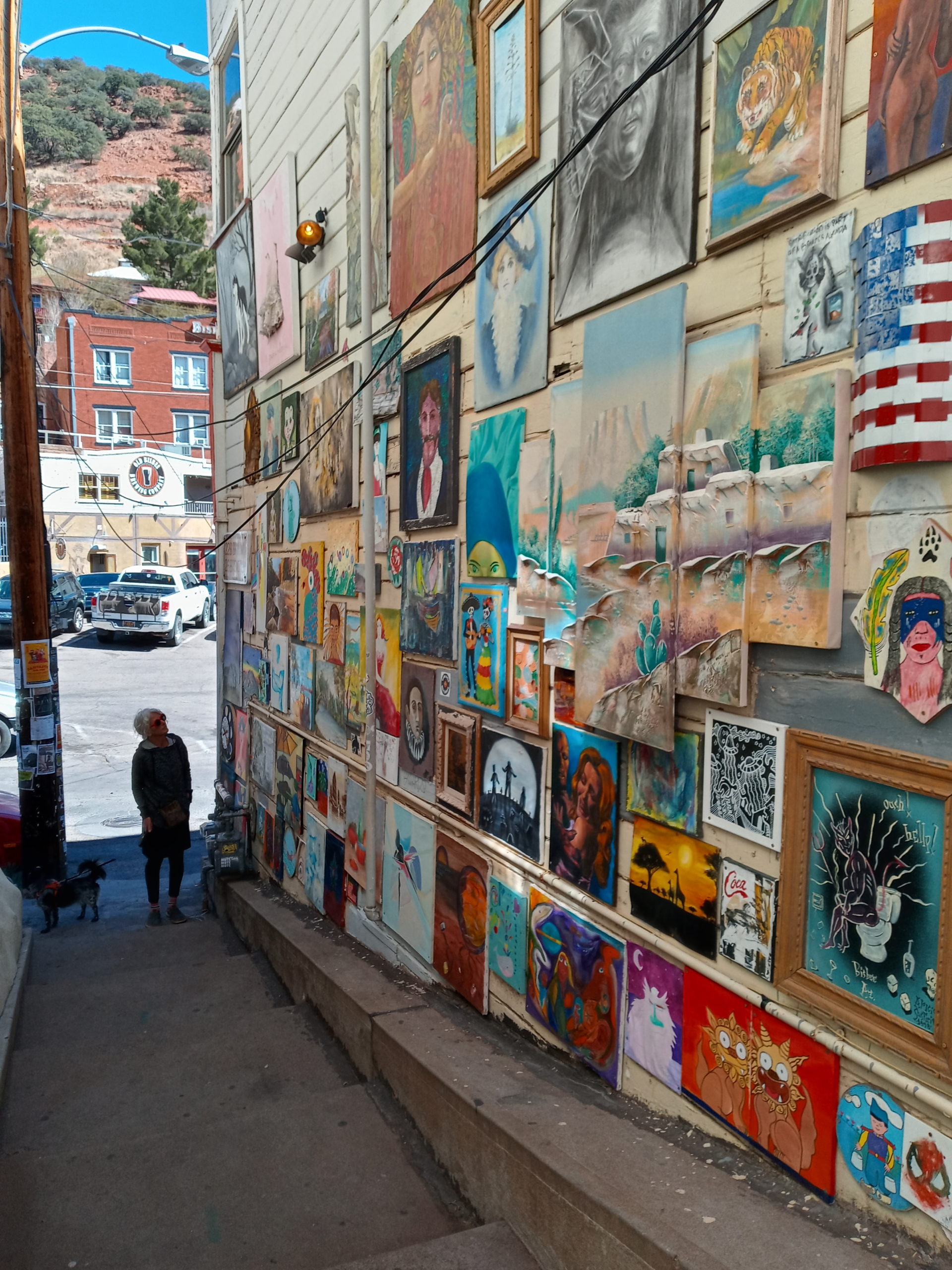
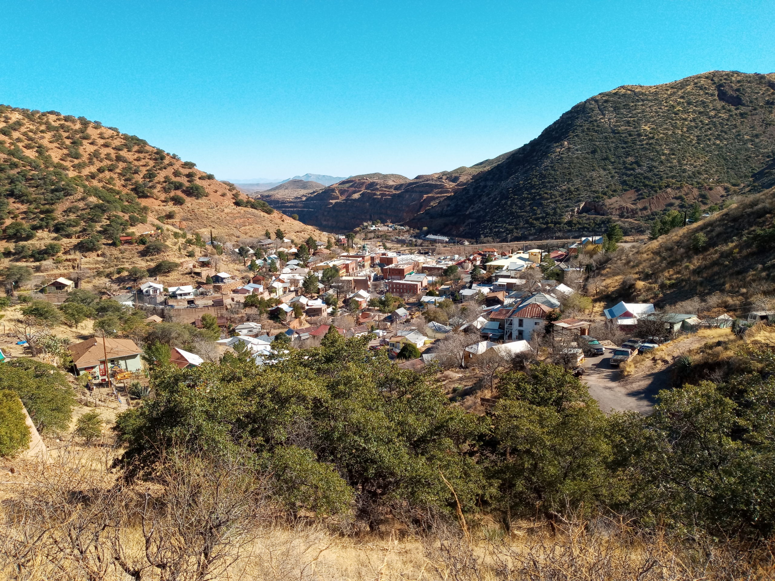
Bisbee has been on my radar for awhile now. An artsy old mining town that was revamped in the 60’s and is still going through changes. We loved the stairs, art, shops and interesting people.
an art alleyway in Bisbeefrom a trail above the town
Paul looked up an Ardour user and we had a delicious Vietnamese dinner at Thuy with Jordan, his wife Nila and two sons Sequoia and Tanha. We park our van outside their home for the night. Steam Punk design and some really cool trailers in the back yard that they created and were shown at the Eclipse Festival. Lots of dogs and two puppies for Billy Goat to play with. Good conversations and budding new friendships.
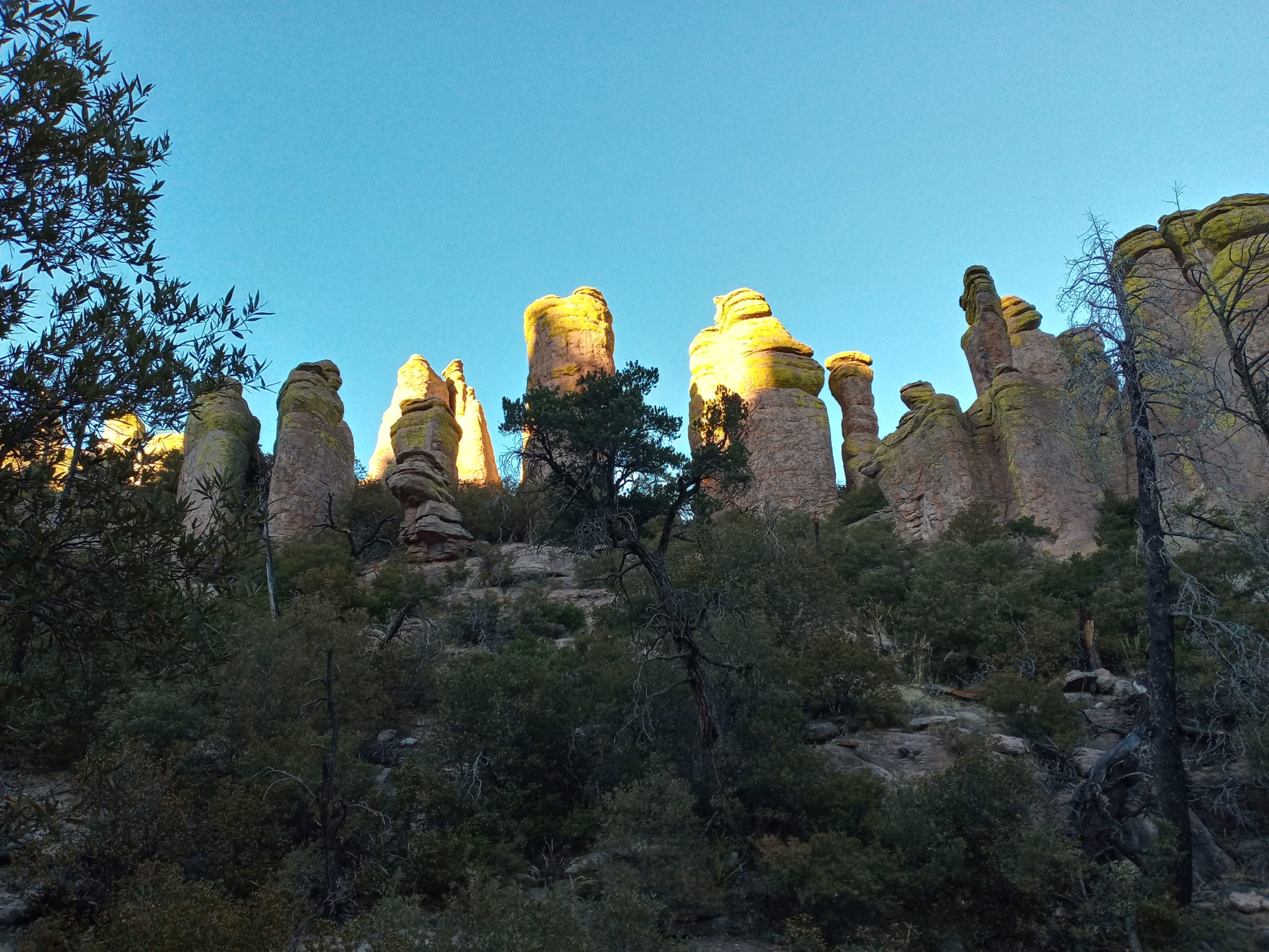
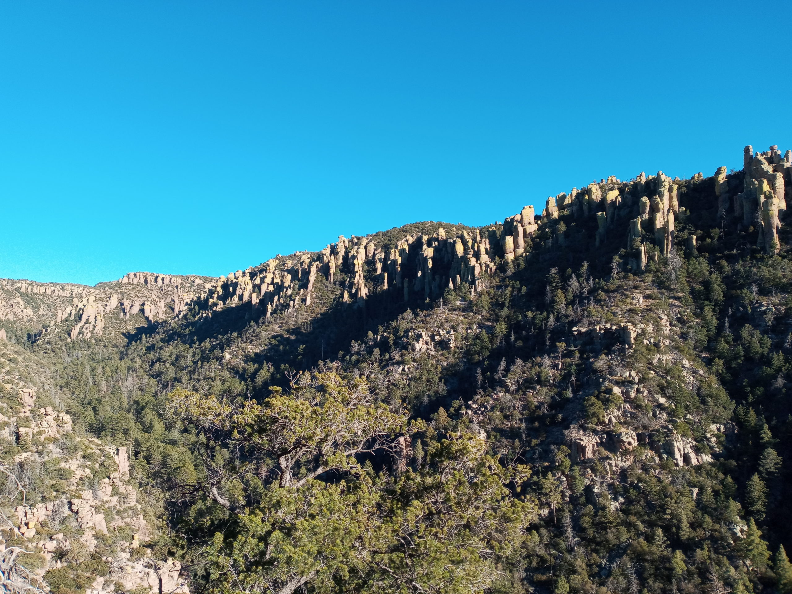
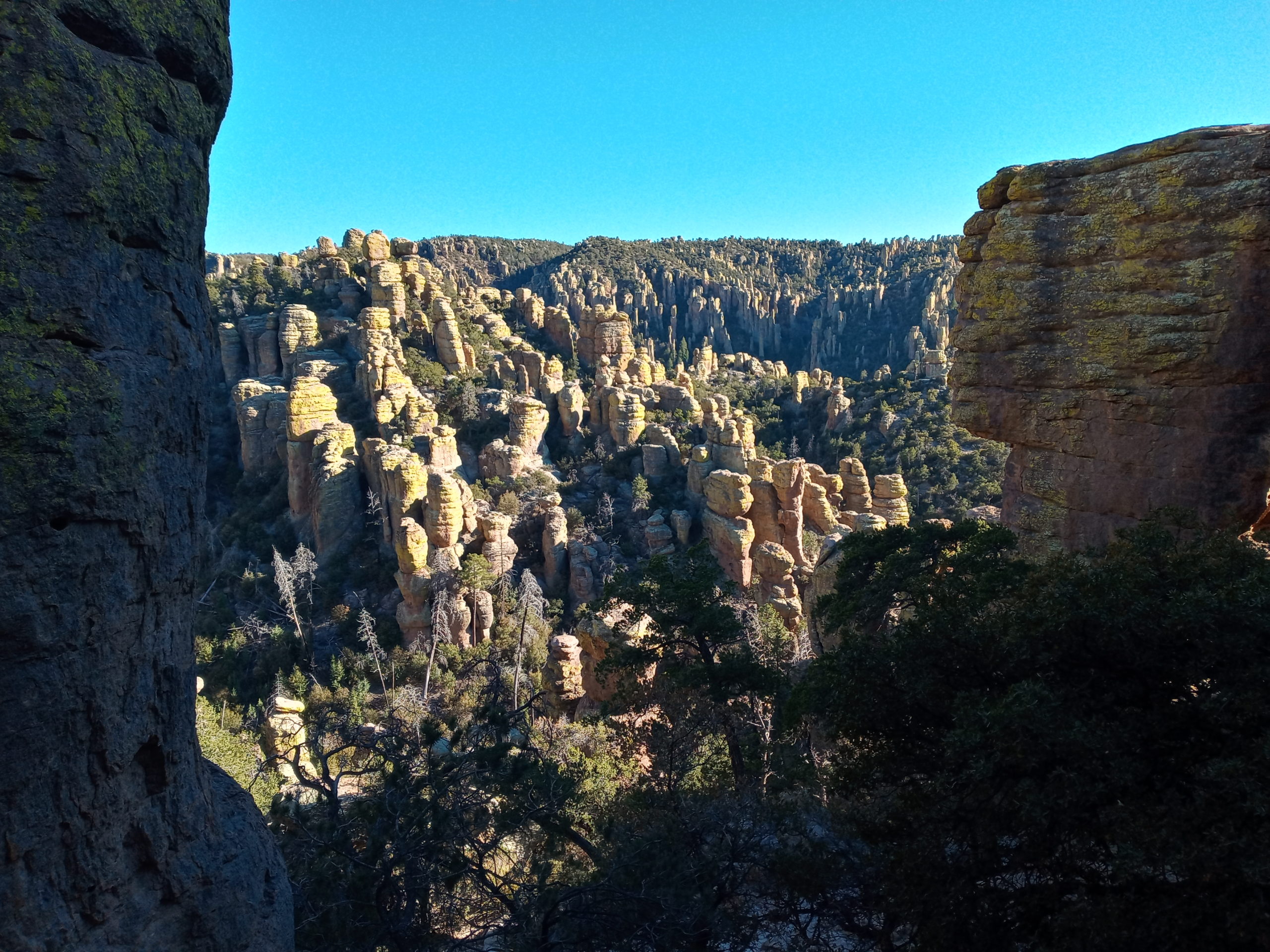
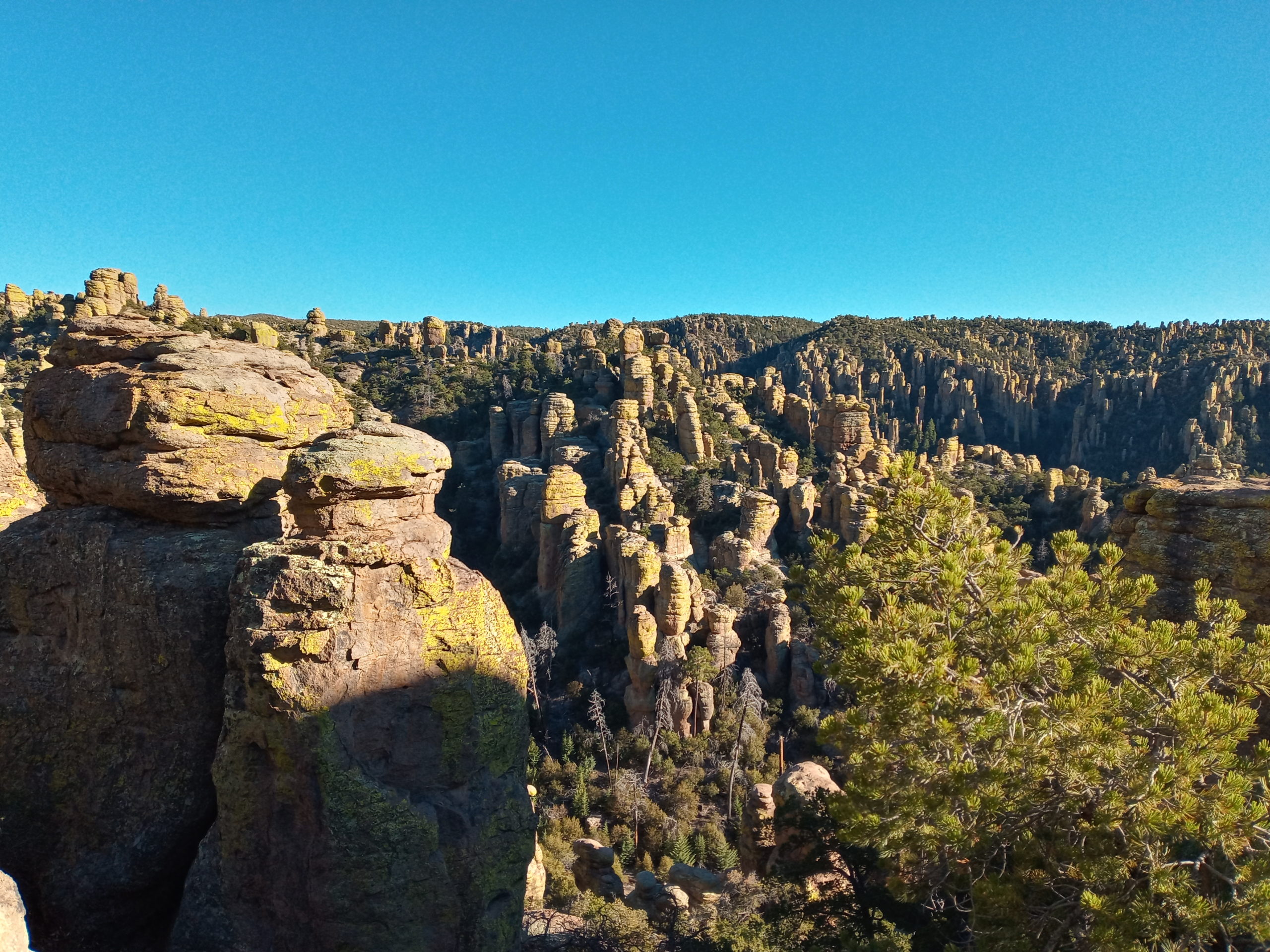
Wake up a bit late a do a short morning walk. You can see the border wall in the distance. Boo. More morning conversation and a yummy breakfast. We say our goodbyes and head to Chiricahua National Monument. Paul and I do a short 3.8 mile hike on the Echo Canyon loop. Spectacular rock formations and that glowed as the sun was going down through the canyon.
twilight over Chiricahualike an army of sleeping stone warriors
No more available camping so we go just outside the park and down a forest road (very washboarded) about 5 miles and camp next to a dry river bed. Many dispersed campers.
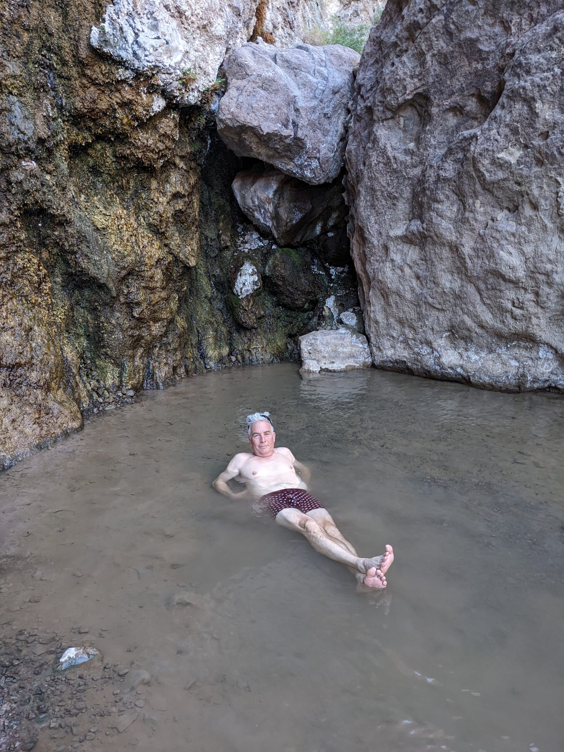
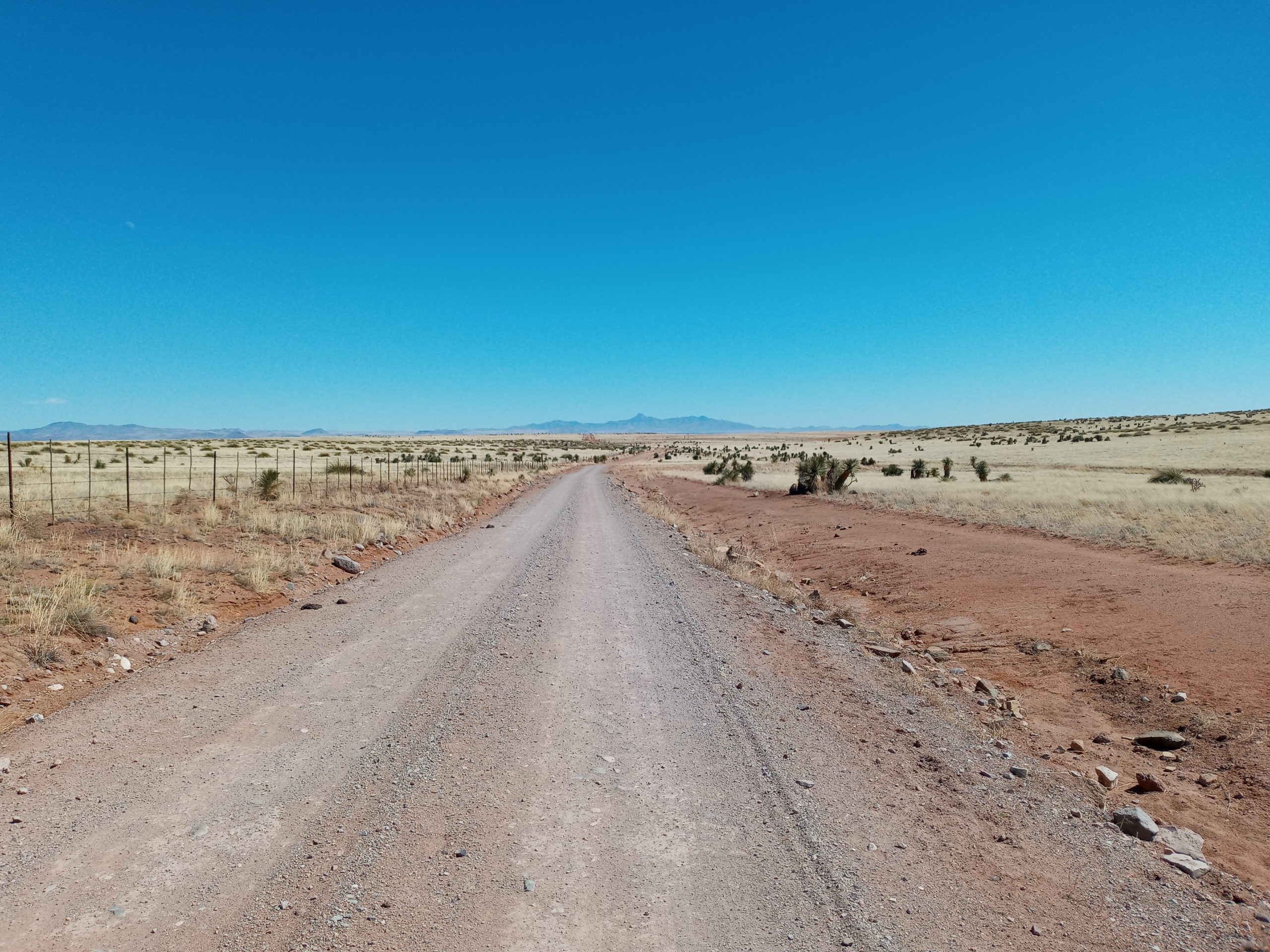
Not wanting to drive (bounce) out the 5 miles, Billy and I do a morning run and meet up with Paul at the end. Now to journey home, but not without a soak. Riverbend in TOC is completely full so we go back to Faywood Hot Springs near City of Rocks SP. Paul enjoys the drive on a long dirt road called Whitewater, that cuts out going up to Silver City.
60mph on this dirt road. Whee!
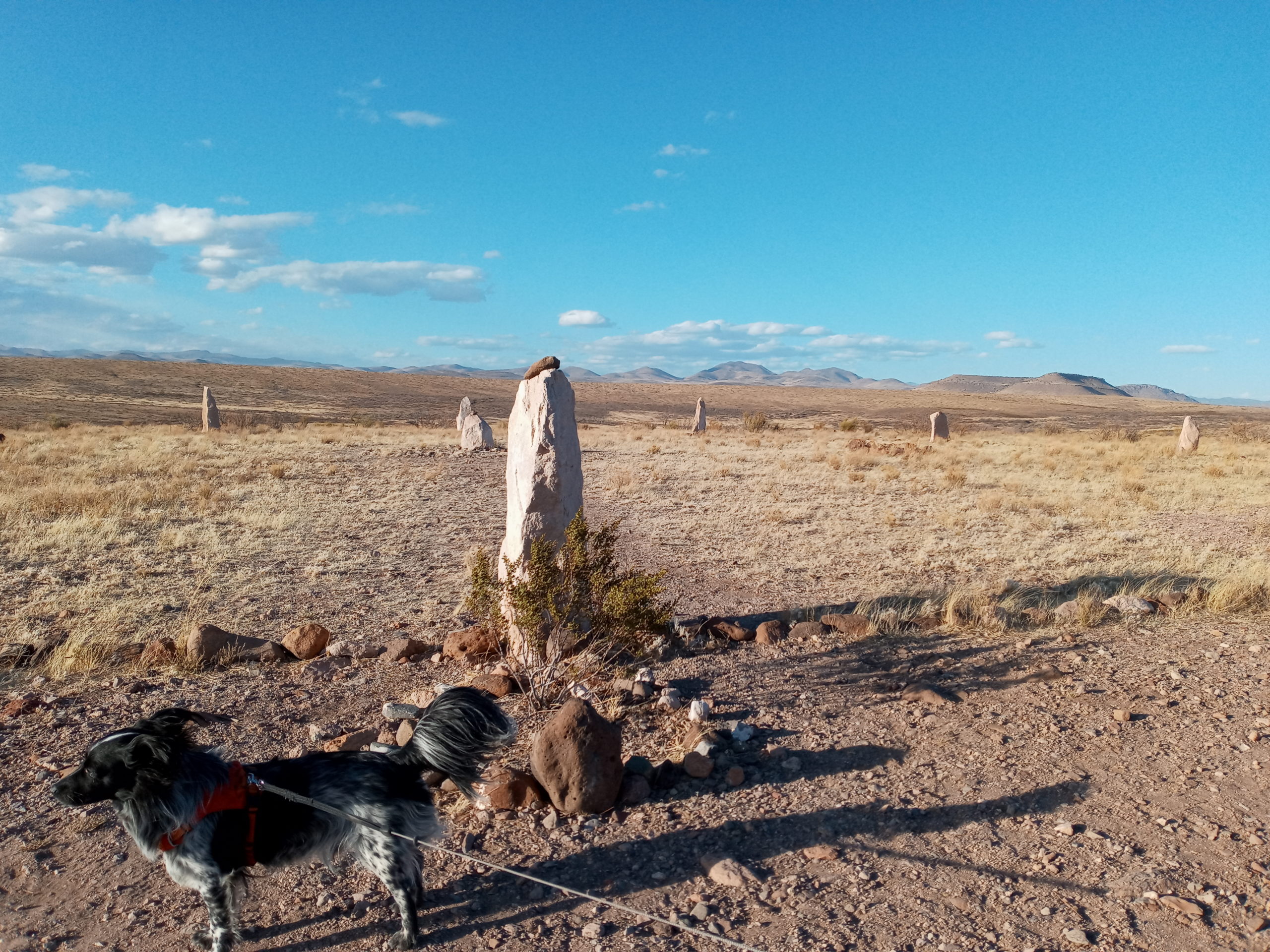
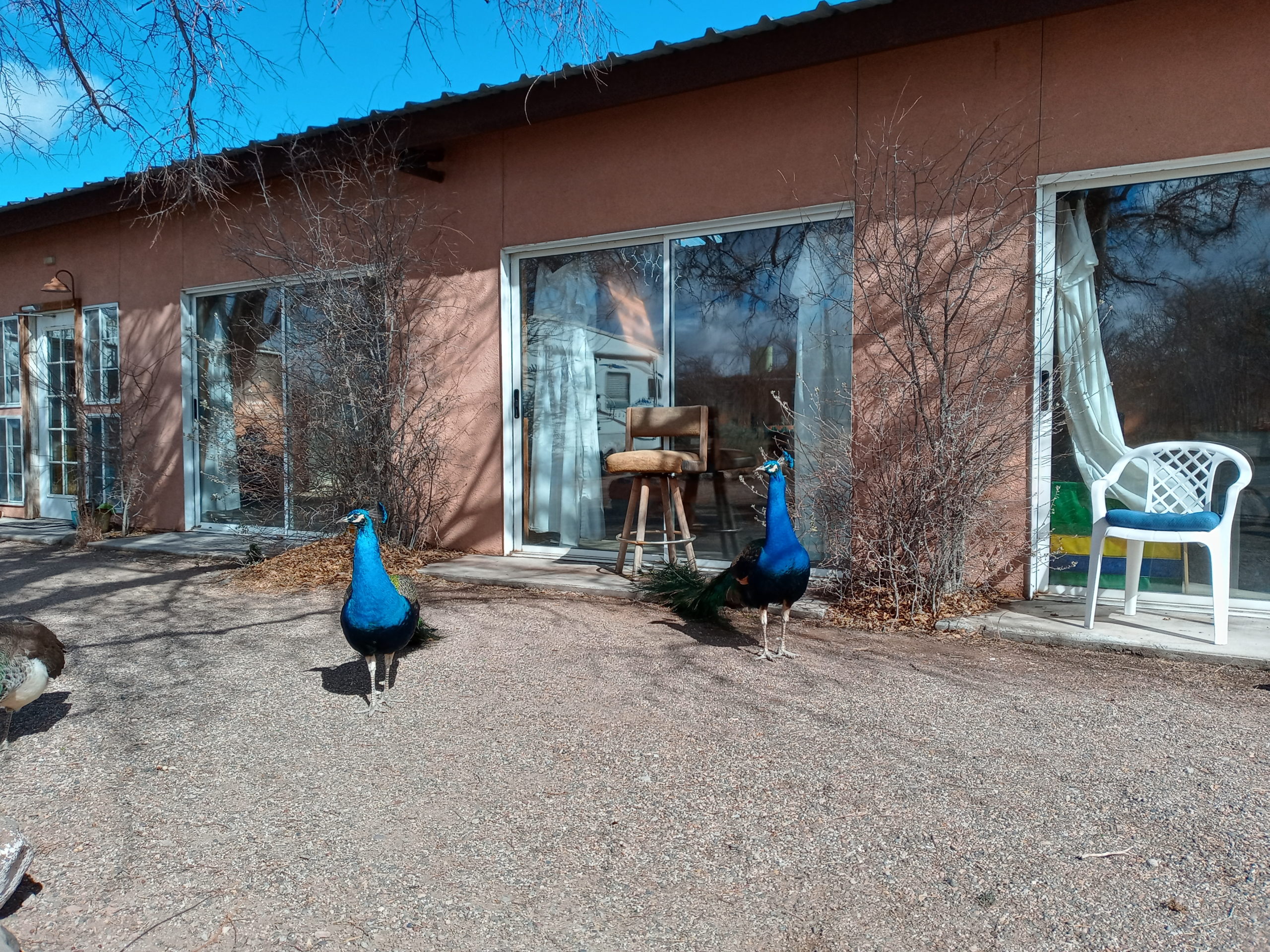
Arriving in early afternoon, Paul soaks most of the day while I soak, nap, hike a bit with Billy. Very funky place, clothing optional, peacocks, stone ring and star chair and places for tents, RVs, vans, and cabin rentals. The whole place could use a bit of polish but we appreciate its tenacity.
Stone ring with dogPeacocks in the calm morningfunky art
Heading home was uneventful. A quick stop in ABQ for late lunch at Poki Poki Cevicheria an interesting Asian fusion place. Paul shops at Whole Foods, one accident on I25 north with a delay, and then the quiet roads heading to our home in Galisteo. Ahhhh….