Paul and I have always wanted to drive the length of 55O in Colorado. Our daughter Rachel invited us up to Palisade, CO. for her 30th birthday so we figured, why not? We started in the late afternoon and only made it as far as some BLM land in NM. Nice thing is that there are plenty of places to pull off and sleep when you get tired, and it is usually pretty scenery.
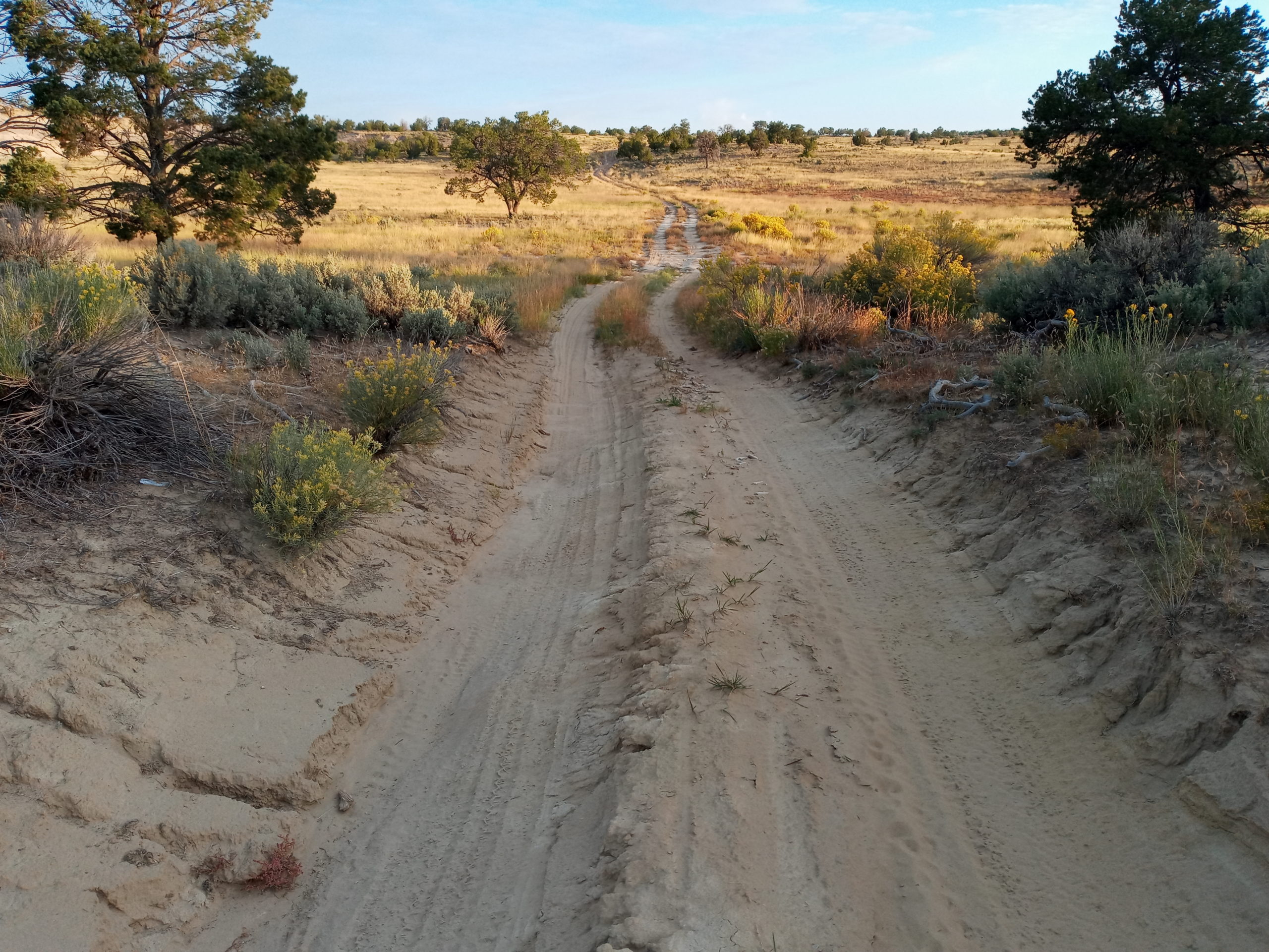
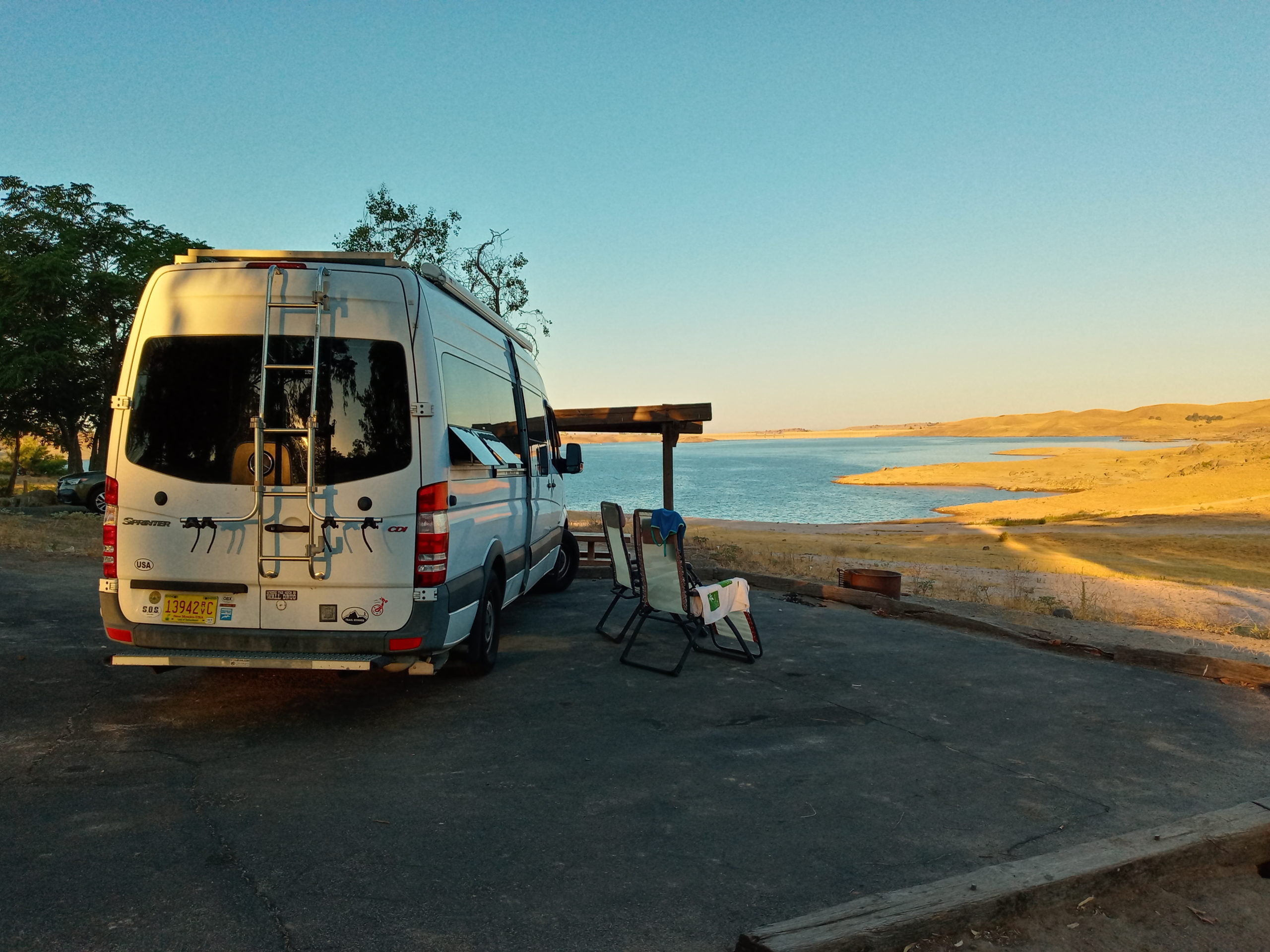
a BLM pull-off for the night(a little sandy, but we didn’t get stuck)
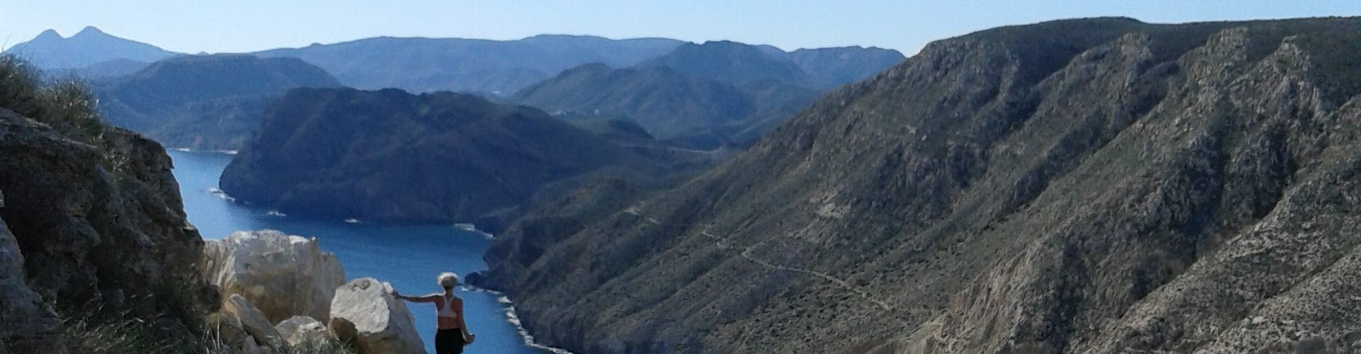
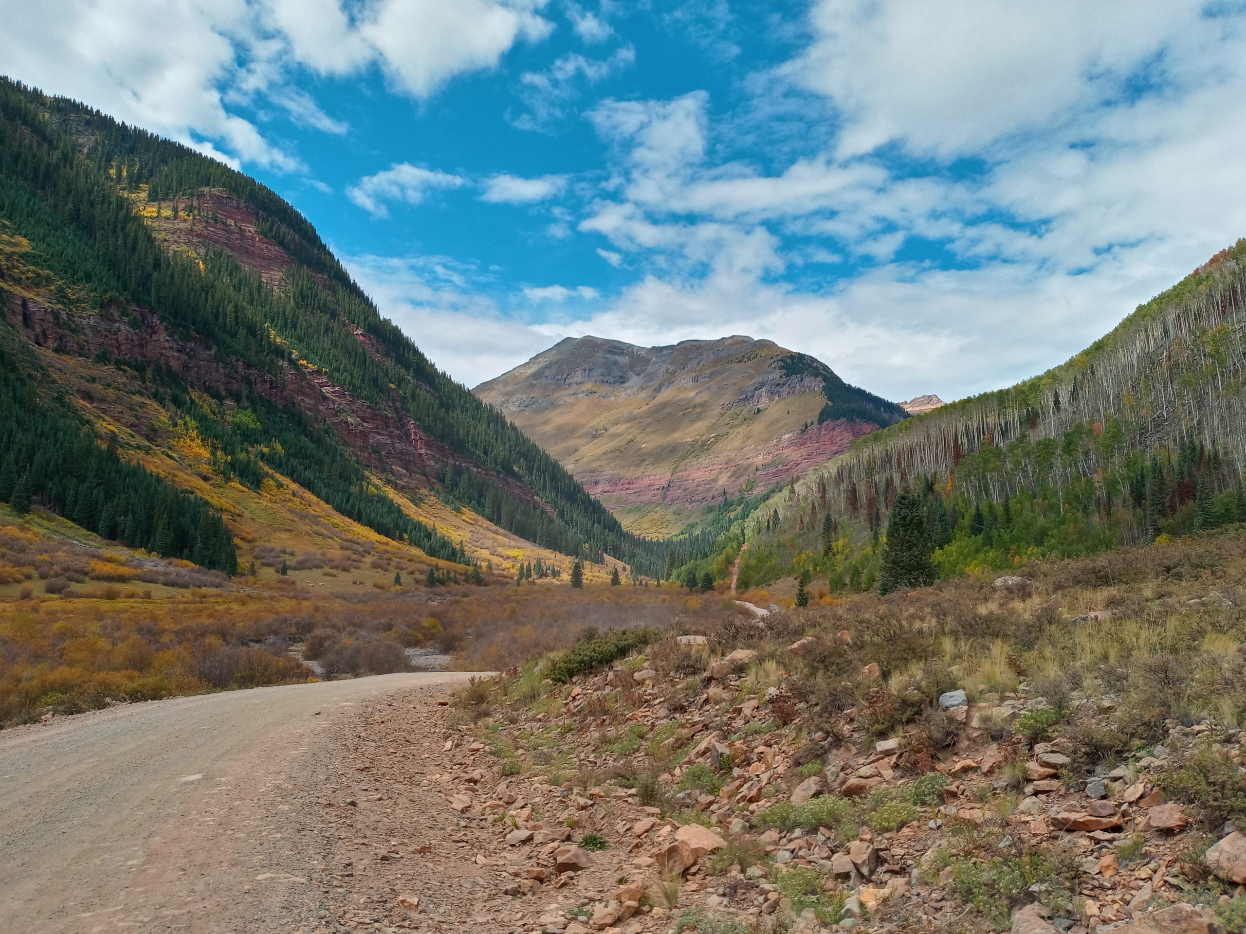
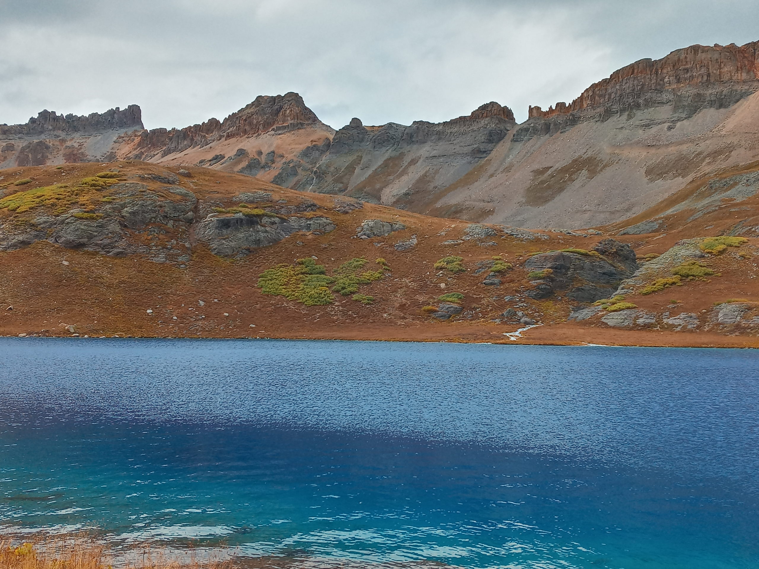
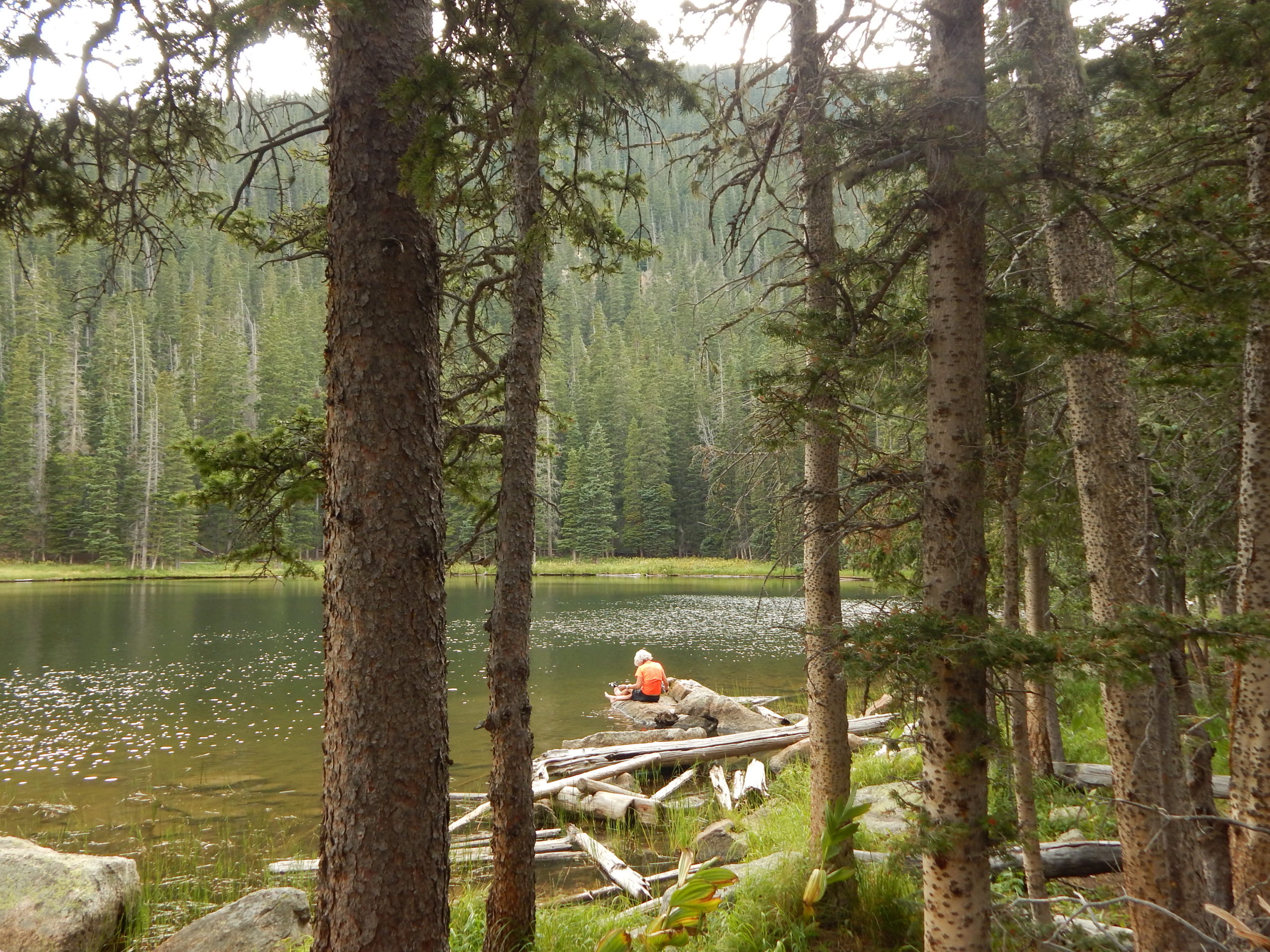
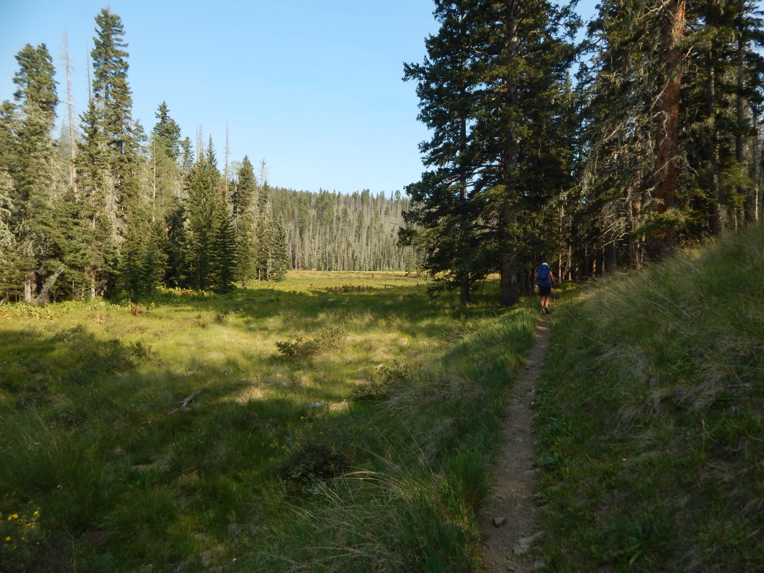
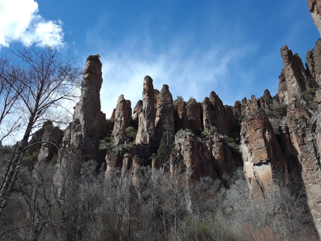
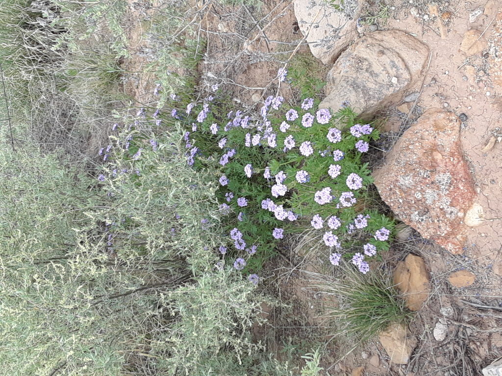
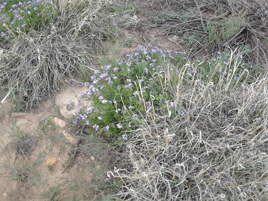
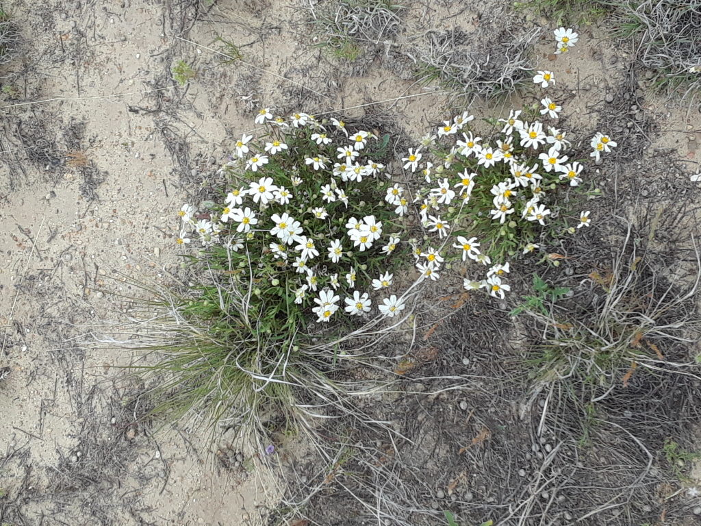
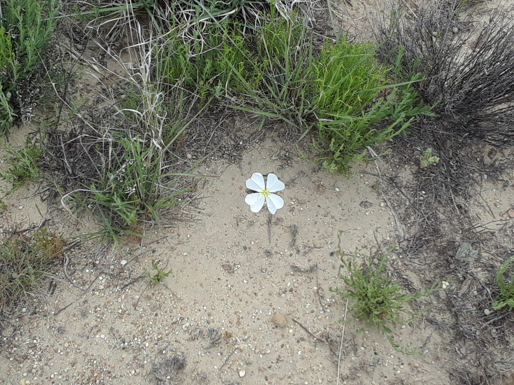
We planned a hike on the Ice Lake trail outside of Silverton. It had just reopened because of a forest fire the previous year. Most of the fire happened down low on the trail so only a small portion of the trail was affected. The trail was a challenging climb but very doable when slow and steady.
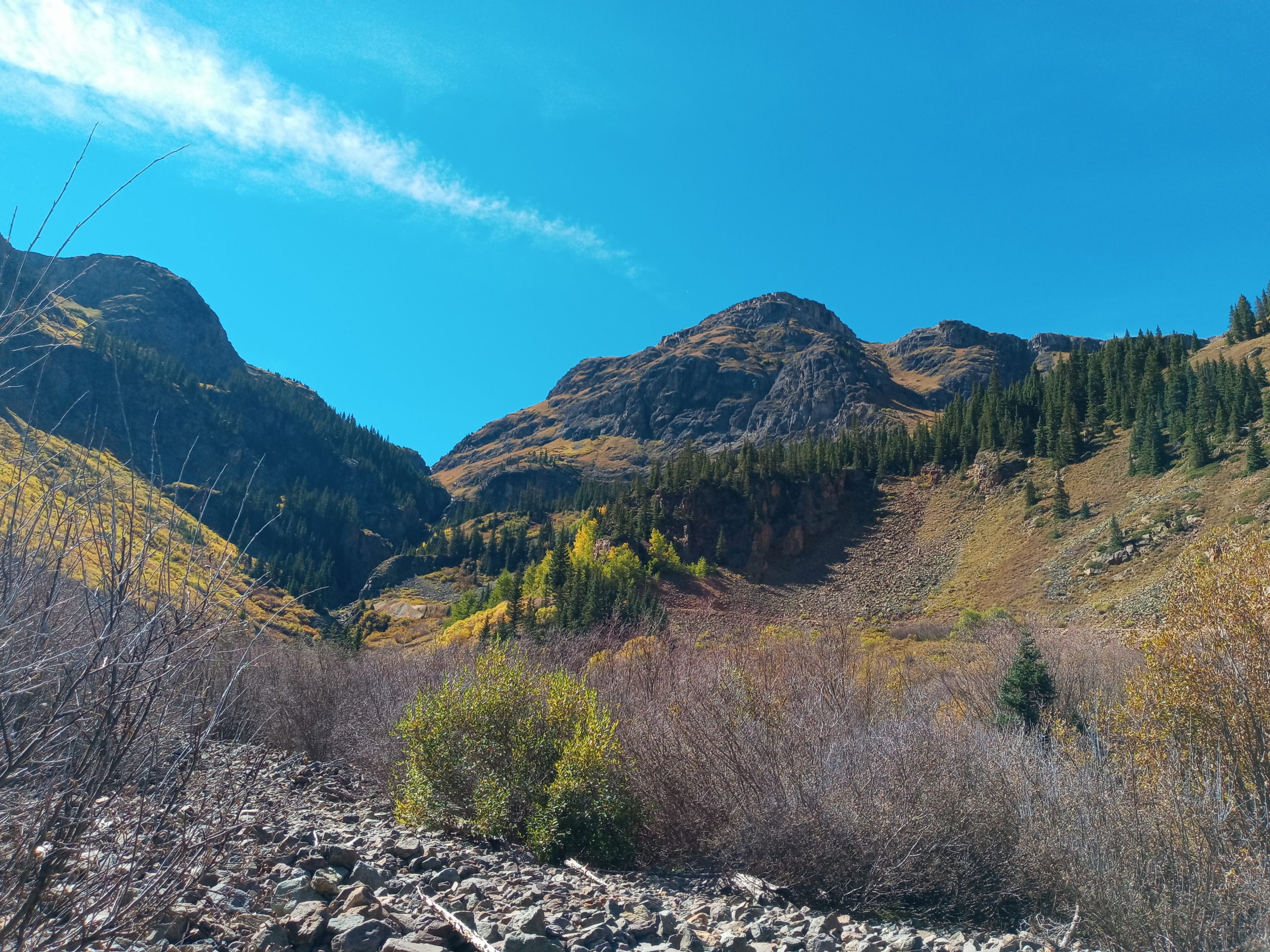
driving to the trailheadthe view from halfway up
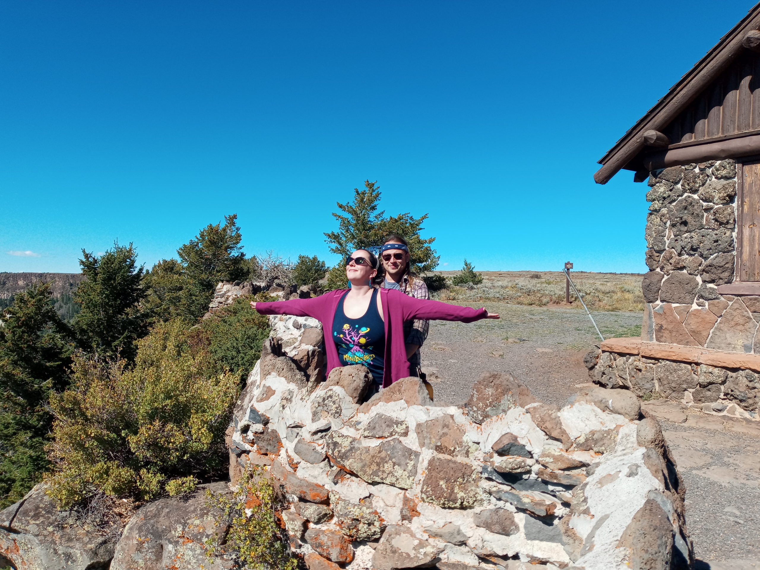
celebration
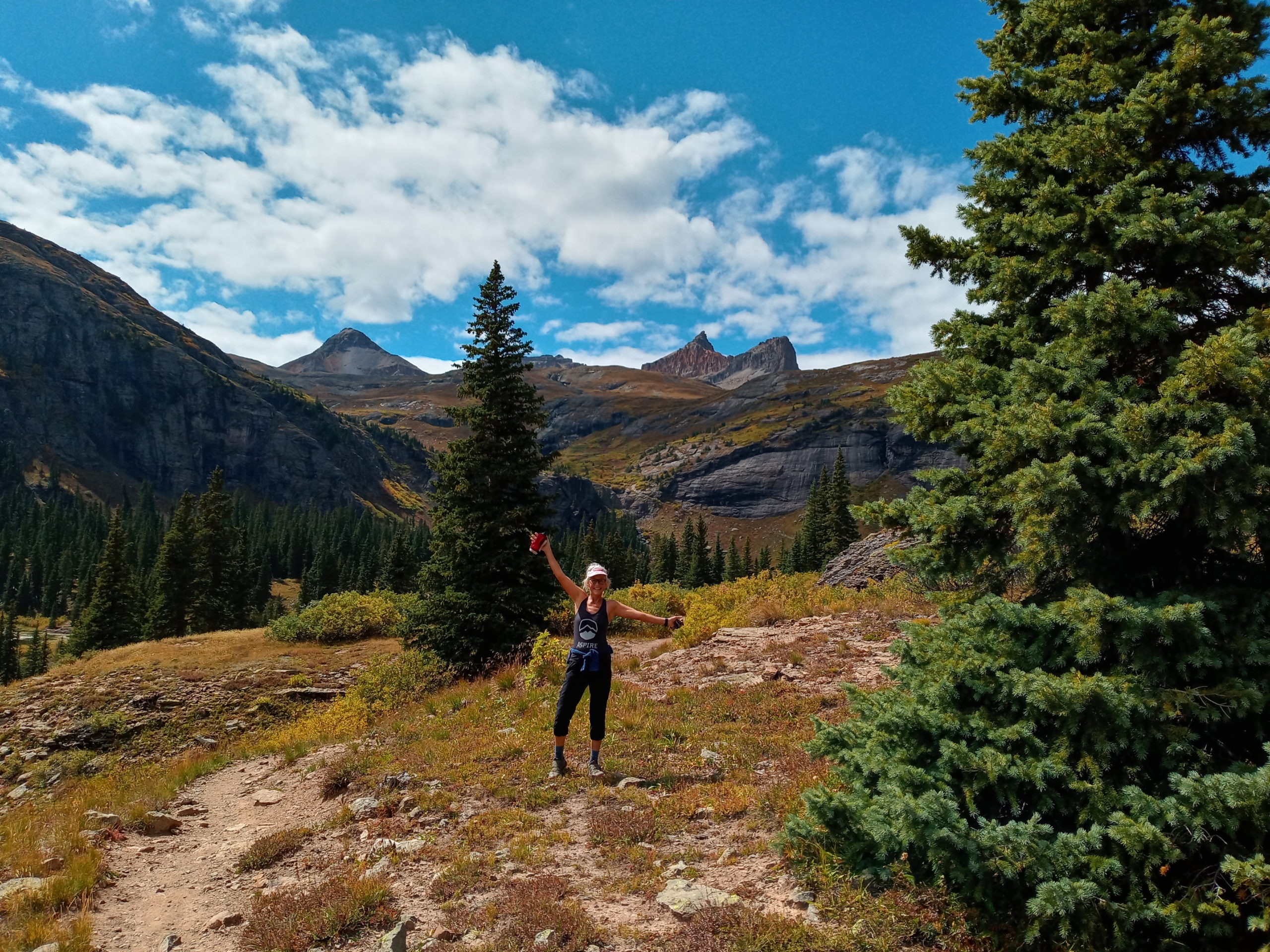
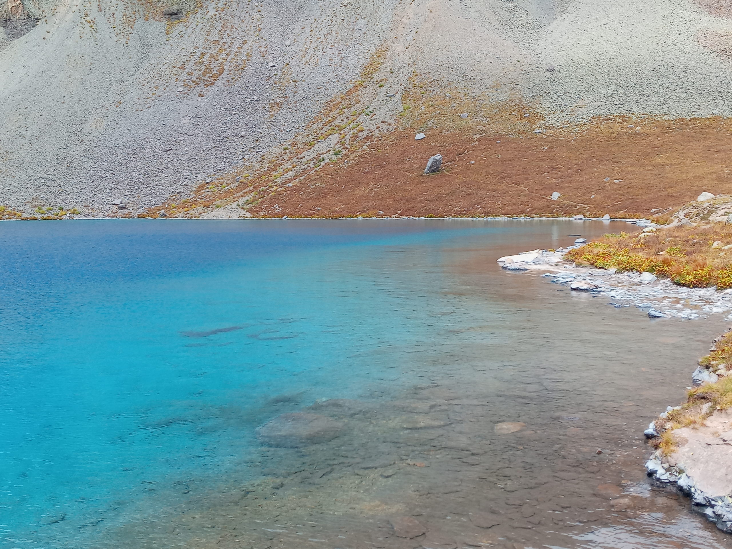
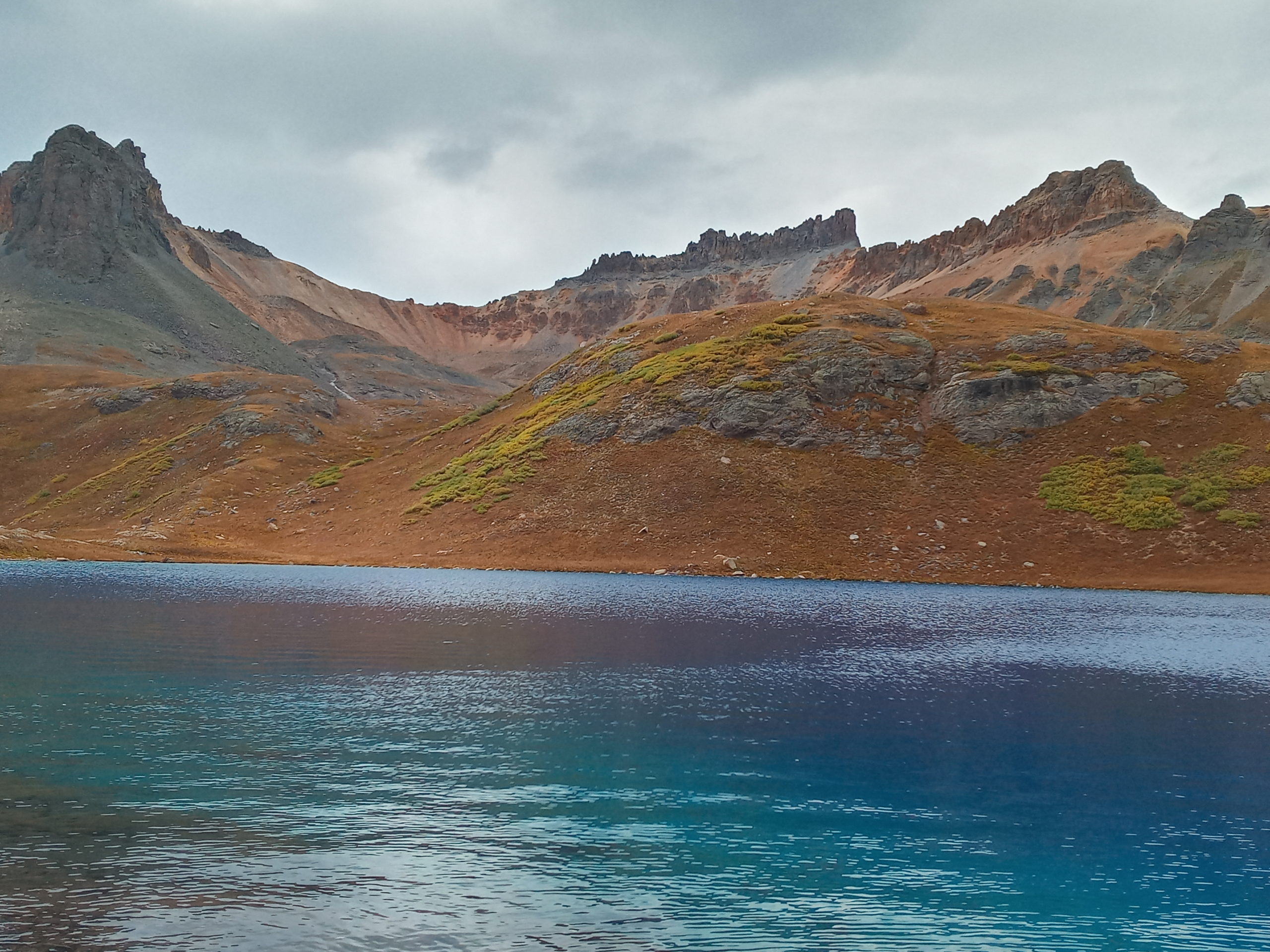
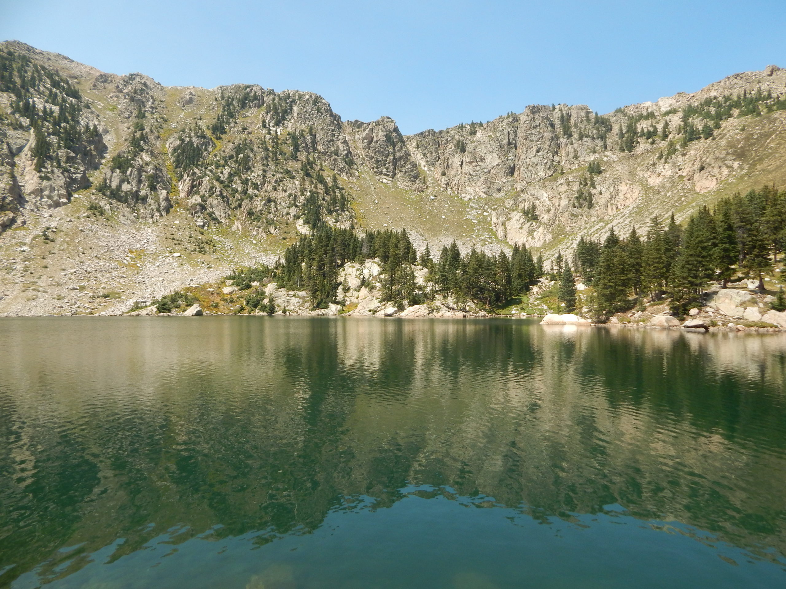
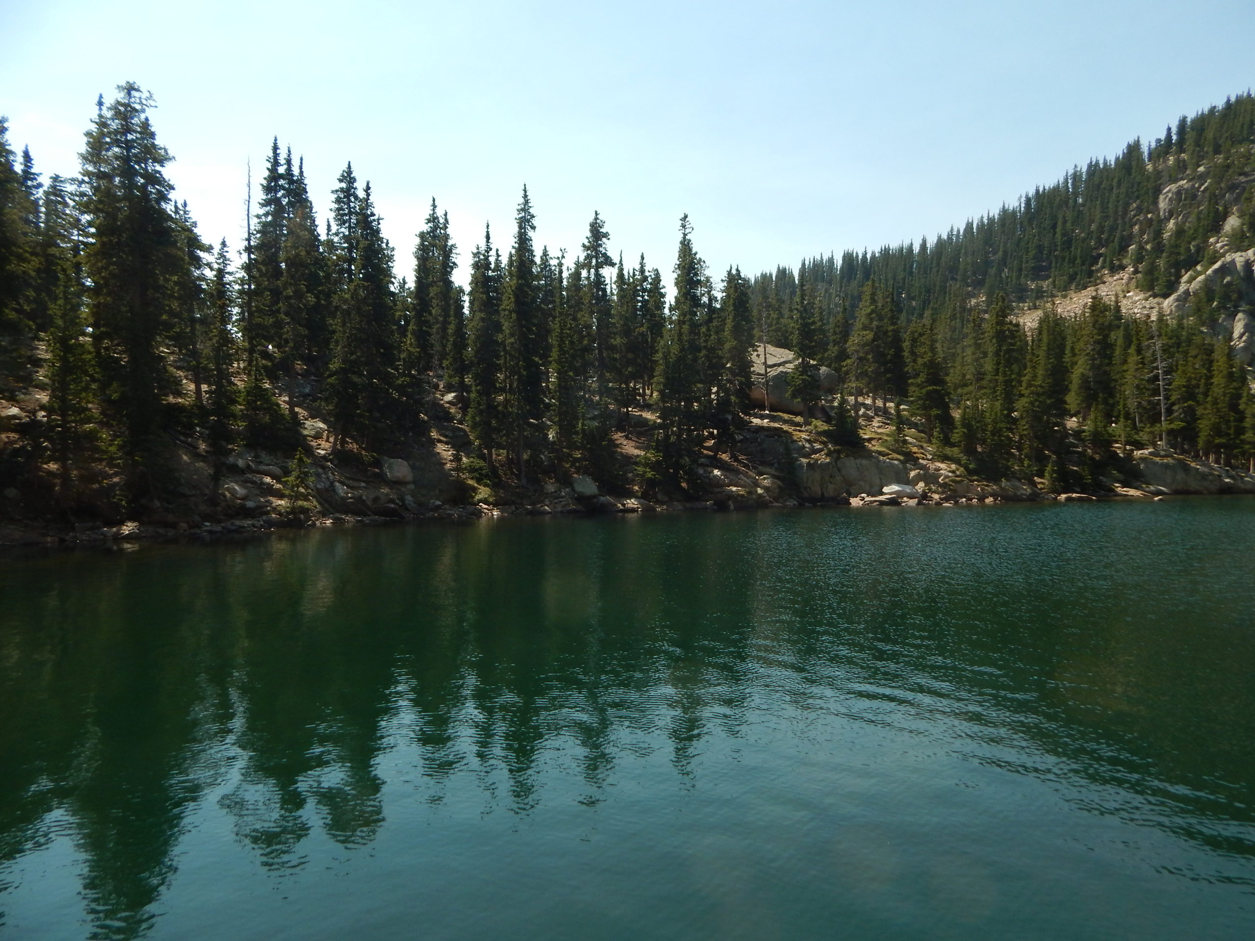
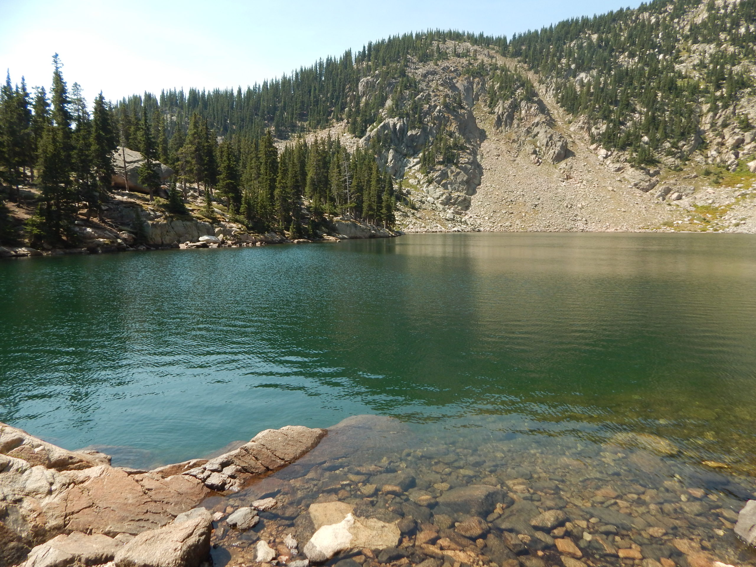
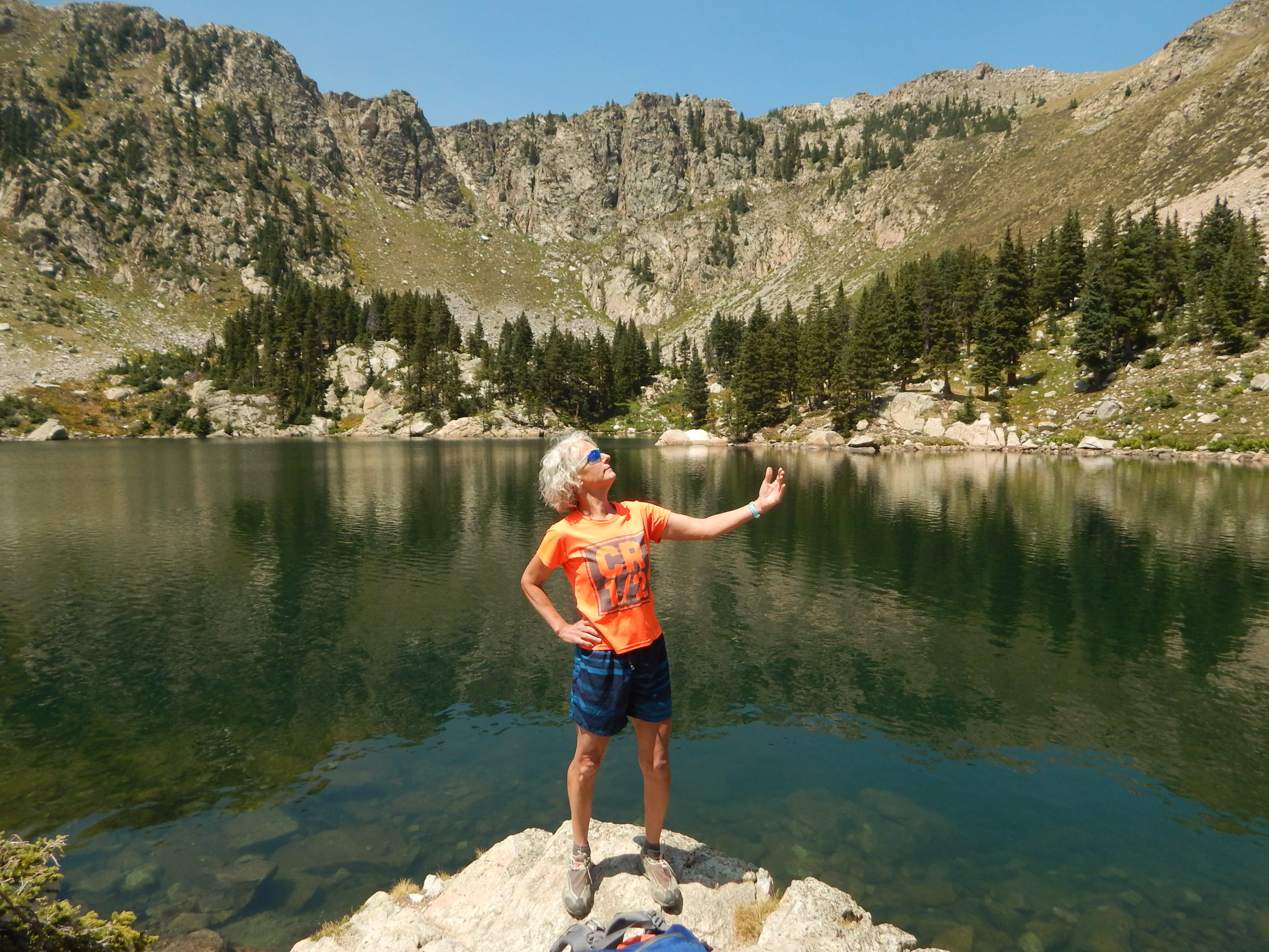
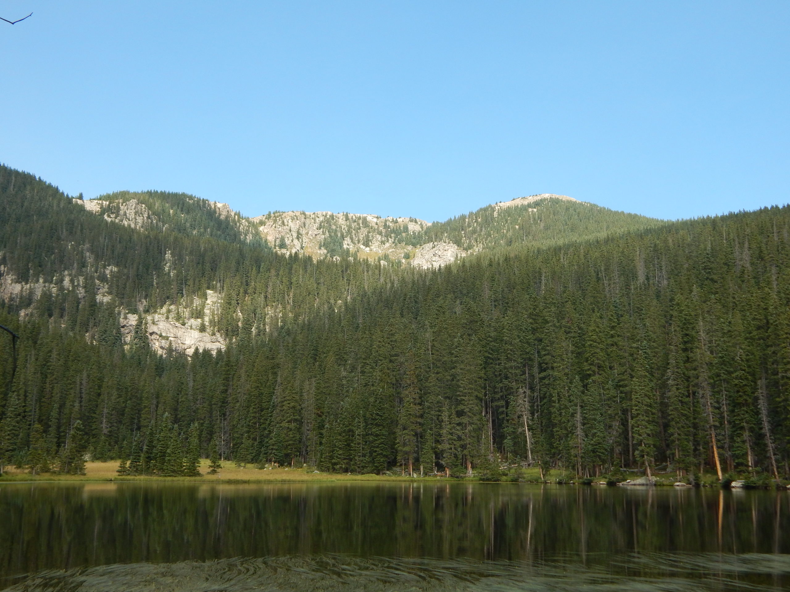
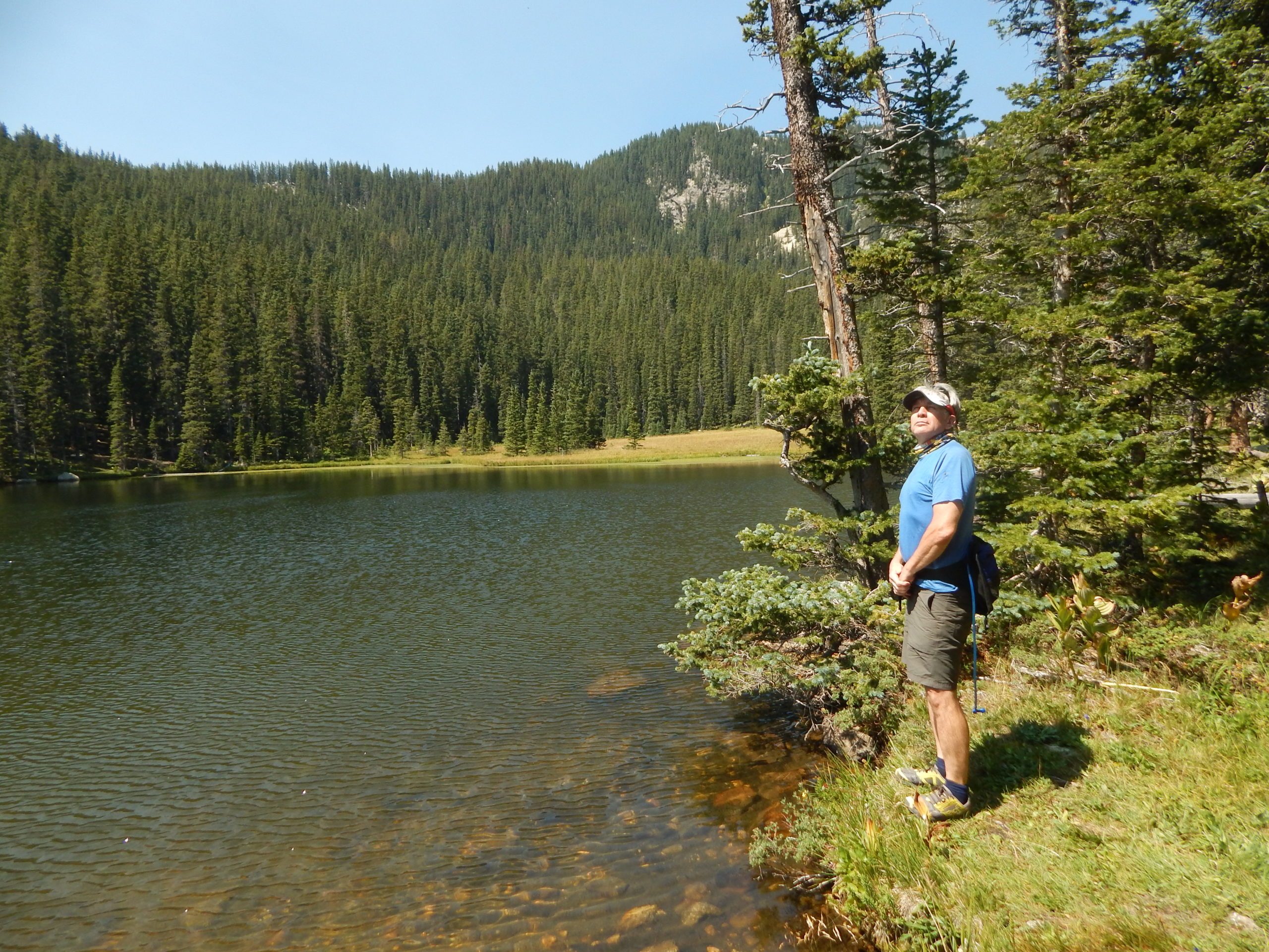
When we reached the top it was much cooler and we were treated to some spectacular views and aqua blue lakes.
Going down was much quicker and we even ran some segments.
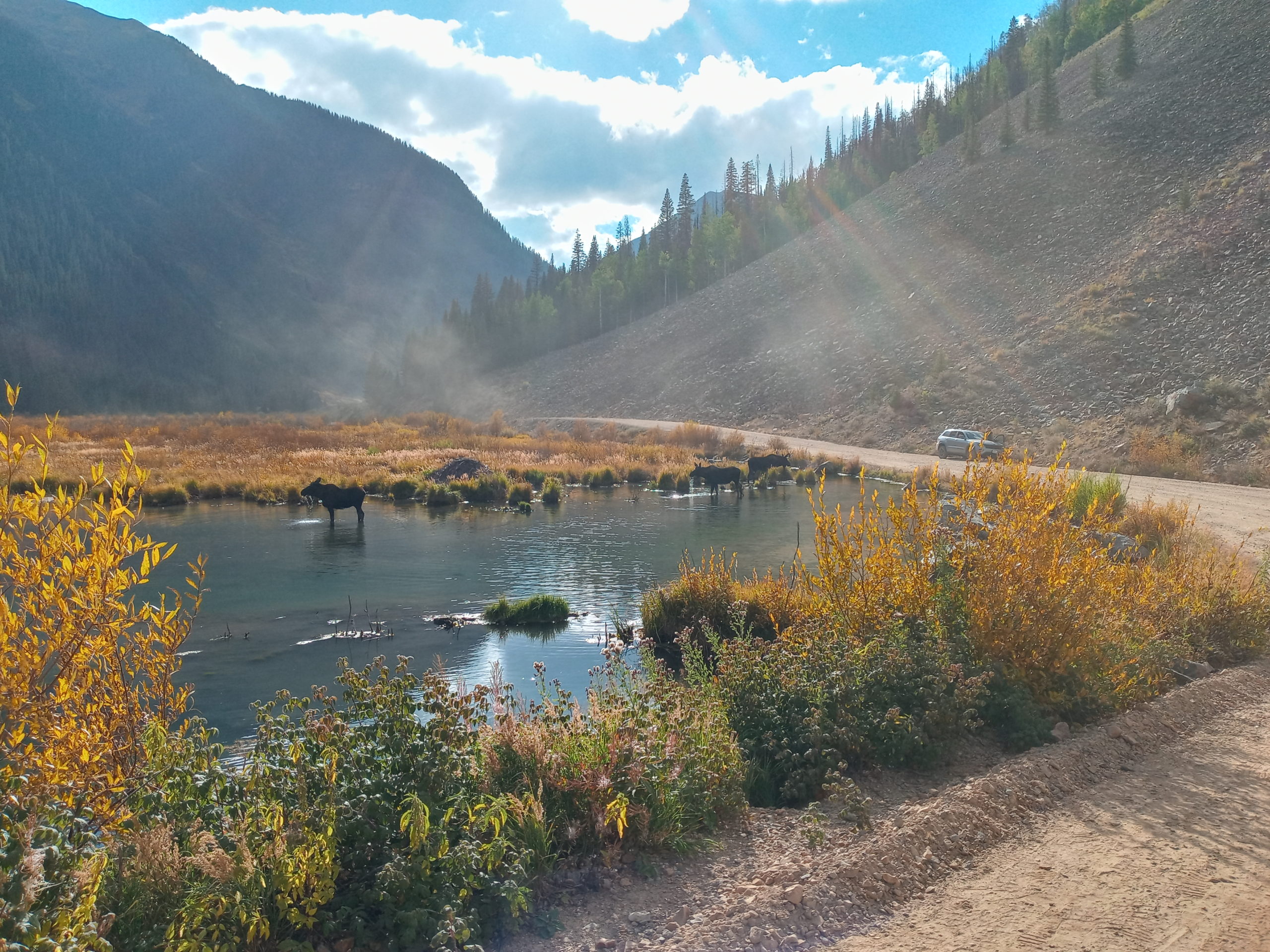
the view from near the topMoose on the loose
After our hike we headed north through Ouray and then looked for a place to stop for the night. We thought maybe Ridgeway SP but it looked uninviting as the water was so low. Paul spotted a sign and we drove into Billy Creek State Wildlife area. They have designated spots for camping but we were thrilled to find a beautiful, free place in quiet, open land. The wind kicked up for a bit but then settled down in time for sleep.
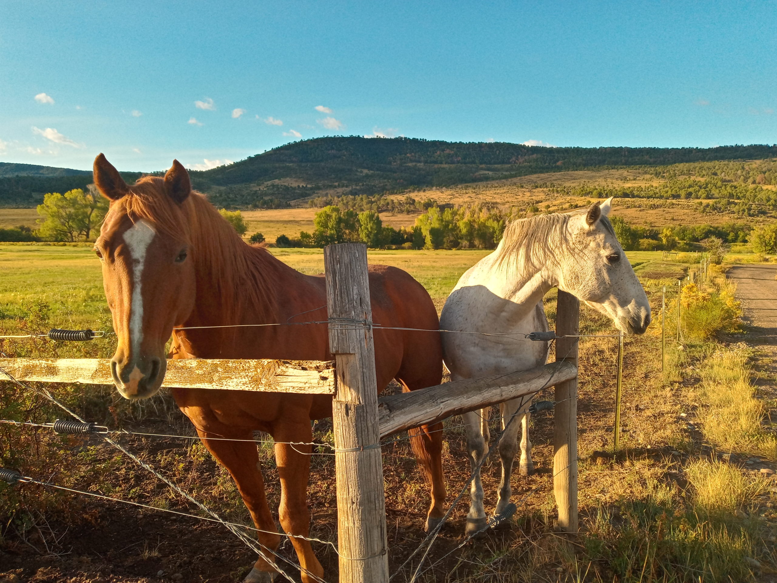
Horses at Billy Creek in the morning
The next morning we finished the drive to Palisade. Maps took us through the Escalante State wildlife area which was lovely and marshy looking. We met up with the kids at the Palisade Farmers Market on Sunday around 10 am. Very impressive for such low population but Grand Junction is only 10 minutes away. The wine festival was underway at 11 am. so we ate breakfast and headed to Liat and Brandon’s place to park. We all rode bicycles to the Wine Fest and sipped, danced, and bought some stuff till 4pm.
Paul and I checked into the James. M Robb S.P and showered, rested etc.. then we met up with the kids for dinner in Palisade. Everyone a bit sleepy, we called it an early night.
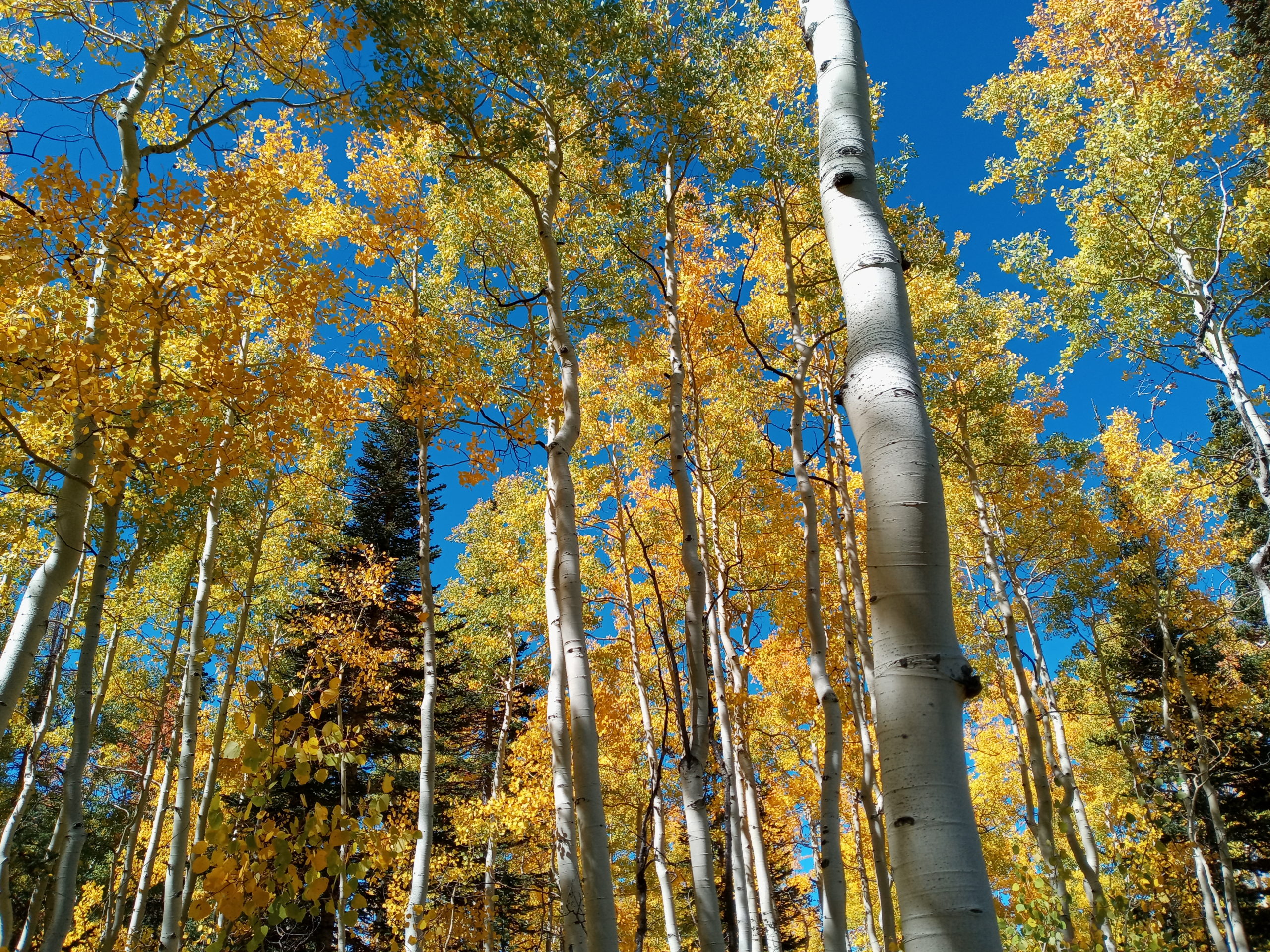
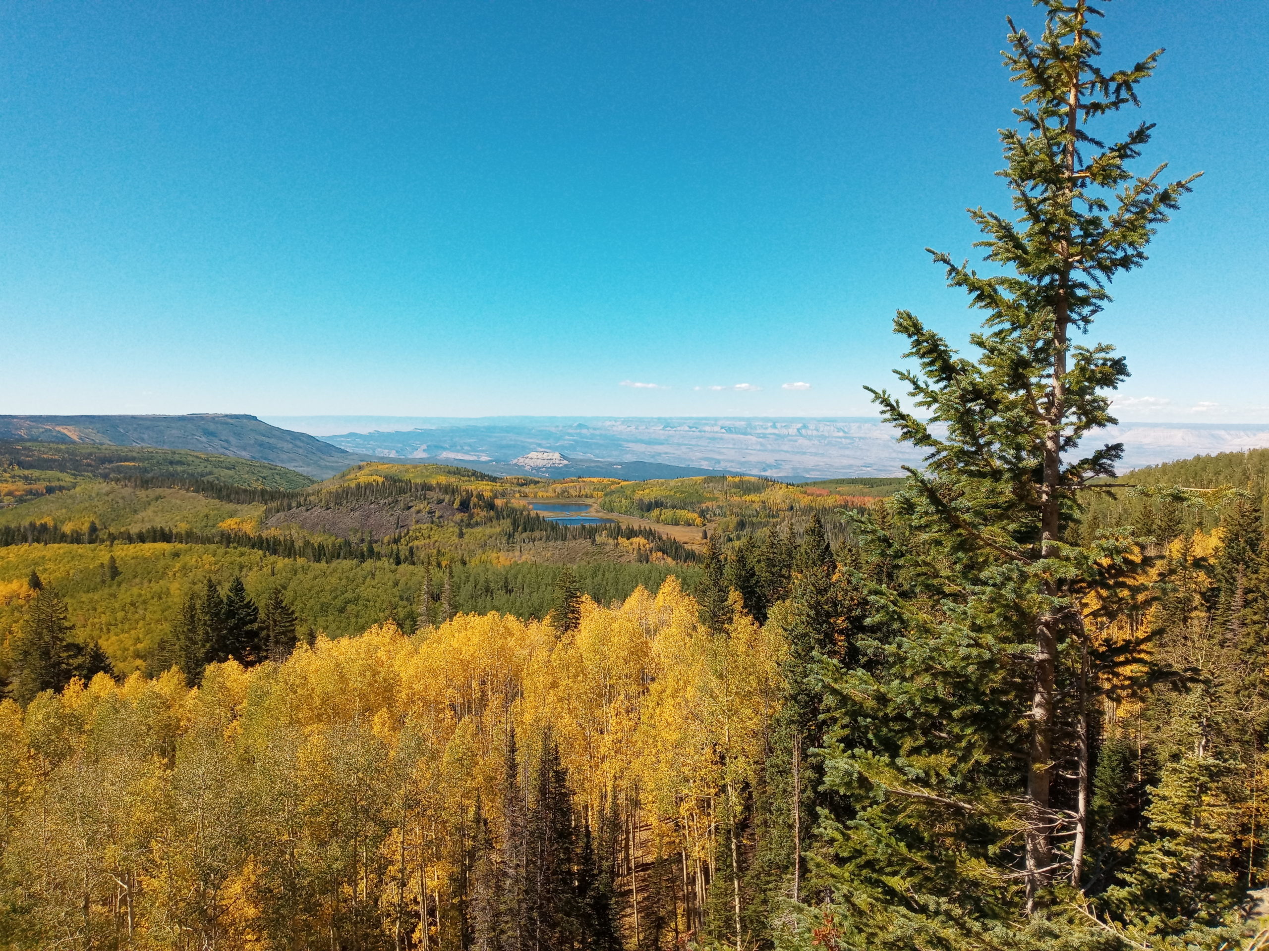
Rachel wanted to go on a hike for her birthday so we headed up to the Grand Mesa. Liat knew a sweet out and back that showed the beautiful Fall colors of the aspen trees, next to running water and the valley below.
the birthday girl at Land’s End
We drove out to Land’s End afterwards and then Ozzy did some impressive driving down a windy gravel road for 18 miles.
Paul cooked a yummy dinner for everyone. We had wine, cake, songs, and a full moon to boot.
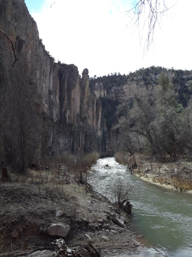
The next day we traveled back the same way we came although turning at Durango.. We did one stop for a crazy hike at Mill Creek and I don’t recommend the outback part. Stay on the road! Although I did see a porcupine face to face, which was cool.
the site of the infamous Mill Creek bushwacking incident
After that whole experience, we needed a soak so Paul drove all the way to Pagosa Springs and we sat in the free Nathan’s Hippy Dip hot springs. The warm/hot water felt so good and you can cold plunge in the river. Driving on with the night creeping in, we pulled over on 285 and the Continental Divide to eat dinner. Then Paul sailed us all the way home by the light of the moon.
Paul and I have been making many trips to Wisconsin and back and find it hard to change our route much. We normally spend one or two overnights in the van. This trip was for my father’s memorial in August. We started out on the evening of Aug. 16 and slept in the rest area outside of Las Vegas, NM. Quiet enough and gets us on the road early. On this trip we decided to check out Manhattan, Kansas. We pulled into Tuttle Creek S.P but it didn’t look like a good lake to swim on that side. The Big Blue River that flows into the Kansas River was damed to create a large recreation area. It was starting to get dark so we moved on until we found a sweet spot. Brown’s State fishing lake is in the Northeastern corner of Kansas. Free camping and porta potties plus a quiet except for frogs, birds and crickets chirping. We did a little walk around in the morning when we awoke.
parked in/on the lake
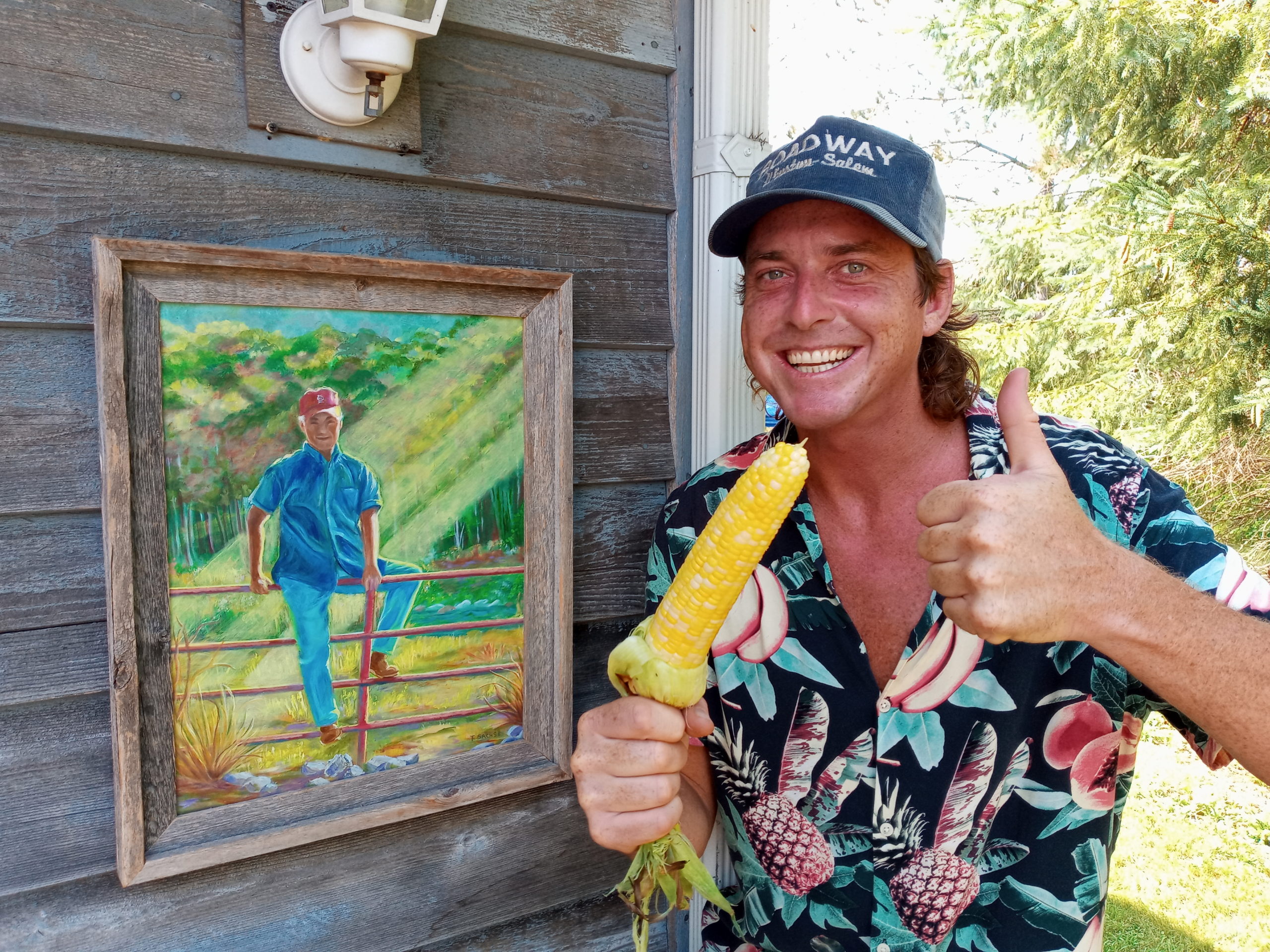
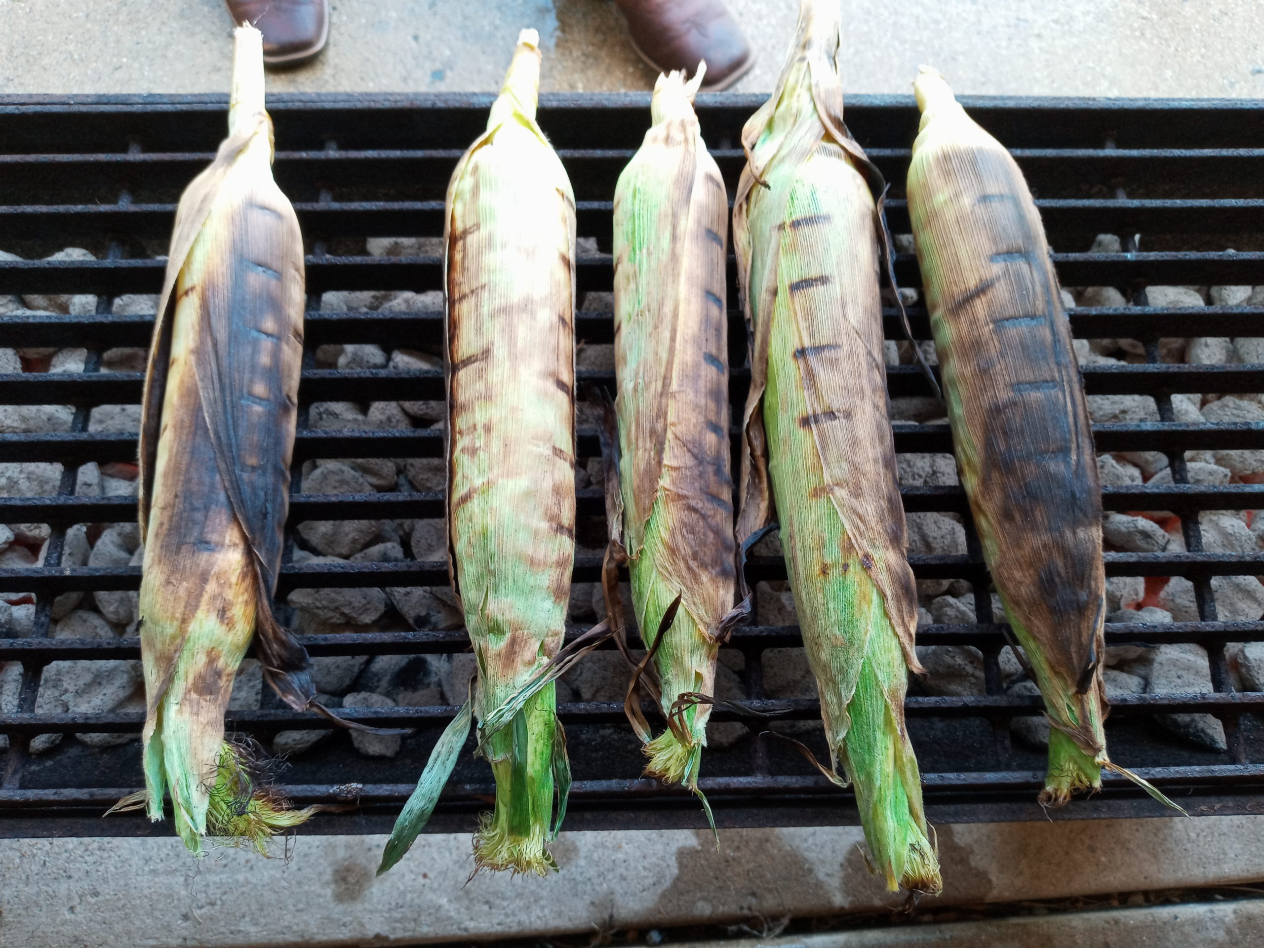
After spending a really nice time in Wisconsin, swimming in lakes, eating corn on the cob, and singing sweet songs, we headed back home.
Somewhere on 151 outside of Dubuque, Iowa, Paul and I hit a crazy storm. We listened to the radio which scared us with alert sirens. We pulled over by a corn field and waited until it mostly passed. I think there where gusts of winds around 80 mph. I was pretty freaked out. We got a late start traveling so we ended up in a rest area on I80 outside Omaha in Kansas for the night. (way too warm)
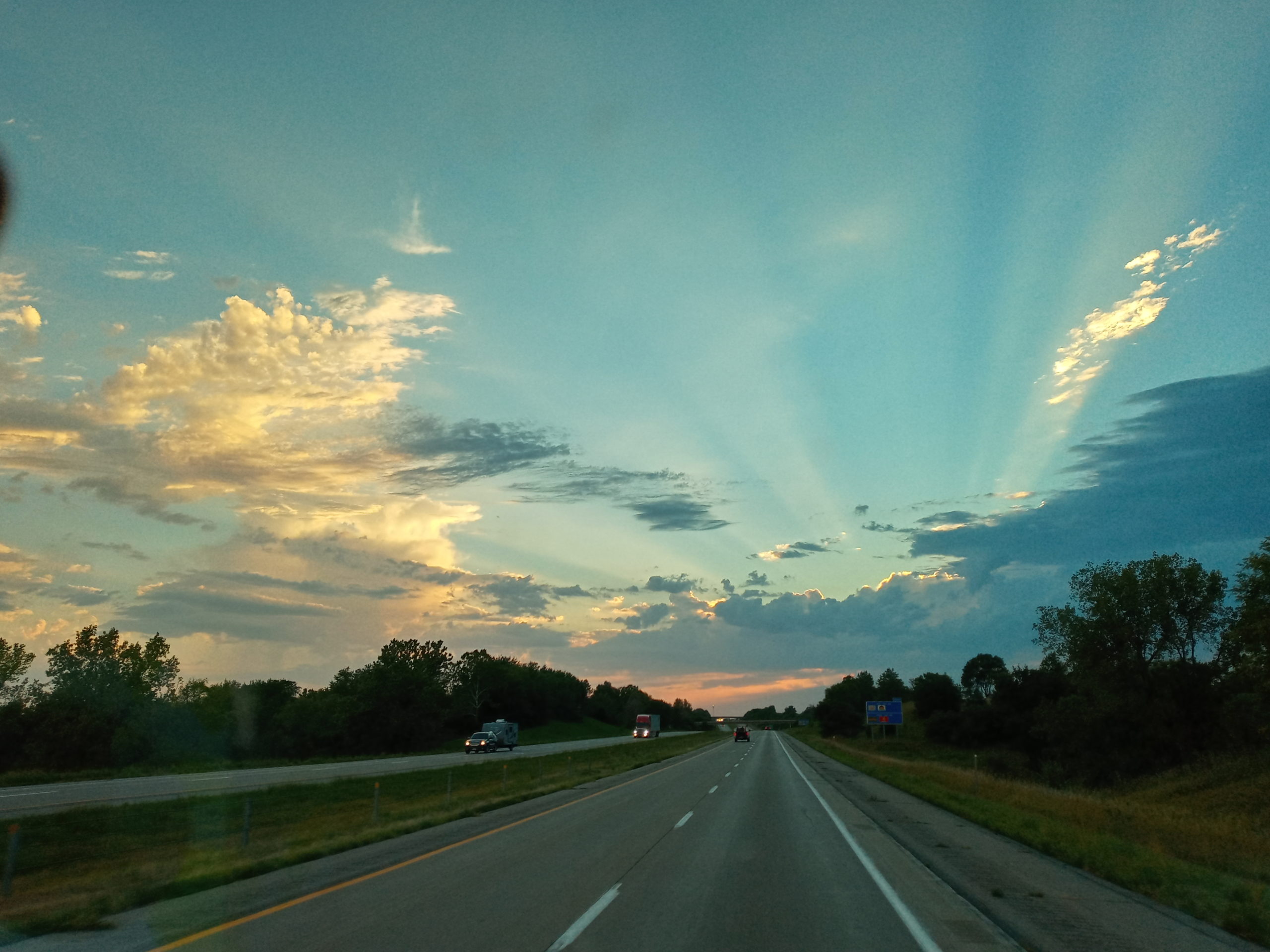
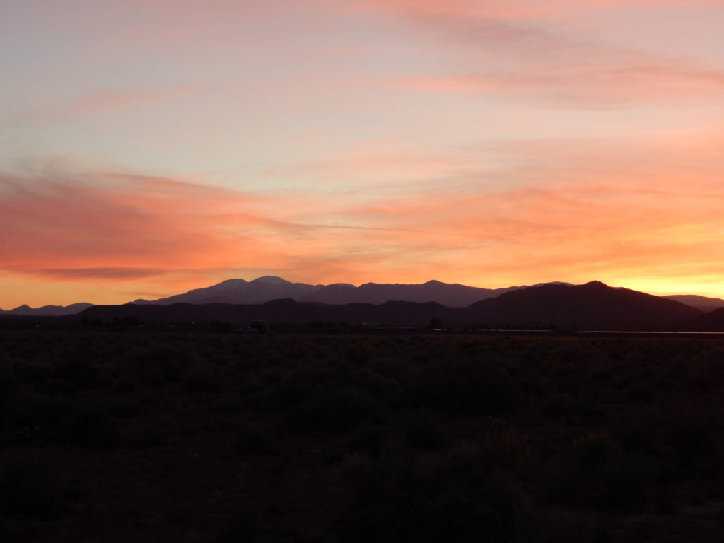
Highway Sunset
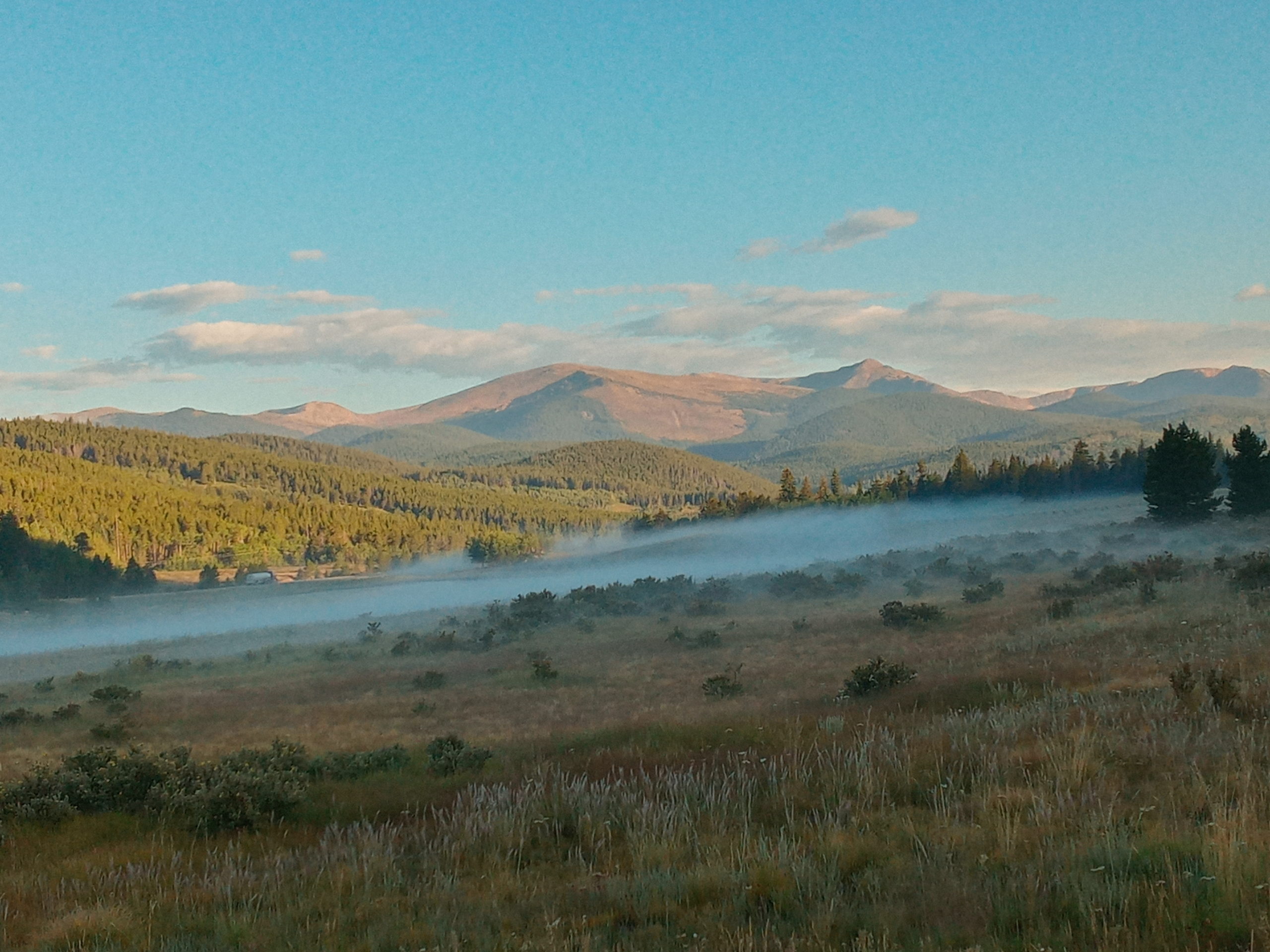
We decided to drive through Denver the next day on 285 and camp for the night in some cool mountain air. We stopped at a National Forest Park on the Kenosha Pass. Paul did some daring off road driving but we ended up in a legit spot for the night. Super pretty and chilly night air.
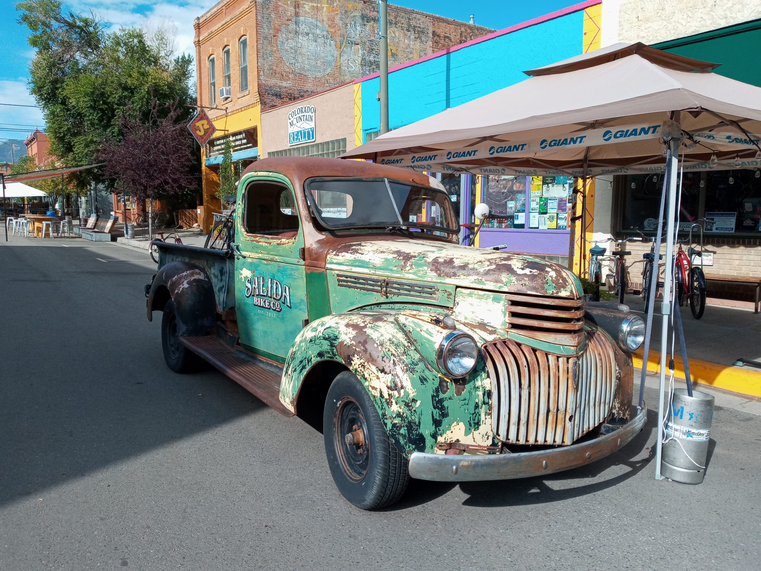
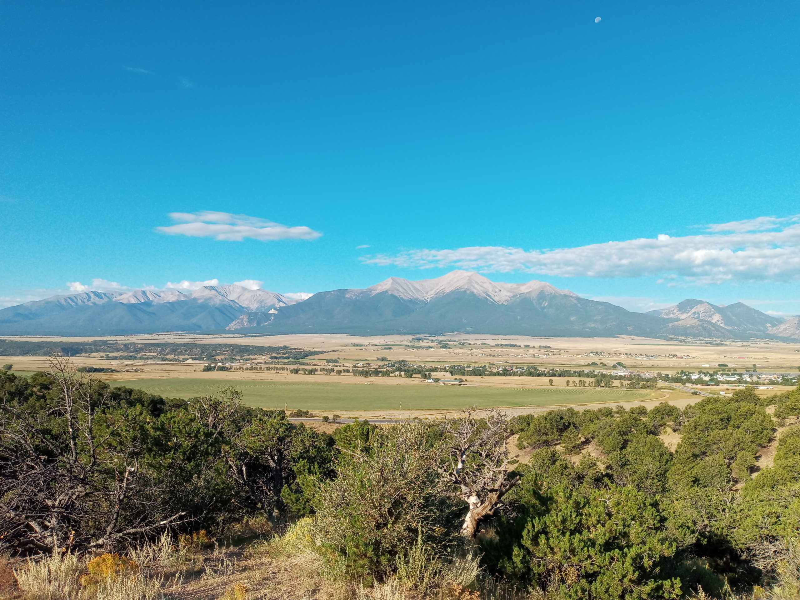
The way back on 285 is pleasant. We stopped for coffee and walked around Salida, a cute, artsy mountain town that is worth a visit.
The Collegiate Range near Salida
The rest of the way we have traveled before but it was nice to change it up a bit.
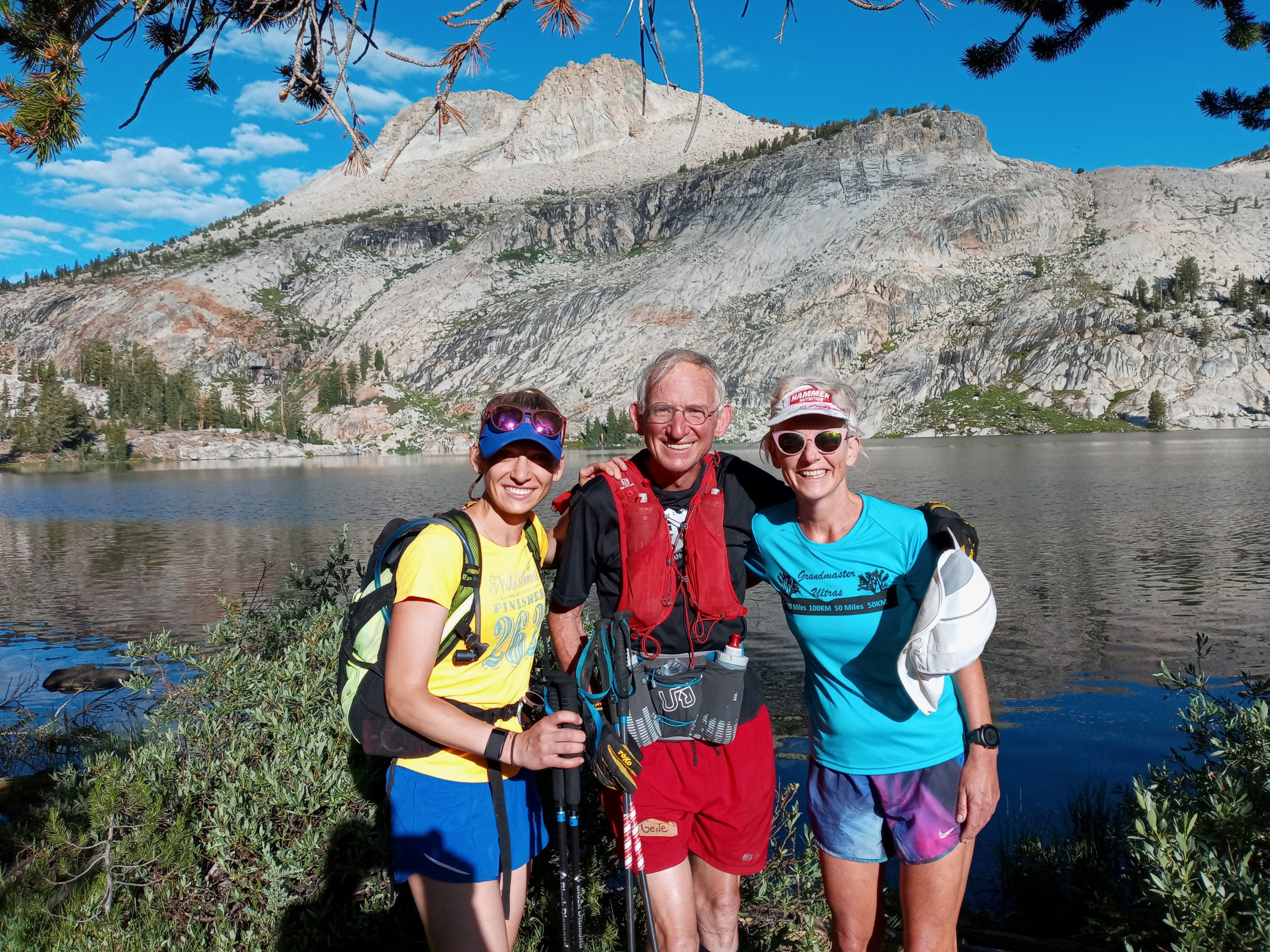
My good friend in Philadelphia, Gene Dykes, asked me if I would like to join him and his daughter Hilary on a running trip in Yosemite. I have never paid money for a organized running trip before but I also have never been to Yosemite and wanted to experience the park the best way possible. The trip exceeded my expectations.
Paul and I left New Mexico and headed to Flagstaff on July 4th. We had planned to park in the National Forest overnight but found all forest access closed due to fires. We found a quiet spot on Lake Mary Rd. near a trail head where rain softly lulled us to sleep.
Up early in the morning, we drove to the next town Williams. Williams is a gateway to the Grand Canyon and is a cool historic looking town. There is a train that runs from the town to the Grand Canyon. Many hotel, motels, and places to stay. Route 66 shops, restaurants and places dating back to early 1900’s.
We drove west on I-40 and did one bypass on Historic Route 66 going through Peach Springs, Valentine etc. Sounds nicer than the actual places but a good diversion and quiet road. Next up on I-40 was the Mojave Desert where temperatures reached 108 degrees, according to the van thermometer. In Bakersfield, CA. we took 65 which had less traffic but was probably slower. There was oil drilling at first but then the farms began to line the roadside.
We booked a night stay at Millerton Lake S.P. near Fresno. The place was still a little busy after the 4th of July weekend and pretty hot until the sun went down. I took an evening dip in the lake and had a proper swim in the morning before heading to Yosemite.
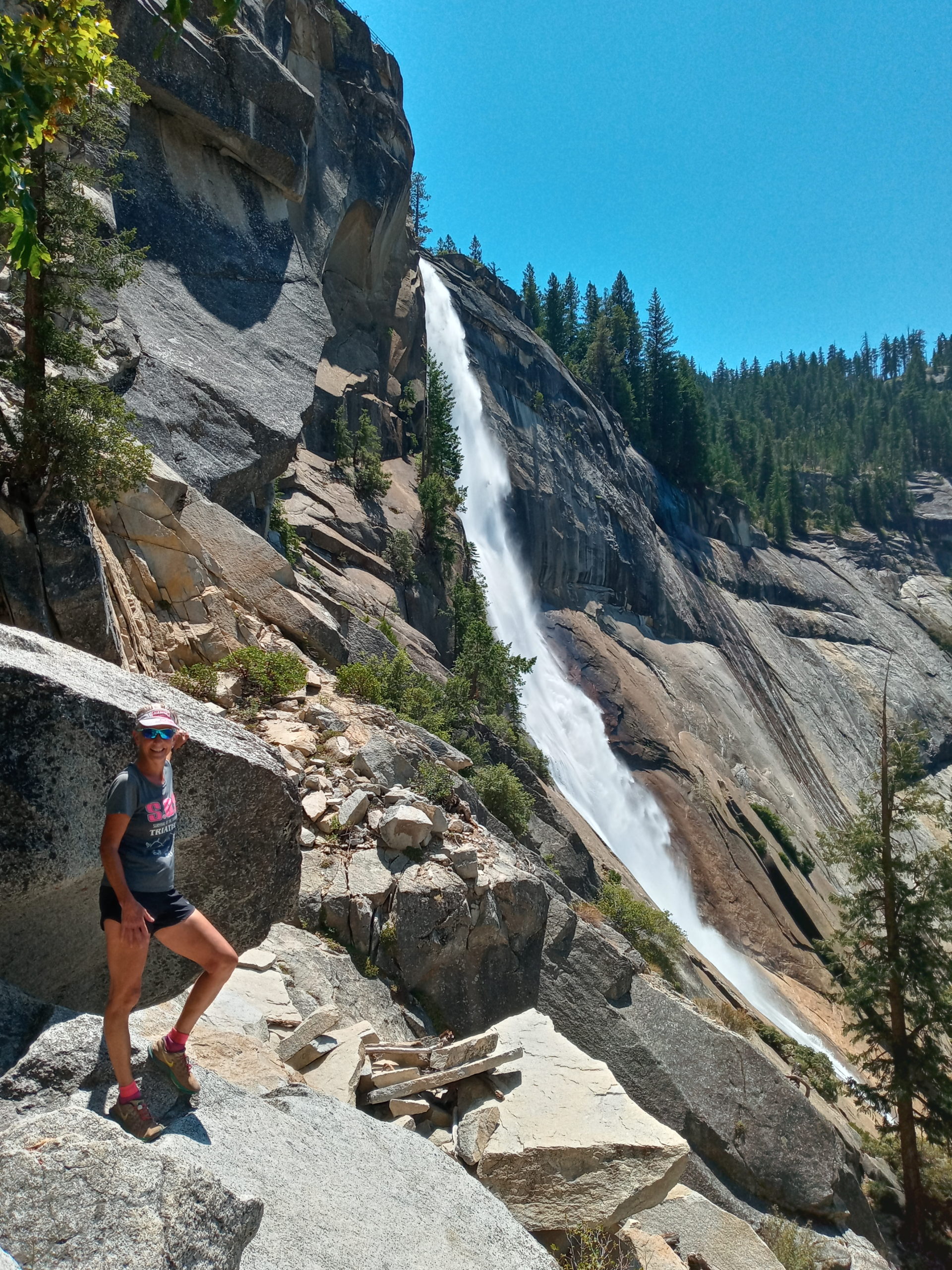
Aspire Running Adventures is the group that organized my trip. I met up with everyone at a cool place called Flying Spur which you had to go through the park to get to. It is an old property that John Muir once had a cabin on. The owners were gracious to have us all park there. After a meet and greet and a yummy salmon dinner, we talked about our itinerary. There were a few people who wanted to get up before dawn and run to El Capitan to watch the sun rise. Of course Gene was game so Hilary and I said yes too. That meant getting up at 2 am!!!
Day 1 of running: Big Oak Flat to Porcupine Creek
So I did not sleep much. I said good-bye to Paul who would have his own adventure, and got into a van taking us to the trailhead. Trent, Nick (our photographer ) and Frederic (a very fast runner)started running ahead of us. It was completely dark and mostly wooded. We had our lights to guide the way and had a goal of reaching the top of El Capitan by sunrise. It was all up, up, up and Gene was starting to fall behind. Hilary and I decided to keep going and we made it there to see the sun cresting in the distance. Gene arrived not to long after and we all had a good break up top. The rest of the day we enjoyed a slower pace taking in views at Eagle Peak, dipping in Yosemite creek, and heading out to North Dome. The day was long, beautiful, exhausting, stimulating, all at the same time. How alive do you feel in the wilderness and in nature? I feel truly alive.
After getting back to our new camp at Tioga Lake, we set up our tents, swam, ate dinner and went to bed early. I slept well because I basically passed right out.
Day 2: Lakes Basin
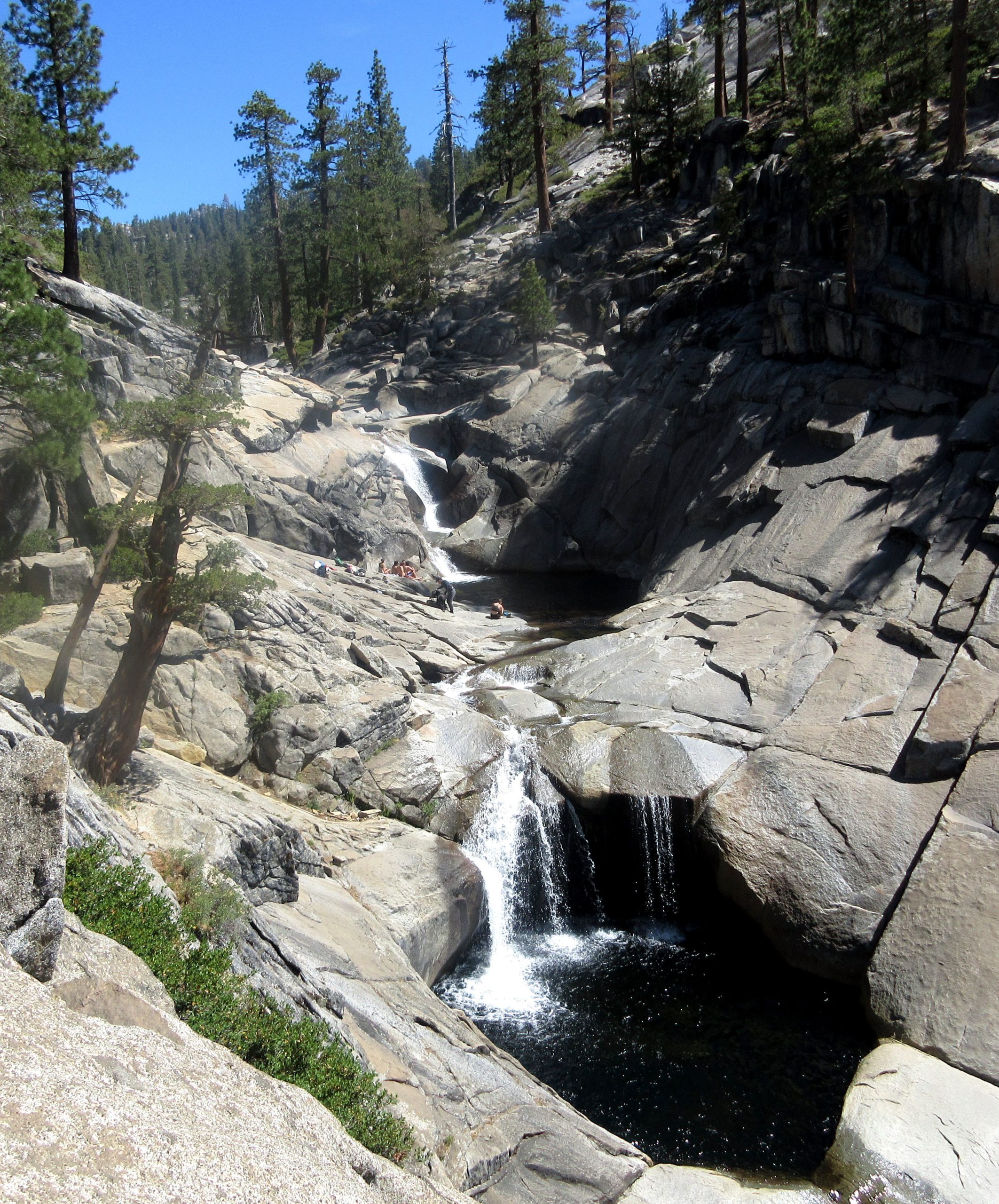
Not so early of a start today. A smaller group opted to do the whole run. Frederic and Brittany lead the way but those speedies soon dropped us. Gene, Hilary, Shaun, Kara and I went a bit slower. I loved the water and views of this loop. Shaun and I tried to out run the swarms of mosquitos in the woods. We took a break and let the others catch up. I decided to go off on my own in order to get to the lakes earlier. After a hard switch back climb in intense heat, I had a memorable swim by myself(and the dragonflies) with mountain tops, clouds and nobody around. Magnificent! I ate my lunch and was finishing up when the group came by. Yeah! We all enjoyed the rest of the lakes and a pretty easy downhill to finish off the day.
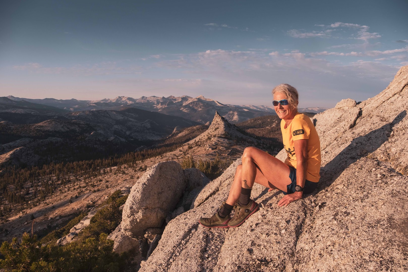
Day 3: Cloudsrest
I did not sleep well at all. My nose was stuffy, Brittany makes loud mattress noises, and Gene snores. Not much I could do and we had another early start in the dark. I managed to get moving and stayed with Hilary, Brittany, Frederic, and Nick for the beginning of the day. Nick took a lot of gorgeous photos as we went off trail to climb Tresidder Peak and watch the sun rise on Cathedral Peak.
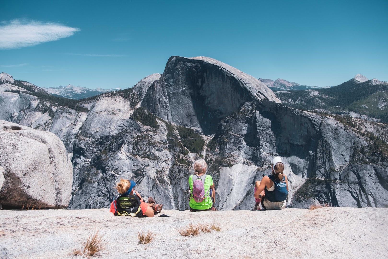
It was actually fun scrambling to get to the highest view points. Hilary and I climbed down together and met back up with Gene on a pretty meadow area of the trail. There were a variety of trails on this particular day. We headed into the woods and then near the bottom it opened up with lots of water ways by Sunrise Creek and scratchy shrubs. My legs got cut up a bit on those. We met up with Brittany and Shaun and ran to a trail intersection where we would head up to Cloud’s Rest. We rested, filled up our water bottles and had a bite to eat. Brittany lead the way and Shaun and I followed behind. Gene and Hilary came after us. It was a hard climb and at some points when looking up, you thought “I am going up there???” But again, it was beautiful with gorgeous views of Half Dome and the surrounding area. When you actually reached the summit it was full of people who came from another direction (easier I presume). This was probably my favorite view spot of the trip. Getting close to the edge was tempting but very scary. Lunch at the top and then mostly a down hill with Shaun running along side me. Tenaya Lake beckoned at the finish and I jumped in to clean off all the dirt, dust, and sweat of the day.
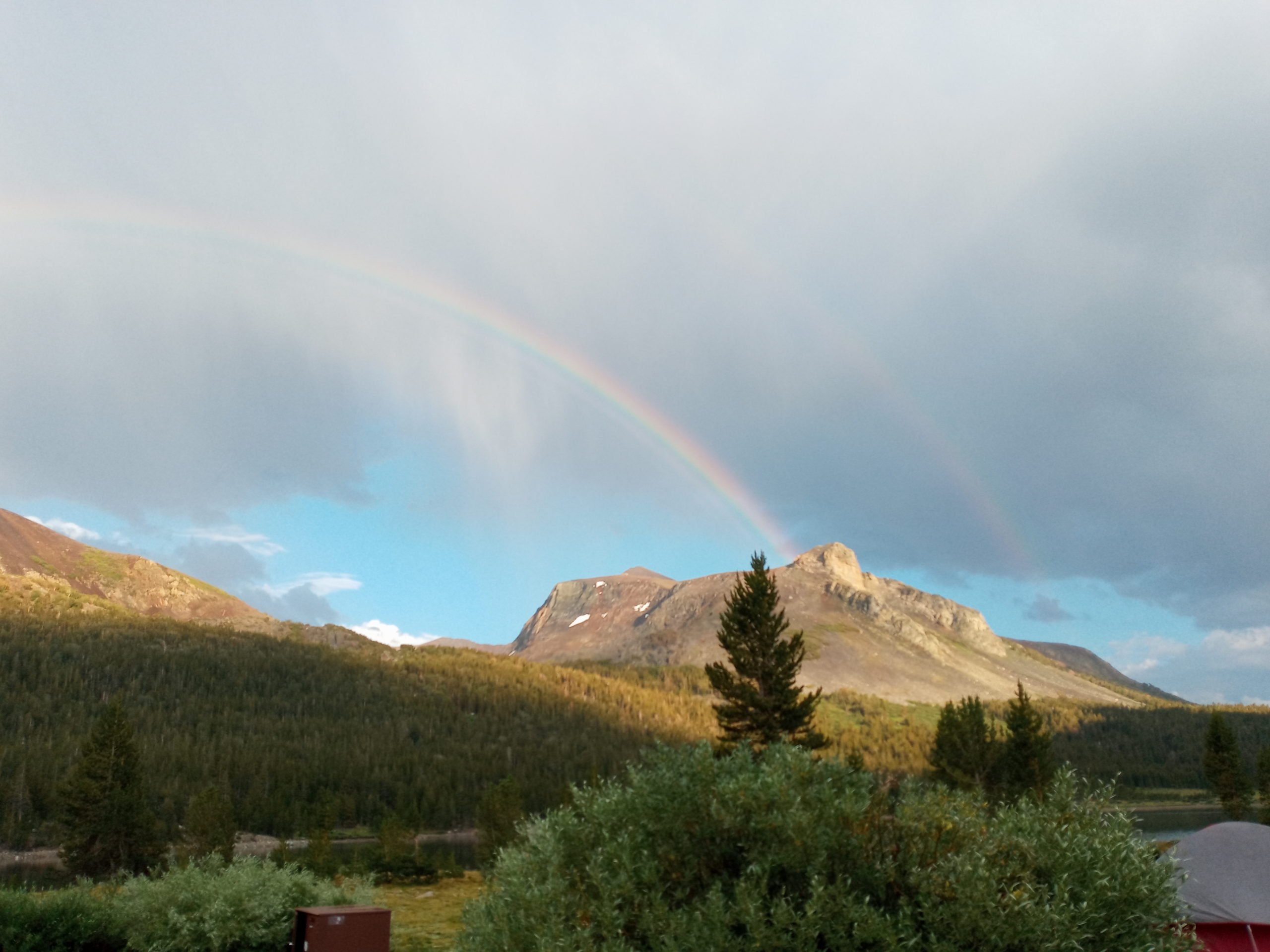
On arriving to base camp, I was surprised to see Paul parked there. He had an ordeal and decided to camp at Tioga Lake. It was much cooler there and we even had a short hail storm, rain and a huge double rainbow over the lake. After a dinner of ? I gave up my tent to Trent and slept soundly in the van that night.
Day 4: Vogelsang Pass to the Valley
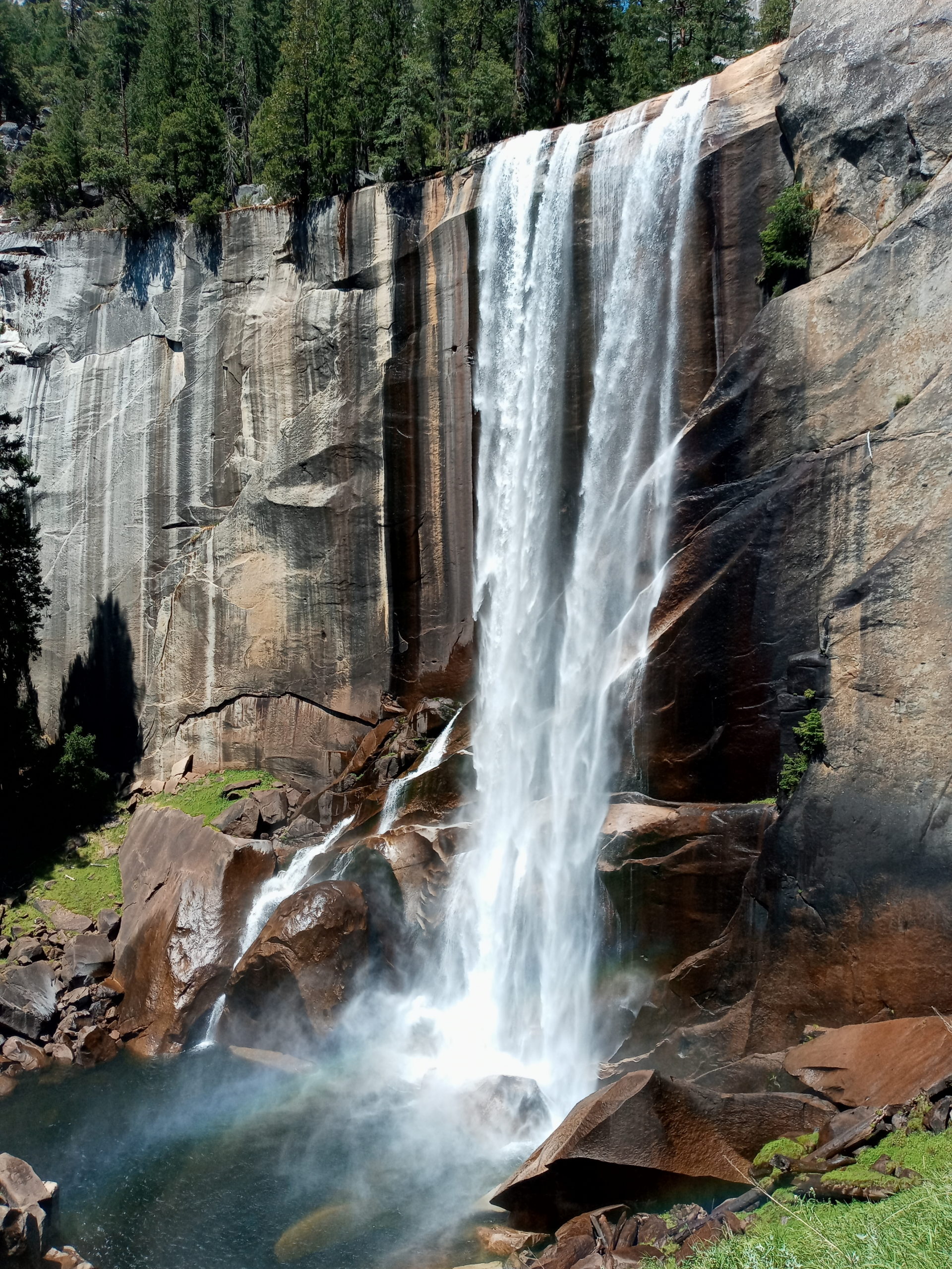
I wasn’t surprised when everyone wanted to get an early start today. The whole group unanimously agreed that it was going to be a hot, long day and we should get out there asap. In the dark we headed out on the Pacific Crest trail toward the Vogelsang Pass. It intersected with the John Muir trail for about .7 of a mile then turned onto Rafferty Creek Trail. Hilary, Gene, Jess and I made our way up to Vogelsang Lake. It was a beautiful morning with marmots and critters enjoying the daybreak. I went ahead and spent some time trailing Jess. We saw Nick, Brittany and Frederic at the top of Vogelsang Peak. This was pretty much the end of climbing for the day. We headed down into wooded areas and stayed close to the Lewis Creek where the pleasing sound of gurgling water filled your ears. We had plenty of places to fill up our bottles. Jess and I met up with Jeff and Theresa who wanted to stop for lunch at Merced Lake. I continued on by myself while searching for a good spot to take a dip. The water is pretty fast and the current can be dangerous. Nick ran by and we spotted a good place. I stopped and Frederic and Nick carried on. It was nice to submerge in the cool water, eat my lunch and be still for a bit. Brittany found me and we decided to carry on together. It was a good thing because we needed support getting through a fire burned area that was super hot and had no shade. Once through that we went on a hunt for water and ended up taking a break near the top of Nevada Fall. Cooled off we headed down the steep, slippery and harsh stone steps all the way to the bottom of the Mist Trail. We stopped and took a few more photos by Vernal Falls. We ran into so many tourists at this point it was strange and sort of out of place in this wild kingdom. But nevertheless, Brittany and I flew by so many people heading down toward our goal of finishing the day. One mistake was passing our last turn and we ended up doing a bit more running, jumping into the river and finally heading toward the crew at Upper Pines Camp Ground. Tacos, beer and margaritas were on the menu for dinner (Too bad I was doing dry July). As a group we decided to go back to our base camp at Tioga where it is much cooler for the night. The ride took a long time though and by the end I felt car sick. Thankfully I just had to climb into our camper van and nod off.
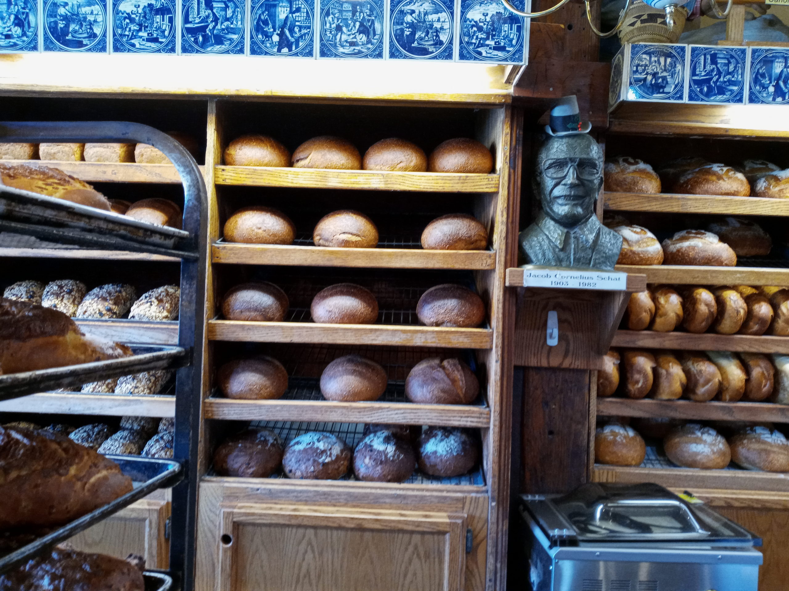
Initially the next morning, Paul and I signed up to do volunteer work in the park. It was cancelled because of the heat. After breakfast and saying goodbyes to everyone, we headed east. We decided to stop in Bishop for some chille cheese bread at the famous Erick Schat’s bakery.
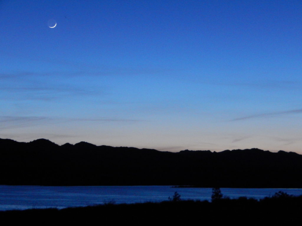
Bustling town with lots of tourists. We did a quick grocery store stop and continued on. We drove 6 North to Ely then onto 50 where we pulled over on BLM land in Utah. Quiet night with a small sliver of a moon in the sky. There was some smoke from fires in the air which got worse as we traveled on the next day.
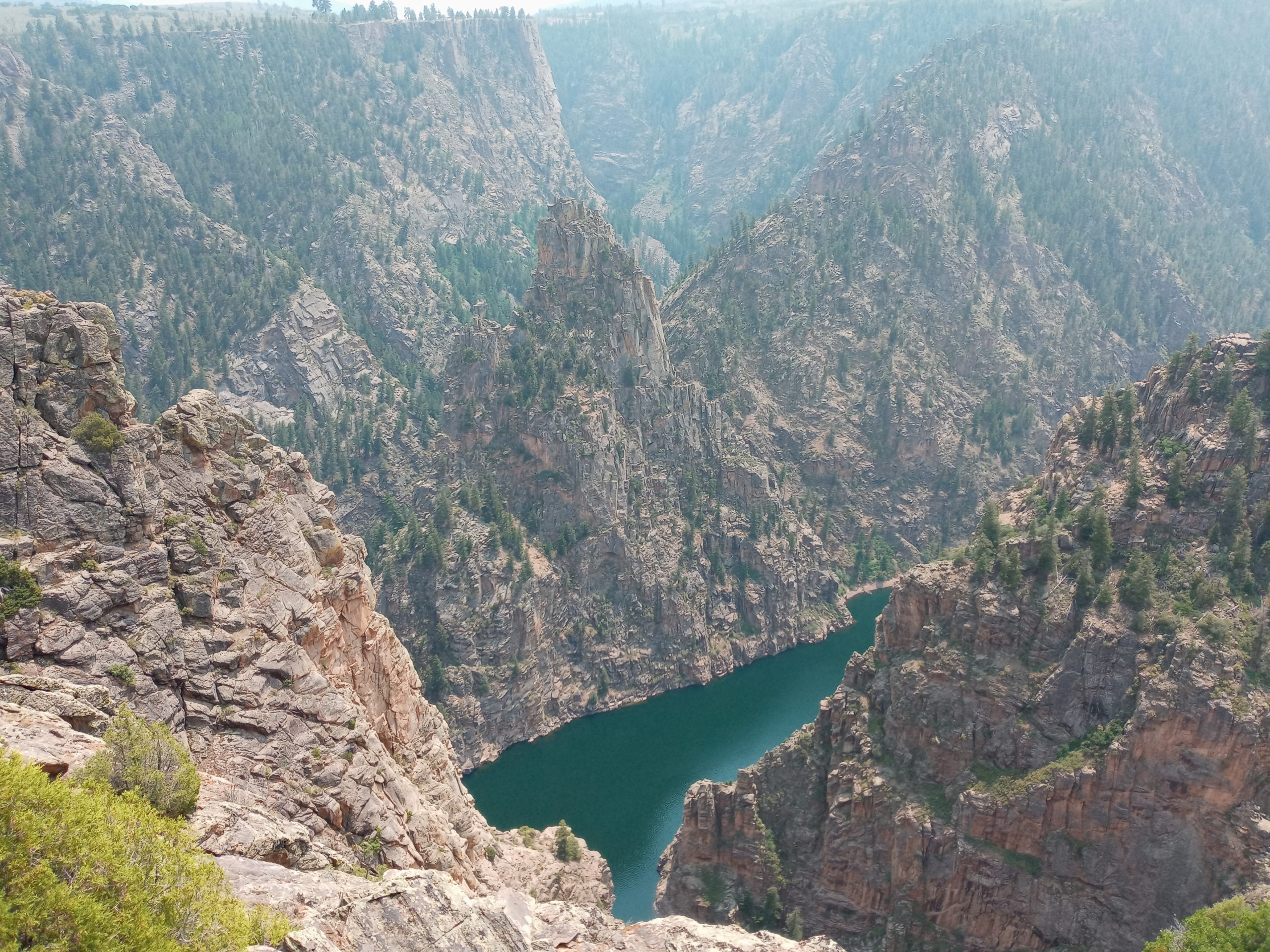
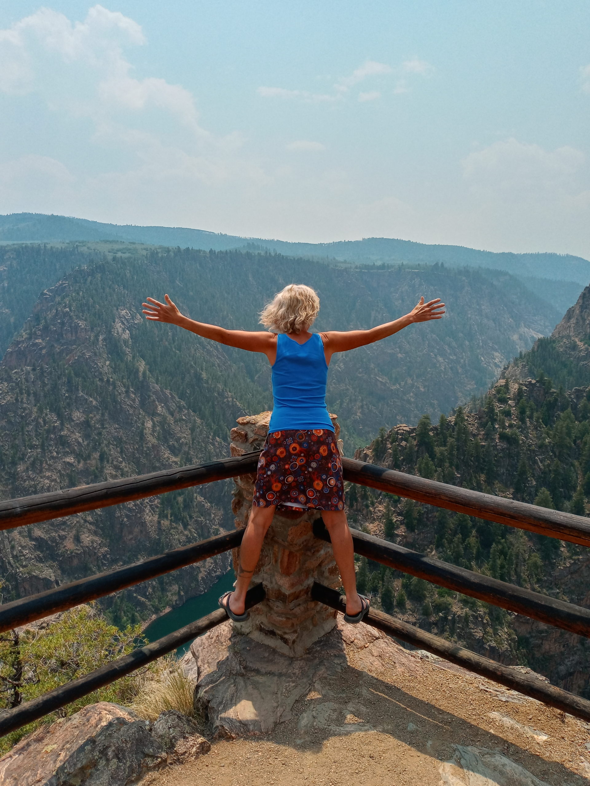
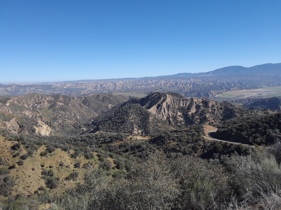
We stopped at the welcome center in Grand Junction which was pleasant. Paul and I were amazed at the long line of cars at the Chic-a-fill drive thru, Crazy!!! We had to take an alternative route on 92 through the Black Canyon of the Gunnison NP. It was a windy road with no hardly any barriers and a big drop off. We stopped and checked out the views more than once. Wow! Fabulous.
After driving through Gunnison we went south on 114 to connect with 285 S. We took another byway to go through the Monte Vista National Wildlife Refuge. I went to the Mt. Blanca fudge company for a chocolate shake while Paul filled up with gas. Quirky owners but friendly enough to me. I also got a vanilla orange coke for extra caffeine. The drive down 285 was pretty and also uneventful as far as traffic. We made it back by dinner time and Evan even had some leftovers for us. Our home felt cozy and welcoming.
I was encouraged by my good friend Gene dykes to run my first 1OOk. It was about a 10 hour drive from our home in Galisteo, NM to Littlefield, Arizona where the race took place. We felt pretty safe driving, sleeping, and eating in our van.
We left on a Wednesday with a quick stop in ABQ for groceries and headed on a familiar stretch of I40 West. We have gotten used to sleeping in rest areas on our trips but were surprised to find our Arizona spot closed for construction. We pulled in anyways and there was room to park plus port-a-potties. We had dinner and slept well.
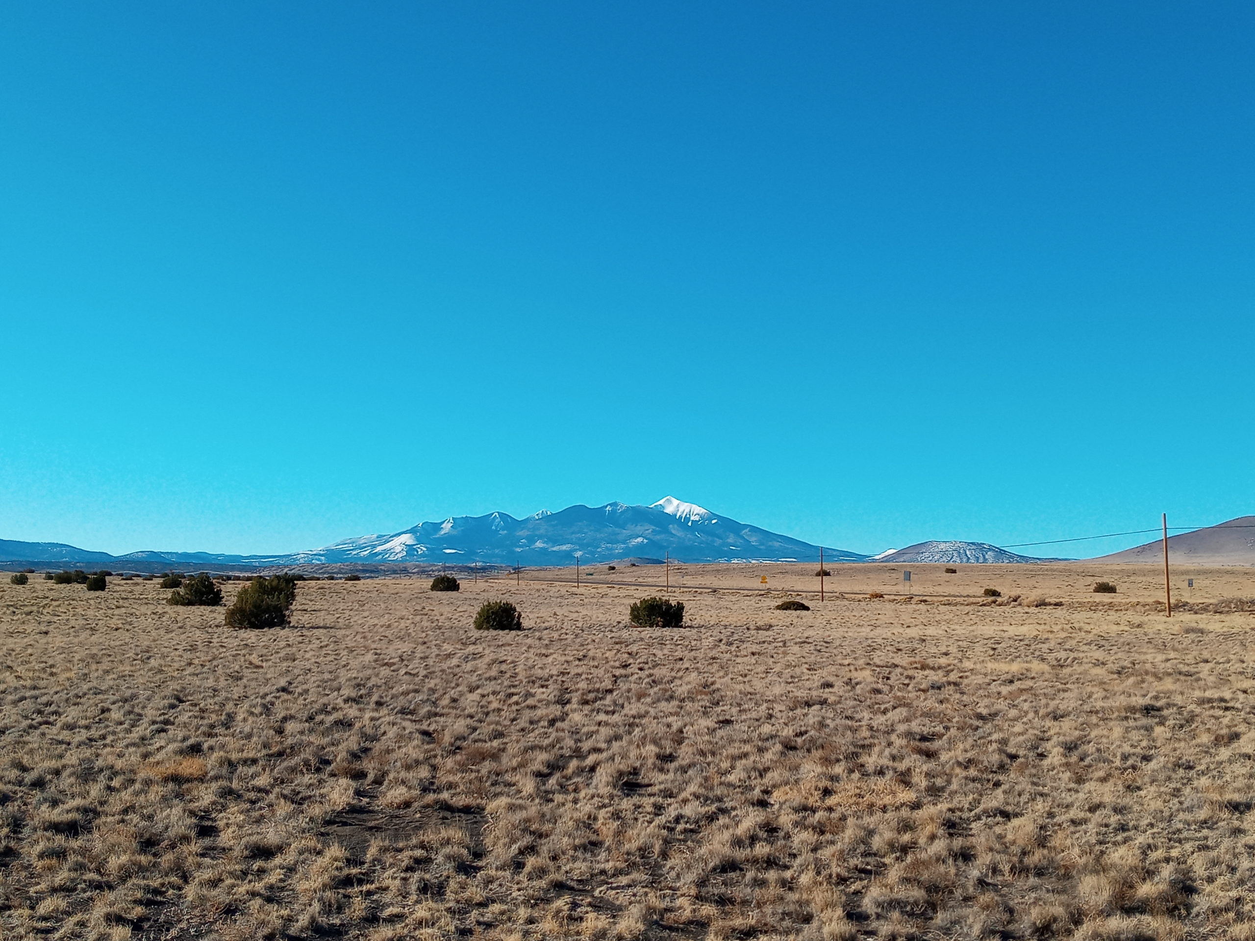
The traveling got better once off I40 heading north on 89. There was hardly any traffic plus beautiful views all around. We stopped for breakfast looking back at the San Francisco Peaks near Flagstaff.
Looking south to the San Francisco Mtns at breakfast.
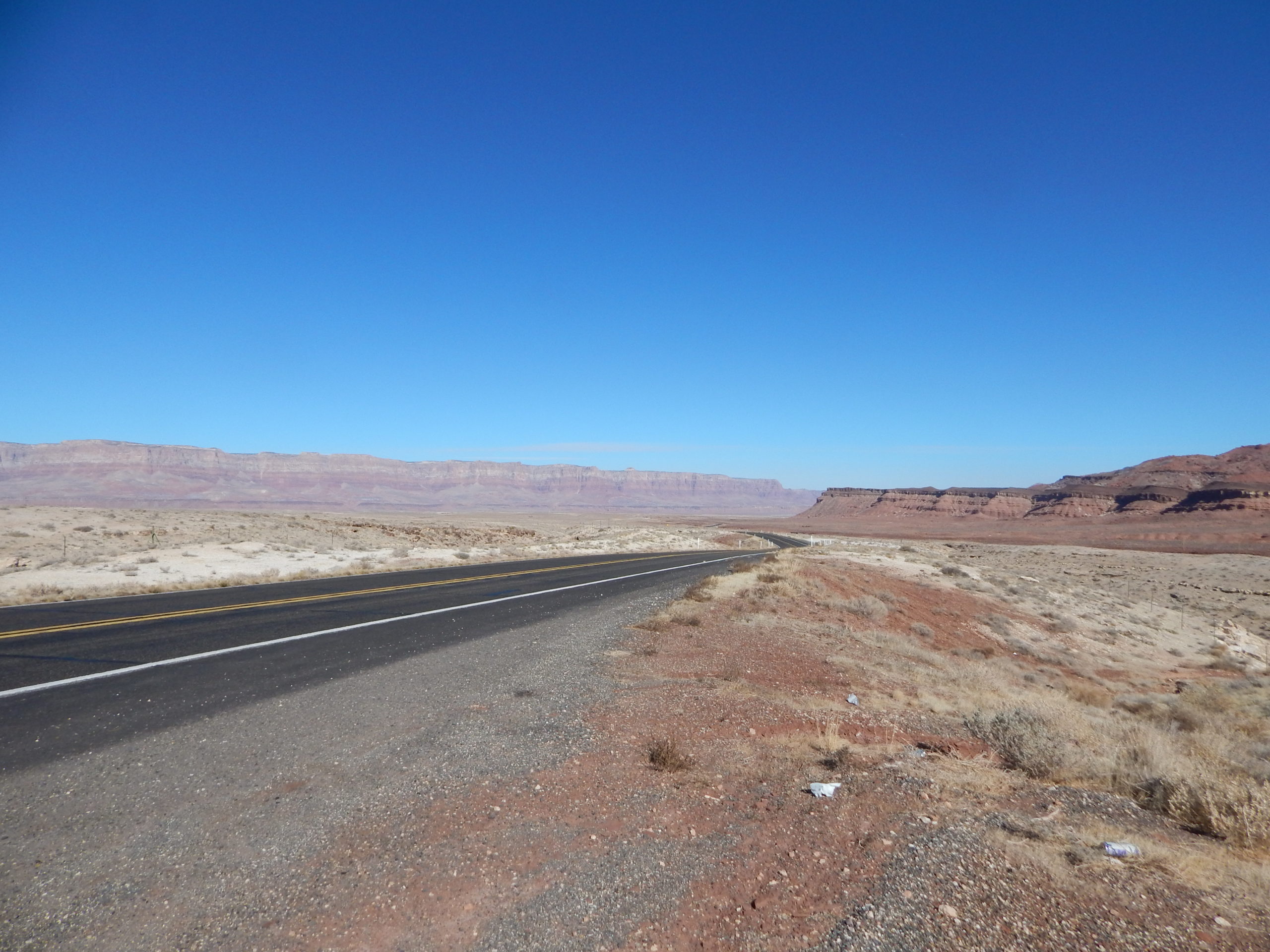
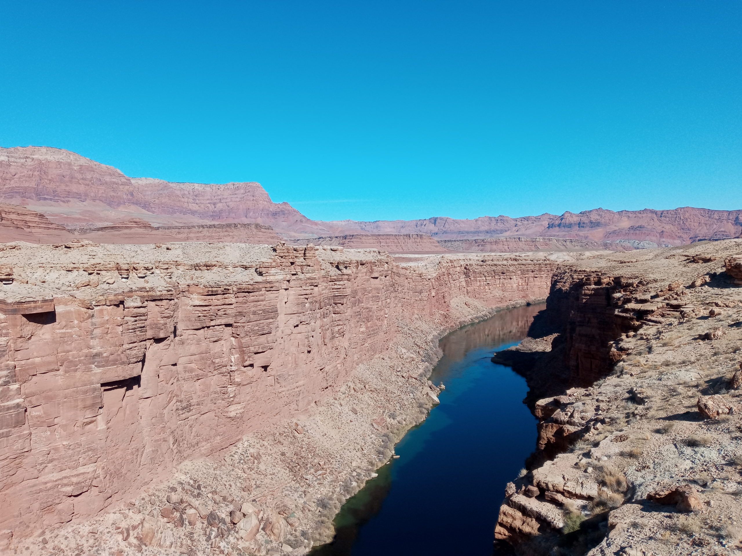
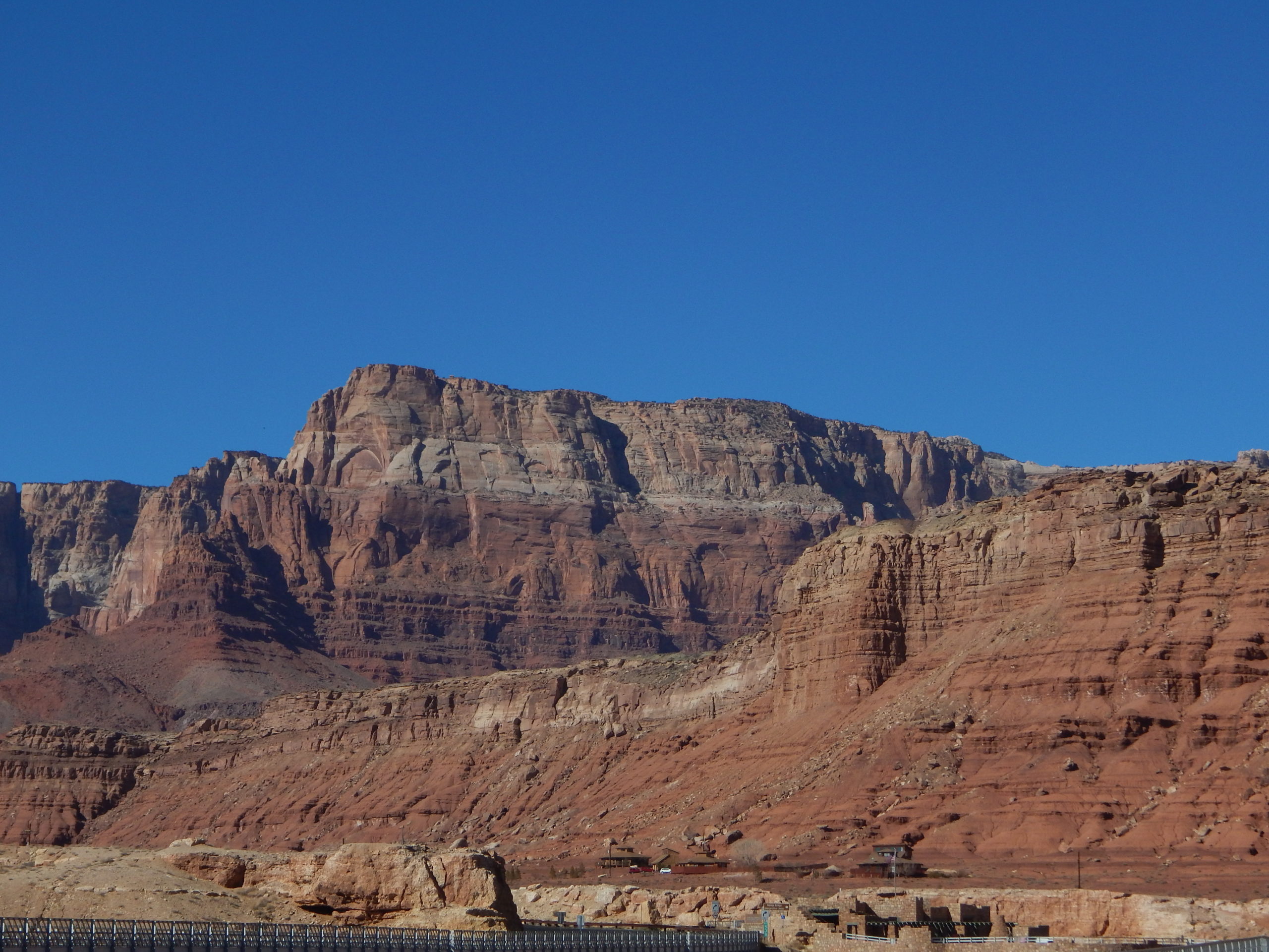
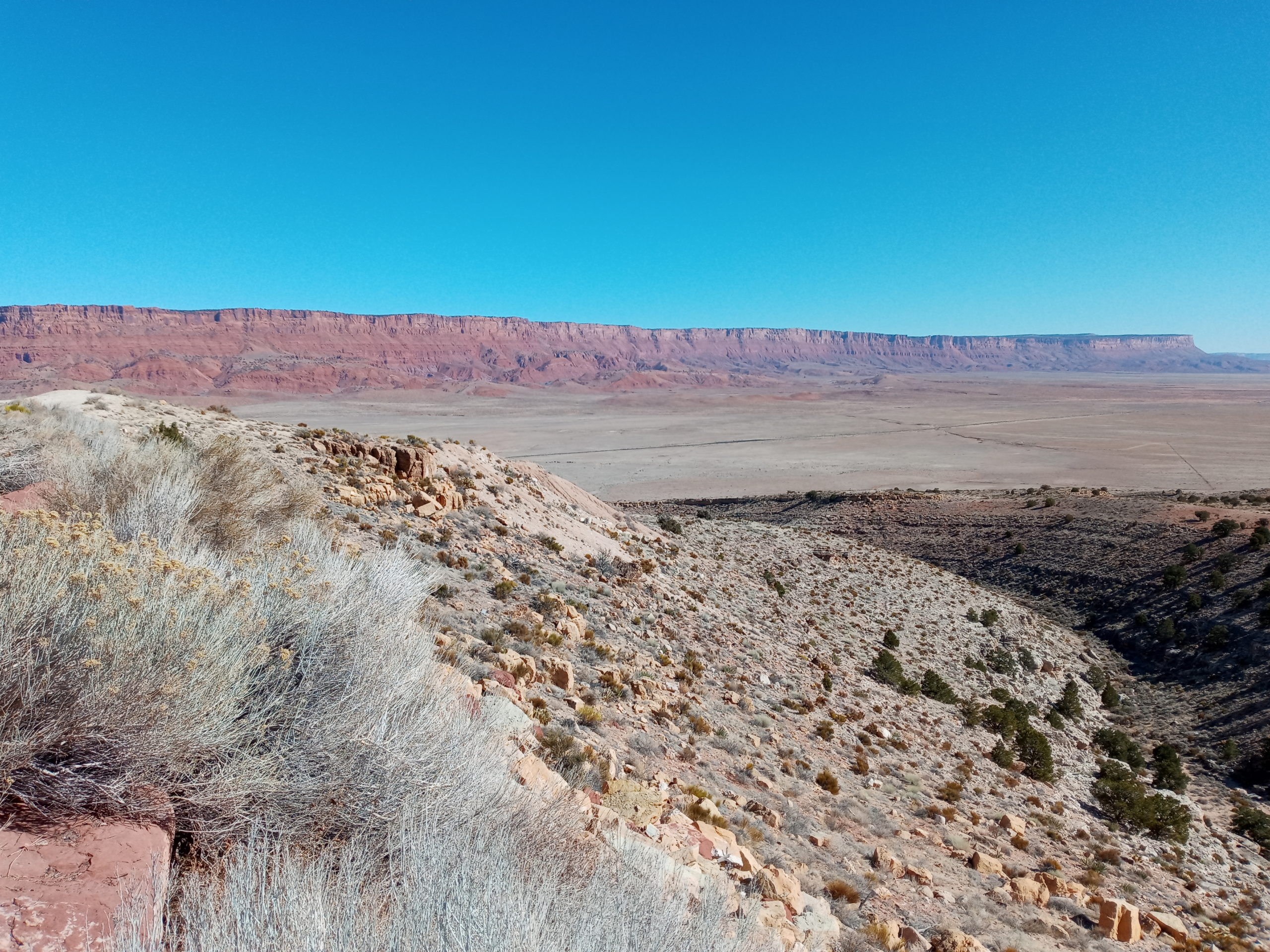
Continuing North, then West on Alt. 89 we encountered beauty everywhere. Marble Canyon where we crossed the Colorado river on the Historic Navajo bridge and then The Vermilion Cliffs National Monument. Wow!
First view of the Vermillion CliffsThe Colorado, from the bridge near Lees FerryPart of the Vermillion Cliffs, near the Lees Ferry Bridge over the ColoradoThe Vermillion Cliffs, from the climb up to the Kaibab Plateau. Incredible!
We climbed a bit and saw some snow where you turn off for the north rim of the Grand Canyon. Campgrounds closed for the winter. It was a very pretty forest and quiet. We ate lunch in the parking lot of the Pipe Spring National Monument. No time to explore though. Up and over through St. George and then down again through the slot canyon along the Virgin River.
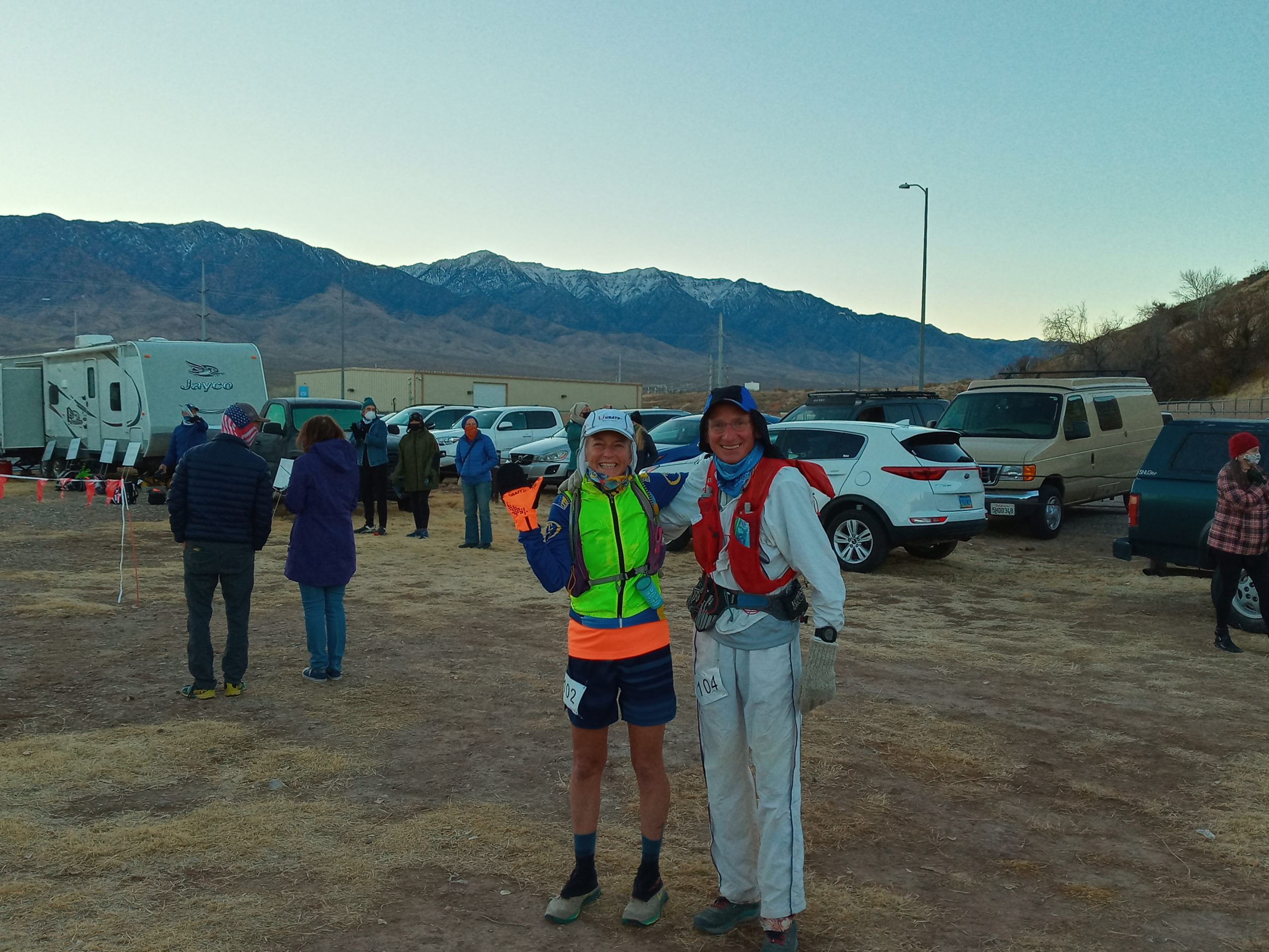
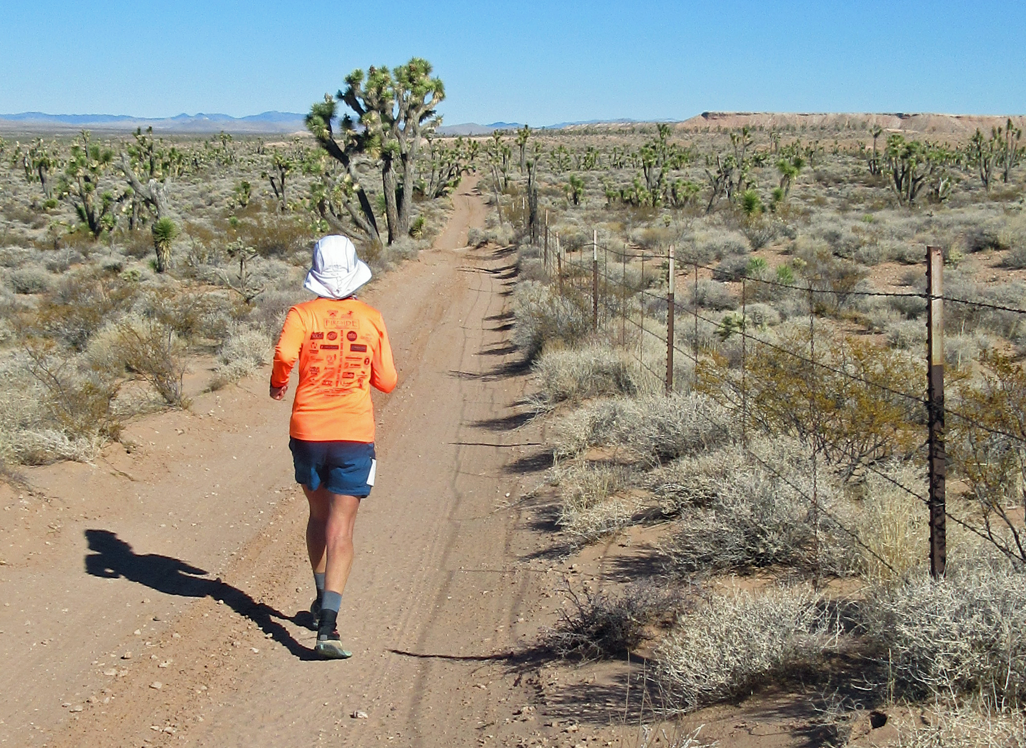
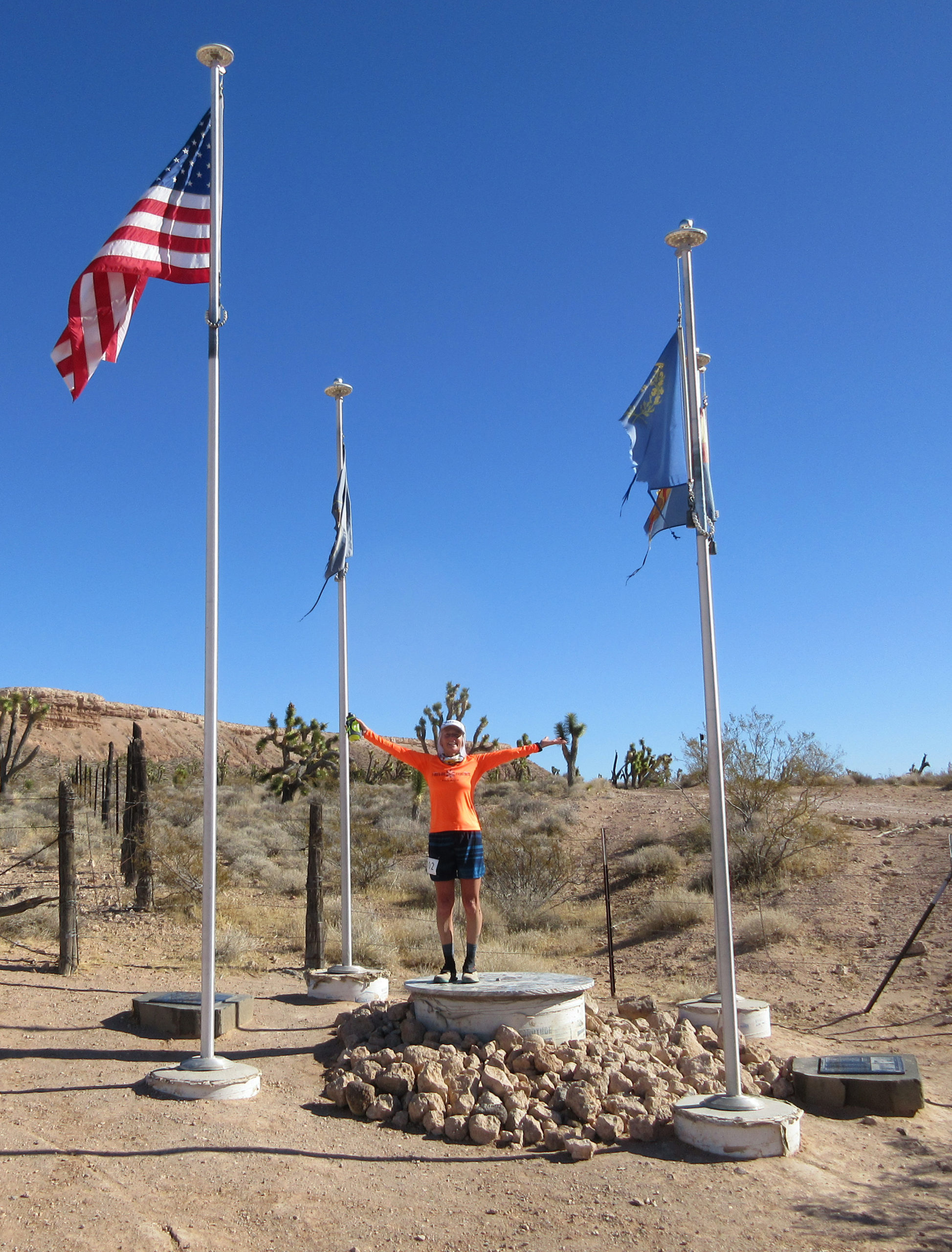
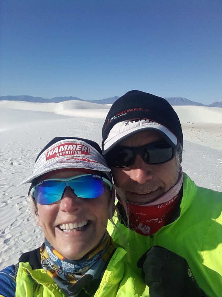
Parking overnight at the race start was pleasant enough. Grandmasters Ultra 100 miler and 100k began at 8 am Friday, Feb. 5th. Gene is a pro at these events now so he was schooling me through the first half. I felt confident but midway was pretty hard mentally. After a break and change of shoes, I felt better and more energized. I must say I enjoyed the second half of the race tremendously. Watching the sunset glow on the cliffs, stopping and staring at the stars in the sky and the cool night air refreshing my now tired legs. Gene and I got separated but he was never too far behind and a much better down hill runner. We finished 1st and second place!
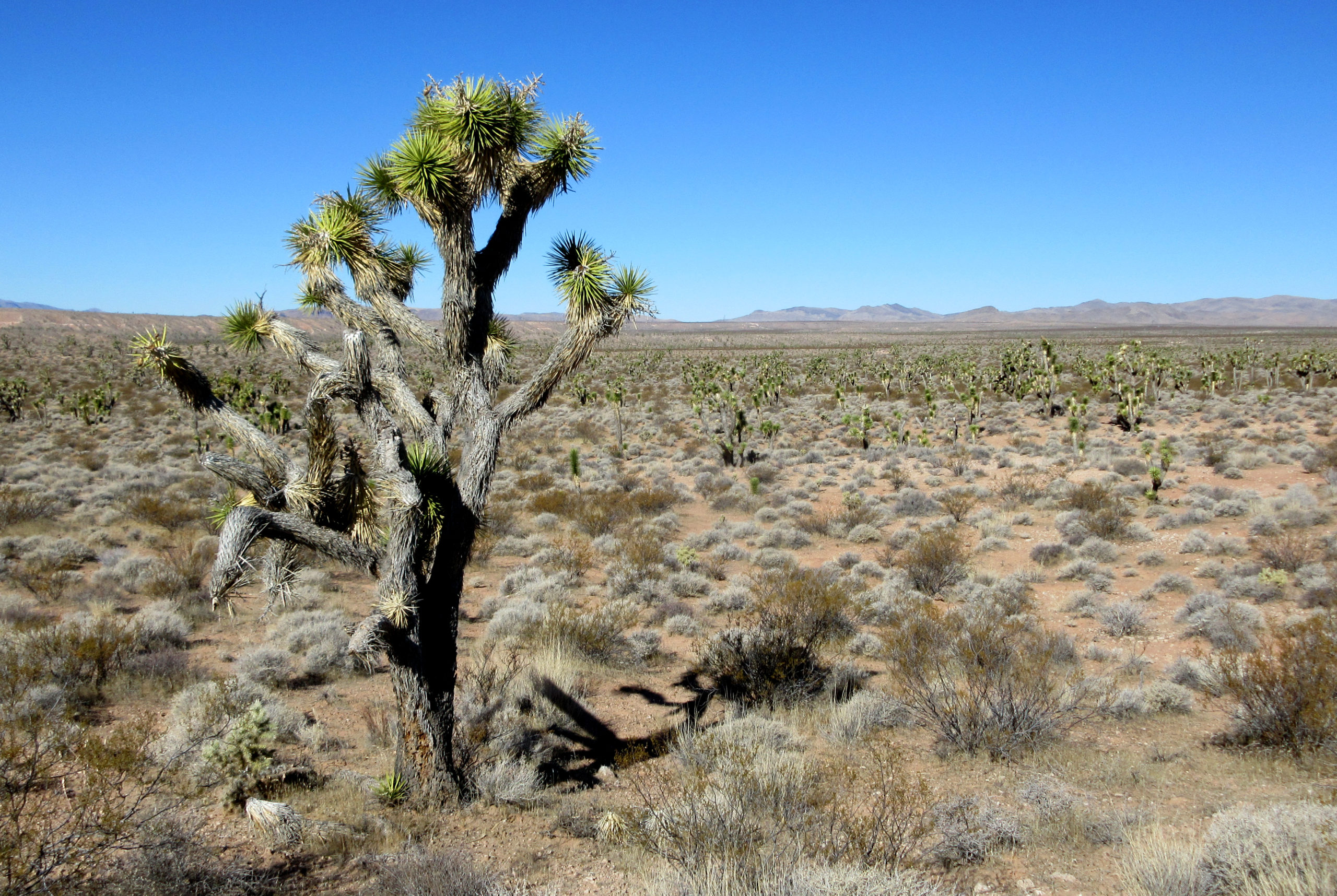
Julie and Gene at the race startThe landscape of the course. That’s one of several thousand Joshua Trees here.Julie doing her thing in the desertJulie at “3 Corners”, where NV, UT and AZ meetEvening time with Julie & Gene still hours from the race end
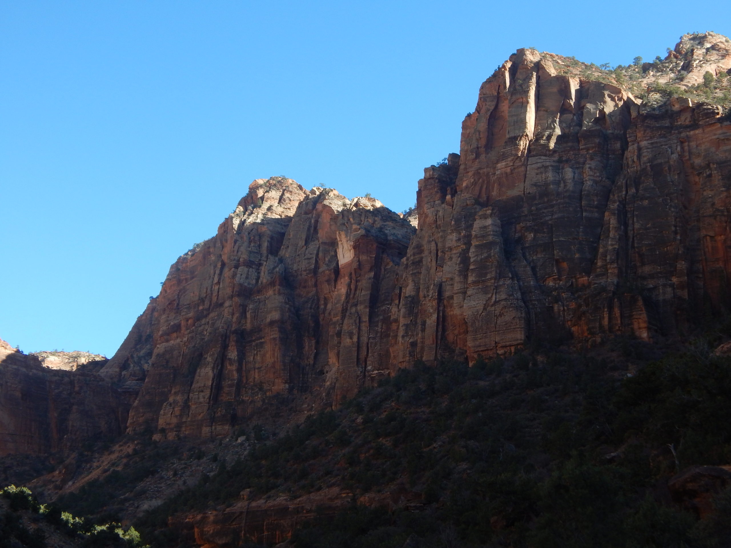
The next day the race site became a lawn mower race site too. It was interesting for a bit but then just felt noisy and dusty. We left mid day to get on with our drive back this time taking a route through Zion. Paul and I have never been to Zion NP before and just driving through makes us long to return. Fantastic! Sleeping came easy parking on BLM land with views of The Grand Staircase and listening to a Steve Roach concert. Plus a couple glasses of vino.
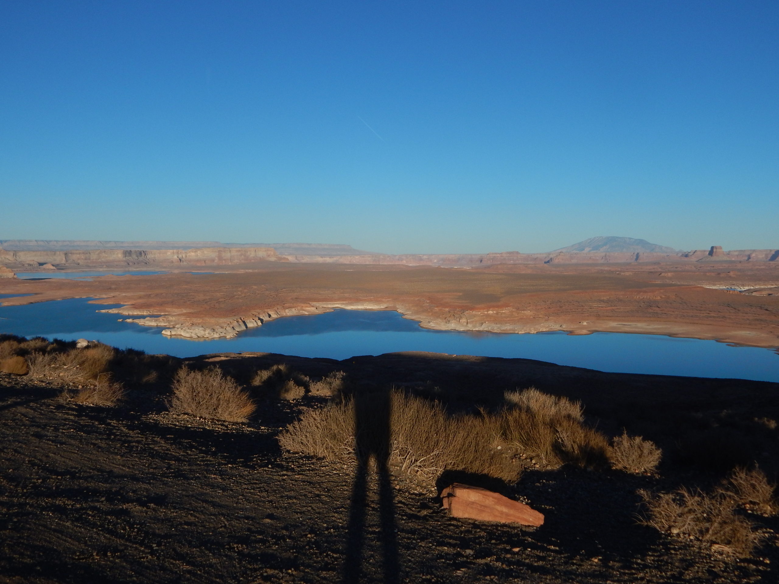
Pictures can’t do Zion justice. This doesn’t even begin to convey the majesty of it.just above the dam that formed Lake Powell from the Colorado River
The rest of our journey home was back down 89 but turning left to Tuba City and the taking 264 through Navajo and Hopi Land. Some of the land looked very pretty and you could see some farming plots being developed. There was a lot that looked impoverished though. Paul and I both talked about how COVID19 has hit all tribes even harder.
Back safe and sound in Galisteo without much contact with people. (except Gene) and an overall feeling of being grateful for these small journeys.
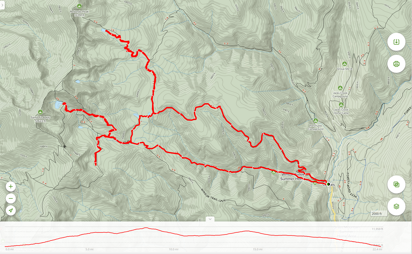
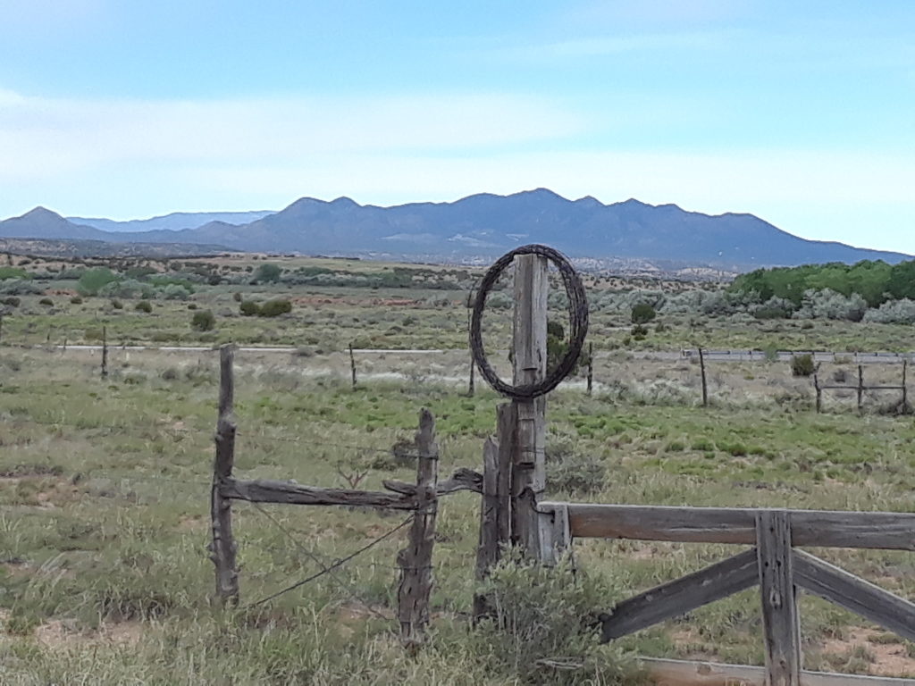
We’ve been in New Mexico for over a year by now, and although we’ve been up in the mountains quite a bit for trail running and day hiking, we’ve not yet done any overnight backpacking trips. It seemed like it was time to change that, and after quite a lot of reviewing, we decided to explore part of the Pecos Wilderness. The main trailheads for the Pecos are just over an hour’s drive from home, and we decided to head up to Cowles and then do a 22 mile “loop with side arms” that would take us to 4 of the larger lakes on the east side of the main Sangre de Cristos ridge.
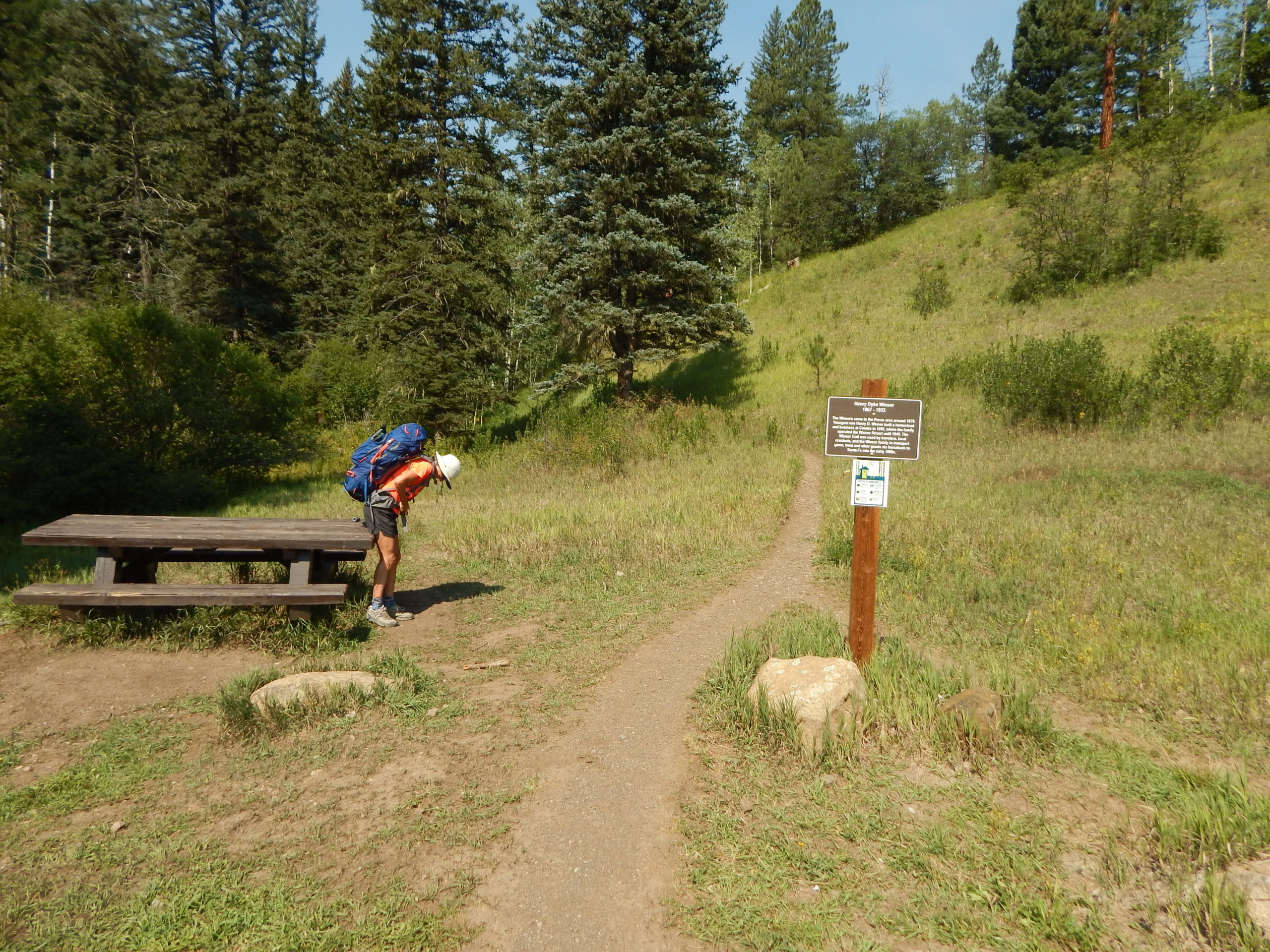
After getting a flat tire on the way out of Galisteo, we arrived at the trailhead by about 10:30am. It didn’t take too long to get our packs on and walk onto the clearly labelled Winsor Trail.
A navigation error (aka “Paul thinking he could remember the route, so he didn’t bother to look at the map”) less than a mile in took us onto a very rough and tricky “boot trail”, with lots of low trees and tricky areas. Although it seemed to be a real trail, after about 1/2 a mile or so, it petered out, and we were forced to look at the map and realize that we were in the wrong place. We backtracked a bit, crossed the creek, and scrambled maybe 50 yards up a steep slope to get ourselves onto the real Trail 261. This is technically closed right now, although for no apparent reason: it is well maintained, free of downed trees and a nice steady grade. We climbed about 1800′ to meet the Winsor Trail (which takes a more circuitous route to reach the same spot), and then continued along it to a larger creek crossing and the intersection with the Skyline Trail. Another 600′ of climbing and another missed turn finally took us to our first lake – Spirit Lake – and our first campsite, at 10,809′.
We were entirely alone at Spirit Lake for the night, but only after a couple arrived at the lake with their German Shepherd (off leash). The dog saw one of the many deer that seem to like to spend time near the lake, and took off in a crazy chase. It’s owners eventually got it back, fortunately uninjured. As a city dog, I suspect it had no idea what it was up against chasing a bull deer with significant antlers. They splashed in the lake for a bit, and then headed back.
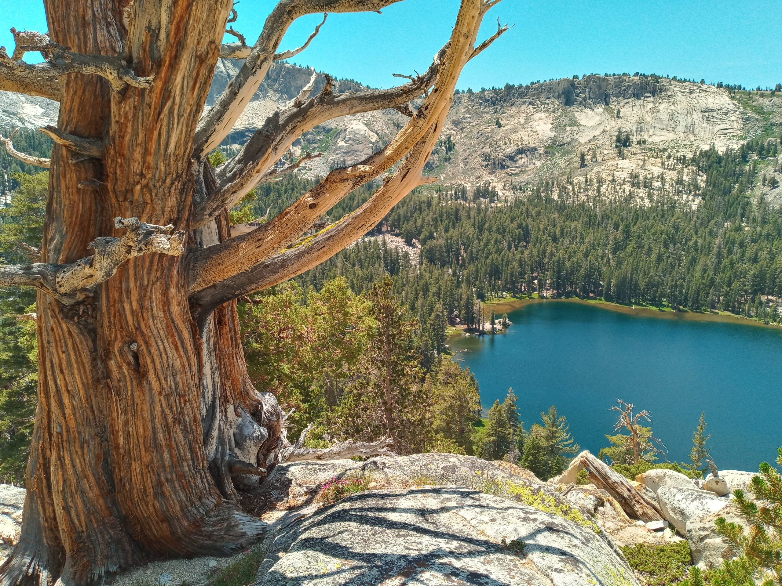
The next day we packed up, and started walking up towards Lake Katherine, the high point of the trip at 11,742′. We didn’t know that the trail was technically abandoned, which meant there were a lot of downed trees to cross over or walk around. After a mile or so, the trail got much steeper as it climbed up to meet the newly-named Skyline Trail, and then we switch-backed up some more to finally get to the lake. And what a lake it was! Crystal clear blue waters rimmed by steep mountain slopes (the back of Santa Fe Baldy).
The water was very cold but both Julie and I took a full plunge and I even “swam” a little. We sat around on rocks in the warm sun afterwards, ate a snack, and then headed back down. We loved it so much that we plan to come back with wetsuits, doing a somewhat easier hike from the Santa Fe Ski Basin on the other side of Baldy, and actually enjoy a “real” swim in this magnificent lake.
This time we took the Skyline Trail down, which was steeper and much less shaded than the route we had taken up. Eventually we met back up with the Winsor Trail, and after a very short section, were back at the junction that allowed us to turn north towards Stewart Lake.
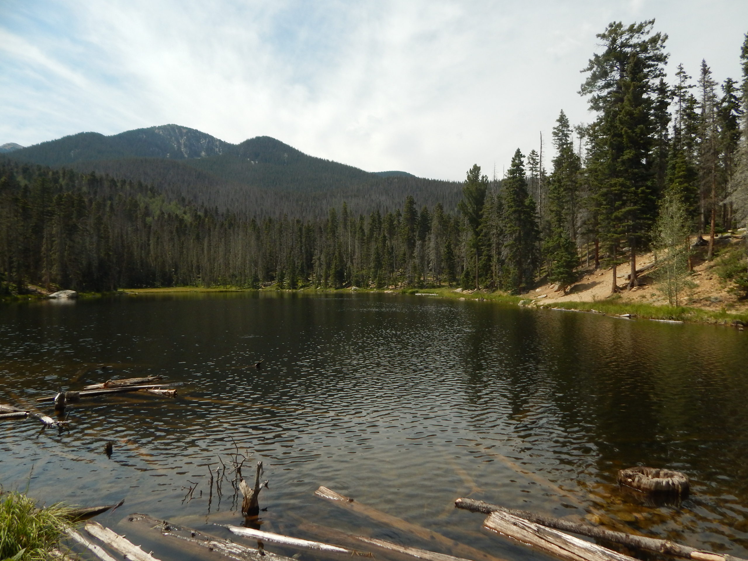
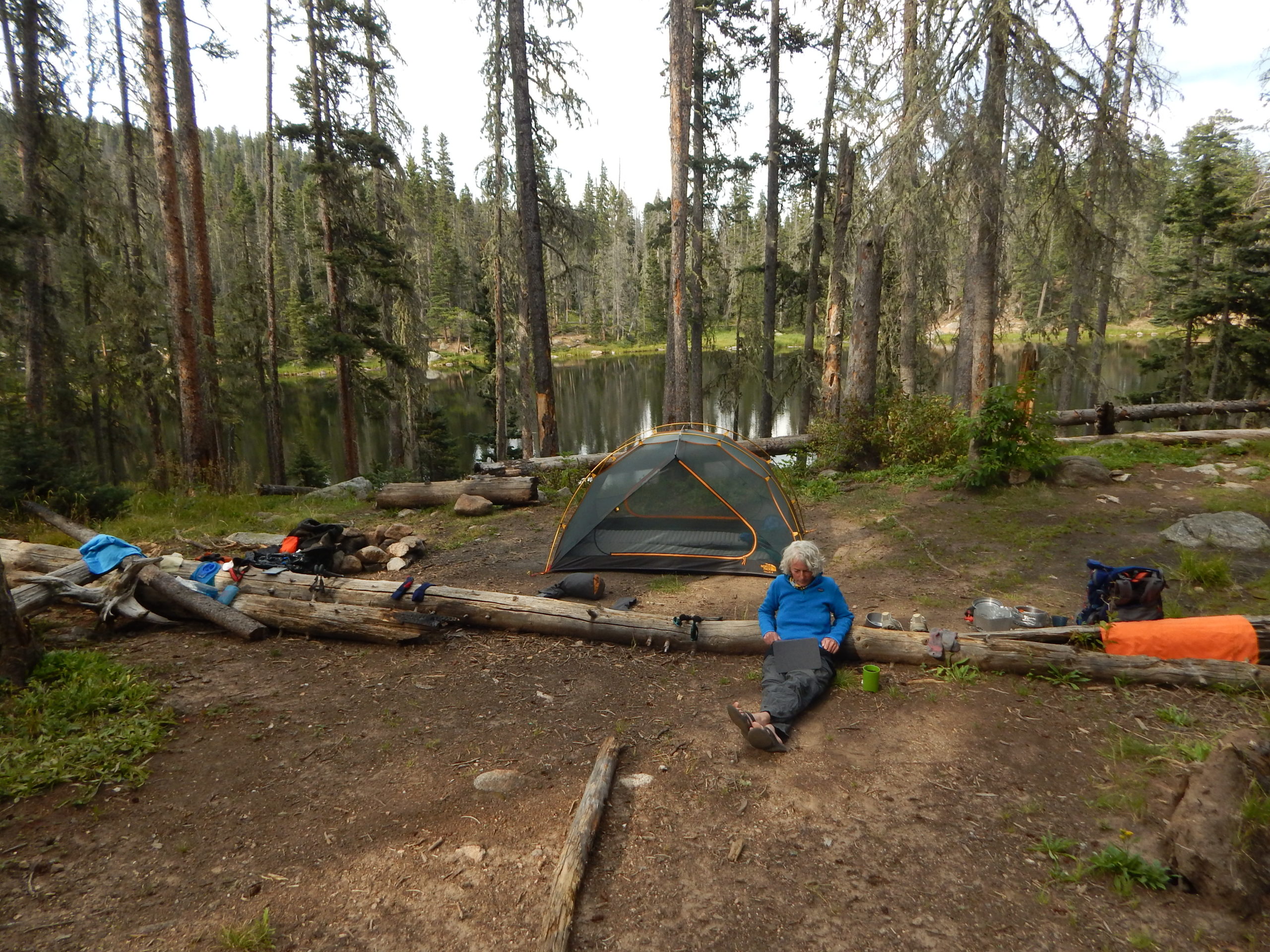
Stewart Lake (10,232′) was pleasant enough. We found a nice campsite overlooking the lake (though probably closer than the official 200′ distance). Julie swam in the lake for a bit, and chipmunks kept threatening any and every food item that we had with us.
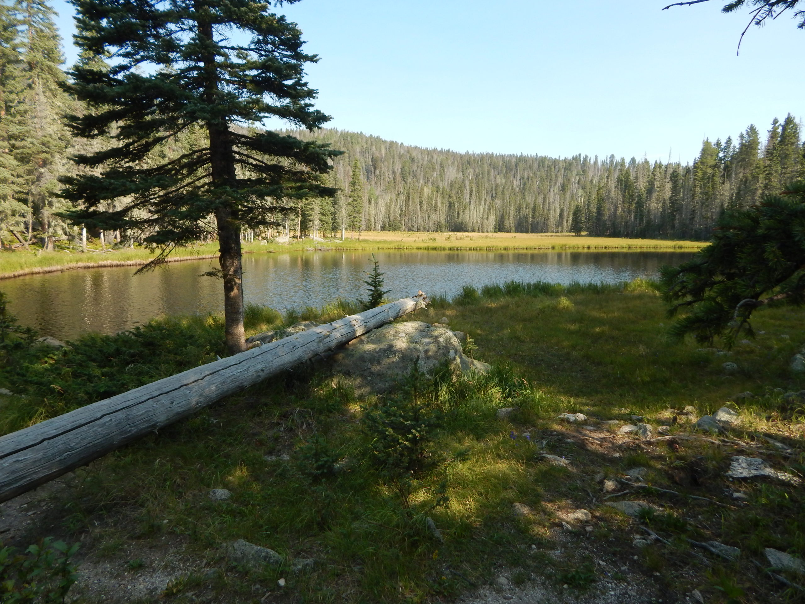
The next day we packed up and hiked a very pleasant and easy half mile to so to the junction with the Winsor Ridge Trail. We turned north, dropped our packs in the trees (removing the food and hanging it up, to discourage animals from trying to get into them), and continued with just a small day pack for the walk up to Thompson Lake 11,091′).
This turned out to be very nicely graded steady ascent all the way up. We met a woman with two young children who had been camped up there for 3 nights, now heading back to where we had started from. Thompson wasn’t particularly remarkable, but after we found a warm spot in the sun was a nice place for a mid-morning snack and talk with the mountains as our backdrop.
We headed back down the way we had come up, and about an hour later re-united with our packs to begin the long descent down the Winsor Ridge Trail. This was initially much flatter than I expected, and we soon reached an area with magnificent open views back to the main ridge of the Sangre de Cristos, with Santa Fe Baldy as the high point, and where we had been just the day before at beautiful Lake Katherine.
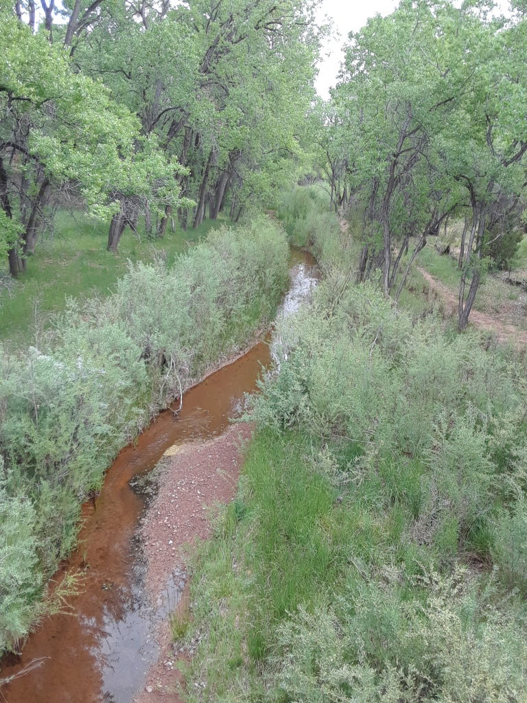
We trudged down the Ridge trail as the day warmed up. There was a lot less shade on this south-facing slope than we had coming up Trail 261, and we were glad to be descending rather than ascending (there was very little water along the 5 mile, 2000′ elevation change). Eventually, we began to see a few houses (mostly summer cabins) in the Pecos Valley in front of us, and sometime after that, could see the green-roofed cabins that we knew were on the road to the trailhead. A final descent to the road took us by a forest service campground, which was quickly filling up on this Friday afternoon. We started walking the mile or so back up the road to the trailhead, but quickly decided to drop the packs in the shade, leave Julie to filter some water from the creek (we were very thirsty), and I walked back up to get the car.
On the way home, as we turned right in Pecos village, we could finally see the huge column of smoke from the Medio forest fire that was burning on the other side of the Sangre de Cristos. It was remarkable, and a bit scary. 30 minutes later, after picking up some fresh Colorado peaches and a couple of plums, not to mention a cold beer, we were back home.
One of the reasons Paul and I chose our new home was location to nature and our ability to travel. When we finally got programmable heat put into our home we could leave on a short van trip at the end of February. On Day One: we headed south stopping only in Albuquerque to stock up the van with healthy food and a bit of vino.
Right off of Hwy 25, we did a trail run in Sevilleta NWR. It was Sunday so nothing was open and no one was around. Easy, well marked trails with some nice views, birds, and arroyos. Perfect place to stretch our legs.
We ended up sleeping at Elephant Butte, SP. We found a nice spot up high with views of the lake. Very quiet. Day 2: In the morning we ran some trails in the park. The trails are lined with rocks, not too difficult but a bit sandy. It was almost hot so we became sweaty in our shorts and t-shirts. Sweet!
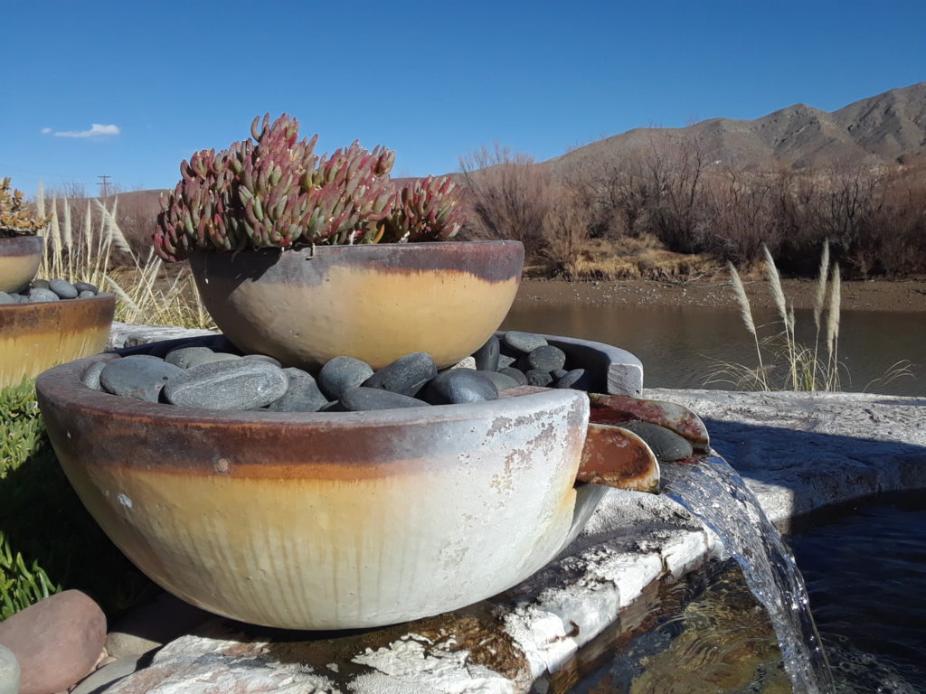
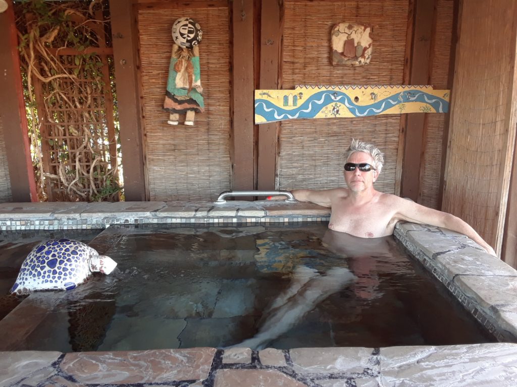
Truth or Consequences: A town with natural hot springs. Both of us were excited to try a hot spring so we chose River Bend. It did not disappoint. River Bend has many pools to soak in located right on the side of the Rio Grande. Lots of birds to watch while in the tubs. At night they put some laser lights on foliage that makes it look like a whole different magical place. The spa was originally a fish hatchery and you can sit in the fish tub still today.
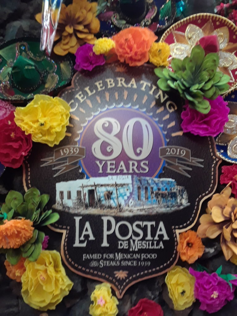
Day 3: we did a short run in ToC which went up to a veterans home on windy trails and back. We enjoyed one more soak before departing. Lunch at our neighbor Deirdre’s suggestion at La Posta in Mesilla was tasty. The place is so colorful, plus birds and piranhas in the lobby are over the top.
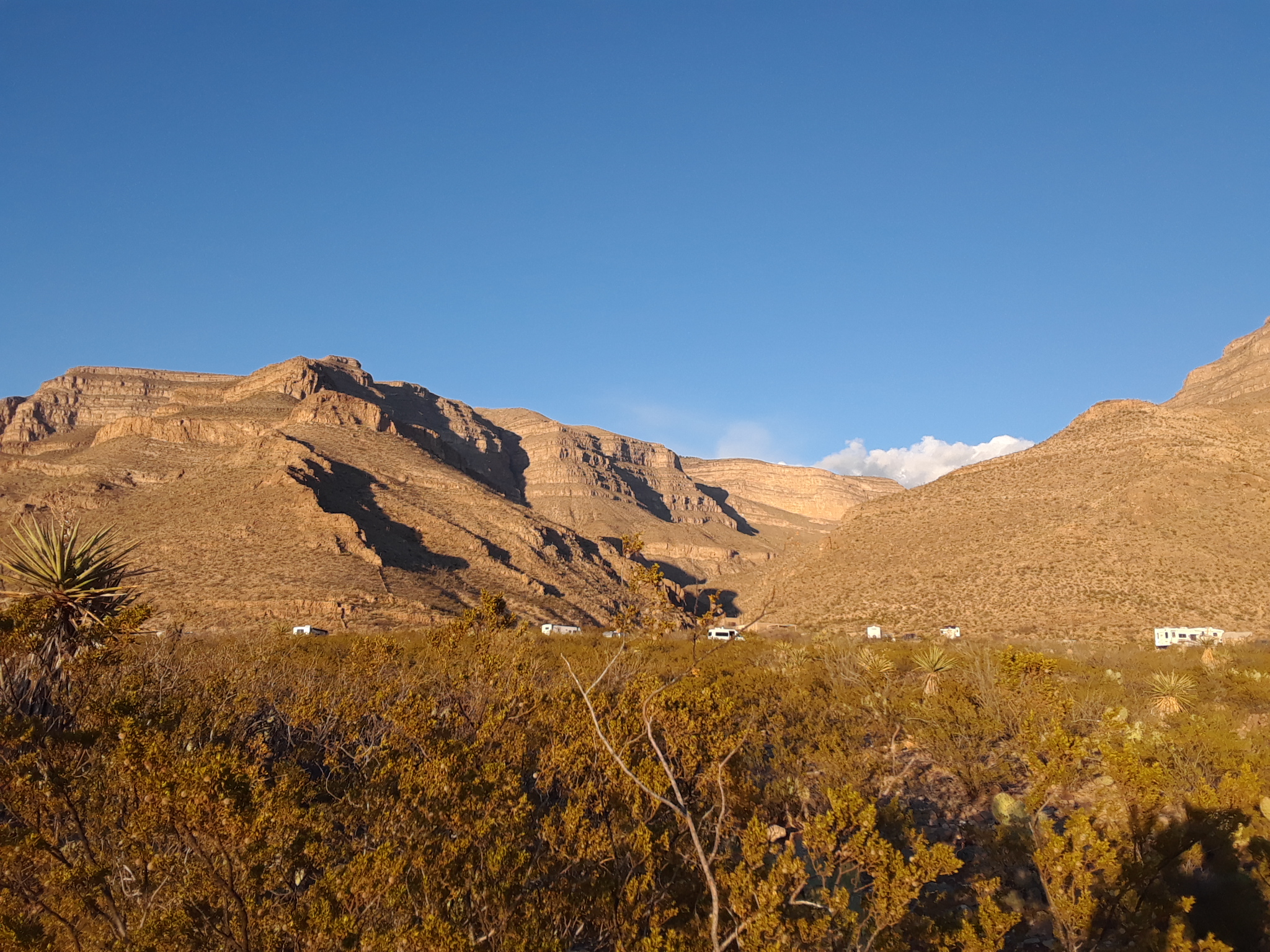
We sleep next to mountains at Oliver Lee SP. after a long ride and not altogether pleasant.
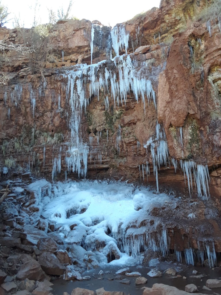
Day 4: we have one spectacular run in the Lincoln National Forest. An old train line was turned into hiking trails. The grand view looks out at White Sands in the distance. A waterfall was another stopping point. Driving was also pretty nice in this area.
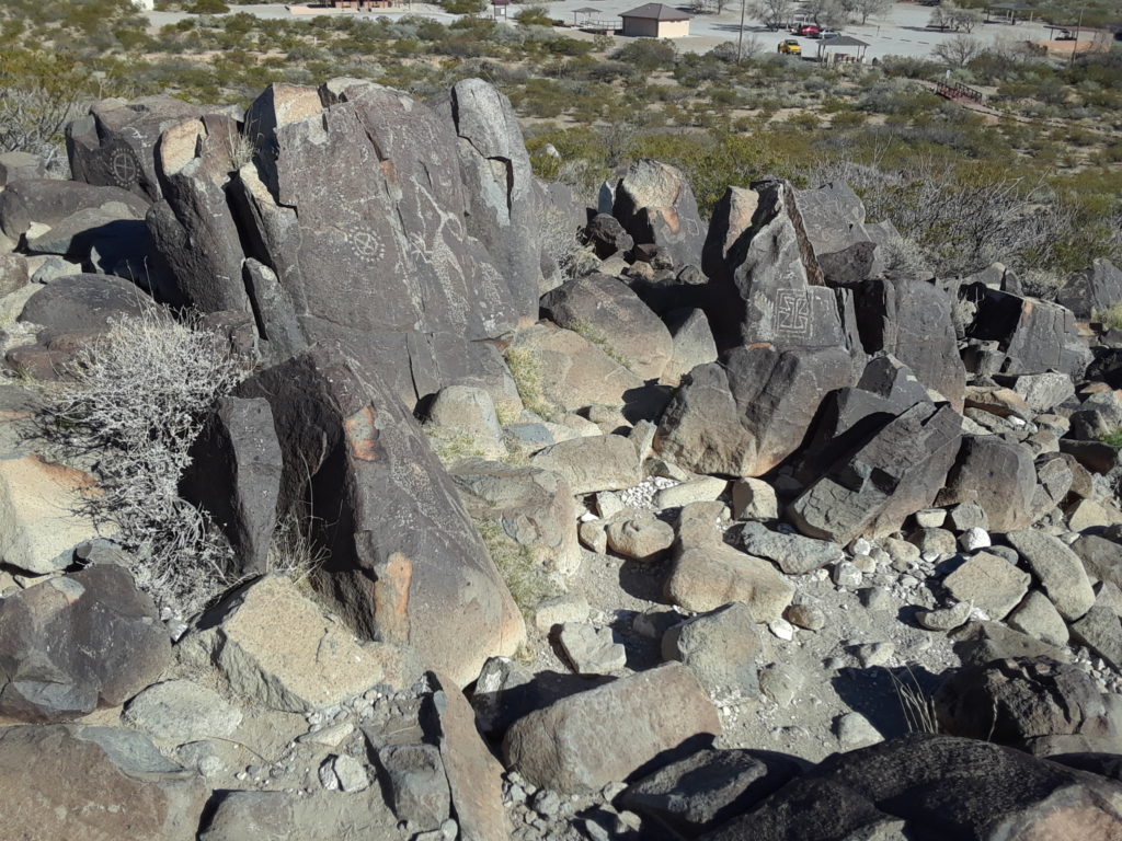
Next we headed to 3 Rivers Petroglyph Site where we walked around then camped for the night.
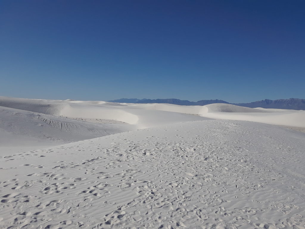
Day 5: Early morning White Sands NP run. A bit cold in the early am but as the sun rose in the sky, we were glad to have arrived before all the other people. What a bizarre landscape. Not to hard to run on because the sand was pretty cold and firm in most places. We got a lot of sand in our shoes.
After running we had coffee and breakfast in the van. We then drove to Las Cruces and had lunch from a food truck called Luchador. Full stomachs we headed west to Rock Hound SP. Nice spot nestled in the hills. We sat outside for awhile. I painted some rocks for fun.
Day 6: I explore and collect some rocks in the morning. The park is known for its abundance of agate and quartz crystals. You are allowed to take some home with you. We do a short run on the Spring Canyon Trail. Very steep and impossible to run in some places. We were hoping to see the Ibex that were donated by Iran but we never saw any. Another day for a soak! We camp at Faywood Hot Springs. Peacocks, nude tubs, smells a bit like weed around camp. Rustic in a good way. We find a remote, quiet spot to camp. Beautiful sunsets.
Day 7: Ride our bikes to City of Rocks, SP. Lock them up and do a wide run around the park and up the biggest hill. Cool rock formations and great view of surrounding area up on top. Sleep and soak at Faywood one more night.
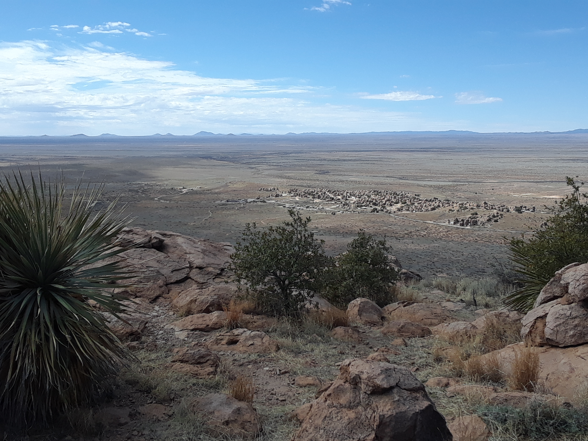
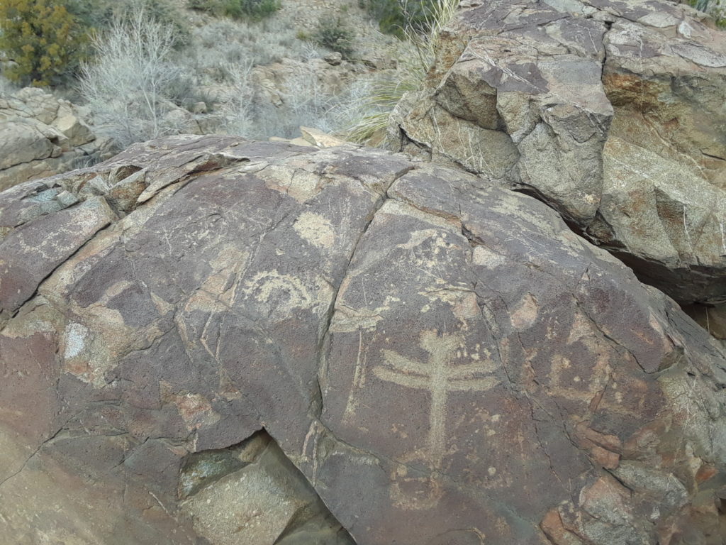
Day 8: Drive towards Silver City. Run Dragonfly Loop. Fairly easy trail that winds around to a river and back. Dragonfly petroglyph on a stone plus a few more.
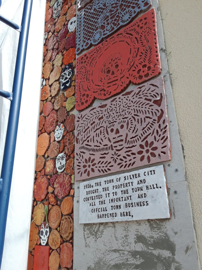
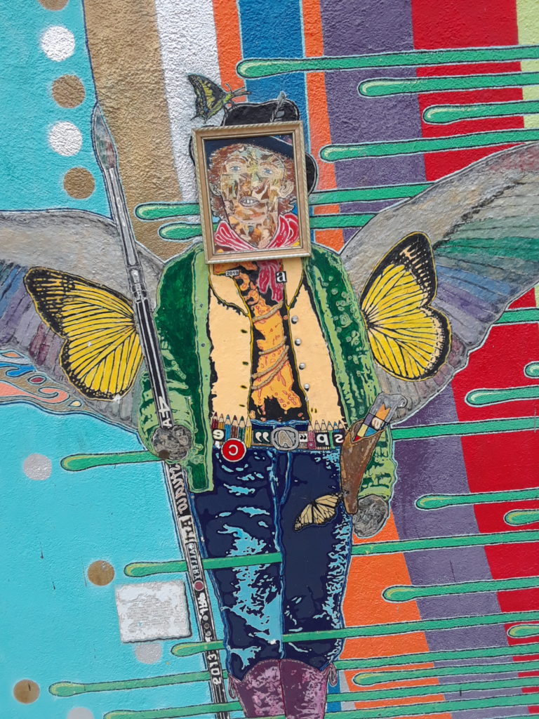
Next we explore Silver City. Check out a new mural with mosaic and tiles going up. Lots of art galleries. Paul buys a piece of art. Chai tea and music at Tranquil Buzz coffee shop. Paul food shops at local Co-op while I look in Space art gallery. Weird, eclectic art.
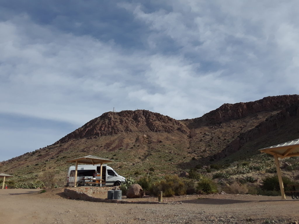
After resupply we drive up very windy route 13. There are plenty of free national forest camp grounds on the way up. We decide to pay for a view (and bathroom) at the Mesa Camp ground. It over looks Lake Roberts and had only one other camper. We took a short walk to explore. Must be a nice place to cool off in warmer weather. Dinner in the van and another lovely sunset.
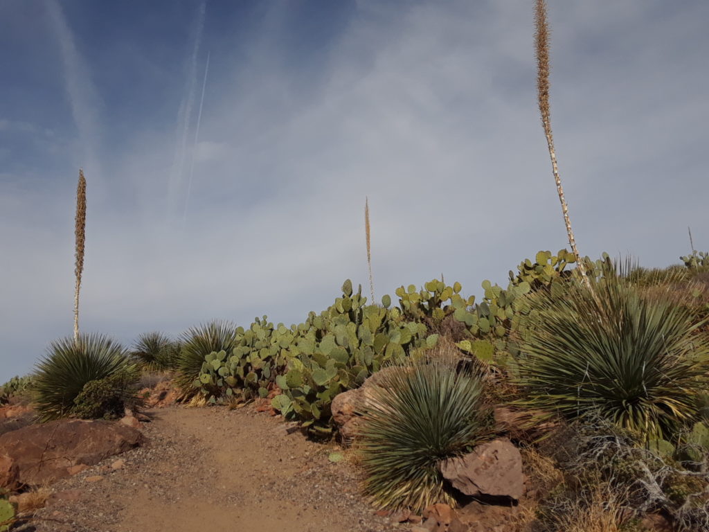
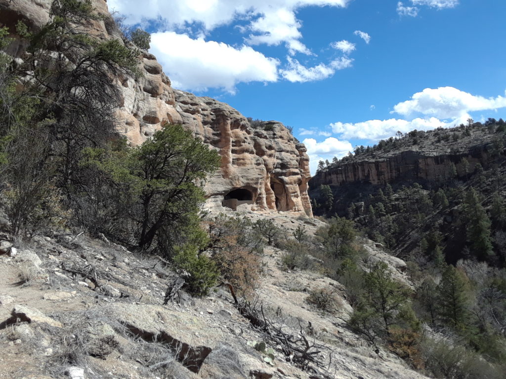
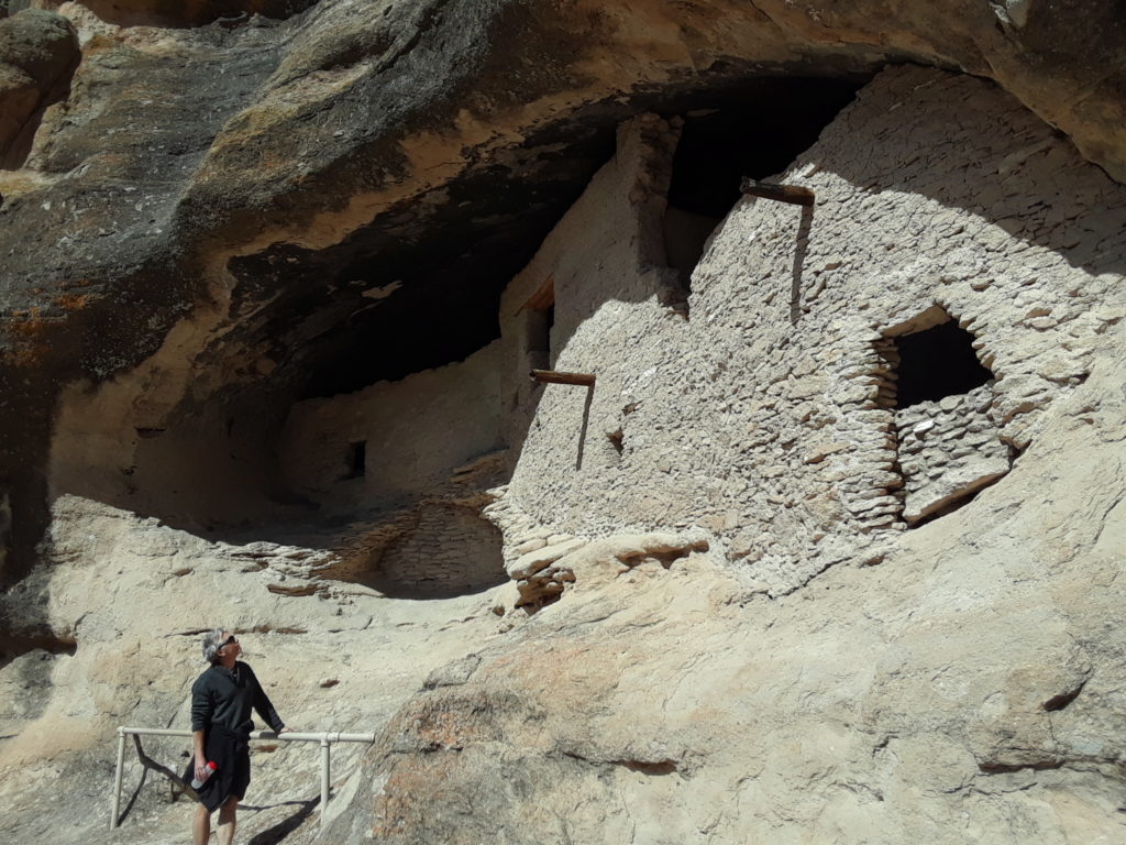
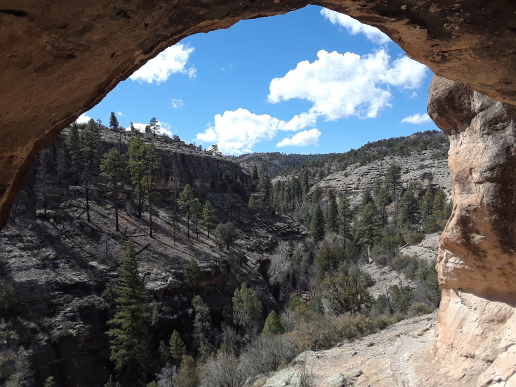
Day 9: Wake early and drive to Gila Clif Dwellings National Monument. check the visitor center for trail map and information. Small museum with artifacts and a movie. Hike the loop to the cliff dwellings which was very well maintained. The dwelling is well protected so it is mostly intact. A small village under a rock ceiling with outstanding views and a river below.
Next we decide to do our daily run in the park on Little Bear Canyon Trail. The trail starts out in the open but then changes into a slot canyon opening onto a larger river. Peaceful, majestic, and breathtaking. If god created a church, it would look like this.
After the run we drive back down the mountain and on 180 north. We sleep in NF Cottonwood Campground right off the road. Very dark and quiet.
Day 10: We wake and walk around a bit. Trail goes off from campground and a little stream. On our drive back we stop and see the Very Large Array, a famous astronomical radio observatory. Driving towards hwy 25 we see small towns and a good amount of poverty. Sad. Our daily run was to be simple so we pulled off at Bernardo WR. Mostly dirt roads but there are bird sanctuaries and lookouts. Farm fields surround the area which attract the birds. We drive 60 all the way to 285 which was mostly very pretty. Back at home in Galisteo, New Mexico until next time.
This post is written mostly for Paul’s mother, who isn’t going to be travelling much any more and will certainly never see the landscape close to where we now live. Sometimes, you can (and must) travel from a bed instead of a van.
This morning we went out on a short 4 mile run, mostly on trails around Galisteo. The weather wasn’t particularly sunny, but the photographs below capture some of the details of the neighborhood as well as a few broader landscape shots. Sorry that the photographs do not link to larger versions, but even the larger versions where not really worth viewing due to graininess and the odd morning light.
Ask not for whom the bell tolls …. the gate to the local cemetery
UK drystone meets New Mexico stone
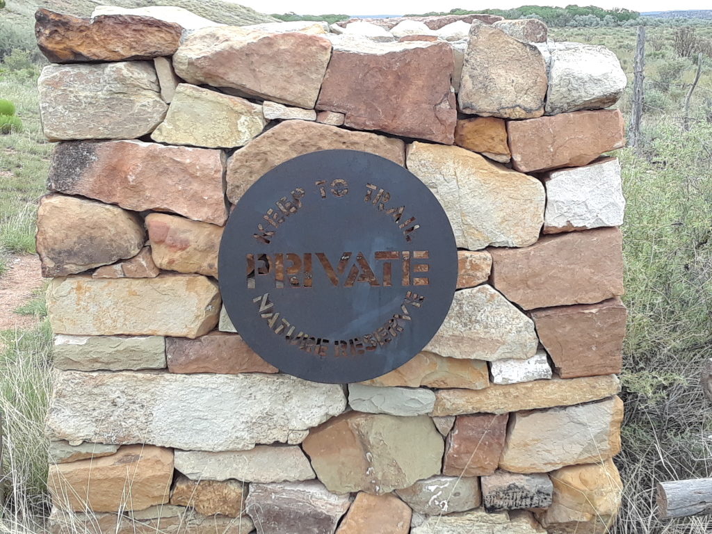
At least the British know to add a trail across their nature preserves…
The two shots above come from the edge of a property owned by a British couple. The husband is a fairly famous architect who grew up in Woodford and like me used to ride his bicycle into Epping Forest as a child.
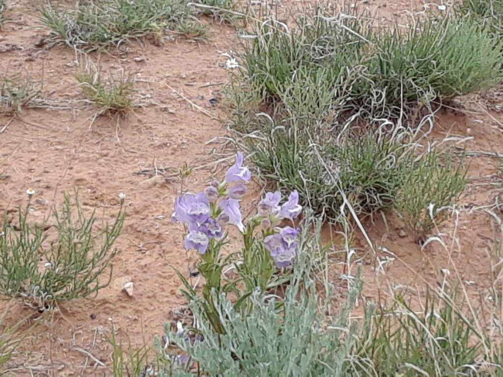
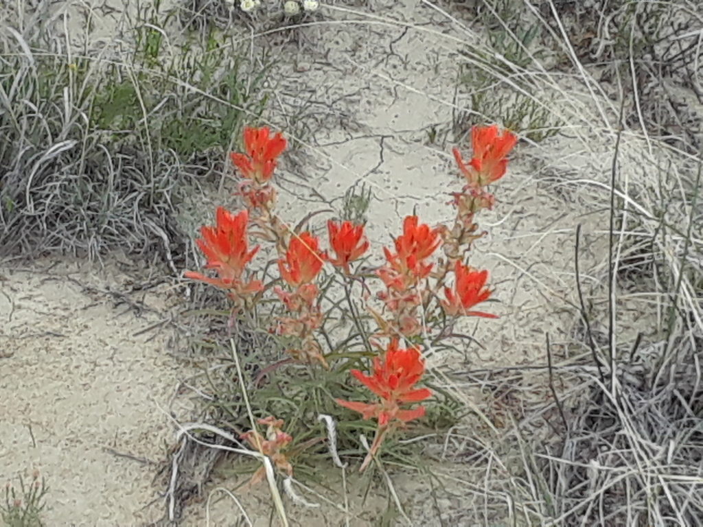
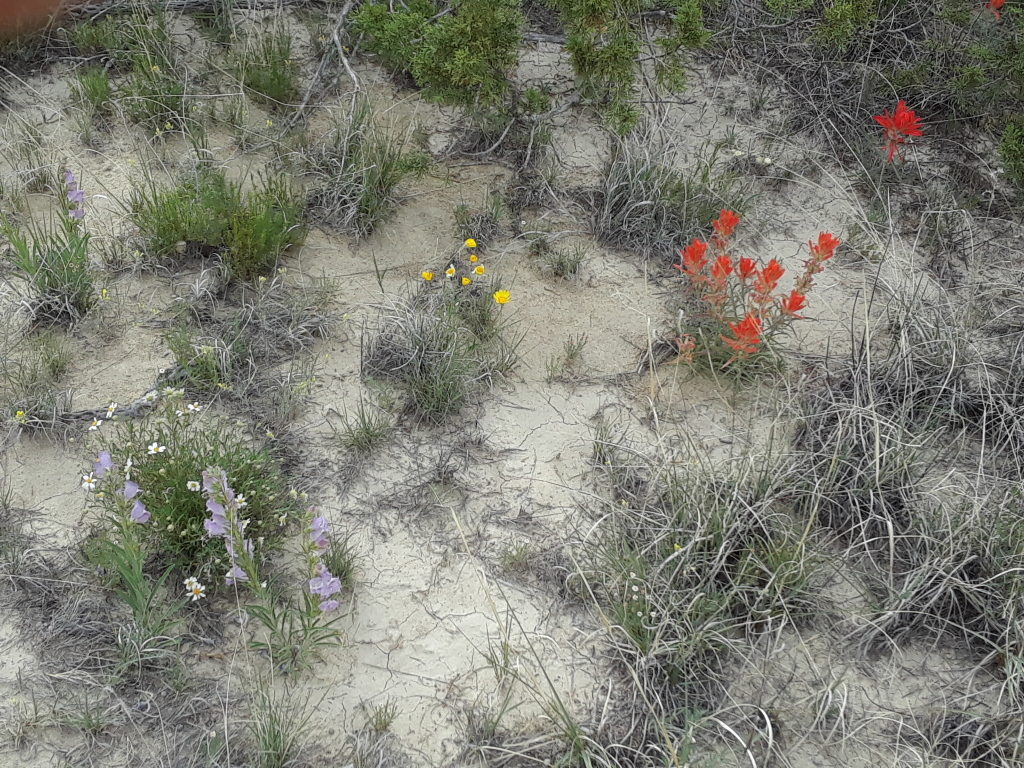
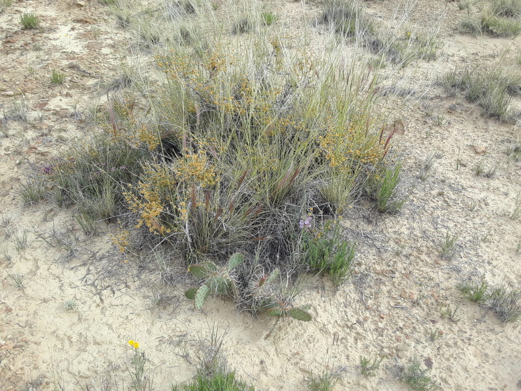
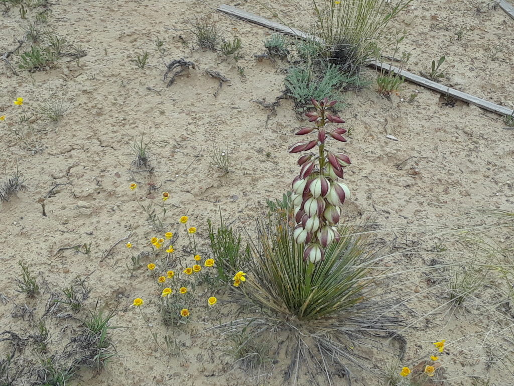
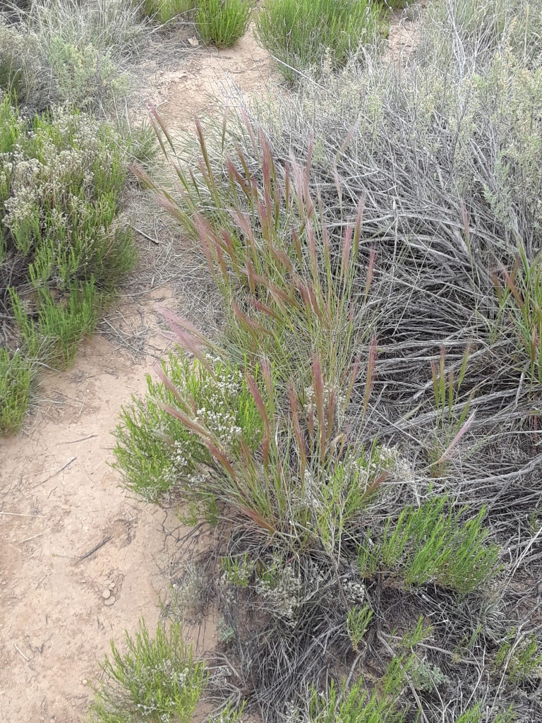
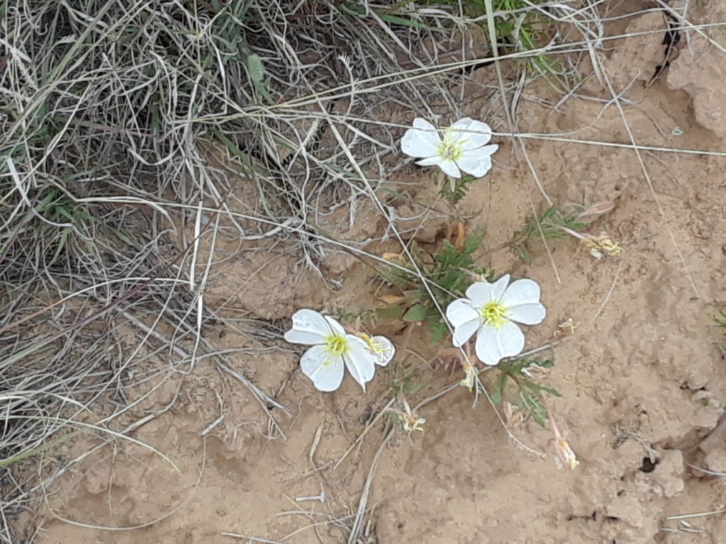
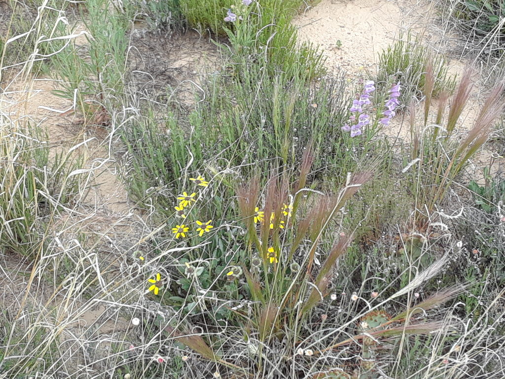
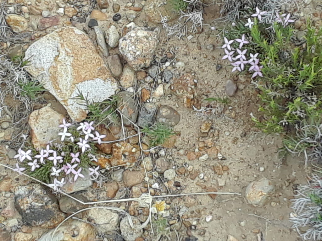
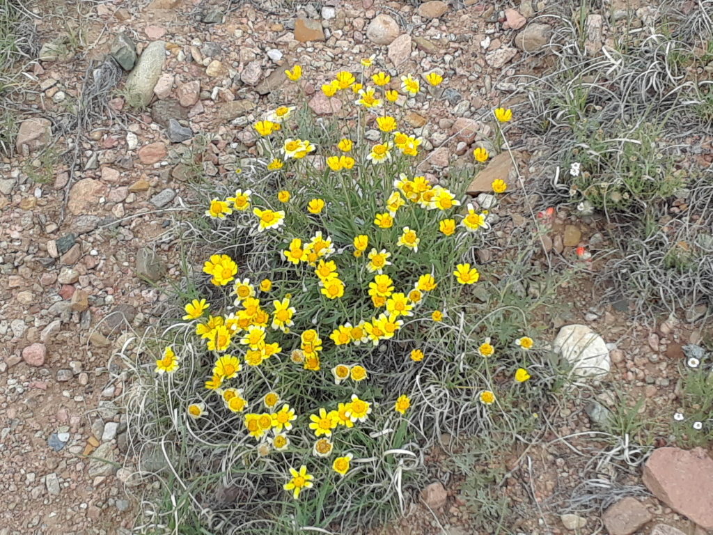
Above are examples of the different way that color and a particular kind of botanical beauty occur here in our semi-desert climate.
The Jemez Mountains to the westThe Sangre de Cristos Mountains (still with snow) to the northCerro Pelon, a landform that defines an edge of the Galisteo BasinThe Galisteo Creek, which flows (almost) perenially a few 100m from our homeEl Puente de Galisteo, which we almost always have to cross when going home
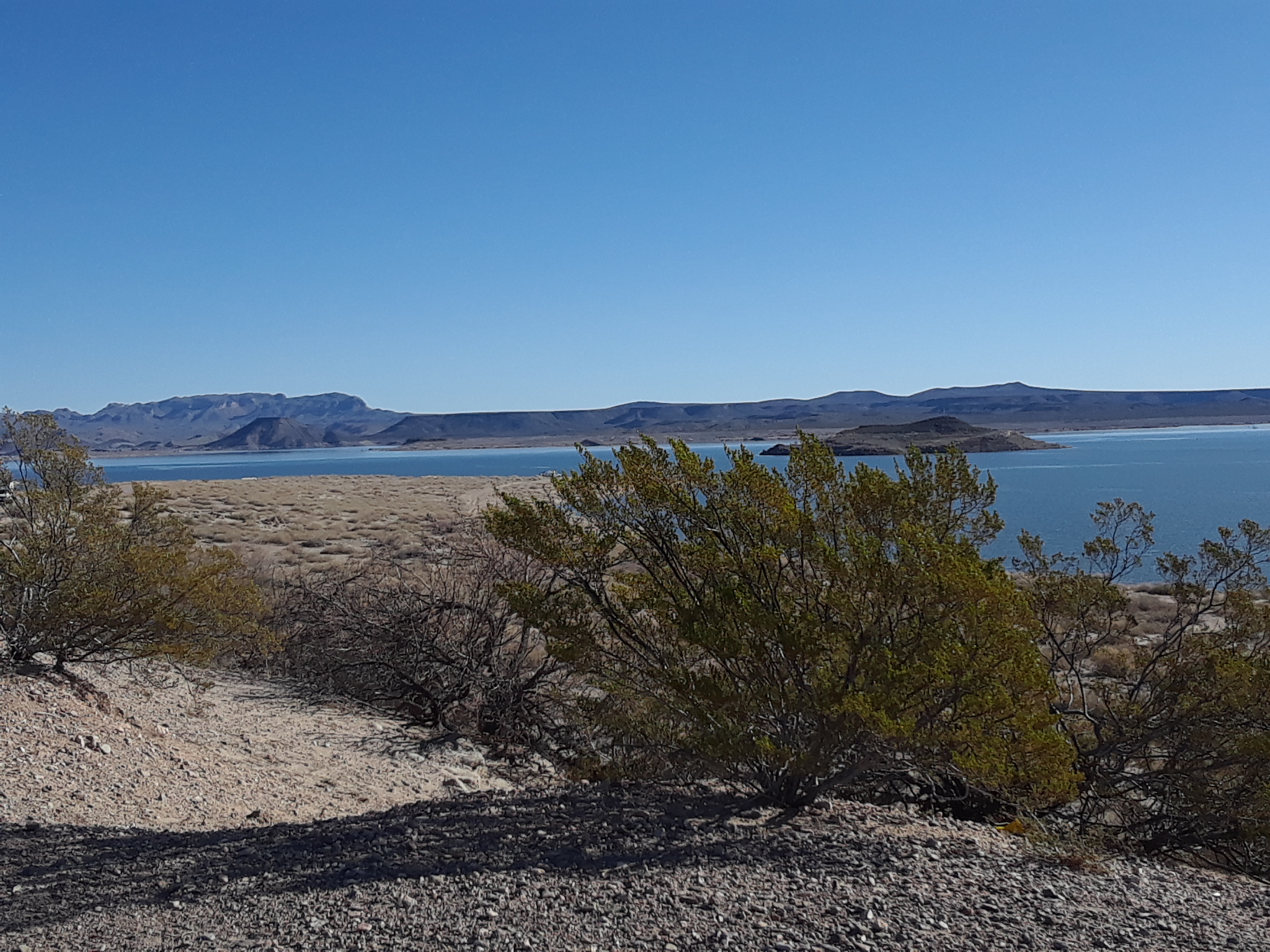
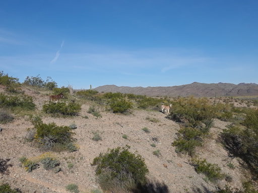
One thing I was hoping to do more of on our west coat trip is swim. The coastal water was too cold so Paul and I decided to find a lake in Arizona. Alamo Lake SP is a large lake in the middle of the desert. It opened in 1969 after a dam was built to control the flow of the Bill Williams River. It is popular with boaters and fishermen. There is an abundance of spring wildflowers and we enjoyed listening to the wild burros. There were many spots to choose from so we got a terrific lake view. It was a new moon so the stars were extremely bright and easy to pick out many constellations.
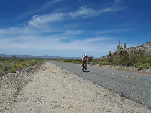
Having a few days to relax and not move the van, I napped, played guitar and read while Paul worked. We enjoyed swimming but wore our wet suits as the water was a bit choppy and colder than I like. You could definitely swim by the shoreline without one. On an early morning run I spotted wild burro on the road. They all just stopped and stared looking surprised to see me. The drive into the park was 40 miles so Paul took the opportunity to ride his bike out while I drove ahead.
Our next stop was a special treat to visit my cousin Kelly, Mark, Finnegan, and Delilah. They have a beautiful home in Fountain Hills and we spent the evening there having dinner and catching up. We talked till late then Paul and I slept comfortably in their driveway(in van of course). Next time we will remember to take a few photos.
We try our luck at another park but Lyman Lake State Park is not appealing for swimming. Dirt beaches and when we tried to walk in it was muddy. Probably just good red earth but couldn’t motivate myself to jump in. We did enjoy the park trails quite a bit. You could piece together a bunch of trails for a longish run. There are large rocks with petroglyphs, adobe ruins, and plenty of peace and quiet. Dark night sky with shooting stars.
Bluewater Lake SP is located in the Zuni Mountains, New Mexico. I wanted to check it out for future swimming. It was super windy as a storm was coming so I didn’t get a chance to go in. We parked our van near the pinon and juniper trees for protection. I think this place will be enjoyable in summer when warmer as its altitude is at 7,400 ft. The lake can freeze over in the winter allowing ice fishing. I managed a beautiful, short run on park trails. A wide variety of birds, canyon walls, a dam, and expansive views. The wind picked up even more and it started to snow. Time to go back to Santa Fe.
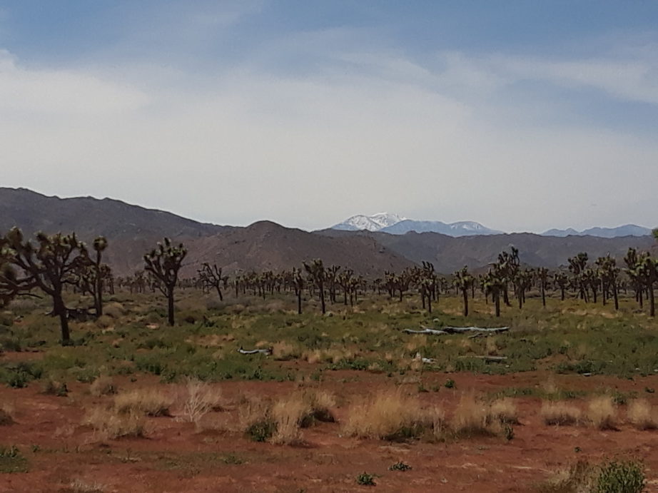
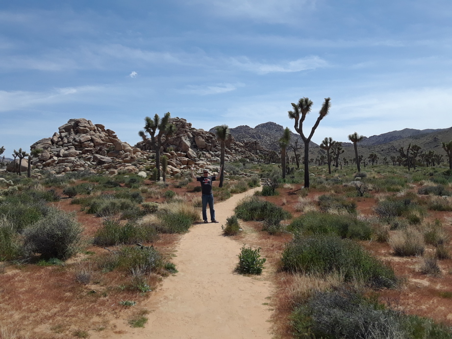
I still haven’t found what I’m looking for…but this is pretty close. We arrive at Joshua tree and all the campgrounds are full (of course) because its spring break time. We decide to do a drive through the park to get a scope of the place. I can no longer stand being couped up in the van so we park by Split Rock and head out for a run. We connect various trails together, skull rock, face rock, discovery trail and even made our own trail. (got lost)
In God’s CountryWith or Without You
BLM land camping is normally pretty good but we read reviews of camping in Joshua Tree BLM and it was pretty mixed. When heading out on bumpy dirt roads we found many people in all sorts of campers, tents, RVs, etc.. were spread across a large field. Securing a level place to park, we set out our chairs, had a nice dinner and watched the sunset over the San Gorgonio Mountain range.
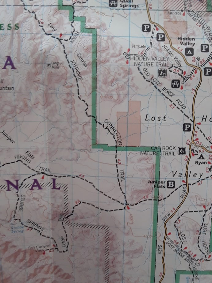
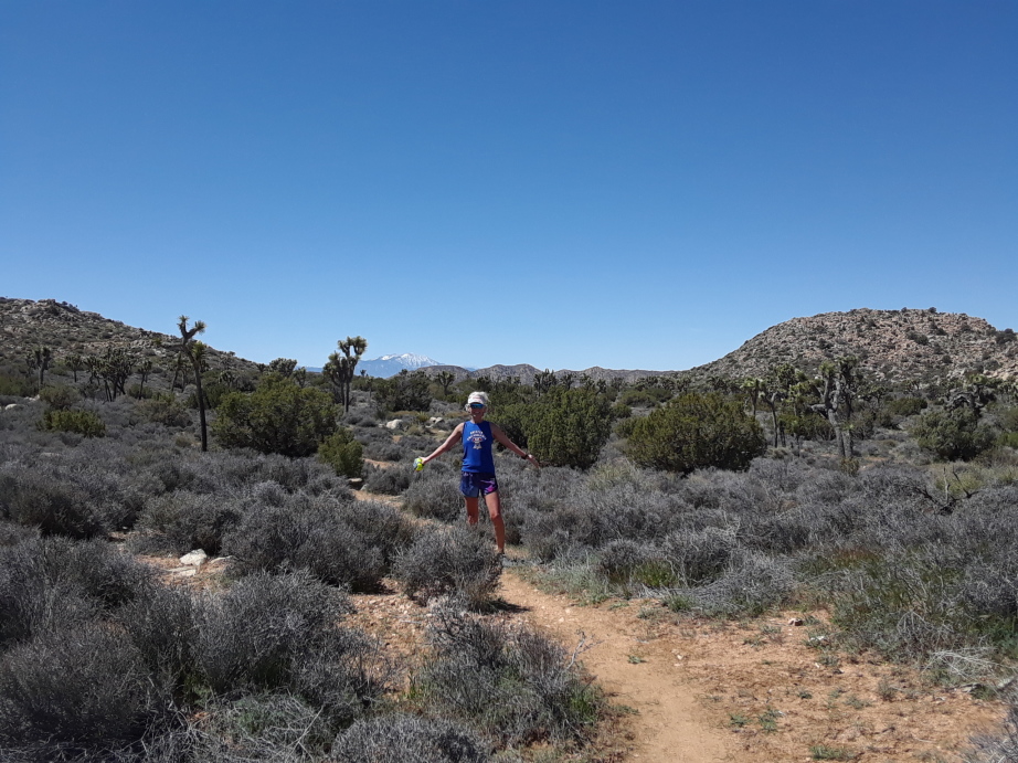
In the early morning we head to Natural sister’s cafe for organic coffee and juice. No bathrooms on BLM so that too. Back into Joshua Tree Park and have breakfast in the van. Head out for a long run on Stubbe Springs Loop.
Lots of good single track, some sandy parts, and becoming immersed into the desert . Big eared jack rabbits hopped very fast off the trail ahead of us. Flowers of various shapes, sizes, and colors dot the path. Cactus varieties also cling close so you have to be careful when running. They are super sharp. Wide open views of Mt. Jacinto and Mt. San Gorgonio.
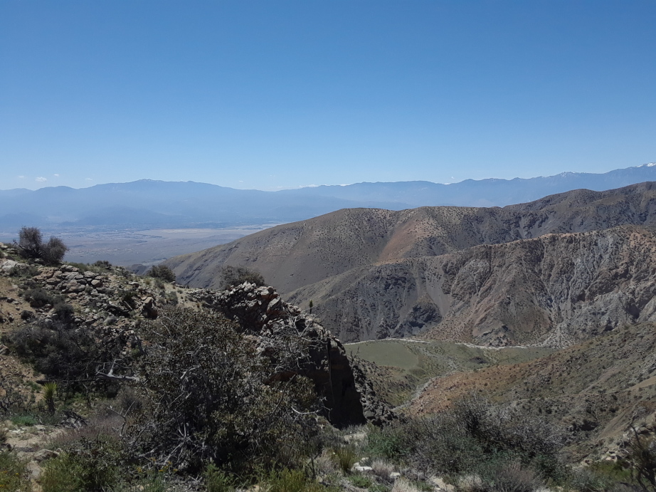
down in the valley at left is where Coachella happens
We both got pretty hot by the end of the run. Lunch break in van at Keys View. One more overnight on BLM land and Paul is able to get some work done. 4G on the hot spot, whoo hoo. I choose to stream a movie instead.
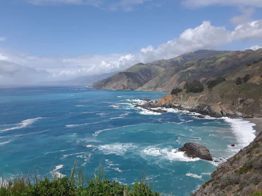
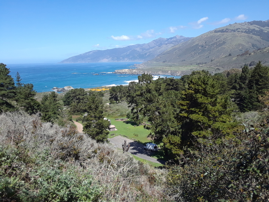
March happened to be spring break for many students and all the camp grounds on the coast looked booked on-line. We decided to drive Pacific Coast 1 anyway and see what we could find. This was my first time to Big Sur and the surrounding areas. I was floored by the beauty and now know why this drive is so magnificent. We asked at Plaskett Creek Camp ground if we could stay a night. They were full but let us share a group site with another friendly surfer man (John). We sat outside the van and enjoyed the ocean sounds. In the morning we ran along the muddy coastline, some in pastures.
spot the van at Plaskett Creek SP
Sunshine, sea air, trail running, and even mud..ahhhhh happy place. The national forest lets people camp for free right up the hill from where we stayed. Tricky road but we know now for next time. Crazy views.
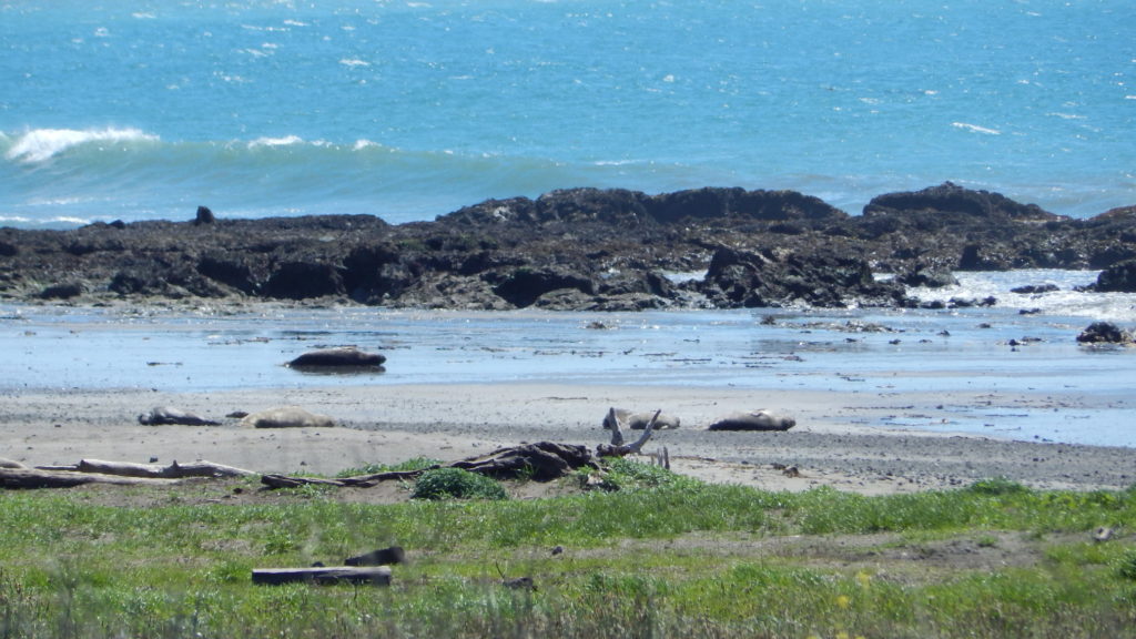
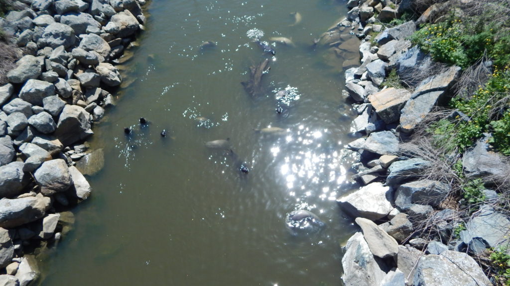
Elephant seals sunning on the beach. I didn’t know what they were at first.
They had some official viewing areas but Paul and I drove to a beach spot where kite boarders were surfing. I walked down the road a ways to a small bridge and looked over. To my surprise there were all these elephant seals looking up at me. They found a perfect place to hide and swim in creek water. They made fun noises while playing. I ran back to tell Paul and show him my discovery. We watched for a bit and then left them to their privacy. Cool find.
San Simeon Camp Ground was set back from the beach. Our daily run included scenic overlooks, rest-stop benches and interpretive panels with information on wildlife and habitat. San Simeon Natural Preserve consists of vast wetlands, riparian areas, and several undisturbed native plant communities including unique mima mound topography. The Preserve is also the wintering site for monarch butterfly populations. Very pleasant indeed. The beach is vast but it was windy and I couldn’t even find a place to nestle in and enjoy a book. Lots of driftwood everywhere too.
Cambria is a pleasant shopping stop. We buy bread and have taco lunch from a food truck. We make our way inland on 166 and find parking in National forest land. ( one dirt road was way too scary for me and treacherous) There is plenty of bug life but also extreme quiet. Peaceful night sleep.
Morning rest stop in a small town New Cayuma. Head back to the ocean over a pass on 33. Stop and eat lunch out of van to take in the sights a bit longer.
Back at the beach we camp at El Capitan SB, Nice ocean views but a rocky beach. I walk a mile north and find one with sand to relax and read. Only a short dip here as the water is so cold. Wake early and enjoy a sunrise run with bunnies, wild flowers, and hugging the ocean. The bike path was closed because of erosion but you can manage a run and it connects with Refugio SB. This is a nice spot directly on the beach with sand. Would be my choice next time.
Gaviota SB is rustic but has charm. Nice sand beach, showers, train bridge, and many interesting rock formations.
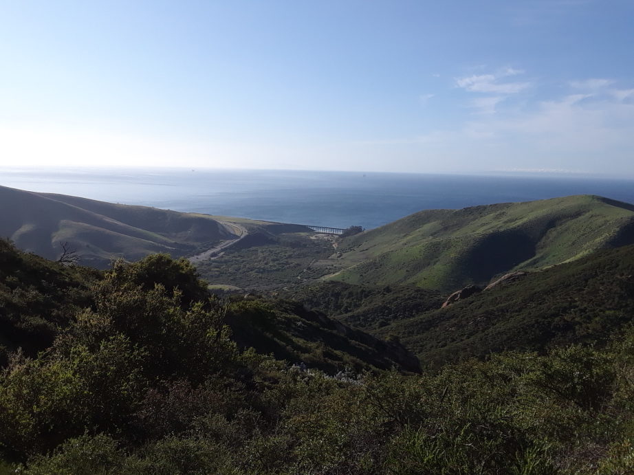
It gets windy here and dusty too so being in a van was a plus. Paul and I did an epic run to a sulfer hot spring. It was harder than we expected, and longer, but we both agreed it was worth the challenge.
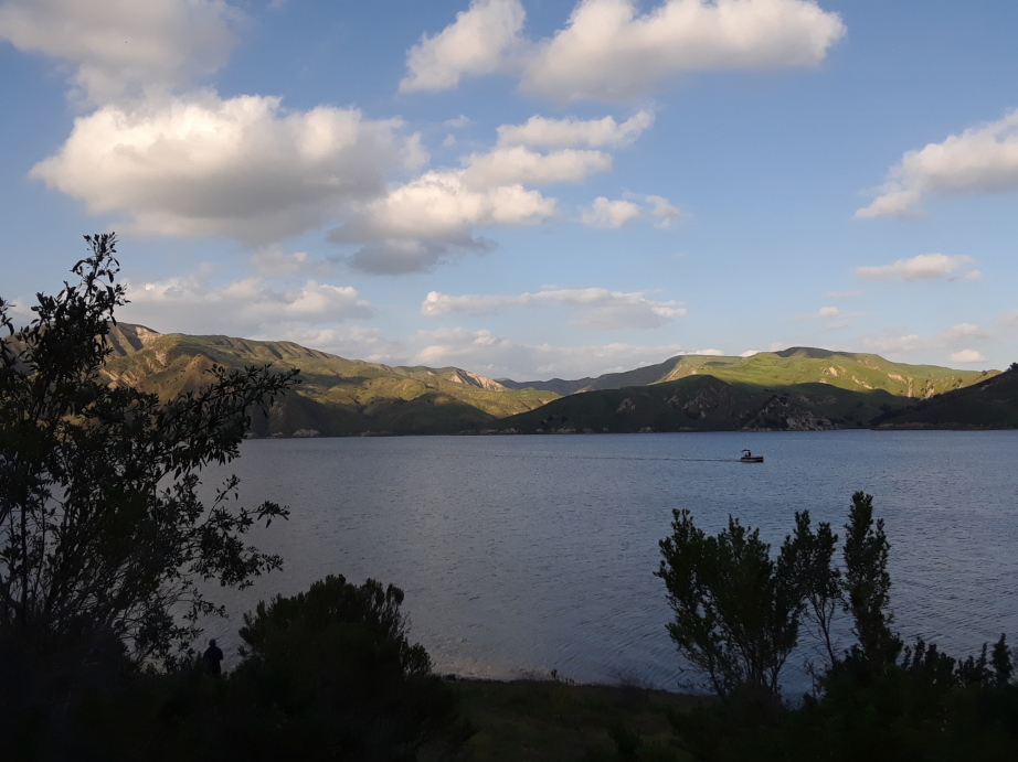
Lake Piru is off the beach but worth mentioning. The camp is set in a 100 year old Olive Grove. Very quiet at the beginning of April but is probably hopping in the summer. The green trees, blossoms, deer and crazy big horn cows make it even more interesting.